Sootip Peak
November 28, 2023
2055m
Pemberton, BC
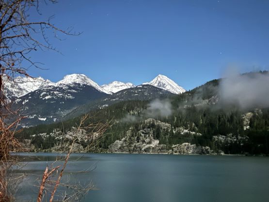
“Sootip Peak” is the unofficial name of the highest summit on Soo-Rutherford Divide not far from Pemberton, B.C.. This is actually quite a massif that occupies a large area of land to the south-west of Pemberton and boasts over 400 m prominence. The ascent is however, no-brainer except for the access that requires a 4×4 vehicle. Most of the ascents are done in summer as the access road isn’t maintained in winter, but the “shoulder season” could provide some snowshoeing oppourtunities. I did not want to do “Sootip Peak” in summer but I also do not have a snowmobile, so my window for this objective is rather short. In fact, if not because of the infamous Tareef Dedhar I would still not put this objective on the radar. Tareef has made two trips out there in November with the second one being successful, but the most important “beta” was the road being drivable to 1150 m elevation. With that in mind, I pulled the last-minute trigger to snag it as a “before-work exercise” on Tuesday. I drove out at around 9 pm on Monday but quickly changed my mind.
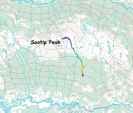
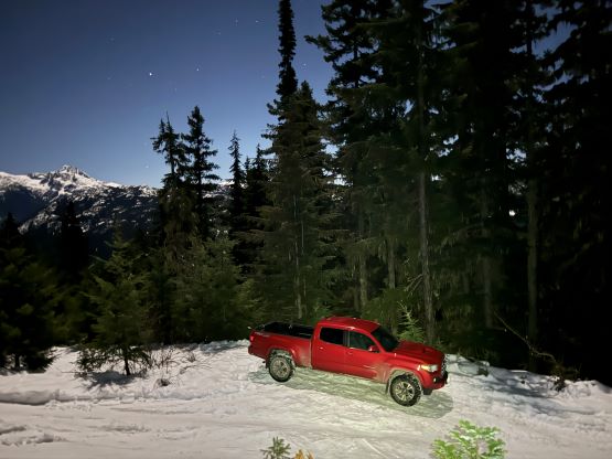
The entire Metro Vancouver was covered in some thick fog thank to the prolonged high pressure system, but the fog quickly dissipated from West Vancouver onward. My original plan was to sleep in the truck at 1150 m elevation, wake up at 4 am in order to be on the summit at sunrise, but then I noticed a bright full moon above the Sea to Sky Corridor. I had already done one midnight ascent under a full moon (Mazama Dome) and that was quite a spectacular experience. I instantly decided to do that for another time. I made the entire drive in one push. The road quickly became snowy around the last switchback under that 1150 m elevation, and I turned around and parked at a small pull-out at around 1170 m. There was just enough space to make the turn-around and park for 1 vehicle. There was already a foot of snow on the ground, and the only reason I was able to drive this high was the existing set of tire tracks. I could have driven farther but I had decided to take a steeper but more direct route instead of following Tareef’s GPX track. This direct route, as per Gaia map, starts right at where I parked.
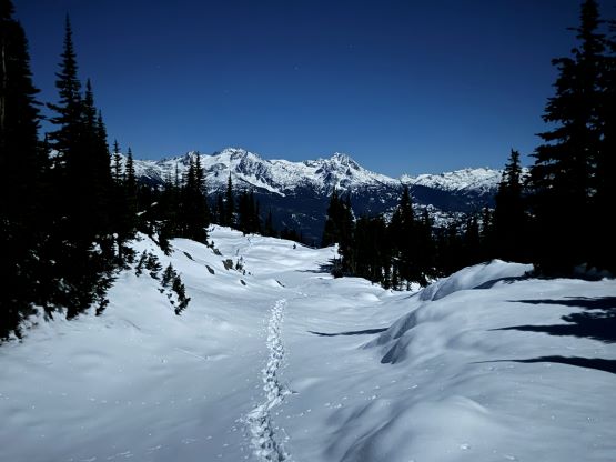
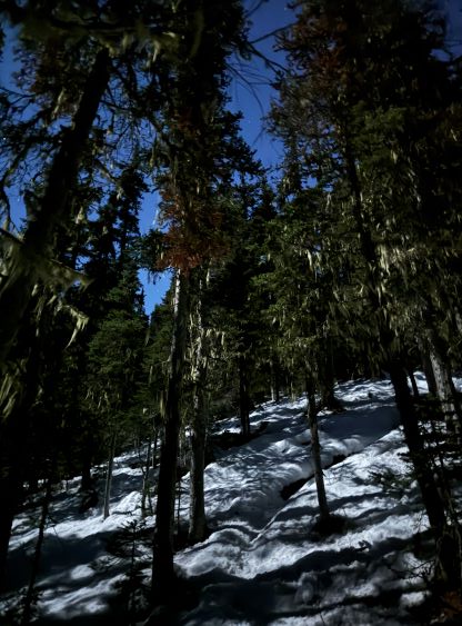
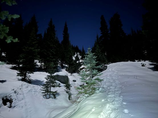
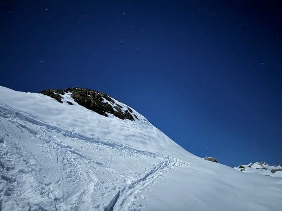
After donning gears I quickly noticed a set of snowshoe tracks made by one descending hiker and sure enough I found an actual trail. The snow was not quite deep enough for snowshoeing but I put the snowshoes on nevertheless, and the snow depth quickly increased. The trail (and the snowshoe track) was quite meandering with some unnecessary switchbacks and some annoyingly flat sections, but in the pitch dark I decided to just stick to the known. In about 20 minutes I had made to the cabin’s elevation and then the two trails joined together. The track/trail had become even more obvious and I also came across skin tracks within the next few hundred meters of elevation gain. The snowshoe track was made to not follow the skin tracks, whether on purposely or not, and I decided to stick with the snowshoe tracks. There was one annoying creek to cross but otherwise I would say this track was decently efficient. A few steep open slopes later I finally exited the treeline zone into the alpine at around 1800 m elevation.
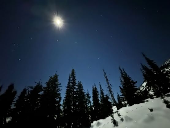
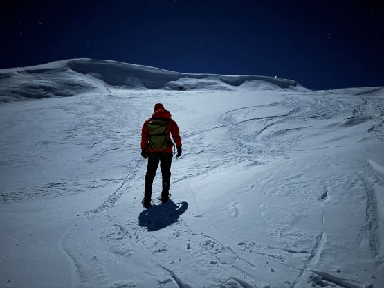
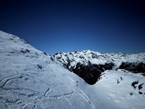
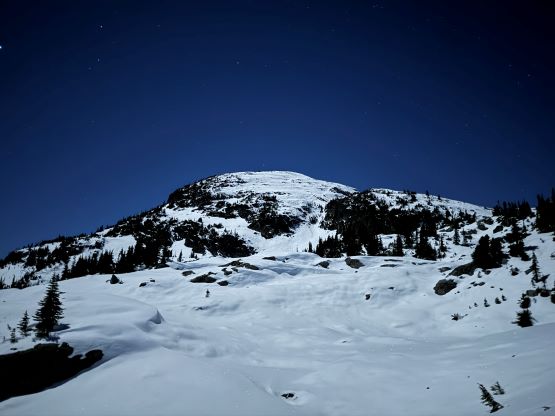
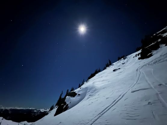
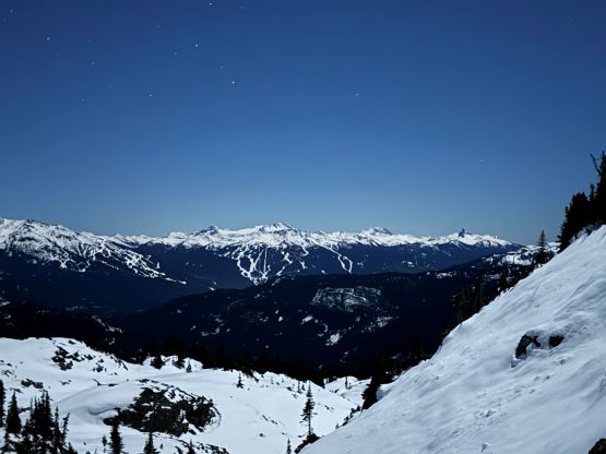
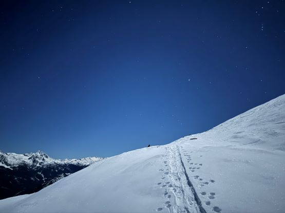
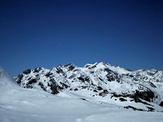
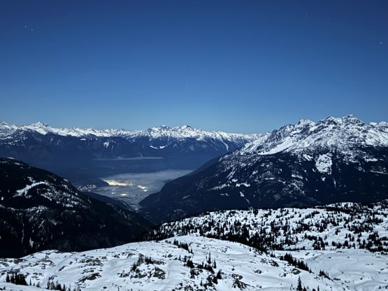
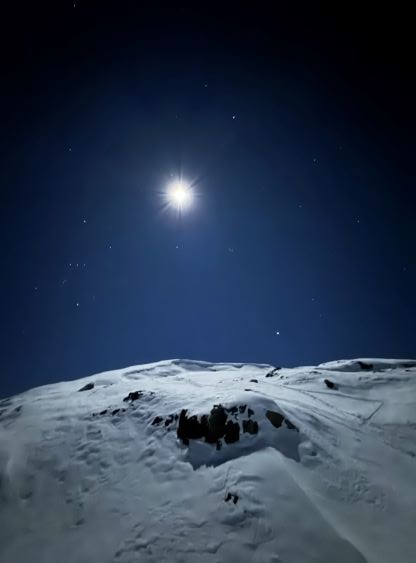
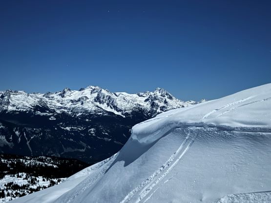
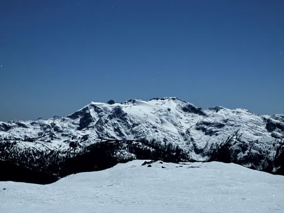
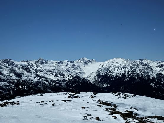
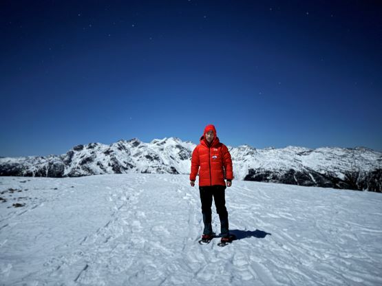
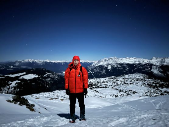
With the full moon I no longer needed to use the head-lamp so I turned it off for some worthy experience. I did make one stop for food as I was feeling quite hungry. The temperature was actually quite tolerable probably due to the inversion, and the wind was non-existing. I was surprised to see at least two or three more sets of snowshoe tracks in addition to a shit ton of skin tracks, so this place was quite busy recently even though the social media hadn’t fed me too many reports. The push to the summit was longer than I thought with still a few hundred meters of elevation gain, and involved quite a few steeper rolls and some undulating terrain. I mostly followed the skin tracks at this point because I was tired from the recent trips and the lack of sleep, and needed a more gradual grade, and eventually made the summit at 2:40 am. The view was mostly as expected. The surroundings wasn’t that bright seeing in naked eyes, but I got some neat photos as the iPhone 15 Pro camera was good enough to brighten up the background. I lingered on the summit for quite a while to fully soak in the experience, and I also made a socials update thank to the strong cell reception.
The descent was rather no-brainer but I was feeling tired and sloppy. To descend the upper slopes was still fun as I could plunge on the soft powder, but the lower slopes in the trees were exhausting. The snow condition was icy and crusty but still soft enough to warrant the use of snowshoes. However, the downhill snowshoeing was hard on the joints in this kind of conditions, so I had to make the descent step by step. I also checked the GPS multiple times to make sure I did not pick a wrong set of tracks and got seriously off route. Eventually I got back to the truck at 4 am. I was feeling strong and decided to force myself to drive all the way back home in a single push, but I was being too optimistic. I started to feel extremely tired and sleepy at Whistler, so pulled over for a short break while taking some night time photos of Green Lake. I got a second wind of energy but eventually stopped at about halfway between Whistler and Squamish. I ended up sleeping all the way to 10:40 am on the passenger seat and then drove back home in the morning. I got back to White Rock with a few hours of spare before showing up at work in the afternoon.