Sloquet Peak
May 2, 2024
1969m
Sloquet Creek / Upper Stave River, BC
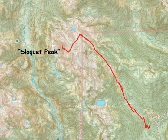
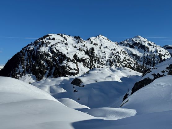
The unofficially named “Sloquet Peak” locates literally in the middle of nowhere, halfway between Pemberton and Chilliwack on the divide between the headwaters of Stave River and Sloquet Creek. The “upper Stave” is basically inaccessible without doing a week-long traverse and/or a heli-drop so the only viable access is from the end of the logging roads system in Sloquet Creek, which is accessed by driving ~70 km down In-SHUCK-ch forestry road from Pemberton or a similar distance up the much-rougher Harrison West from Mission. The peak is only doable as a “day trip” when the Sloquet Creek FSR is drivable to the very end (about 10 km farther than the Fire Spires’ parking), and even so, the drive to and from this spot takes at least 5 hours from Vancouver even with a high clearance, 4×4 vehicle. We are talking about one of the more remote regions in SW British Columbia and there’s no easy way of getting in. This peak nevertheless boasts over 600 m prominence. I had been thinking about it but there’s no way I would drive 100 km down unpaved roads only to discover an impasse, so I wouldn’t going to pull the trigger.
Over the past several years Matt J. had made at least 3 or 4 forays into the zone to scout out the access and the route and it turned out that the Sloquet Creek FSR was blocked by washouts in 2022 and 2023 beyond Fire Spires’ parking. Matt even made an attempt by adding 20 km of road-walking but the route itself also required some bomber snow conditions. Then all the sudden Matt posted on Instagram after finally making a successful ascent so I knew I must take advantage of the “beta” immediately on the next weather window, which happened about 10 days later. Apparently more than myself had been thinking about the same thing, but the window happened to be on a Thursday so only Raphael and Mark L. were able to join. Raphael and Mark opted to drive out in the previous afternoon to enjoy a soak in the Sloquet Hot Springs followed by a proper car-camping with decent amount of sleep, whereas I had to drive out separately due to my abnormal working scheme. I could not finish work until 9:30 pm so I was unable to leave Surrey until 10 pm. This would position me at the trail-head 3 am at the earliest and the planned “wake-up” time was 4 am, so the others wisely opted to pay more gas/vehicle expenses instead of skipping a night of sleep. To me, if there’s no pain then there’s no gain so I happily accepted the fate of having to pull another all-nighter and this time, alone.
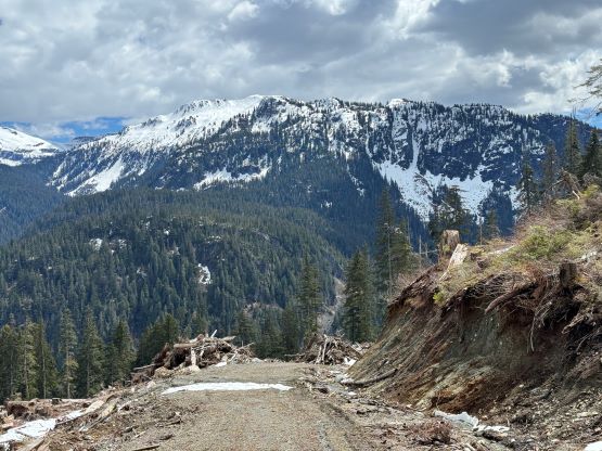
Everything turned out more or less as planned and I enjoyed driving up through the familiar Sea to Sky corridor without being bothered by the traffics. I made a gas stop in Squamish and arrived in Pemberton past midnight. I forgot to inquire Matt about the choice of In-SHUCK-ch versus Lillooet West FSR so despite the fresh gradings I opted to stick to the one that I usually took. The Lillooet West FSR was not as cruisy as the initial 20 km down the east side of Lillooet Lake/River before the split and that made me wonder if taking the other one would be better, but I was still able to drive at averagely 50-60 km/h for the entire way to Tipella. The 20 km up Sloquet Creek afterwards was not too bad until past Fire Spires’ turn-off as the road was apparently only user-maintained by 4-wheel-driving enthusiasts beyond that spot. I encountered numerous boulders and the rock-fall zones were only cleared with enough room for a small or medium sized truck to pass. There were also one wash-out (steep, loose rocks and one deep ditch) that definitely required 4×4 and high clearance to crawl across. I eventually made to their car-camping site at 2:50 am. They had opted to camp below the drivable end and had been communicating with me via InReach. Unfortunately when Raphael sent out the last message indicating the camping spot I was still working in White Rock.
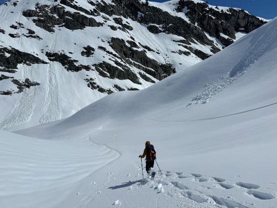
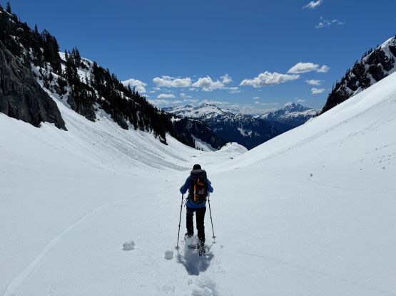
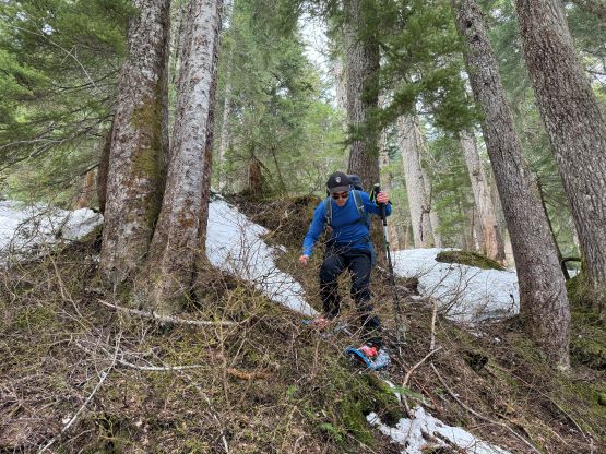
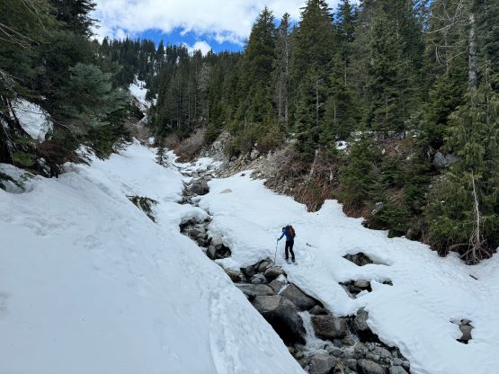
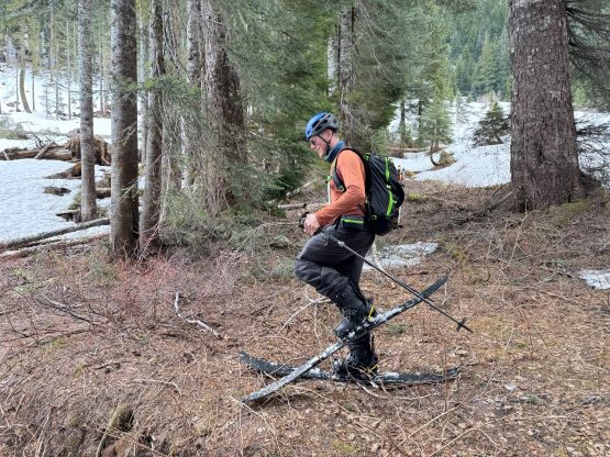
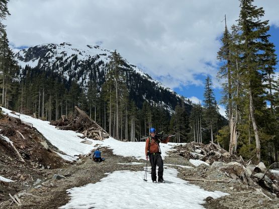
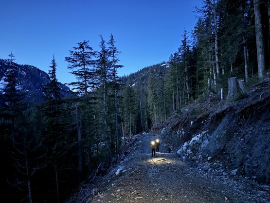
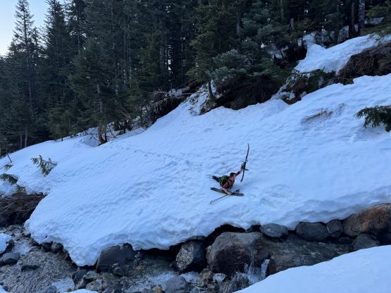
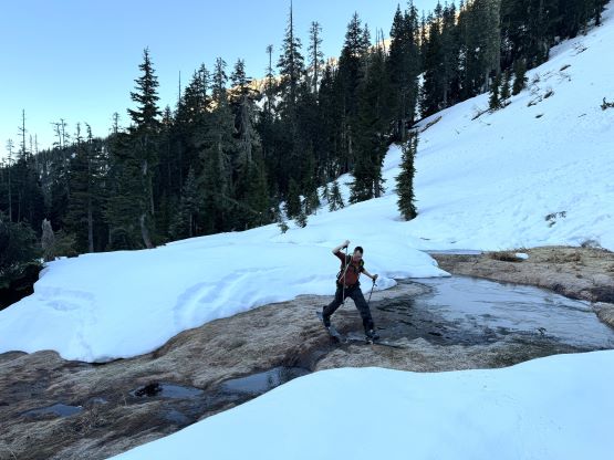
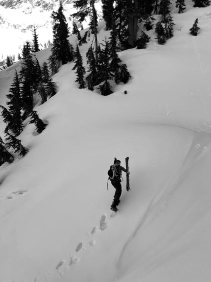
I was able to get about half an hour of sleep before the alarms went off. We then relocated ourselves to the drivable end and started plodding with only half an hour’s head-lamps time. In retrospect we should have started immediately after I showed up at 3 am but I desperately needed that extra bits of sleep. The parking was only at 700 m elevation so the first few switchbacks were dry, but we hit continuous snow at 900 m elevation before the road’s end. Matt’s route is heavily depended on the snow conditions. There must be abundant snow down to as low as 950 m to cover up the alders as the travel through this valley would otherwise be a nightmare. This is not a route suitable for summer travel, but one would also need a snowmobile to access this zone in the deep winter so the timing window is very narrow. There had already seen some significant changes since Matt’s visit 10 days ago, that some alders had grown out and the creeks were opening. Mark for some reasons, opted to switch to skis at the last minute and that was a poor decision. The cumbersome skis turned out to be a major liability on the approach. The snow was mostly icy and there were numerous obstacles including one creek crossing that was troublesome even for Raphael and I on snowshoes. Mark had to take the skis off for at least 10 times and was mostly struggling to keep up, but that was very understandable.

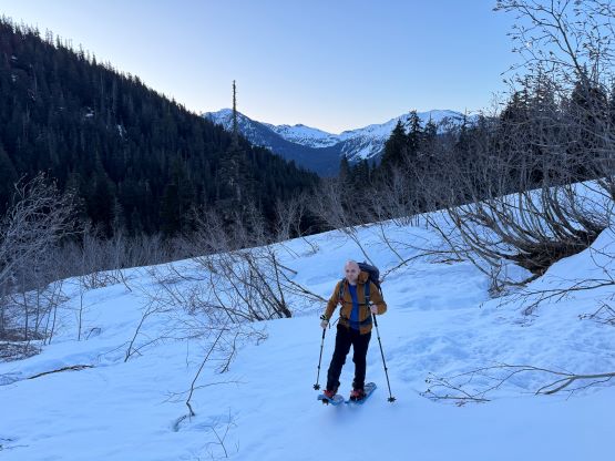

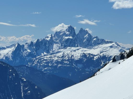
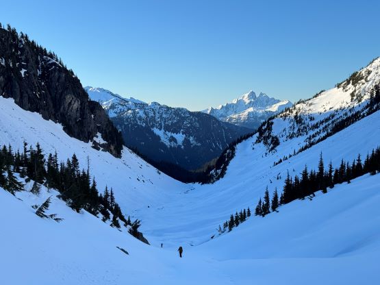
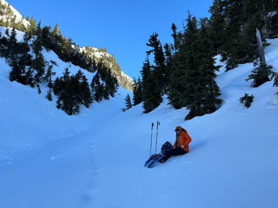
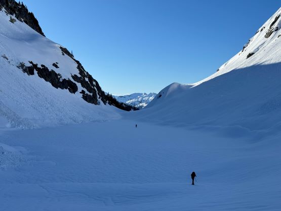
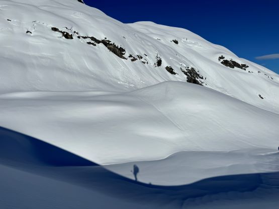
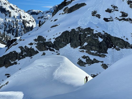
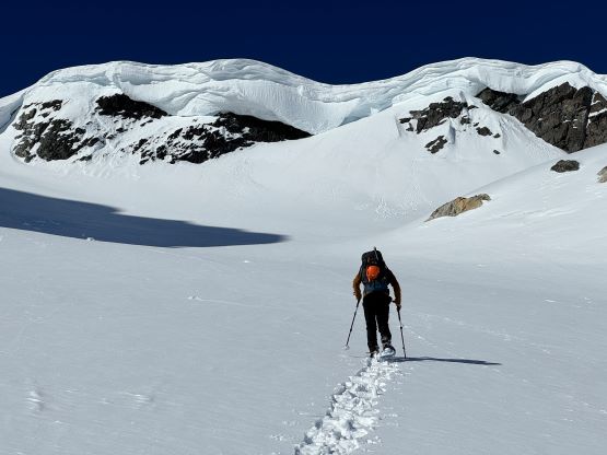
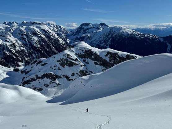
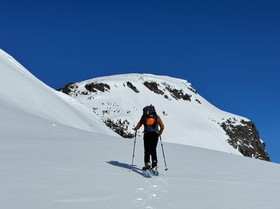
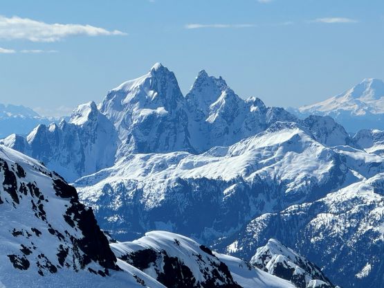
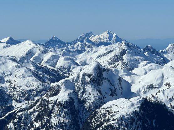
We mostly stuck to Matt’s GPX tracks but made our own adaptations here and there. The valley eventually opened up after a steep traverse at 1100 m elevation, and the snow had become even icier due to the lack of forest canopy afterwards. Mark had to don ski crampons but I’m not sure how much that actually helped. The final steep ascent to the deep pass between “Sloquet Peak” and “Pk. 1680” still made Mark to bootpack, but the snow was not firm enough to support our weight without any flotation device. Meanwhile Raphael and I took a needed break while admiring the view of Mt. Judge Howay’s unusually-seen NW aspect. I also broke another heel strap on the snowshoes but luckily Raphael had brought a ski strap (even though he did not ski) and that salvaged the mission. I did make everyone to bring a harness and some prusiks because of the technical difficulties on the summit block, and I could have come up with a solution using the prusiks but the ski strap was definitely the most ideal. For the 500 m grunt to the col between the north (true) summit and the south peak we deviated from Matt’s route by plodding straight up the middle of the NE-facing rolling terrain to a small glacier higher up. I think our route is less contrived and actually involves less overhead hazard, as Matt’s upper traverse around the south peak was already covered with car-sized debris thank to some cornice fails. The sun’s already beating down the east-facing slopes on full force so the snow was already becoming saturated on the surface layers. I thought about to grab at least one bonus objective on the way out, but we are getting to that time of a year when the snowpack would become completely mushy by 10 am, so I quickly threw away that idea.


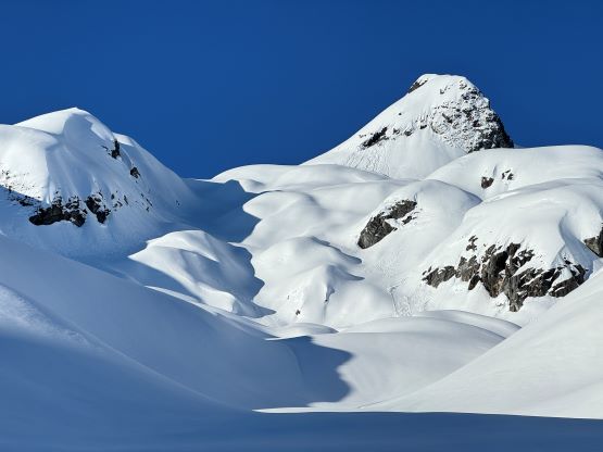


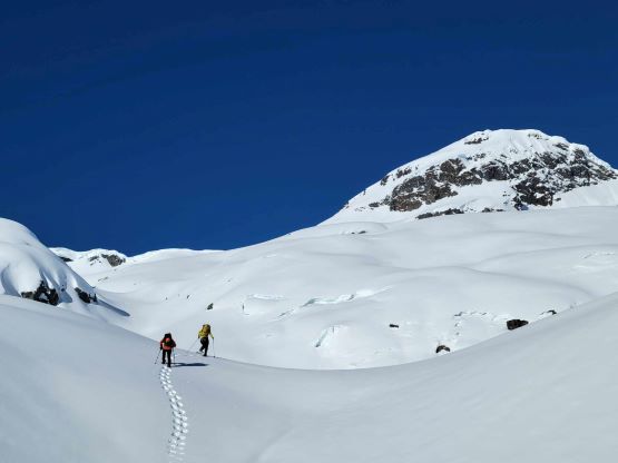
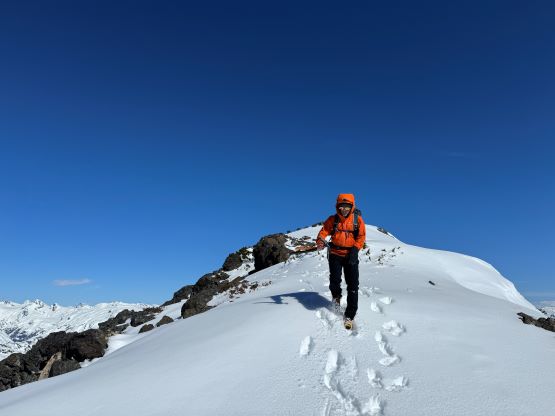
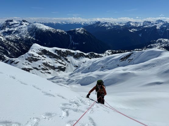
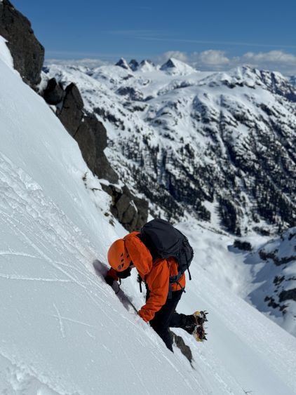
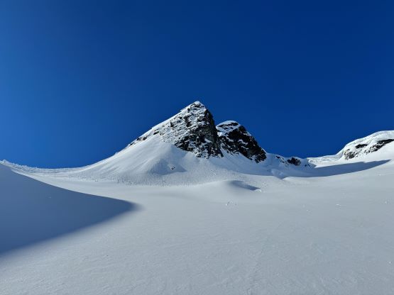
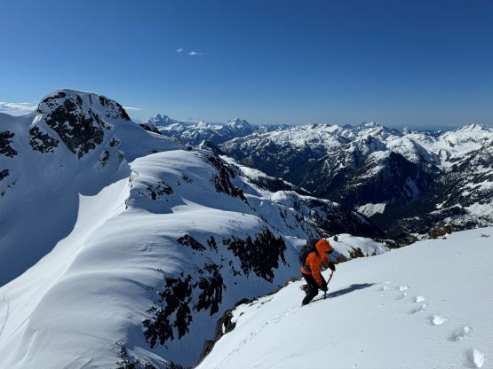
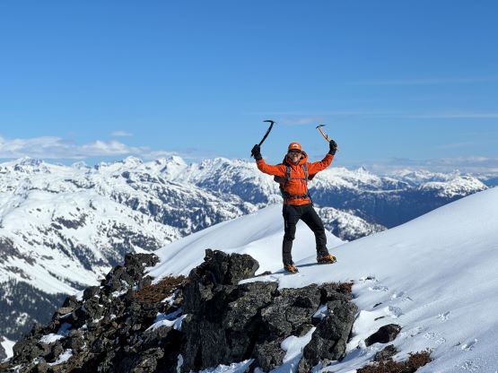
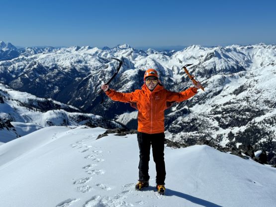
Raphael helped me offloading about 30% of the trail-breaking duty whereas Mark, on skis, took his own way. Mark was not too far behind and was actually slowly closing in the gap as the terrain was finally becoming suitable for skinning, whereas Raphael and I had to deal with some deep post-holing. There’s one more steep traverse to the saddle and then we all swapped the flotation devices for crampons. We all brought two ice axes and I even brought a rope. The pitch turned out to be mostly 40 degrees with just a few meters of 50-degree shenanigan so it was pretty trivial actually. I quickly soloed up and set up a fixed line for the added security, but the rope was mostly not needed as nobody had even bothered to don harness. To reach the actual high point we had to traverse across a narrow and corniced ridge but it was pretty chill, after all. The views were excellent as expected, but we unfortunately couldn’t linger too long up there due to the worsening snow conditions. The ascent had taken us 5 hours, about 1 hour slower than Matt’s pace.
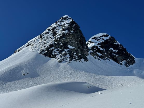


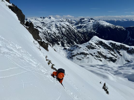
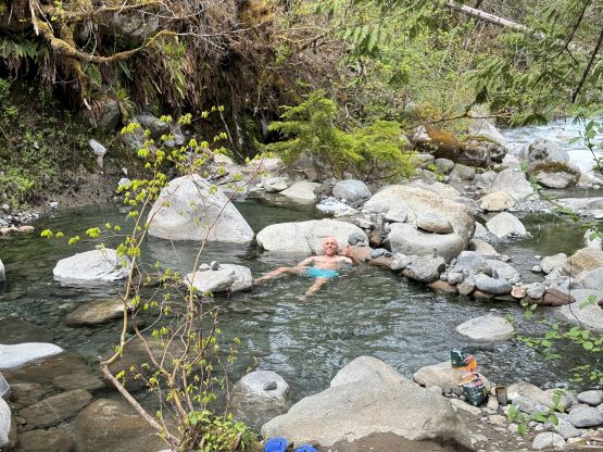
I kept the fixed line in place until both Mark and Raphael finished the down-climb, then took off the fixed line and down-climbed the pitch myself. I thought it was pretty chill. Mark then took off skiing the 500 m descent down to the pass and that’s the only section that justified bringing the skis. Raphael and I, on the other hand, were suffering in the mushy snow. We nevertheless made efficient work but the descent was very exhausting. The worst was to descend the upper half of the valley. I had promised to Raphael that we’d be walking like a drunk pair and I was surely not kidding. That’s just something to be expected on a sunny day in “mid spring” in the South Coast. Meanwhile Mark was not having an easier time neither as judging by the tracks he must have done at least another dozen of transitions. Raphael and I eventually caught up to Mark just when we were about to exit the forest back onto the logging road, and we all finished the round trip in not much over 8 hours. Raphael had opted to leave his tent and camping gears in the open so we drove a kilometer down and packed his gears. We then all drove down and went for a soak in the hot springs. This was my 3rd hot spring visit and the only one that required a fee, but it’s not much after all (10 dollars per person). Raphael decided to ride with me back home and was able to offload about an hour’s driving duty, and that made it possible for me to get back home at 9 pm. There was fortunately not much traffic throughout the corridor but lots of motorcycles.