Saxifrage Peak and Cassiope Peak
September 24, 2025
2501m
Pemberton, BC
Saxifrage Peak and Cassiope Peak are popular scrambles well documented in Matt Gunn’s Scrambles in SW British Columbia and because of that, these are among some of the better documented objectives in the vicinity of Pemberton. The road access (Spetch Creek FSR) is on the other hand, quite rough which is the sole reason why they haven’t, and will never become as popular as some of the nearby hotspots such as the Joffre Group or the Semaphore Lakes area. A few years ago I had already climbed Cassiope Peak via a completely different route in winter and my original plan for Saxifrage Peak was also a winter climb via the 50-degree East Face “ski route”, but such would require all stars to line up perfectly. There existed a few windows like that, but I always ended up prioritizing climbs that had to be done in winter such as Pyroclastic Peak or Big Four Mountain. I gradually started to accept maybe I should simply “aim” to tag Saxifrage Peak via the scramble route in summer, and if doing so I might as well redo Cassiope Peak since I would be there anyway, and didn’t get to see much on my original Cassiope Peak trip.
This past Wednesday seemed like right oppourtunity. I had a dinner commitment such that I needed to be in UBC no later than 8 pm. Not having a full day available to do grander adventures I eventually laid my eyes on some of the “Gunn Scrambles”. I threw out a few objectives and Miranda and Dave signed up for Saxifrage Peak. The original plan did not include Cassiope Peak but as the day progressed, it was apparent that we would have enough time to tag both, so why not. As usual I would not bother to do any research for objective(s) included in the book, and I would purely rely on the GPX tracks downloaded from peakbagger.com, my own experience as well as my partners’ research. It turned out that none of us had done much digging so we would simply find our own ways in situ. The one trip report that I briefly skimmed through mentioned over 10 hours round trip time, so that’s another reason why I wasn’t initially planning to do both objectives, as I had only budgeted 8 hours for our outing. I picked up Miranda from Burnaby at 5 am and we were in Pemberton 2 hours later. I didn’t have time to do food preparation in the previous day so I needed an extra half an hour’s stop in McDonald’s. Dave was already in Pemberton as he planned to spend a few extra days bagging peaks, so we drove towards the trail-head in two separate vehicles. The Spetch Creek FSR was not meant to be driven in a 2WD van but Dave was determined to get his vehicle up high. After trying that initial steep and loose hill 4 times Dave eventually got his van past the crux, so we did get two vehicles up to the Valentine Lake’s trail-head.
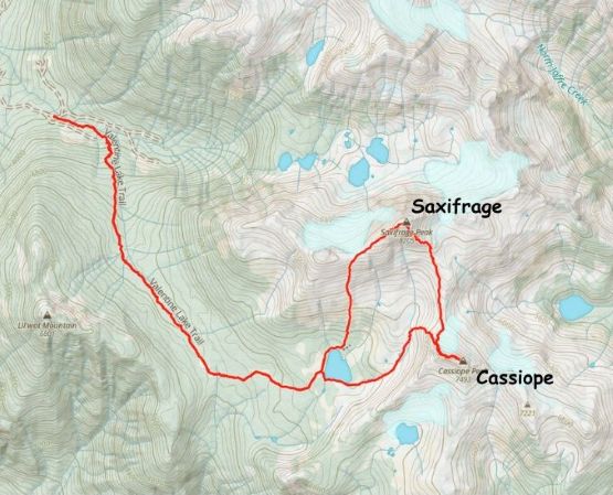
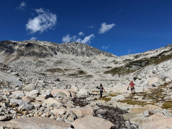
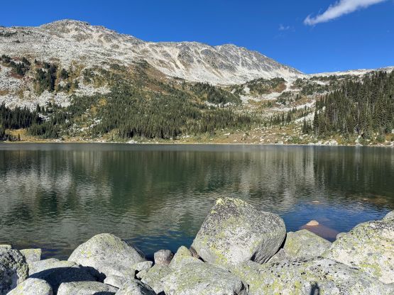
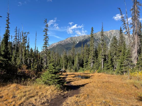
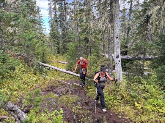
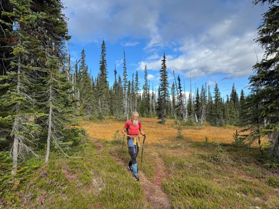
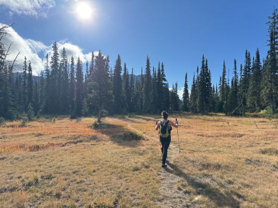
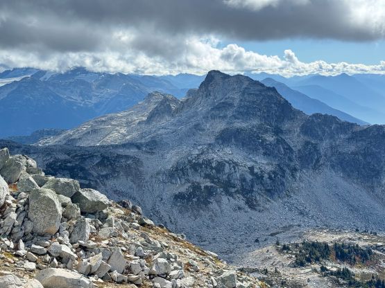
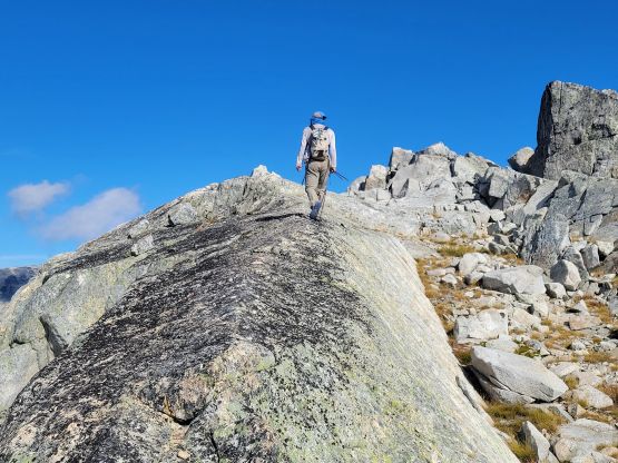
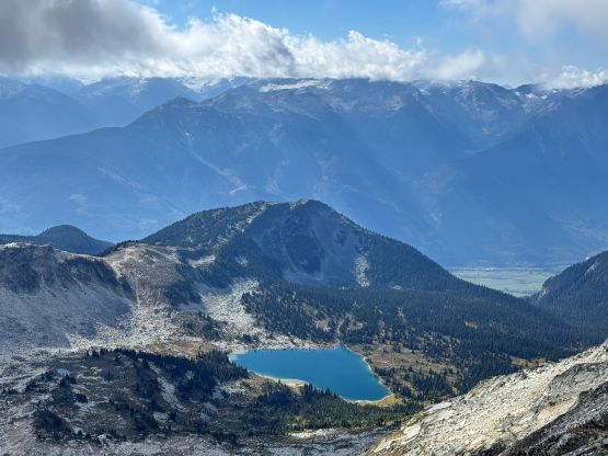
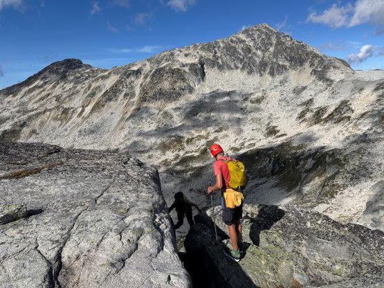
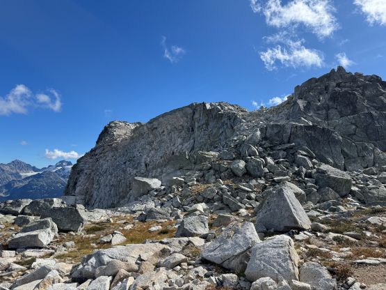
We actually briefly tried that spur road branching off to the right 200 m before the trail-head but didn’t get far enough to make the additional bushwhacking worthwhile, so turned around and settled on the standard start. Miranda went ahead to set a blistering pace up the trail, but within 15 minutes we all had to slow down to a more reasonable pace. The trail was very boggy and muddy so very thankfully we didn’t do this in the middle of the summer, as the area would be insane with mosquitoes otherwise. We made one long break to eat blueberries but still finished the approach in 1 hour 40 minutes. This approach was longer than I thought with substantial amount of plodding in flat country. Valentine Lake would be a nice place to set up camp as recommended by some of my friends but I simply could not afford doing overnight trips these days. I could hardly manage a day-trip without commitments in the city in the evenings. The easiest way of tagging Saxifrage Peak is via the W. Ridge and SW slopes (Class 2) and that’s also my original plan, so we went for that way. There’s not much worth documenting besides the route requires over 700 m elevation gain from the lake and the plodding was boring and monotonous. There’s some route-finding along the ridge thank to the blocky terrain, but one could keep the scrambling under “3rd class” if that’s the preference.

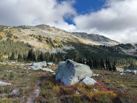
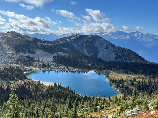

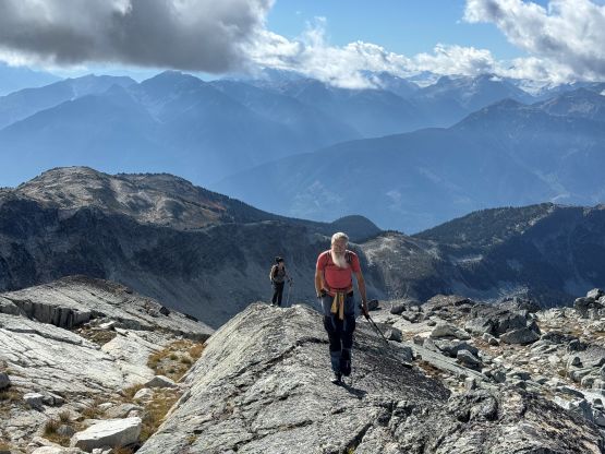
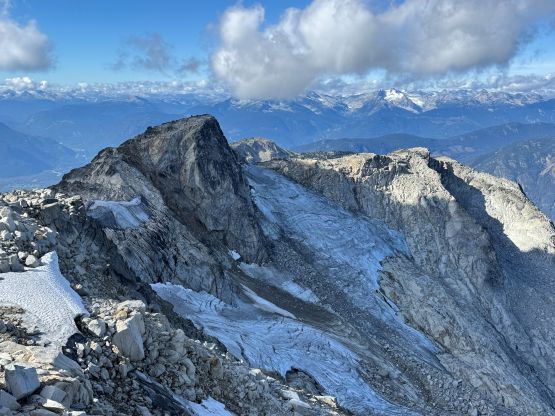
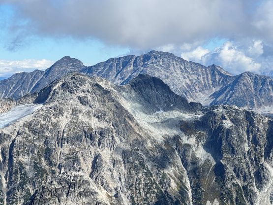
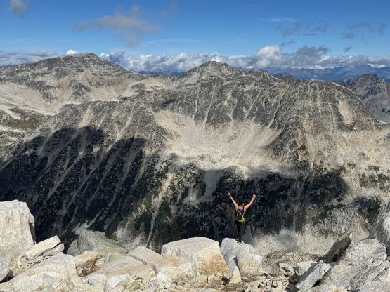
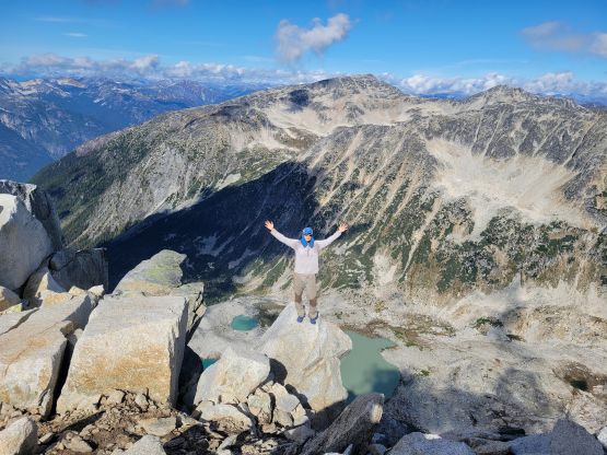
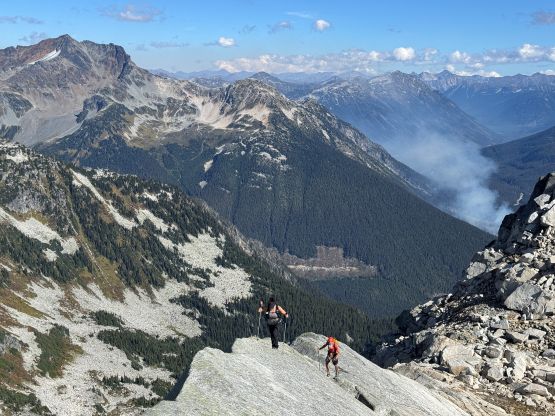
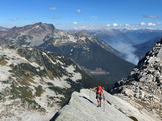
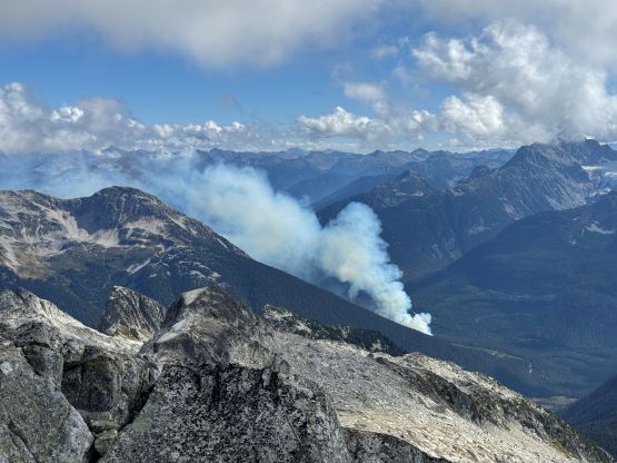
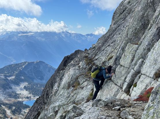
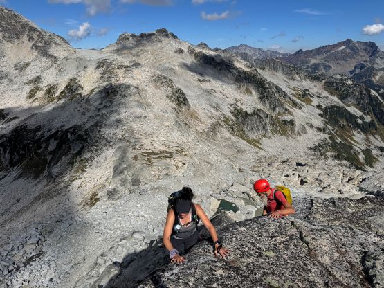
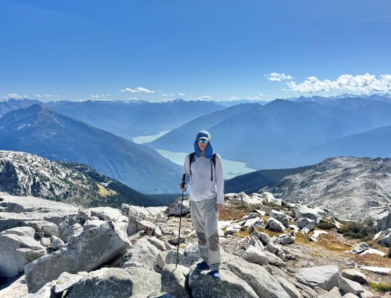
We made the summit of Saxifrage Peak in just over 3 hours so the final decision was made to traverse towards Cassiope Peak for completion purposes. I knew nothing about the SE Ridge of Saxifrage Peak besides briefly reading about “complicated route-finding”. I would actually agree with the assessment, that the route-finding would be difficult and complicated if one’s trying to keep the difficulty under 4th class. The three of us however, are very capable scrambling 4th or even low 5th class terrain so we more or less went for our own variations here and there, partially voluntarily and partially involuntarily. We crossed path with the cairned route multiple times and we weren’t on purposely trying to make things more difficult, but as mentioned in the other trip reports the route-finding was not trivial. The few “mistakes” we made were veering too far away from the ridge crest down skier’s right side, so future parties should keep that in mind. Once in doubt, traverse left back towards the SE Ridge proper. Lower down we stayed entirely on the west side (skier’s right) of Saxifrage/Cassiope col and the terrain was mostly grassy ledges and boulder fields.
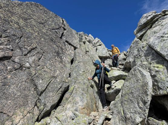
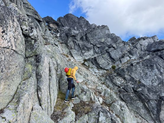
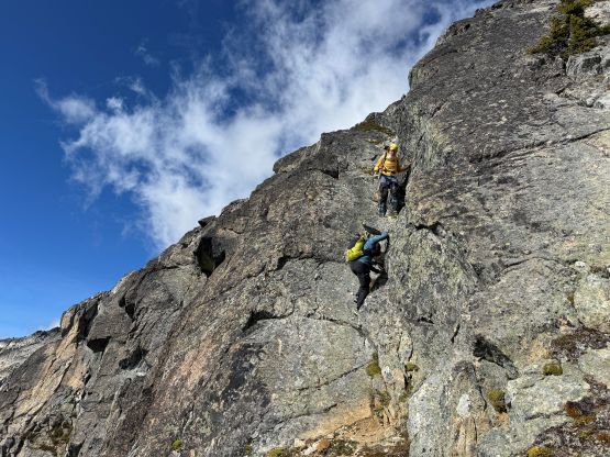
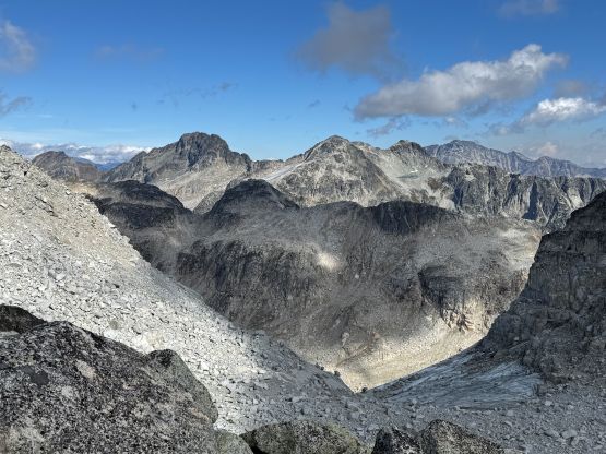
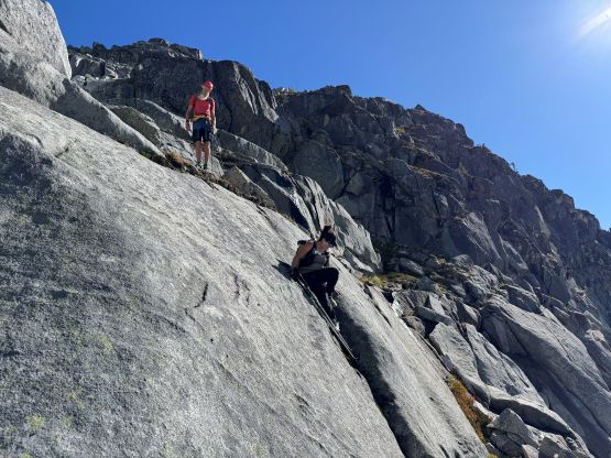
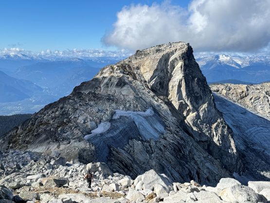
I checked the GPX tracks a few times, and it seemed like the standard route on Cassiope Peak required us traversing hard climber’s right to access a gully hidden from view. I made the decision for us to abandon the scramble route to go for the “ridge direct” variation. There appeared to have a few difficult rock steps but if I decided to repeat an objective I had to make it more memorable than simply plodding my way up. The route turned out to be rather chossy and difficult, and involved at least two sections of exposed 4th class climbing. We all pulled our way through, but we would not be down-climbing this variation. To connect towards the true summit we also descended the crest of the corner slab which was exposed but fun. Overall I did not regret redoing Cassiope Peak but this objective (via the summer route) was slightly more involved than anticipated. It was also interesting to know that asides the very summit, the two routes that I took did not overlap at all. I could hardly relate that I had indeed climbed this same peak twice.
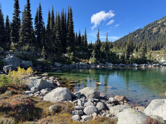
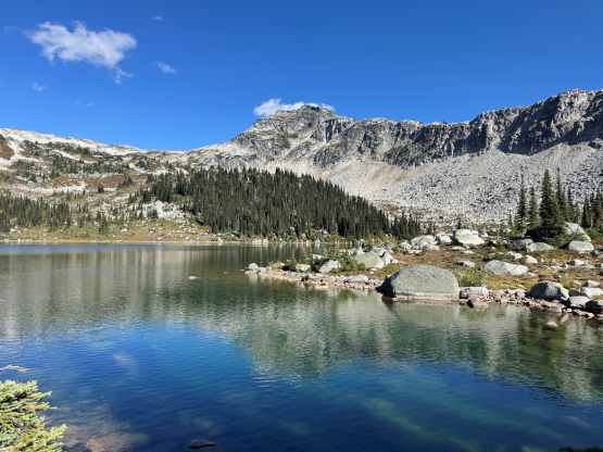
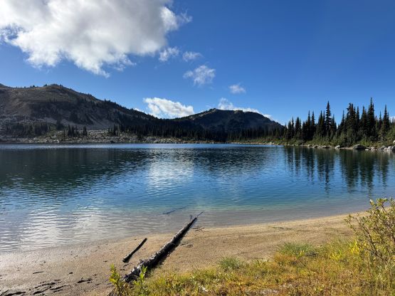
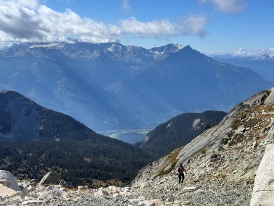
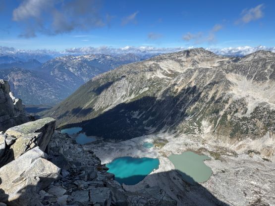
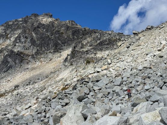
We weren’t doing particularly great on time so after taking in enough of the views we had to rush our way down. I led the entire descent by staying as close to the “Gunn route” as possible. I correctly located that grassy/ledge gully and the scrambling should indeed be no worse than 3rd class. Lower down we went off-route again and did some tricky down-climbing on steep heather mixed with blank granite slabs. We eventually made our way down to the lakes and took the last break of the day refilling the water bottles. There had been no reliable running water until this point so we desperately needed to rehydrate. Descending this valley toward Valentine Lake was tedious with lots of boulder hopping, and so was the traverse around the lake. We then jogged halfway down the trail and power-walked the rest of the way. Our round trip time was 7.5 hours and despite the heavier-than-usual Lion’s Gate traffic, I made my way to UBC at 7:50 pm. Clair had fortunately (or unfortunately) finished her classes half an hour earlier so I still made her wait for me.