“Ruffle Peak” and “Eyeball Peak”
February 18, 2026
2257m
Duffey Lake Road, BC
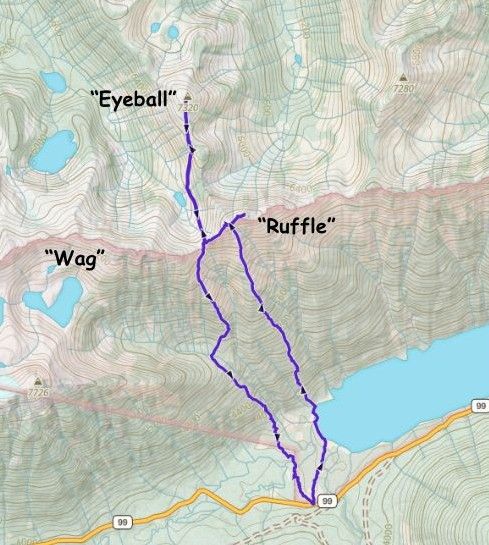
“Ruffle Peak” is the unofficial name of one of those P100m objectives looming immediately above Duffey Lake, whereas “Eyeball Peak” is hidden behind the ridge further to the north, but still boasts over 100 m prominence. The names are obtained from bivouac.com. As much as I hated these “Bivouac names” I have to give in these days because these names are starting to stick, at least online and in the peak-bagging community. These two particular objectives lacked information but it wasn’t hard to figure out a viable route based on the topographic maps, the satellite images and the various photos on the internet.
Elise and Tanja were originally planning on another objective in the Duffey zone but I managed to convince them to try this exploratory mission. I didn’t have the details planned ahead but I knew where roughly we should be aiming at, and the details would be decided in situ based on field observations. I was originally considering taking Alastair F.’s approach into the hanging valley south of “Wag Peak” (which the BCMC group used for approaching “Niche Peak”), but we ended up doing the direct south spur of “Ruffle Peak” by crossing the frozen Duffey Lake and descending Alastair’s route on the return. Our route had much worse dead-falls but Alastair’s route was worse at the bottom. In short, these peaks are only for the die-hard peak-baggers with obsessive-compulsive disorder and should not be recommended to the general public. I think it sucks balls no matter how one dares to approach.
To make it worse there were at least 15 cm of fresh snow over the past few days, and the temperatures had taken a dip with windchill below -20C on the summits. Needless to say I was oscillating for about 2 days but in the end I decided to join and took Wednesday off work. These conditions would be considered “normal” for Alberta Rockies but after living in Vancouver for more than 10 years I had notably become soft. I did remember to dig out the balaclava and ski goggles from the depth of the buried gears and stuffed them in at the last minute. On the bright side there wasn’t enough loading to change the big picture, that the avalanche forecast was still “green brick”. Elise and I left home at 4:15 am and then grabbed Tanja from Squamish an hour later. I insisted for us to stop in Pemberton’s McDonald’s for breakfast as I preferred to eat hot food. We eventually got to the starting point about 4 hours after leaving home. The parking pull-out was the same as the BCMC’s “Niche Peak” approach, which Tanja and friends followed a few weeks prior.
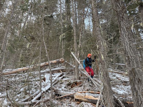
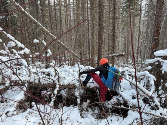
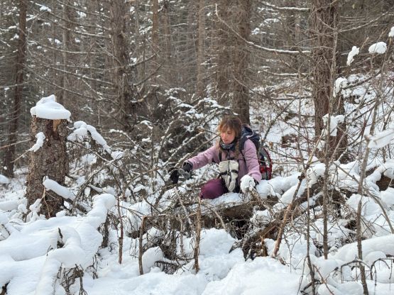
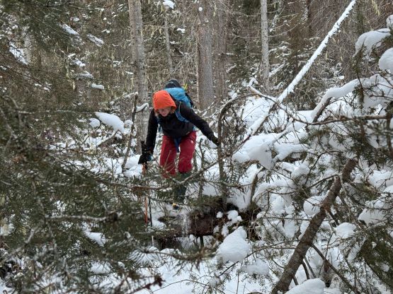
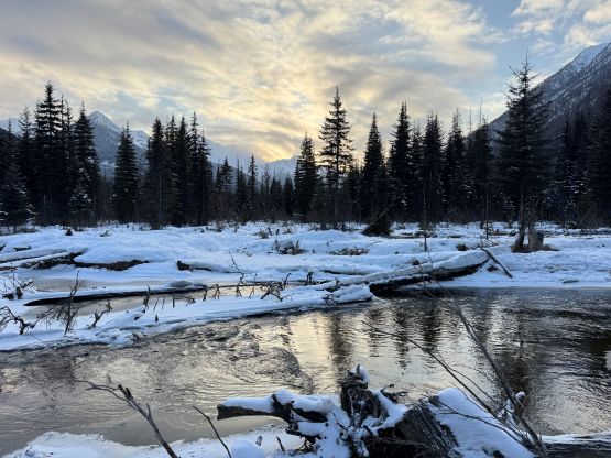
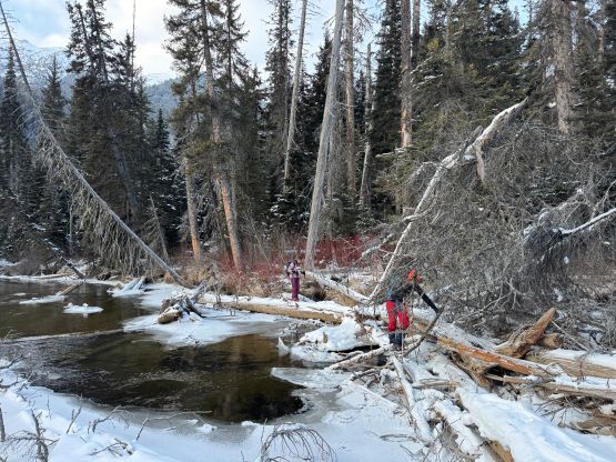
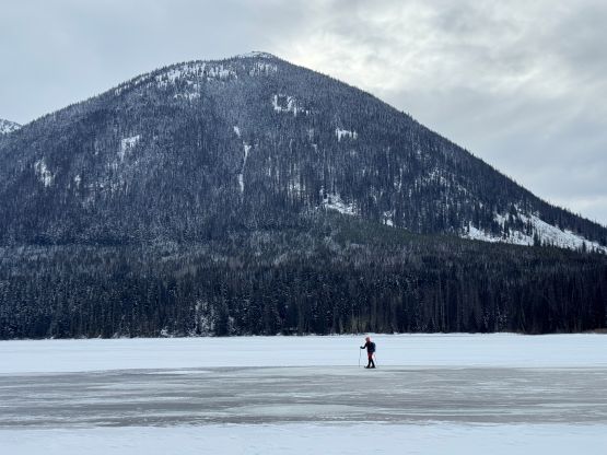
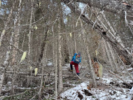
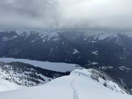
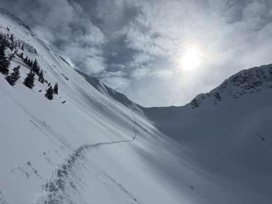
Right off the bat I announced that we wouldn’t be taking the BCMC’s route simply because I was more keen on trying something different. This was meant to be an exploratory mission after all so we should try to avoid using “beta” if possible. We veered right away from the GPX track aiming straight towards the west end of Duffey Lake. I was anticipating some fast plodding in open forest on snowshoes, but the reality was cruel. Despite having a meter of snowpack to help smoothing the terrain, there was enough pick-up sticks and tight timbers to make the bushwhacking real. I thought this kilometer-long dash was quite bad but it was still better than the BCMC route that we took on the return. At least there’s no swampy section nor zones with gigantic dead-falls. The lake didn’t appear to be fully frozen with at least one patch of open water so I quickly gave up the idea of crossing the open lake. The lake did appear to be frozen when viewing from above several hours later but not on the very far western end. We traversed around the lakeshore but then came to the outflow river which is Cayoosh Creek. This river was completely open and there was no sight of a downed tree anywhere close. Backtracking was not particularly practical at this point but then I thought the lake’s ice was probably okay to cross had we ventured far enough onto the lake’s main body. This resulted in going at least 200m in. My hypothesis turned out to be correct because none of us fell into the water, but the crossing was questionable enough that we made the in situ decision to not return the same way.
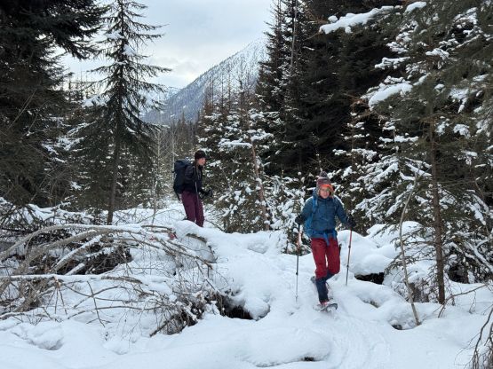
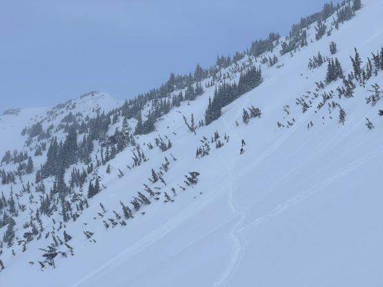
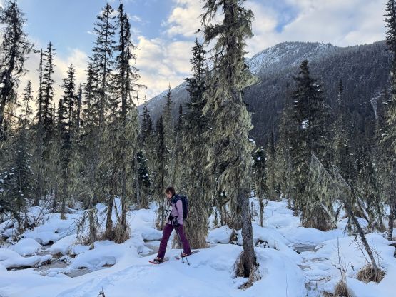
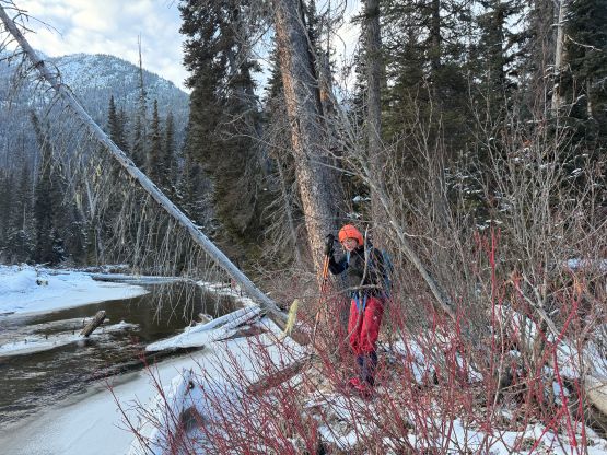
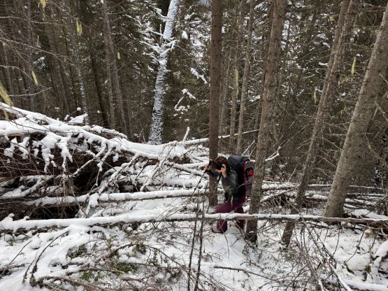
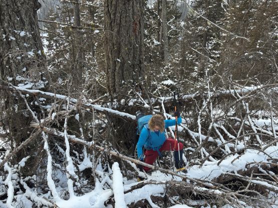
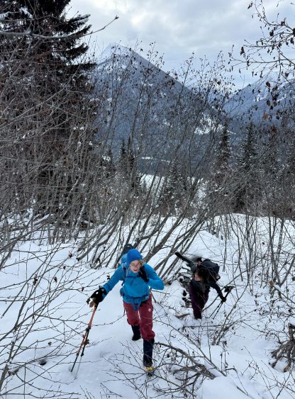
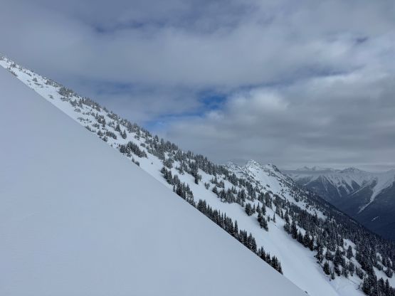
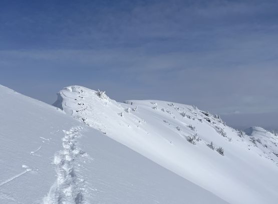
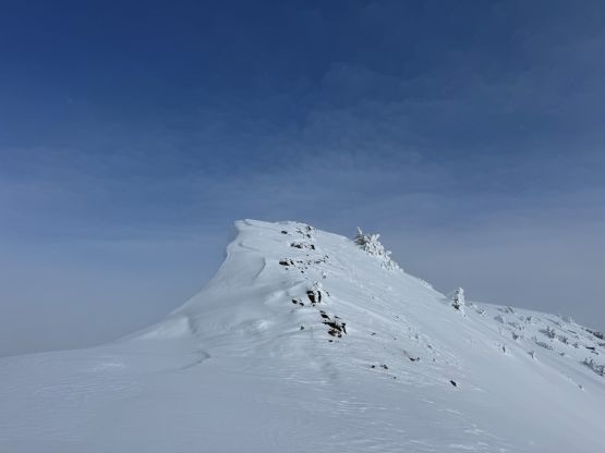
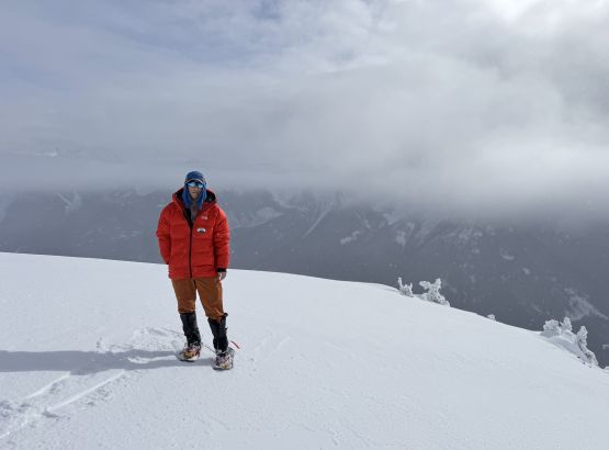
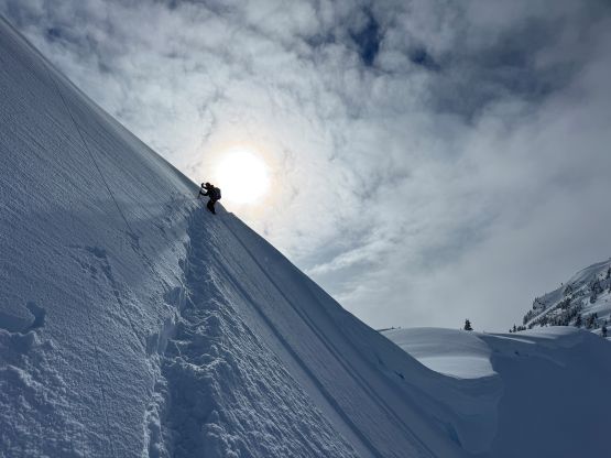
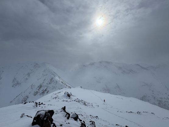
And then there came the bushwhacking. I had done one previous trip in similar fashion by crossing the frozen Duffey Lake further to the east and this one was very much similar. The bottom 300 vertical meters of bushwhacking was actually worse as there’s virtually no snow. We had to remove the snowshoes for this stretch. There’s a dusting of fresh snow but that only served to make the footings more slippery. We encountered unbelievable amount of gigantic dead-falls that required class 3 moves to maneuver around even with careful route selection. Tanja announced that this route was worse than the one she took a few weeks prior so this further confirmed our decision to descend the other way, but first of all we must soldiered through the mess. Thankfully at around 1500 m elevation the situation improved drastically and the snowshoes were eventually strapped on another 200 vertical meters higher up. There were only up to 30 cm of fresh snow in the region so the trail-breaking never became too heinous. The three of us took turn putting the trench all the way up to the summit ridge. The true summit of “Ruffle Peak” appeared to be either the next or the last bump to the east so we traversed across all three high points to be 120% sure. The cornices were unfortunately enormous that we didn’t get that perfect 360-degree panoramic view. The weather wasn’t that fantastic anyway. In fact, the weather was worse than forecasted with only glimpses of views from time to time.

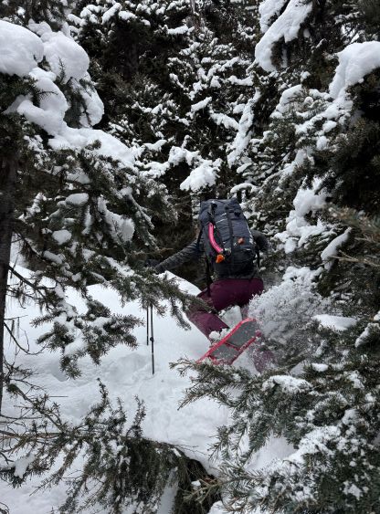
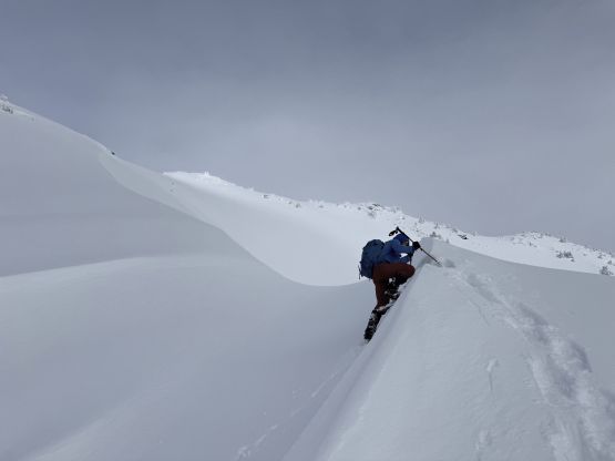
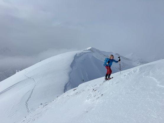
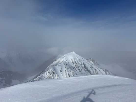
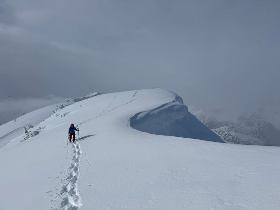
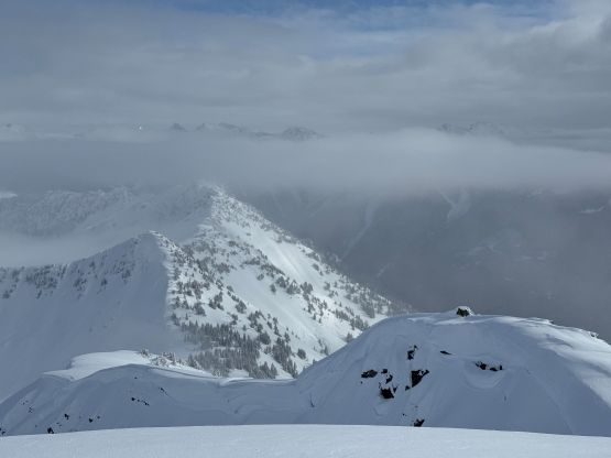
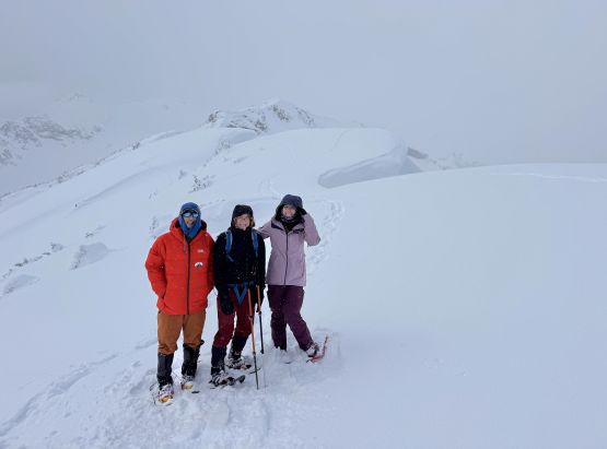
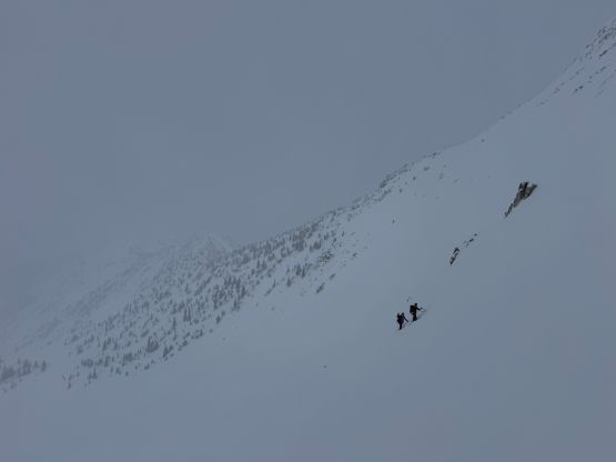
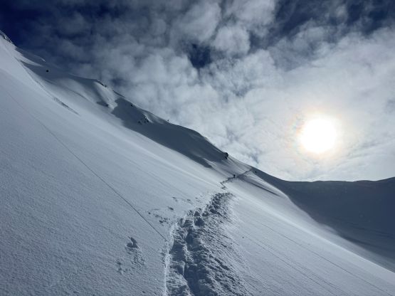
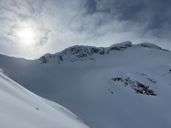
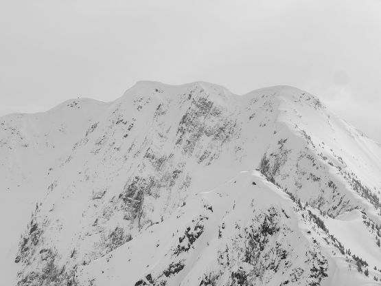
My original plan was to descend the broad NW Ridge of “Ruffle Peak” in order to more or less stay on the connecting ridge towards “Eyeball Peak”, but this didn’t work out as planned. The bus-sized cornices blocked the entrance that I couldn’t get close enough to the edge to have a better understanding of the terrain. I also didn’t want to risk falling through the cornice so we sadly had to descend all the way to Ruffle/Wag saddle, which itself wasn’t trivial neither and required some technical snowshoeing. Most parties would have to remove their snowshoes and don crampons for the descent of the west ridge of “Ruffle Peak” but I managed to lead us down without having to add the transitions. Fortunately I had come with a “plan B”, that was to traverse the steep terrain around the west side of the intermediate bump. This required more elevation gain/loss but actually worked out nicely. Elise and Tanja wasn’t too stoked but reluctantly agreed to follow. We didn’t have to descend all the way to the tarn in this valley because I managed to put up a massively long side-hilling track. The terrain was big though, that having the “green brick” on our side was definitely necessary. The worst was crossing two gullies much higher up around “Bump 2135”. Again, the snowshoeing was quite difficult but didn’t impose much problem on myself. The south ridge of “Eyeball Peak” turned out to be a foreshortened drag which was the unpleasant part of this ascent. This is definitely a rarely ascended peak as I wasn’t aware of any previous ascent on the internet world. There’s however a big cairn on the summit suggesting frequent visits by perhaps the locals. I unfortunately couldn’t find a register, nor did I try hard due to the snow and the cold.
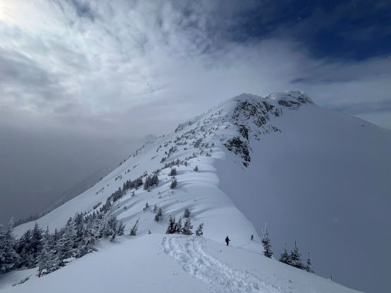
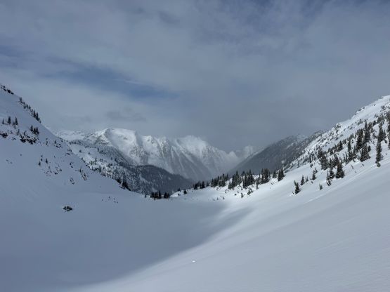
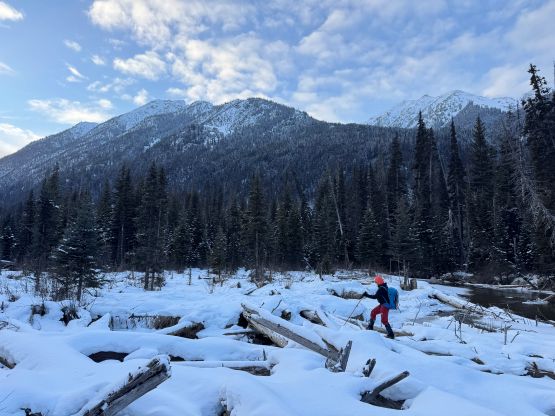
It didn’t take us long to reverse following our tracks back to Ruffle/Wag saddle. The weather had become worse with some light flurries and there’s at least one troublesome step on the east ridge of “Wag Peak” that made me pausing for a second. We made the final decision to leave it alone for another time. I knew from previous observations that “Wag Peak” should be mostly a walk-up via the SW slopes so I would have to try that route another time. To descend the BCMC’s “Niche Peak” approach we had to traverse to the next rib further west, which required crossing more gullies and avalanche terrain. Fortunately the condition was on our side. Descending the SE Rib of “Wag Peak” wasn’t too bad with only minor bushwhacking near the hanging valley lower down. We then crossed the creek and merged onto the Alastair’s group’s GPX track. The snowshoes were quickly removed and then we “enjoyed” some manageable bushwhacking down to the valley flats. The final kilometer-long plodding back across the valley flats was nowhere as enjoyable. Even with a GPX track it was hard to stay oriented. We encountered numerous ugly fields of dead-falls. The swampy section as well as the crossing of Cayoosh Creek was fine given the deep freeze we were having right now, but the pick-up sticks were absolutely horrendous, even with a meter of firm snow. I cannot imagine coming up this way in summer with all the swamps and mosquitoes. The terrain was disorienting enough that I eventually opted to navigate the bearing while holding the GPS screen on my hand (despite the -15 C temperatures), and eventually got back to the vehicle in less than 9 hours round trip. The three of us then took turn driving home and I eventually got back by 9 pm.