“Niche Peak”
December 31, 2025
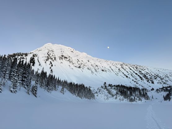
2320m
Pemberton, BC
“Niche Peak” is one of the bivouac-named objectives in the vicinity of Mt. Rohr and Mt. Marriott that boasts over 100 m prominence. For almost 10 years I insisted to ignore these peaks because I absolutely hated these unofficial names. The reason is simple, as I simply do not believe that us peak-baggers have the “right” to name geological features without a complicated approval process by the government. There sure have a shit ton of peaks in this area (based on the 100 m prominence cut-off), but in my ideology they should only be referred by elevation or coordinates. However, these peaks are ascended more and more often these days, that these “bivouac names” are starting to stick at least on the online world, so I sort of have no other way but “accepting” them. Oh well…
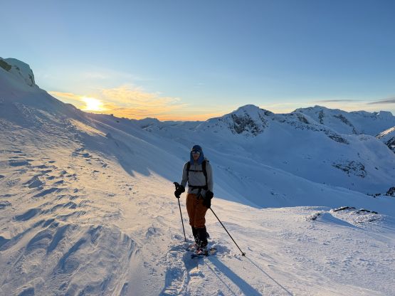
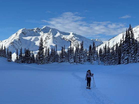
“Niche Peak” requires one to ascend/traverse some steep slopes if done in winter conditions, so I reserved this objective for a day with the “green brick” forecast. This happened on the last day of 2025 and Erica was easily convinced to join. There had been one BCMC trip report in 2023 for reference, but my plan was to use a completely different approach by traversing over the north side of Mt. Rohr. The ascent of “Niche Peak” via the south face ramp would be the same, so their trip still helped our planning. We decided to carry ice axe and crampons but ended up doing the entire ascent and descent on snowshoes. Due to the cat I couldn’t leave home until 6:30 am so we were looking at starting at around 10:30 am, which was a tad bit late for an exploratory objective in December, but that’s fine.
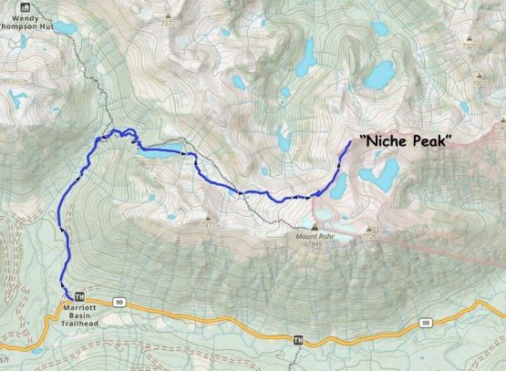
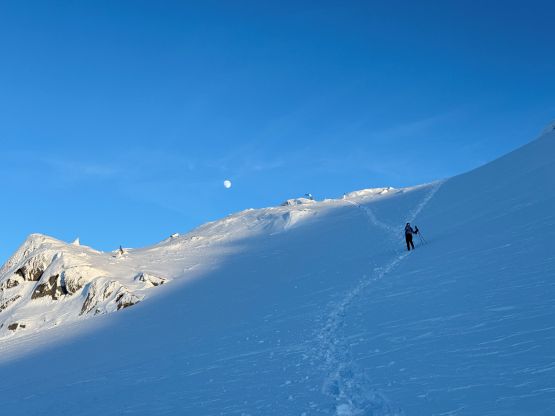
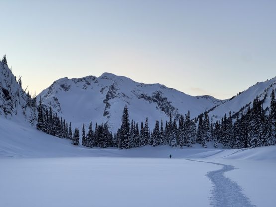
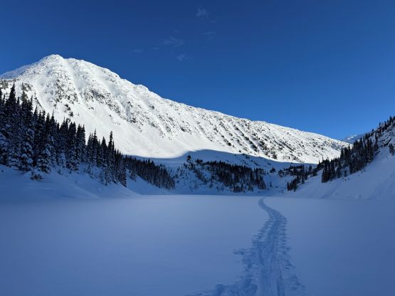
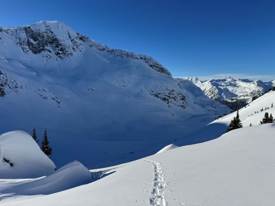
This was only my second time parking at the Marriott Basin trail-head. The first time was Mt. Rohr over 10 years ago, also in December. The approach was longer than what I remembered. It took us a while to plod to the official trail-head, and the route to Rohr Lake was also more complicated than I thought. The numerous sets of skin/snowshoe tracks made for a confusing maze. I made a mistake by not downloading my own GPX track so at one point I thought we were off-route veering too far climber’s left towards Wendy Thompson Hut. This was actually not the case but I made the call for us to make a cross-country traverse to the right. A while later we intersected a set of fresh skin/snowshoe tracks which we quickly discovered was made by Tareef and his partner. We caught up to Tareef on the boulder field immediately underneath Rohr Lake’s outflow. Tareef was on skis but his partner was snowshoeing while carrying the splitboards, said he wasn’t feeling comfortable to skin. That explained the meandering mix set of skin and snowshoe tracks. Tareef’s tracks converged with the main set of skin tracks and in short time we arrived at the frozen Rohr Lake. Plodding across the lake we quickly caught up to the next group of two skiers but then there was no more track to follow.
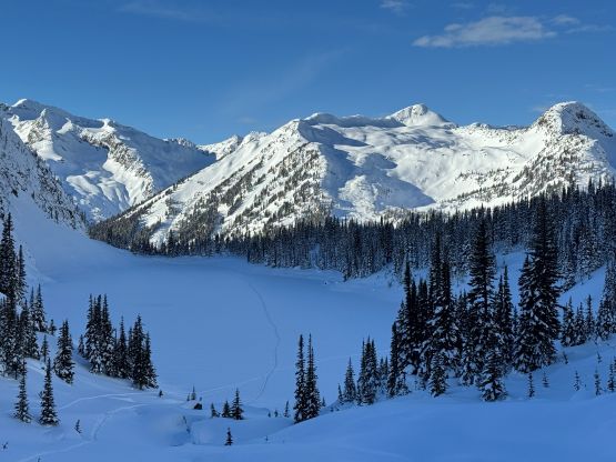
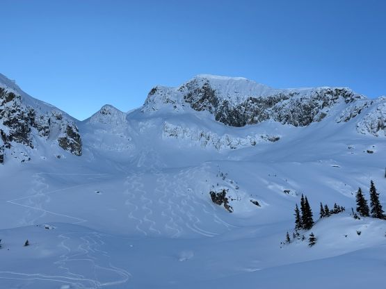
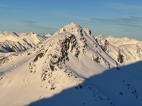
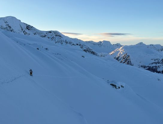
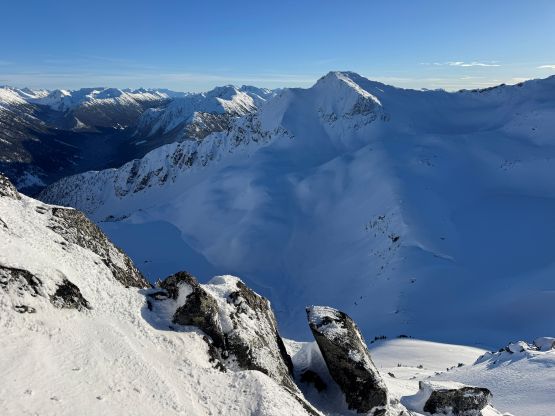
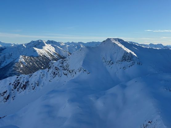
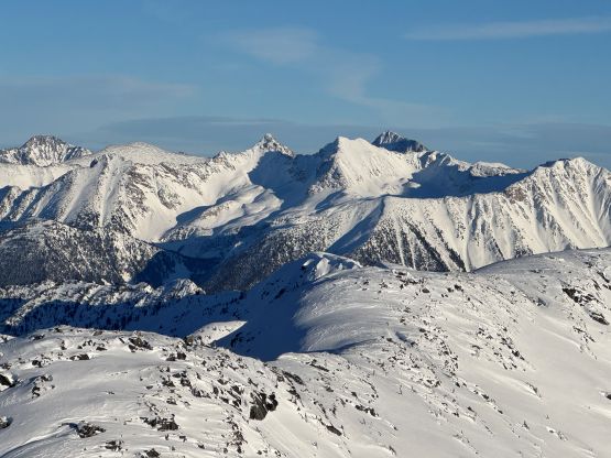
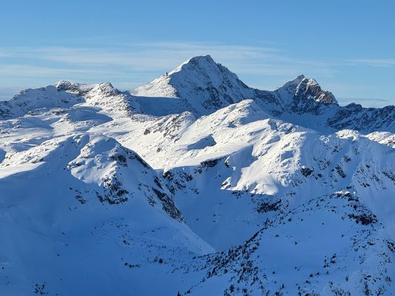
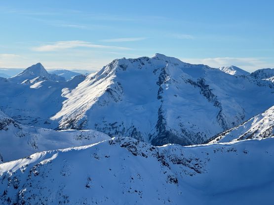
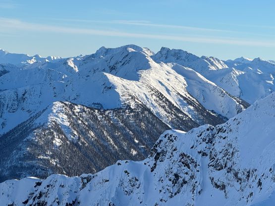
From the basin underneath Mt. Rohr and “Wonk Peak” we deviated from the standard Mt. Rohr’s route and went directly towards Rohr/Growl saddle where we took the first lengthy break of the day. There was some sunshine but the winds were sort of chill. We then ventured into the unknowns. The most certain way to access Rohr/Niche saddle was by dropping over 150 m elevation down to the NE but given the low/low/low avalanche forecast we decided to take a higher line traversing across the steep and complicated north slope of Mt. Rohr. This way requires about 150 m elevation gain and loss so effort wise the two options should be similar. Our route indeed involved a healthy load of traversing and definitely required the most stable conditions. We were able to keep the snowshoes on despite the slope angle approaching 40 degrees so the snow condition was basically optimal.

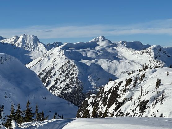


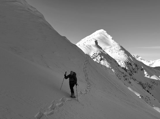
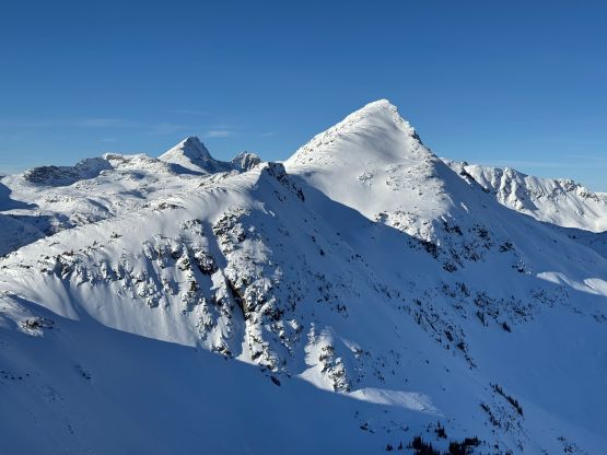

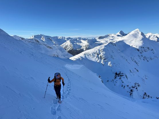
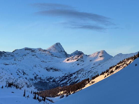
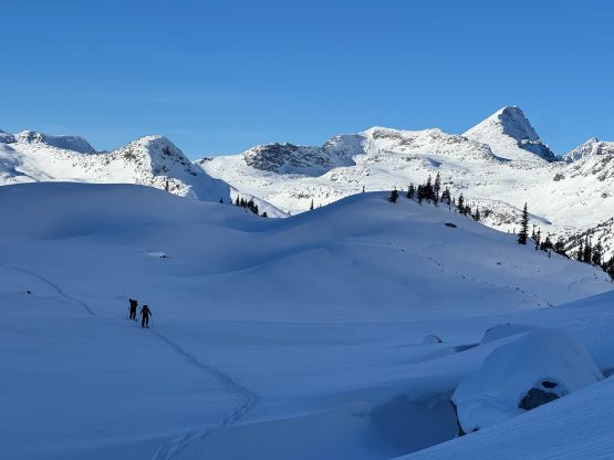
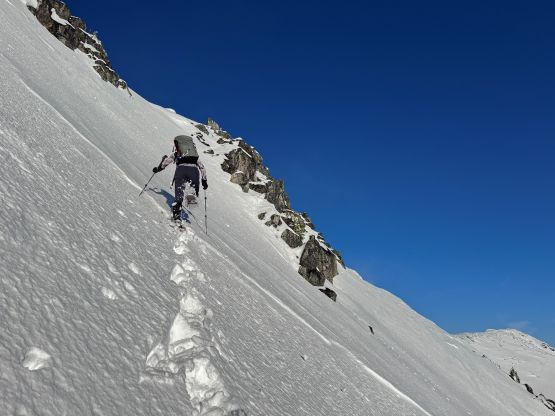
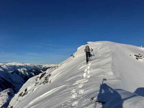
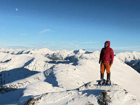
Hitting the high point on Mt. Rohr’s north spur I decided to stick to the ridge crest descending towards Rohr/Niche saddle, but such didn’t work out as planned. The terrain quickly became narrow and exposed, that even though it might work with ice axe and crampons I decided to turn around to try traversing down into and then across the south-east side bowl. I figured this would be faster overall. There’s one unnamed lake in that bowl, but we didn’t have to drop all the way down there. Instead we made another long and steep traverse across the south facing slope and eventually rejoined the ridgeline, which brought us down into Rohr/Niche saddle. From there we finally joined the BCMC’s route by traversing diagonally onto the south face ramp. The ramp appeared steep and it sure was, but given the soft condition we again managed to keep the snowshoes on for the entire way. The slope angle was about 40 degrees at the steepest. There was still fair amount of terrain to negotiate on the upper SW Ridge but nothing complicated, and we managed to reach the summit before the two other skiers’ teams topping out on Mt. Rohr.
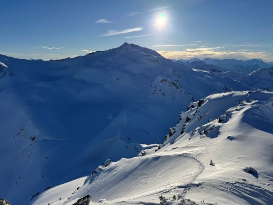


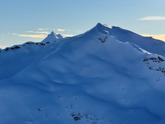

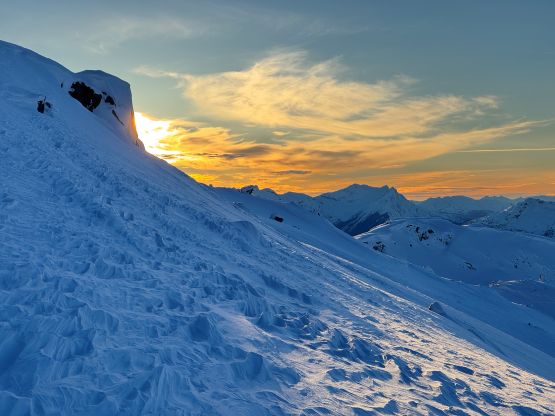
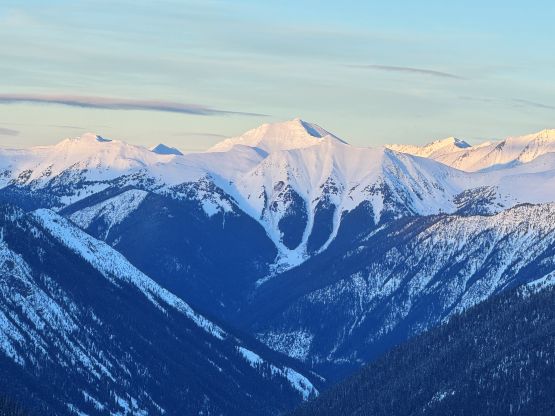
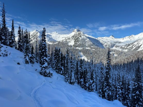
We again, opted to keep the snowshoes on and gingerly made our way down the steepest part of the ramp. It sure would be “better” to switch to bootpacking but we were too lazy to add the transitions. The re-ascent of Mt. Rohr’s north shoulder was a grunt but the traversing section was very scenic with the late afternoon sun. We would have at most half an hour’s daylight time left, so rushed our way back down to Rohr Lake. It appeared that “the other team” had descended the south face of Mt. Rohr as we could only spot Tareef’s team’s tracks, which were made by a mix of ski and snowboard tracks. The snowboard tracks quickly gave way to snowshoe tracks as the terrain became flatter and more undulating, so we knew that we would catch them up quickly. We sure did, near the outflow of Rohr Lake. We then rushed our way down the boulder field plunging down as much as untouched powder as we humanly could. The head-lamps were not turned on until the flats above the summer Marriott Basin trail-head. The final few kilometers of plodding felt like a drag, and our round trip time was just over 7 hours. Given that the BCMC’s group took 11 hours via their route, I would say that our way was definitely more efficient, despite being longer in distance.