“Mount Durieu”
March 27, 2026
2290m
Pemberton, BC
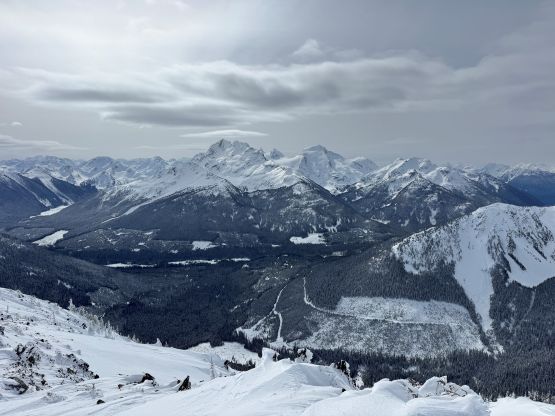
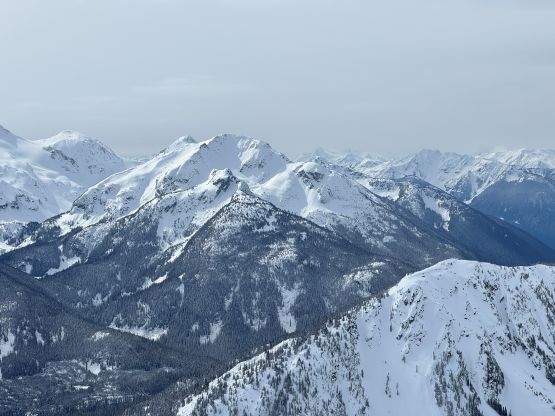
“Mt. Durieu” is the unofficial name of the 2290-m summit on the south ridge extension of Mt. Marriott and the name had been given by Robin Tivy on bivouac.com and has since been adopted on many sources. Most of the peaks in the Duffey area are unnamed so instead of calling each of them by their elevation numbers we might as well use these “bivouac names”, even though I’m never a fan of them. This peak does boast 100 m prominence to qualify as an independent summit. The position of this peak guarantees good views on a clear day and the access seems straightforward. Earlier in the year Andrew K. had successfully blown this one up in the SWBC Peak Baggers Facebook group which now has 20,000 members and my plan was to reserve it for a day with decent weather forecast but questionable conditions or when I was lacking motivation. This is not a “trophy peak”, after all.
Mel had this Friday off and the weather forecast seemed reasonable for areas farther to the east. The Duffey area would see mostly some high clouds. The avalanche forecast downgraded to “considerable” at the last minute so I spent almost an hour zooming in on various map layers and photographs and the decision was still made to go for “Mt. Durieu”. We would be carrying avalanche gears this time. The temperatures seemed fairly cold throughout the day so there’s no point in starting too early. The decision was made to meet at “the church” at 5:30 am and go from there. A couple hours later we were in Pemberton having breakfast in McDonald’s and another half an hour later we got to the Marriott Basin trail-head. This was the second time I parked here within a couple months.
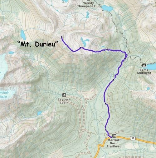
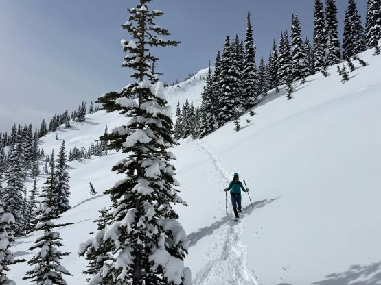
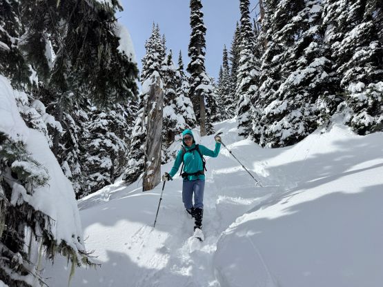
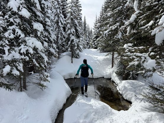
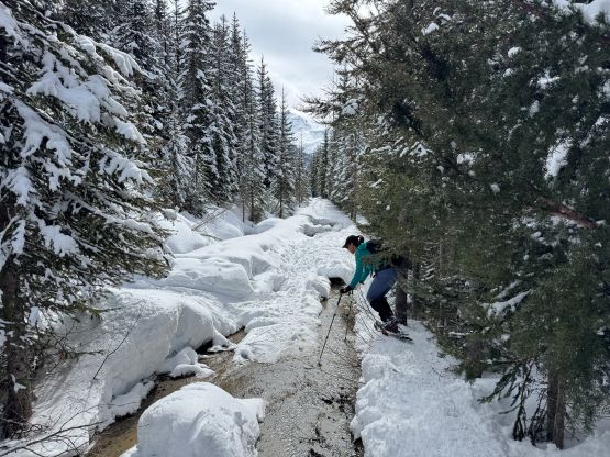
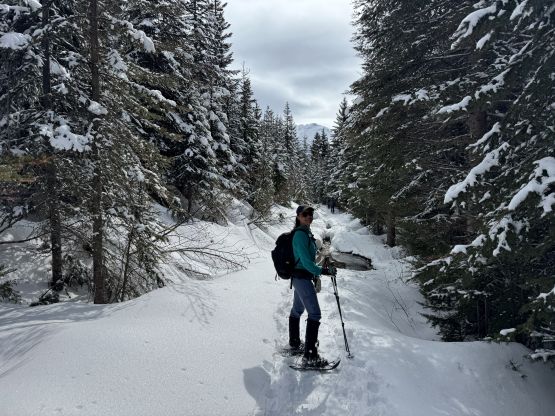
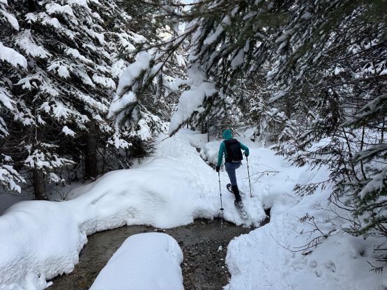
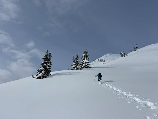
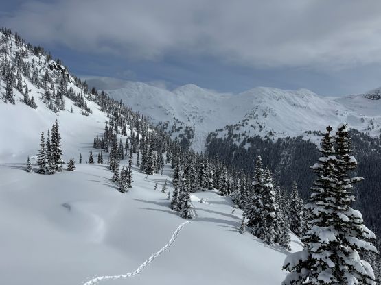
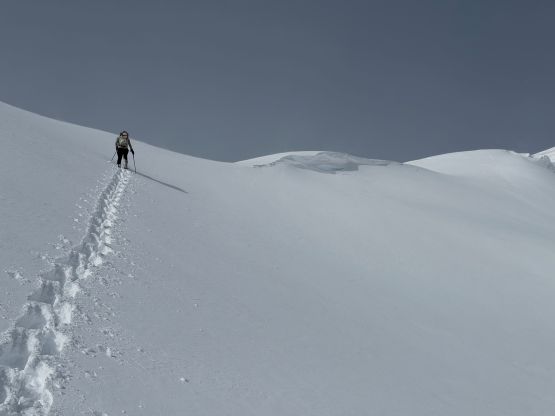
I had brought two pairs of snowshoes and decided at the last minute to wear the 30′ Lighting Ascents. The forecast called for 20-40 cm of fresh snow and the observations reflected that. Once leaving the Wendy Thompson Hut trail I was 100% sure that we would be post-holing for the entire way up. Mel’s strong enough to share the trail-breaking work with me but having the largest set of snowshoes could certainly be beneficial in some circumstances. They gave more contingencies. The initial 3-4 km was a boring slog up the FSR and then the trail (with some up-and-downs). Parts of the service road were already melted out and required some bushwhacking to bypass the water puddles. I had Andrew’s GPX track loaded but didn’t bother to follow. We left the main trail earlier and did a steeper and more direct attack in the forest. I don’t think our route would be the preferred way for the beginners but it worked out nicely for us. Given the heavy duty trail-breaking the plan was to minimize the horizontal distance. Going straight up the steep slopes would put more work on my quads and hamstrings which were definitely where my strength’s at.
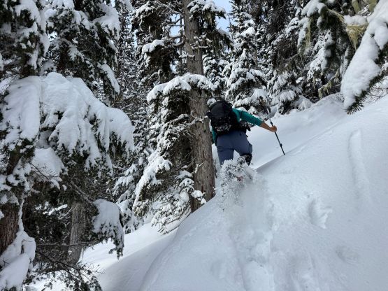
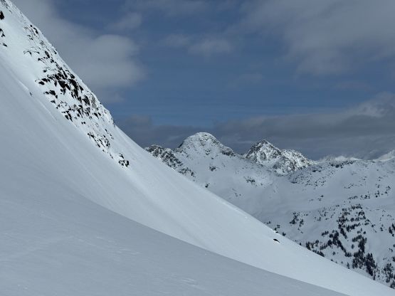
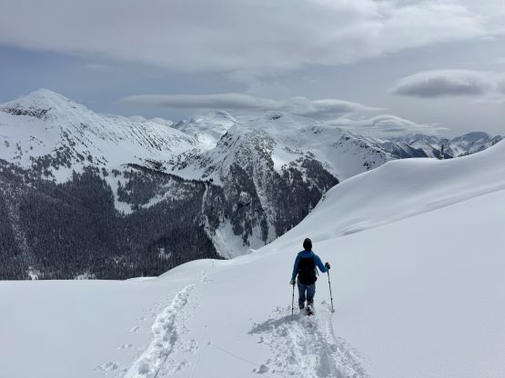
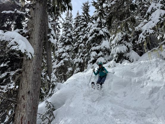
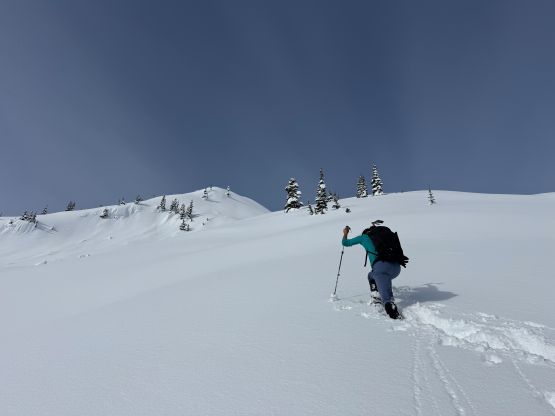
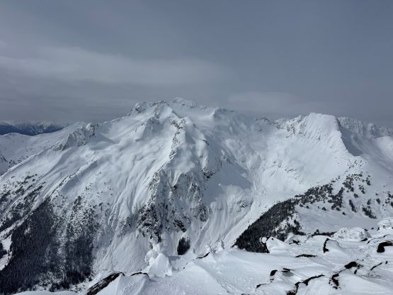
Around 1800 m elevation we came out of the trees and there came the first steep traverse due climber’s left to access the steepest part of this route, which was the section that I was concerning. The terrain didn’t appear as steep in person but I agreed with Andrew that the grade was overall steep enough to impose avalanche concerns. On this particular day we didn’t see any sign of instability as we pounded our way straight up the middle of this stretch. The steepest slope probably goes at around 35 degrees. Higher up the terrain became mellower but the post-holing was sustainedly heavy so we eventually dropped the packs to take a break.
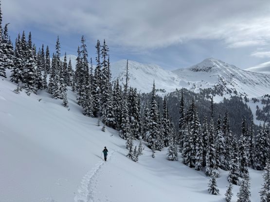
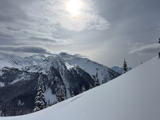
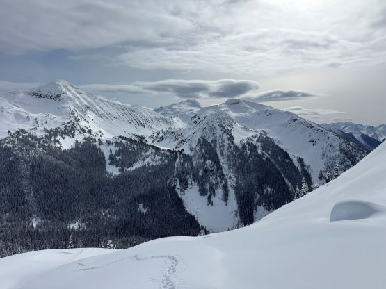
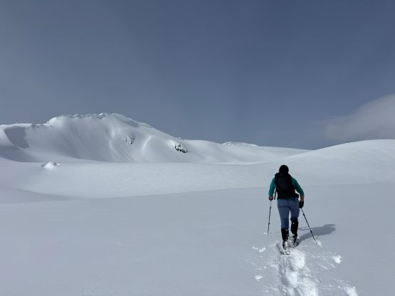
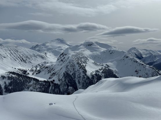
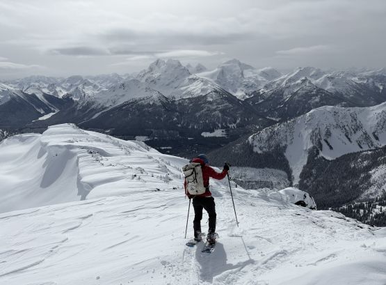
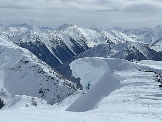
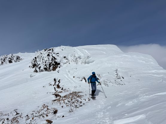
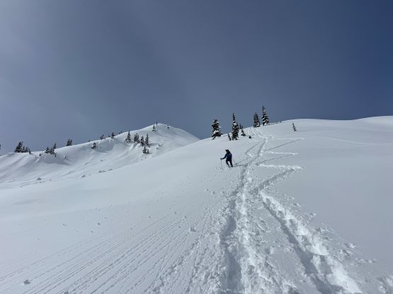
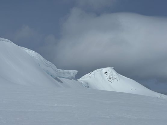
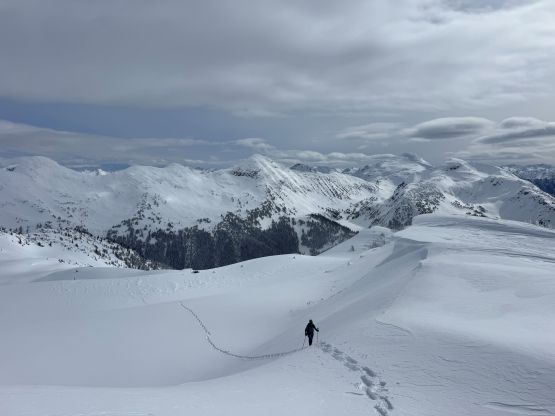
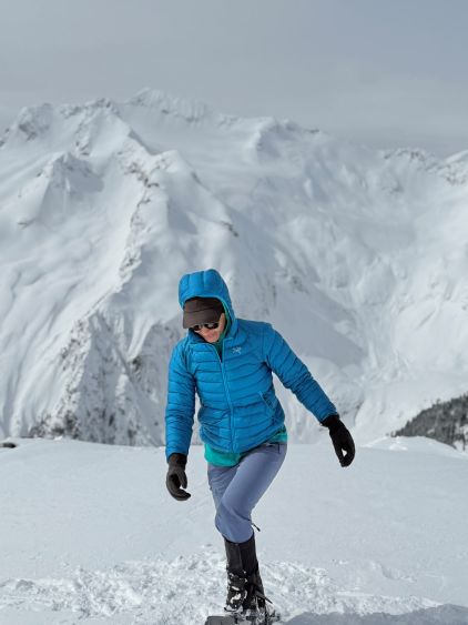
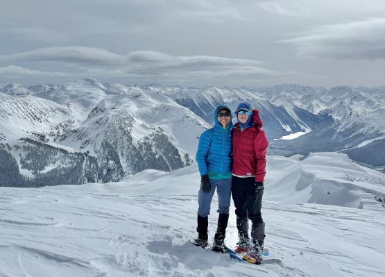
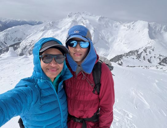
There’s another steep roll to ascend but by going climber’s right the terrain was more or less manageable. We were completely in the alpine zone (“considerable” avalanche rating) at this point but the slope wasn’t as steep as the section we ascended lower down. We then veered left (south) a little bit and ascended another steep but short slope to gain the broad SE Ridge of our objective. The cold winds picked up but the post-holing also gave way to some firmer snow surfaces. There were some large cornices dangling on the side of this ridge but the ridge itself was wide enough such that the navigation was trivial. We did discover several rock crevasses and that’s something worth to watch out for. There were also more up-and-downs than I thought along this ridge so the final stretch took us a while. We eventually got to the summit in exactly 3.5 hours after leaving the vehicle.

Due to the cold winds we quickly started the descent after taking in the views. We basically followed the exact tracks that we had laid for ourselves, but for softer areas we would plunge down the virgin snow beside our tracks. Descending the steep forested section required some care due to tree well hazards and the slippery conditions. We came across some fresh skin tracks but saw nobody around, so I don’t know what they were doing up there. It’s possible that they simply didn’t like our steep “straight the heck up” type of snowshoe tracks and decided to go for their own way up this mountain. The rest of the descent was uneventful and we finished the round trip in 5 hours 10 minutes. I then drove us all the way back to Vancouver in a single shot.