Mount Alex Graham
June 19, 2024
1663m
Williams Lake, BC
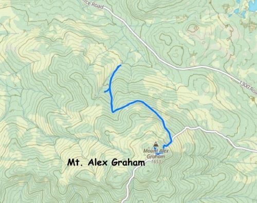
Mt. Alex Graham is the highest point of a large plateau west of Williams Lake and subsequently boasts over 600 m prominence. The entire hill is riddled with logging roads and the summit can be attained by driving a 4×4, high clearance vehicle to the top. Matt J. had mentioned this objective a few times in the past several years and his recent trip report was very helpful in our trip planning. Matt ended up having to walk 3.5 km each way but he thought I could drive to the top in the trusty Taco with some “handsaw actions”. I do not have much experience with sawing but I did own a 500-dollar chainsaw. I bought the saw about 4 years ago for Skihist Mountain and had actually never used it, but I figured it wouldn’t be too difficult to figure things out in situ.
This was a side trip on the way to Mt. Tatlow. Erica and I left home at around 6 am and met up with Adam W. and Dave G. an hour later in Abbotsford. We had budged the entire day for the 9-hour drive deep into Nemaia Valley so we did have plenty of extra time. We grabbed the idea from Matt J. about tagging Mt. Alex Graham while driving up the Chilcotin-Bella Coola Highway. The 4 of us together drove 3 separate vehicles to Williams Lake and then Dave left his van in the Walmart’s parking lot. About an hour later we turned onto “Bush Road” which quickly became “1300 FSR” to the southeast of our objective. The names of these roads are simply obtained from the Gaia map and I’m not sure if they are the actual name or not. On hindsight I should have consulted with Matt more about the driving direction because we got disoriented a few times. There was one washout (impassible in Adam’s Subaru) that forced us to turn around, but Matt did not mention a thing about it in his trip report. I had no choice but to consult with the maps and satellite images and formulated a “plan B” which eventually merged back onto that “1300 FSR” so they had essentially built a bypass but the bypass was not shown on the Gaia map yet. Matt’s northern route was also not shown on the Gaia map but I had downloaded the satellite images and navigated us to the starting point.


The spur road seemed narrow and infrequently used and sure enough, we encountered some deadfalls right from the bat. I was hoping that someone would have come and sawed them through but I guess it was finally the time for me to use the brand-new-but-yet-4-year-old chainsaw. The last time that I had recharged the battery was about a year ago, so I hoped there was still some juices left. I consulted with Adam and Dave but none of us had any experience with the lumberjack’s job, so it took me a few minutes to figure things out, even though I’m not the most talented about machines in general. I ended up having to cut about 10 logs on various stages of this spur road and a few were rather sizeable. I actually do not think a handsaw would be sufficient enough for the job. I did get the saw blade stuck a few times in the logs but Dave kicked the log every time and they broke rather easily. The final kilometer of the road was narrow and rough with some pin-stripping. I offered to transport Adam and Dave on the truck’s bed but Adam was determined to get his Subaru to the very top, so both vehicles got the summit dot green. I normally would prefer to walk a few kilometers even to just stretch the legs, but Erica was still dealing with blisters from our previous trip on Dirtyface Peak. It had been 3 days but I did not want her to take any additional risk as Mt. Tatlow was much more important, so we all agreed with this planned “mechanized ascent”. I actually thought the driving and the sawing was quite fun and it was definitely more memorable than plodding several kilometers on foot.


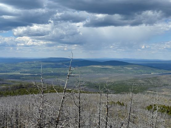
As Matt mentioned there was some strong cell reception on the summit but this would also be our only reception until a few days later back to Williams Lake, so we lingered on the summit for quite a while doing some last minute texting. Eventually it was the time to move on. We followed the exact same route out and were soon on the way to Mt. Tatlow, and then Klokon Peak and Mt. Nemaia.

