Grouty Peak
October 22, 2023
2330m
Pemberton / Hurley Area, BC
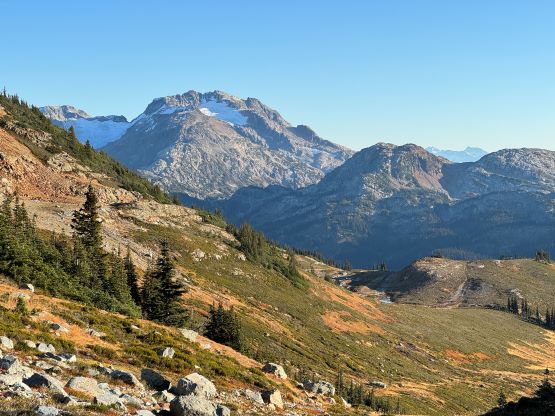
Grouty Peak is the highest point of a large ridge/plateau to the immediate east of Railroad Pass, accessed from the highest point on the Hurley. The highest, and the officially-named peak is on the far northern end, whereas a substantial summit with similar elevation to the south has been unofficially named “Mortar Peak” on bivouac.com. I do believe the official peak is the higher of the two, but to be safe one should ascend both. The prominence of that unofficially named southern top “Mortar Peak” is less than 100 m so I do not count that as an independent objective. Grouty Peak has gained significant amount of attention in the recent years thank to some trip reports popped up on social media. Prior to the pandemic this peak was more commonly done on skis in late spring and late fall when the Hurley is drivable to near the pass. To my surprise there actually exists a well-defined trail from Railroad Pass to the treeline so there’s no bushwhacking even in the summer time.
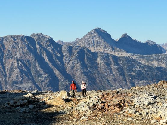
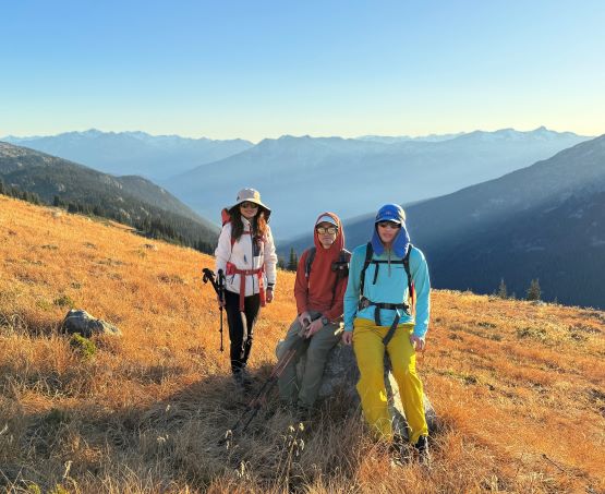
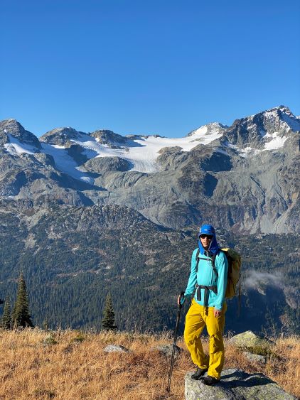
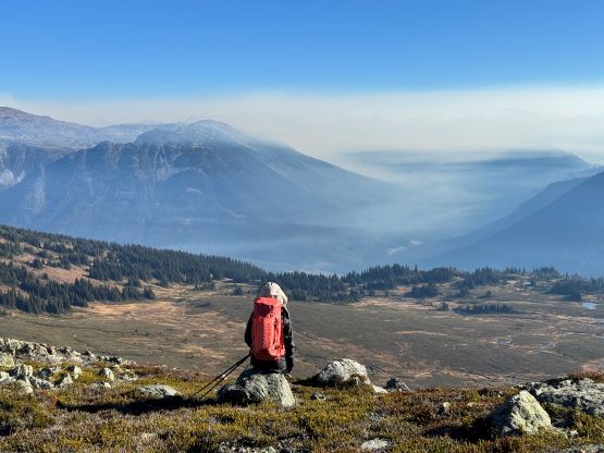
The weather forecast for this past Sunday was more favourable for areas to the north and Lulu and Pan wanted to take advantage of one more snow-free window. I picked Grouty Peak based off their interest. The ascent is straightforward without any scrambling and the majority of the hike would be done in the alpine with expansive views so we could take a shit ton amount of photos. We ended up taking over 1000 photos together and that must be a world record for this objective. I decided for us to “sleep in” and depart Lulu’s place in Vancouver at 5:30 am. The drive to the Hurley area past Pemberton was long and boring and the final hour was driven in sunlight. I needed to use sunglasses and that’s especially rare on the way to the objective at this time of a year. The trail-head was nonetheless in the shade and it was still quite cold when we got out of the vehicle.


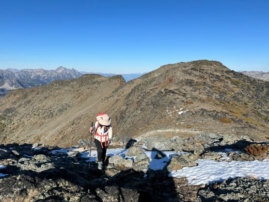
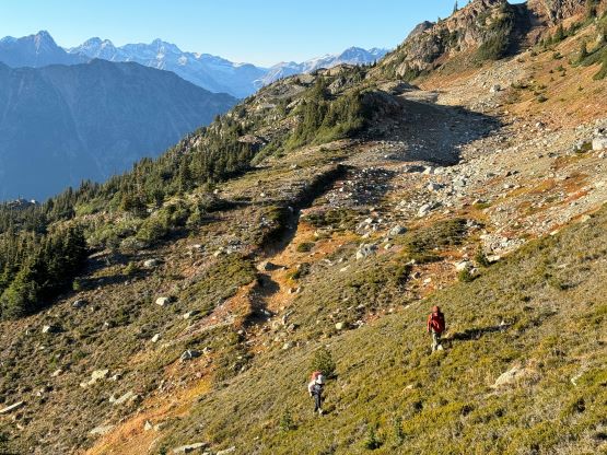
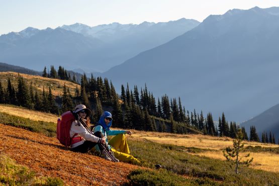
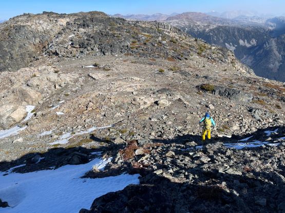
I had downloaded Andrew Knapman’s GPX track but never read the description in depth, and I assumed it was a steep bushwhack to gain the ridge system. With that in mind we crossed the road and dived into the forest without a second thought, but found the flagged trail right off the bat. I anticipated this trail to become faint and difficult to follow, but the reality was the opposite. This turned out to be a well travelled path that led us to the treeline without any form of bushwhacking. I checked the map a few times and we were not following Andrew’s track so he must have gone somewhere in the bushes and missed the correct trail. The trail was indeed very steep with one step assisted by a batman rope. We found the first taste of sun beams after ascending to the open grassy slopes above the end of the trail, and took our first of countless long breaks of the day. I called for this break because I needed to apply adequate sun protection, but we soon realized that we actually needed many breaks like this to take in the views (and the photos). It was then a long diagonal traverse mostly on grass to the broad pass north of a subsidiary bump, and once there we made the spontaneous decision to check out some tarns, even though they were slightly out of the way.

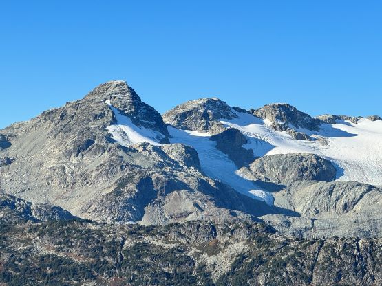

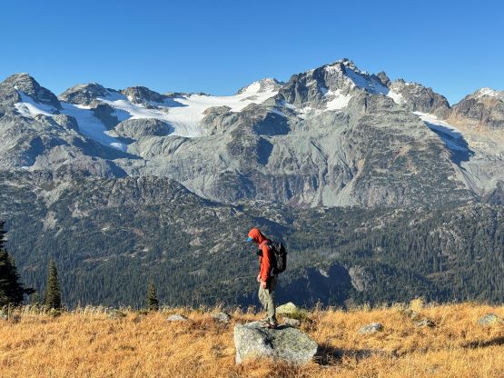

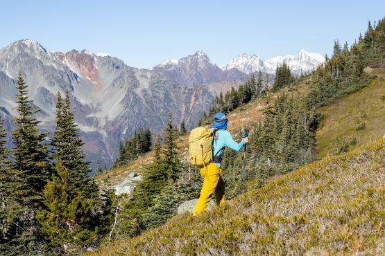


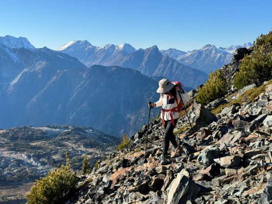
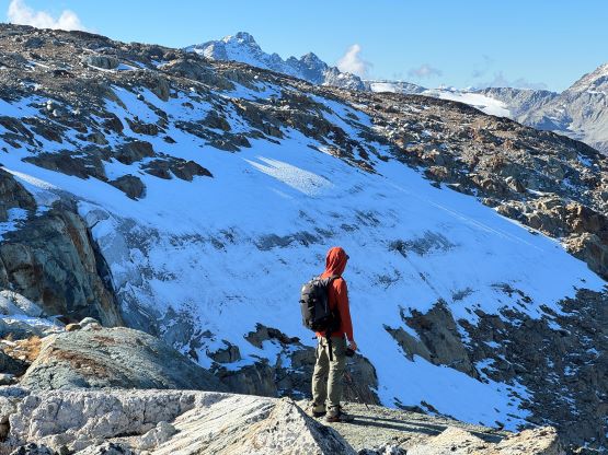
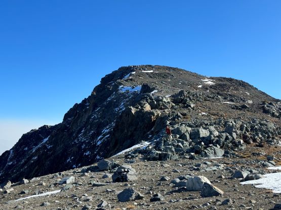
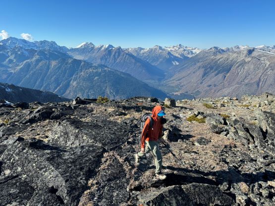
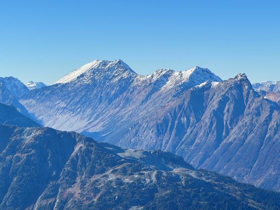
We regained the ridge crest from the tarn and followed the ridge towards the subsidiary bump south of the twin peaks of “Mortar”. The top of this bump was bypassed on climber’s left side, and to traverse around the north side we had to cross a tiny patch of glacier. This was possible because of the thin layer of new snow covering the ice. We then took a lunch break somewhere on the south ridge of “Mortar” and easily plodded to the higher (north) summit of “Mortar” by sticking to the ridge crest. The view was actually more dramatic from this peak than from the higher and officially named Grouty Peak. To connect towards Grouty Peak we had to lose close to 100 m elevation with numerous up-and-downs. This quickly became annoying, but it didn’t take as long as I thought. By visual inspection it was not obvious which of the two peaks is higher, so it’s important to do both. I’m not nerdy enough to bring surveying equipment and my philosophy is to do both, whenever in doubt.
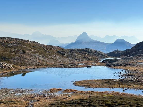


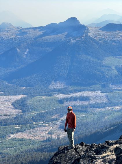


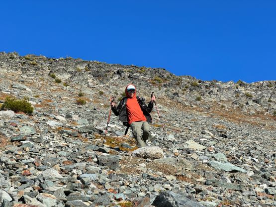
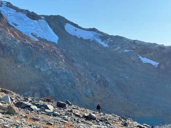
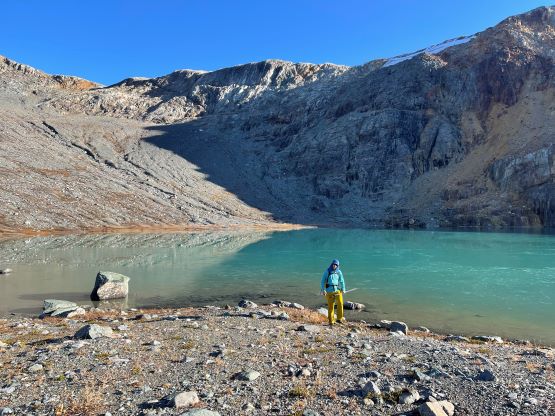
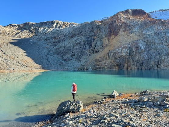
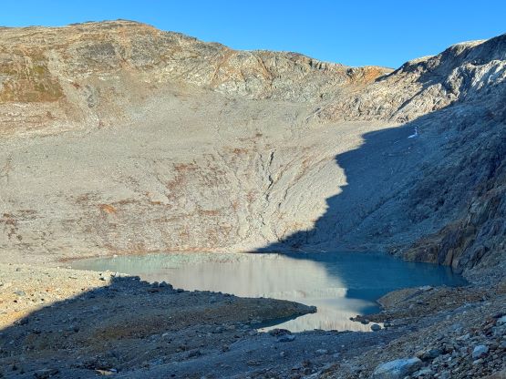
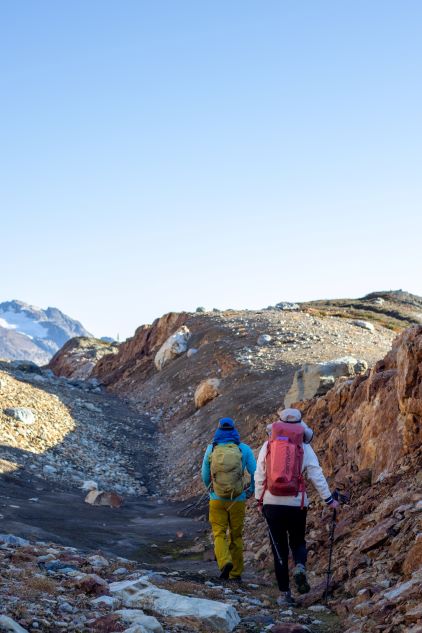
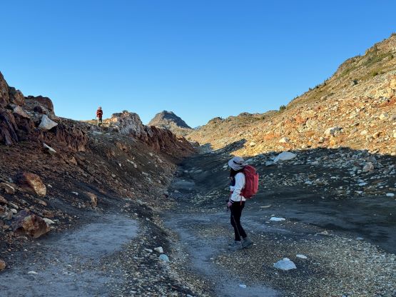
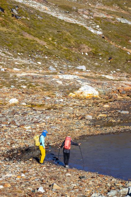
After spending an hour on the summit soaking in the views we finally decided to retreat. We followed the ridge crest back to the low saddle between Grouty Peak and “Mortar”, and then started the tedious re-ascent of “Mortar Peak”. Somewhere in this stage Lulu spotted the beautiful lake south of us. I instantly rejected the idea because that seemed completely out of the way, but then I took a look at the map more closely and commented that we should indeed go check that lake out. I had a theoretical plan to completely bypass the entire ridge system on the return by utilizing the gulch system on the west side of the crest because I had previously downloaded the satellite images in addition to the topographic maps. Descending to the lake involved a mix of compact choss, scree and rubbles on steep terrain, but once there I was instantly glad that we made this decision. This lake was a lot prettier than I thought. After taking another hundred photos I began leading us linking and traversing those gulches and the route worked out just as perfectly as I was hoping for. We again, took numerous breaks and finished the round trip in 9 hours. As mentioned earlier we together took well over 1000 photos in this trip and did at least 20 “long” breaks, but we did move reasonably fast whenever we were moving. I managed to stay awake and drove us all the way back to Vancouver. Lulu had to work in the early morning so it was then only Pan and I going for the late night hotpot dinner in Richmond. I eventually got back to White Rock past midnight, exhausted but satisfied.