Cairn Peak
November 19, 2023
2328m
Lillooet / Hat Creek Ranch, BC
Cairn Peak is the second highest but also one of the more obscured objectives in Clear Range. A simple search on Google returns literally nothing. There is a fairly detailed trip report on bivouac.com documenting a route from Parke Lake to the NE, but the route sounds rather nasty. I have done quite a few peaks in that general area including the highest in the range (Blustry Mtn.), so I knew the bushwhacking wouldn’t be too problematic. The snow condition, on the other hand, would most likely be shitty thank to the colder and drier climate, so “winter” isn’t necessarily the ideal time. I did my homework analyzing the various map layers and came up with a solution from Pocock Creek to the SE, accessed by driving ~20 km down into Hat Creek Ranch from roughly halfway between Lillooet and Cache Creek on Highway 99. At the time I thought I would be “pioneering” a new route with absolutely no “beta” on the internet, but I had apparently missed Don Serl’s trip report. I discovered this trip report after returning home, and the route that Don took was pretty much the exact way that I ended up taking.
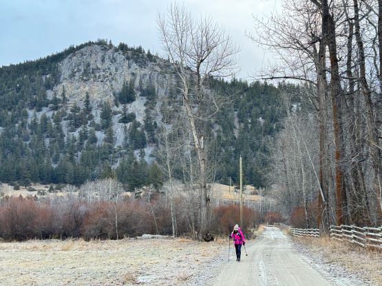
The driving distance to Hat Creek Ranch is almost 400 km each way from Vancouver so the only reason I went that far was because of the weather. The area locates in the rainshadow zone of the South Coast’s ranges, that when some systems push in from the west this area can still remain dry. This was the exact case of this past Sunday. Kate was keen to come along even though she had never heard about this objective, nor the area in general. To put down such a long drive the only practical way was to car-camp. I finished work at around 5:30 pm and we left home about an hour later. I did the usual food and gas stops and then did a single push all the way to the entrance of Hat Creek valley 4 hours later. The main road was in an excellent shape that I was able to cruise up in 60 km/h on average. I could have in fact driven even faster but there’s some snow and ice and I was already tired. About 20 km down the mainline we arrived at the start of the spur roads and I was hoping to drive at least a few additional kilometers up. It turned out that all of these secondary roads are in private properties with “staying out” kind of signs. I attempted to drive in nevertheless, but a gate presented itself within 1 km from the main road, so I turned around and parked outside their property on the main road. This was quite a bummer but I explained to Kate how I handled similar situations in the past. The plan was then made to camp right away and deal with the unknowns in the morning.
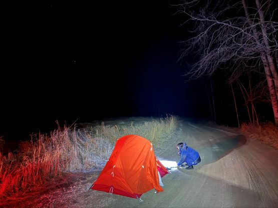
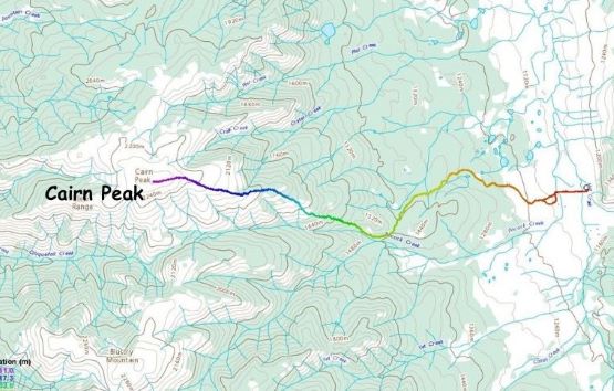
I would normally prefer to wake up early and walk past their property in the dark (when they are likely sleeping), but I seriously needed to sleep. We ended up waking up at 6:30 am and didn’t even need to use head-lamps. The worst case scenario would be getting caught on the way in, but then I still had several alternative objectives in the area to salvage the day. It turned out that we encountered not a single person nor cattle whatsoever, that the trek through the ranch land was entirely trouble-free. The only downside was the added ~5 km of walking (each way) compared to the “best case scenario”, but we wouldn’t complain. The walk through the ranch was actually quite scenic. In less than 2 km we exited the private property and encountered tire tracks. I was looking around on the satellite maps but couldn’t figure out where exactly these tire tracks came up from, unless there’s a road paralleling the mainline all the way in from the very beginning, avoiding the ranch lands all together. We only needed to follow the tire tracks for a brief section because upon reaching the next intersection we would turn onto untracked roads again. We encountered two barbed wire fences on this higher road but no more sign of recent human traffic. The road had become progressively narrower but the alders hadn’t taken over, that we were able to easily walk to the road’s end at 1420 m elevation.


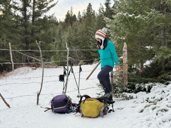
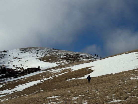
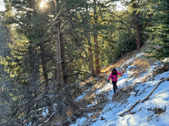
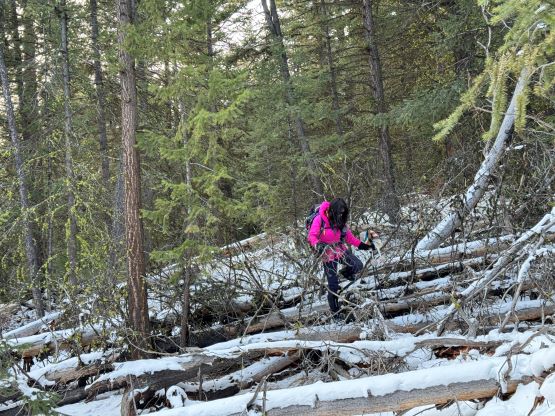
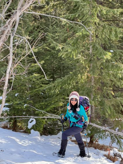
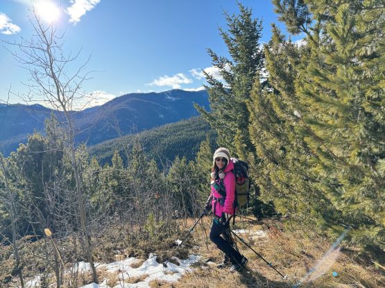
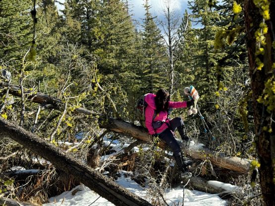
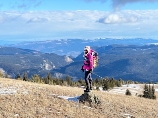
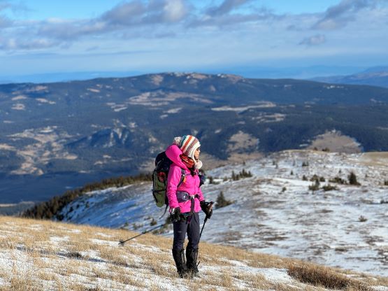
There are a few kilometers of cross-country travel from the road’s end to the alpine zone on the uppermost east ridge, and I expected some bushwhacking but not entirely bushwhacking. The terrain turned out to be mostly as expected. I knew from the past experience in the area that the south facing slopes are generally more open than the north facing slopes, so I essentially did a long diagonal traverse side-hilling above the north fork of Pocock Creek, staying entirely on the south-facing (sunnier) slopes. There were a few zones of pick-up-sticks and several steep and slippery rolls (thank to the fresh snow), but nothing really worth noting. A few open grassy slopes offered some much-needed views. The only tedious aspect of this route is the overall length as we did end up spending a few hours picking our way in the forest and the route was becoming very monotonous.


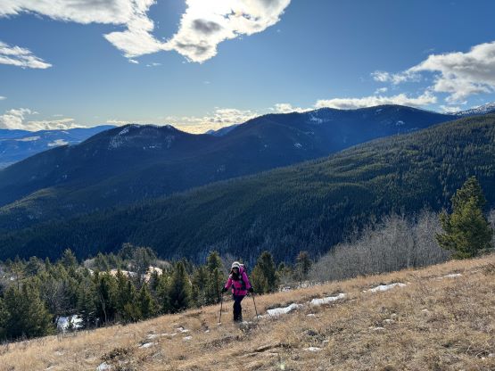


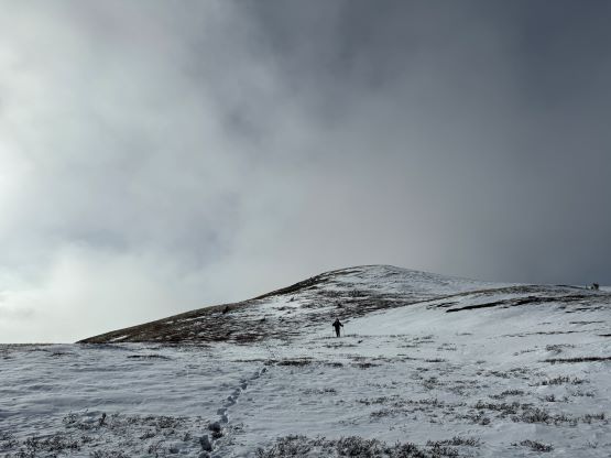
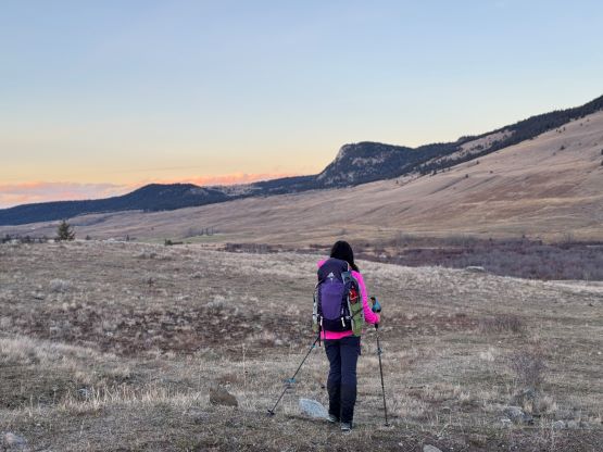
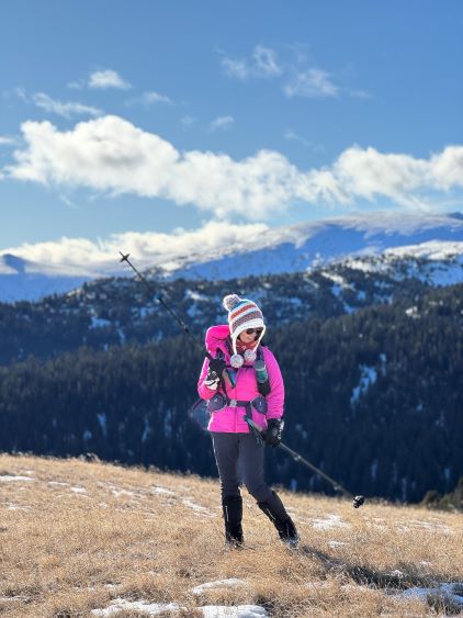
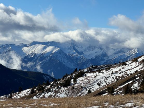
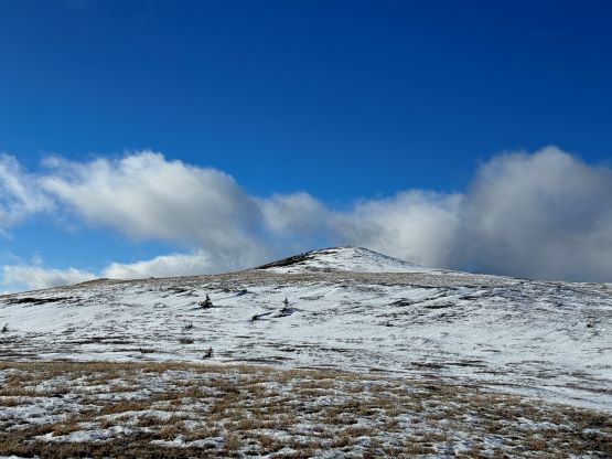
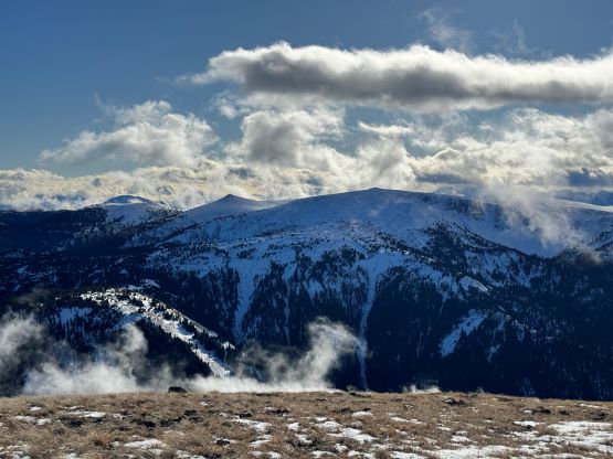
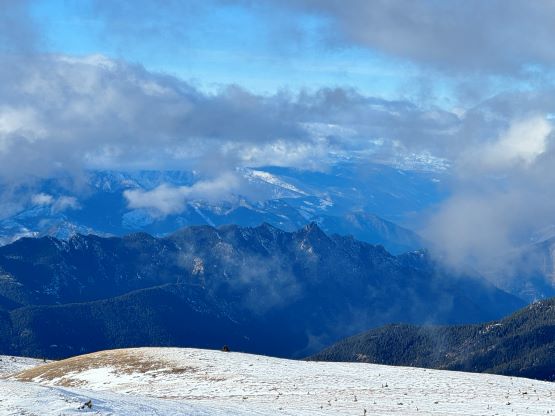
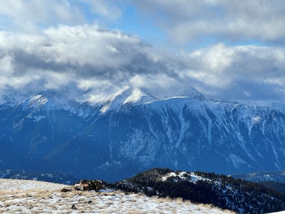
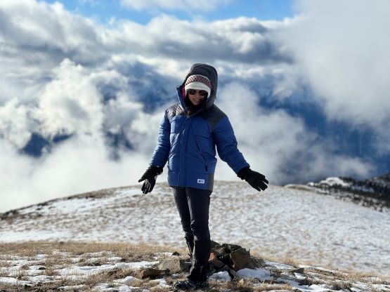
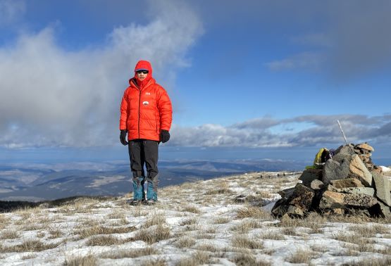
At around 2000 m elevation we finally got onto the east ridge but the terrain wasn’t as open as I was hoping for. Instead, we had to pick our route in the forest for another kilometer with some up-and-downs. Thankfully when the treeline eventually came the terrain did open up entirely, but what accompanied with the expansive views was the gusty wind. I did expect some strong winds from the weather forecast so I came prepared with balaclava and ski goggles. They were however not needed on this particular day as the temperature was fairly warm thank to the sunny weather. The 2-km traverse to the true summit was decently scenic which made up for this otherwise boring approach. We discovered several large cairns on the summit. I had a strong feeling that there must be a trail somewhere and it’s just not documented on the internet yet.


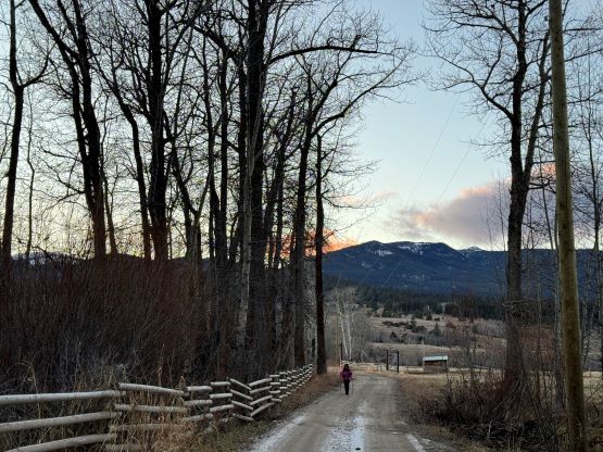
Not bothering to fancy with any alternative ideas we decided to retrace the exact route that we just took. The amount of snow was much less than I thought, such that the snowshoes had become training weight. However, the snow did make the descent much simpler as we just needed to follow our own footprints. The GPS track served as a back-up as the ground was completely dry on some sections, such that the footprints weren’t entirely continuous. The descent back to the FSRs was actually quite quick, but the final 5 km back to the truck was a pure slog. At least the view was great from the lower ranch lands. Our round trip time was 8.5 hours on a leisure pace. The Gaia map suggests a potential short-cut through Oregon Jack Provincial Park back to Ashcroft area on Highway 1, but I decided to stick to the known. About an hour later we got back to Cache Creek for a fancier dinner in a local Chinese restaurant, and in another 4 hours we got back to White Rock. I was completely exhausted but satisfied.