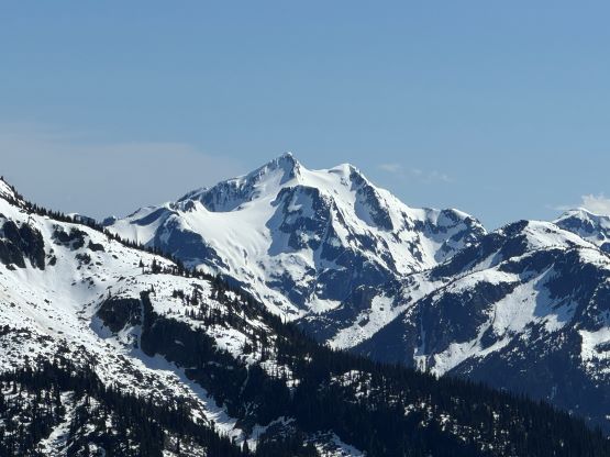
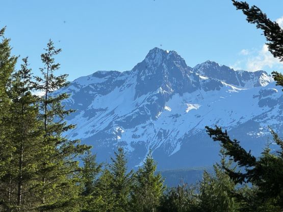
Asherah Peak and Twin Two Peak
June 13, 2024
2546m
Pemberton, BC
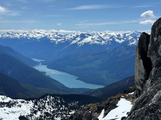
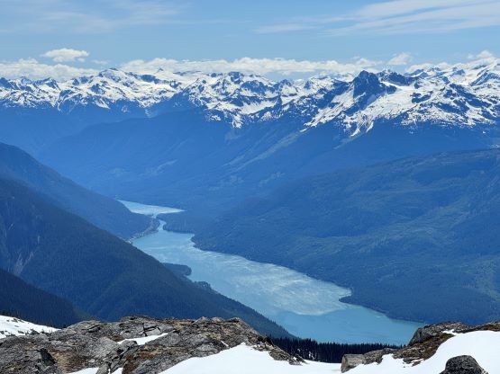
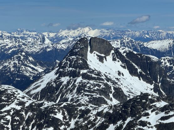
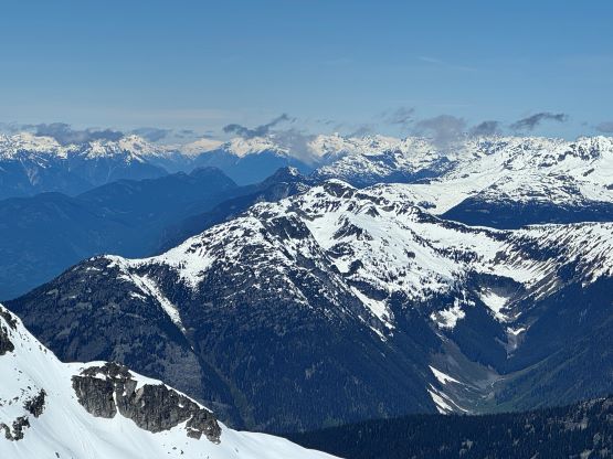
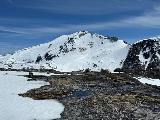
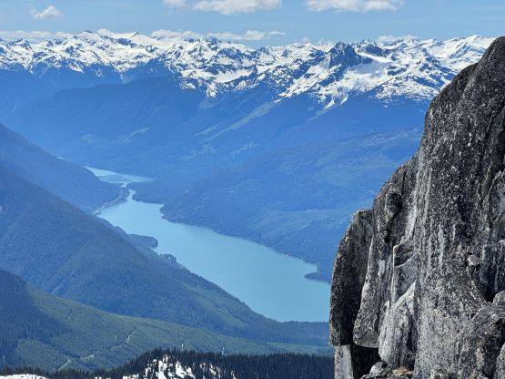
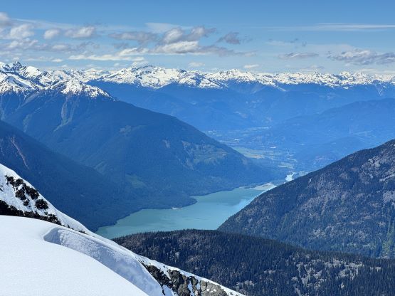
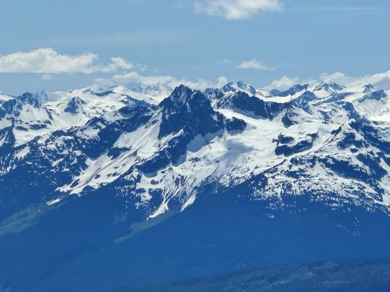
“Asherah Peak” is the unofficial name of a large glaciated massif looming above Lillooet Lake that had been on my radar for at least 7 years. Twin Two Peak is more like an “add-on” objective but is officially named. There aren’t a lot of information about these peaks except for Simon’s trip reports on ClubTread over a decade ago, but I do know a few friends who had done them in person. The access had always been problematic but the North Lizzie FSR was reported to be in “good shape” by Francis doing Meadow Dome earlier in the season. I decided to take advantage of the road beta after seeing a narrow window forming on Thursday. There were literally a shit ton of peaks that I could select from, but I was somewhat set on “Asherah Peak” and Twin Two Peak. Erica and I had been doing quite a few trips in Washington recently and I wanted her to see something different. It was supposed to be just the two of us but Miranda joined the team at the last minute, and as usual the plan was always to camp at the trail-head.
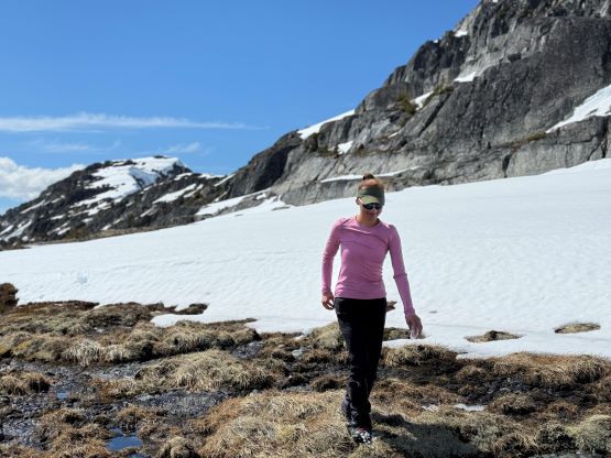
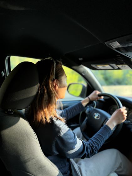
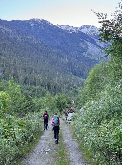
I picked up Erica and Miranda at Burquitlam around 9 pm and a couple hours later we made to Pemberton. The drive down In-SHUCK-ch FSR was uneventful but it wasn’t as smooth as I remembered from Sloquet Peak a month ago. There wasn’t any recent information about the spur road besides Francis’ update so we were facing some unknowns. Thankfully the condition was very much as described. There were some fallen rocks and pin-stripping but we easily drove to 5.5 km. The landslide described in Francis’ report was cleared but it was only passible by small trucks or ATVs so I turned the Tacoma around and settled for the night. The pull-out was large enough to pitch two tents and I just parked the truck in the middle of the road. I had debated about the snowshoes but opted to not carry them due to the bushwhacking with unknown difficulties. This resulted in some crotch deep post-holing but I still think we made the correct decision as the bushwhacking was also heinous. I decided to carry an extra ice tool for Erica and we did put it in use.

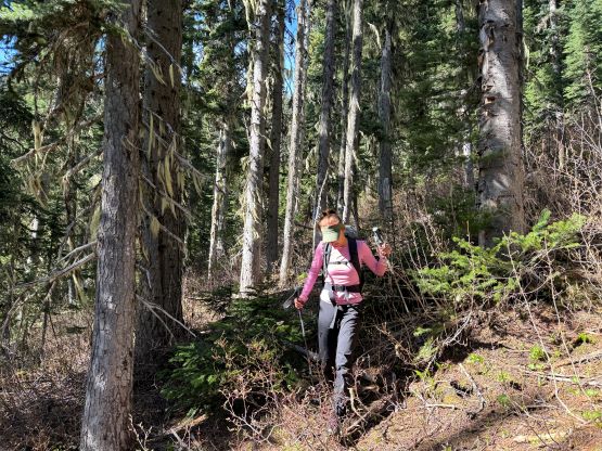
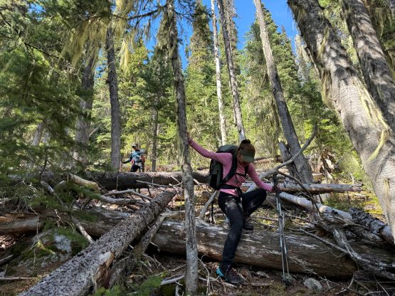
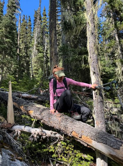
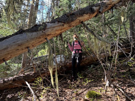
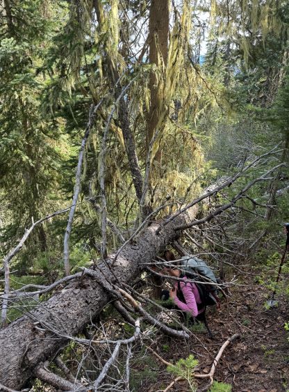
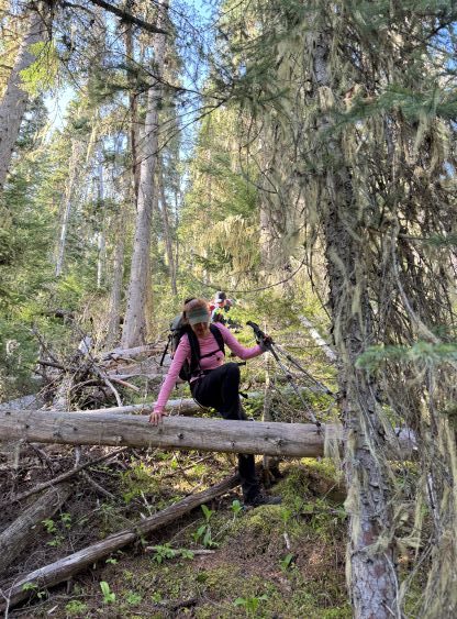
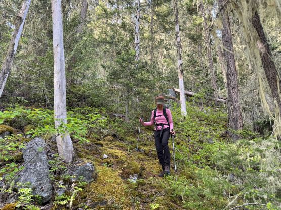
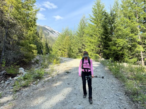
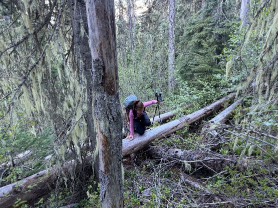
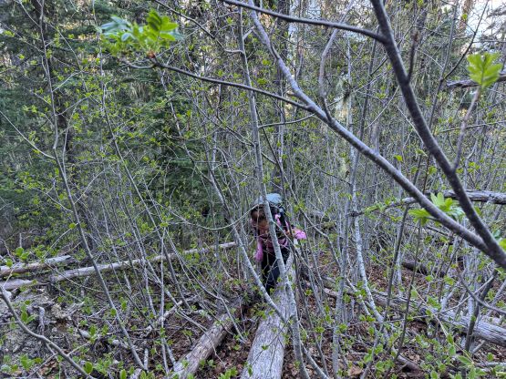
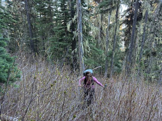
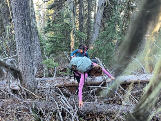
I decided for us to wake up at 4:30 am and we did not sleep in this time. I quickly got up and made some hot breakfast for Erica and Miranda, and we eventually started the day about an hour later. We only had 1 km of road-walking so opted to wear the mountaineering boots truck-to-truck, and the bridge crossing North Lizzie Creek was still intact. For the bushwhacking we roughly followed Simon’s route by sticking on the climber’s right side of the creek draining from the valley between Twin Two Peak and “Asherah Peak”, and the going was very straightforward for about one third of the way up. We also encountered what seemed like a new logging road that was not shown on Gaia map nor the satellite images. The bushwhacking quickly became heinous with a zillion of dead falls and the going quickly escalated into that usual game of pick up sticks. The sticks were also stiff and pocky and some careful work was needed for every step forward. The suffering was much worse and longer than I thought but we all handled it well, mentally and physically. I have to thank Caro Coco et al. for getting both Erica and Miranda trained in this bushwhacking game because they basically were able to keep up with my pace and I was not going slow.
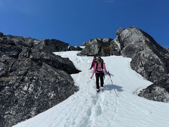
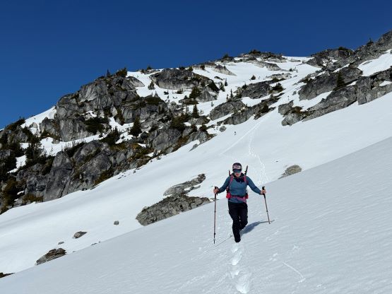
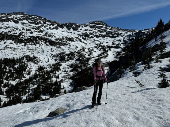
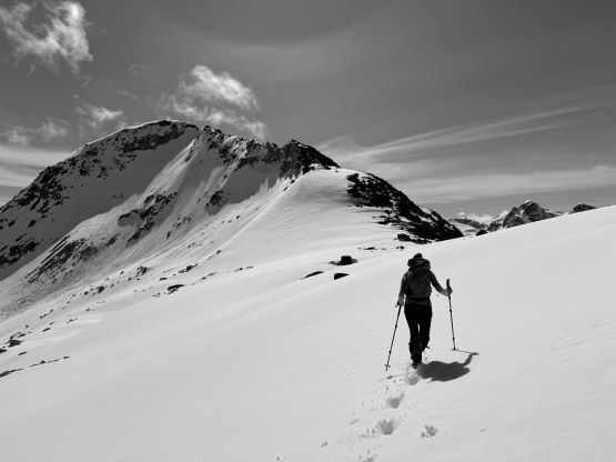
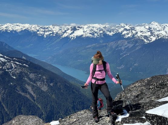
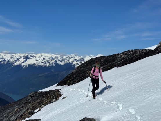
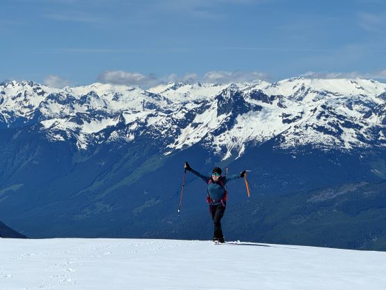
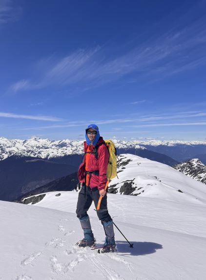
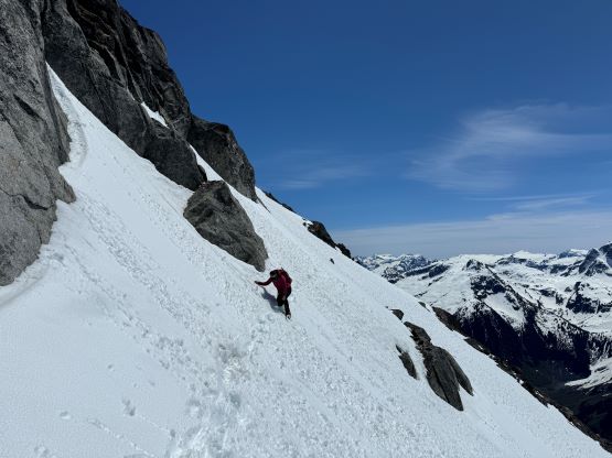
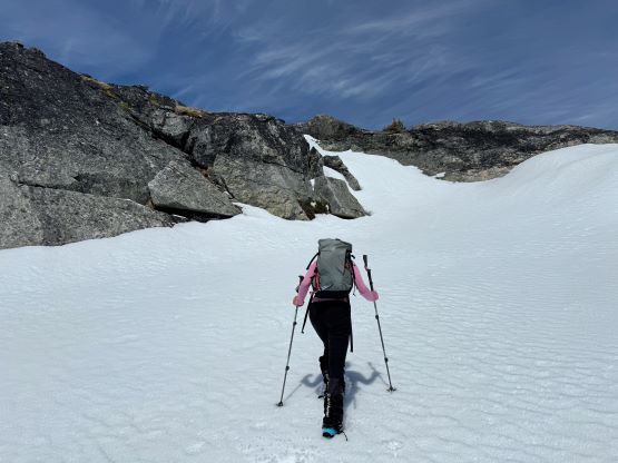
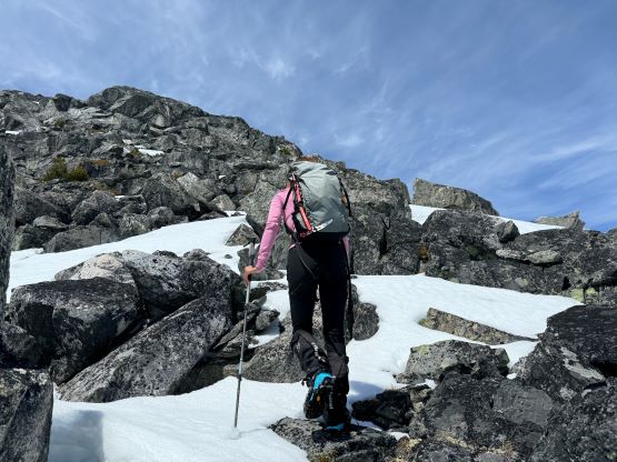
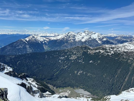
There was no break to be made until the bushwhacking turned into post-holing at 1800 m elevation. The snow in the forest was very soft and that forced me to make one stop to don gaiters. We took a proper break about 50 m higher in the sun and with views. The next stage was to follow the obvious west ridge through the treeline zone and the route involved a few steeper rolls. The snow was actually quite firm in the open and we almost had to don crampons. I however, taught Erica some edging techniques so the crampons stayed in our packs until much higher. There were some micro-terrain but nothing really worth noting and after what seemed like a long time we made to the point where the connecting ridge from Twin Two Peak joins Asherah Peak’s west ridge.
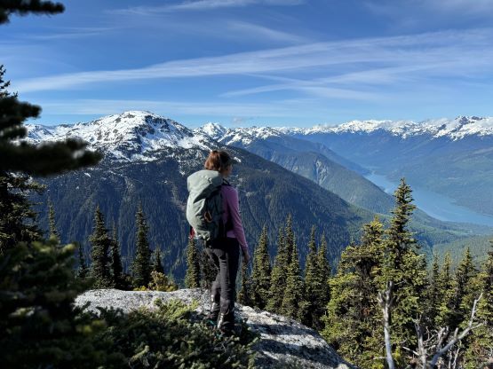
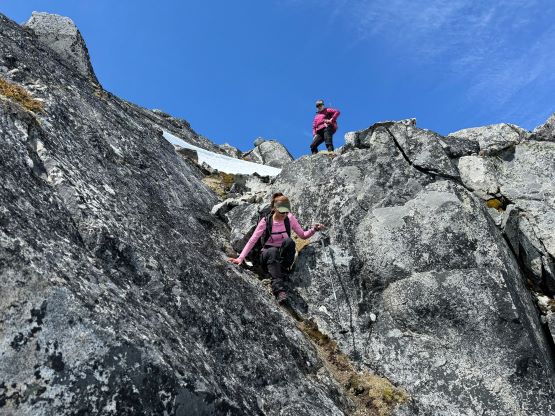
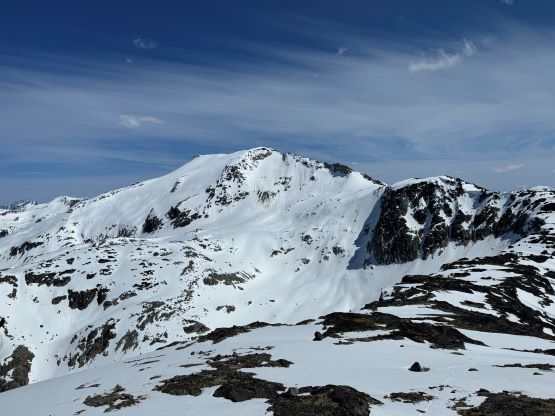
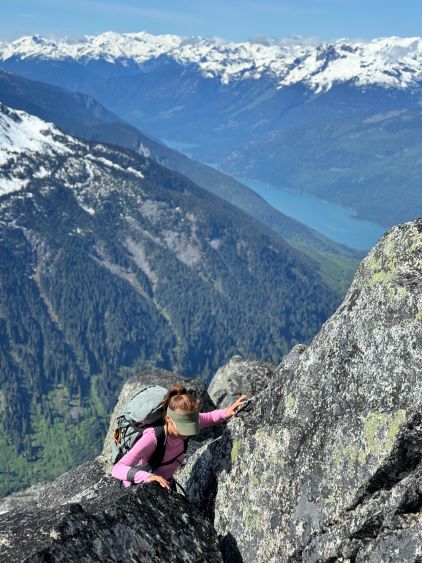
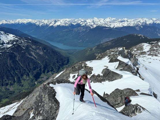
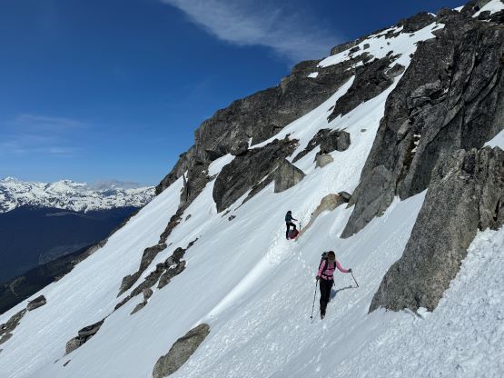
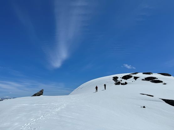
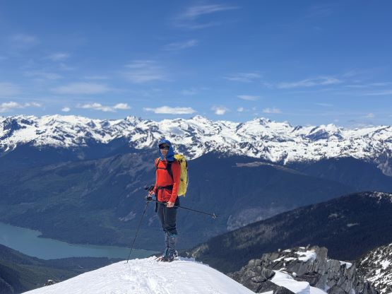
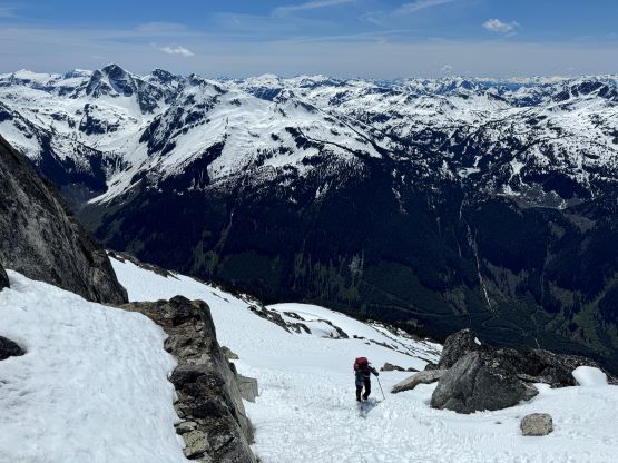
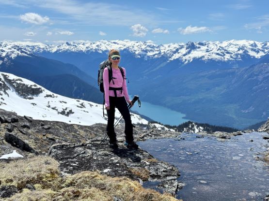
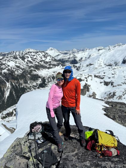
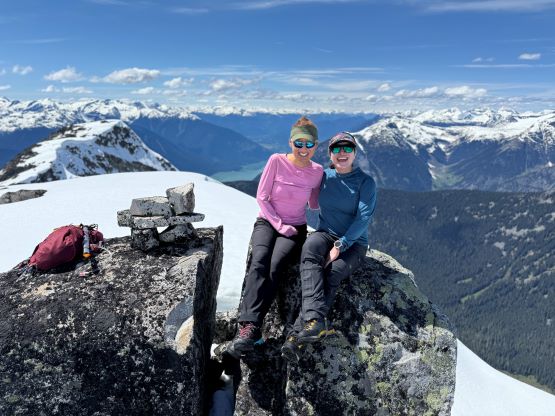
A few more rolls later the ridge steepened and the terrain became rugged. I remembered reading Simon’s trip report that the bypasses existed on the south face and that’s also where I would go if there’s no “beta”. We did some scrambling and snow traversing and then scrambled along the narrow ridge crest with at least one section with some decent exposure. Eventually we still had to descend a snow gully down onto the south face to bypass some gendarmes. The connecting ridge might go without technical climbing, but I didn’t want to fuss around with 4th class terrain. The traverse on the south face was nothing fancier than “steep snow” but the firm conditions made us to finally don crampons. Erica was complaining about the lightness of the ice axes on Dragontail Peak so this time I hauled a Petzl Quark for her. I myself opted to use the Petzl Gully and the Corsa Nanotech stayed in the pack. The steep snow traverse was short-lived and in no time we were back onto the ridge. We did a few more traverses as I couldn’t tell if we were getting close to the edges of some cornices. The ridge was wide and flat based on the topo maps but we didn’t want to take any chances. The true summit was unfortunately on the very far end so there was substantial amount of plodding required. The snow had also softened significantly so we already had to deal with some post-holing.
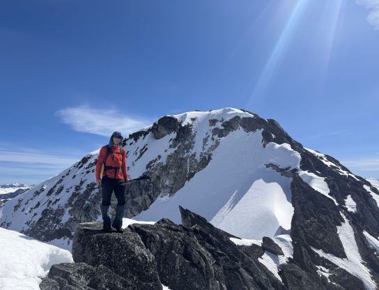
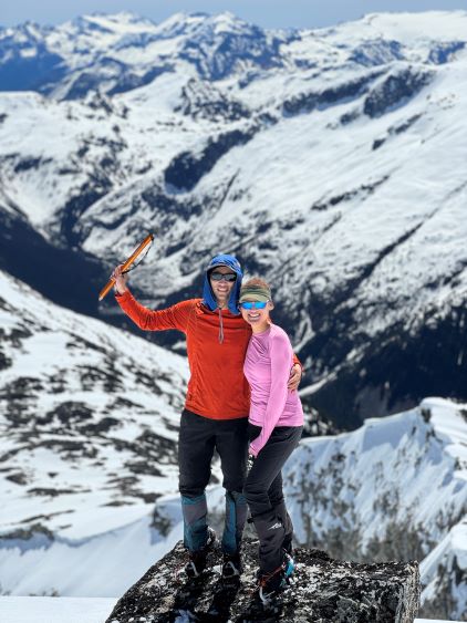
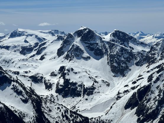
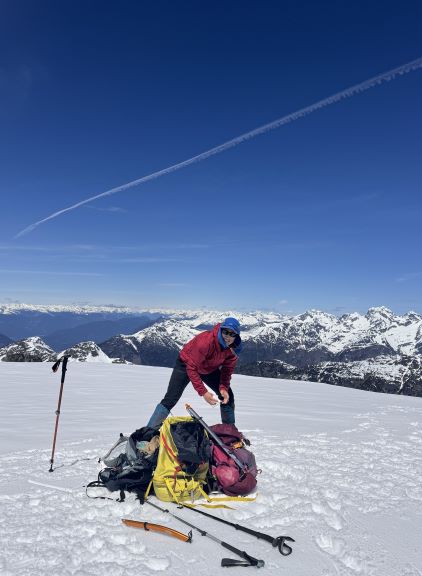
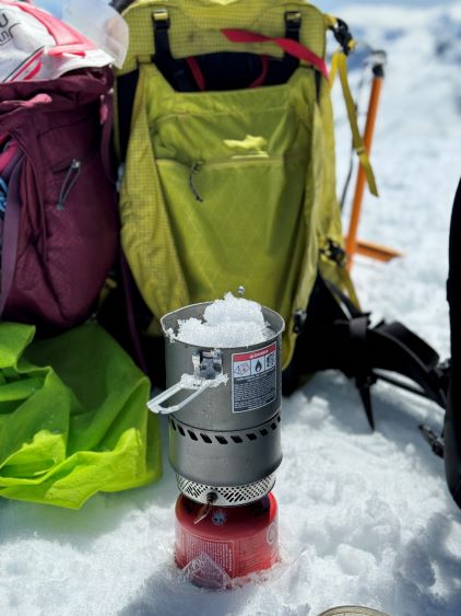

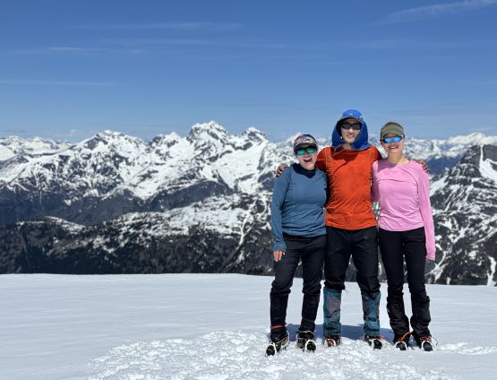
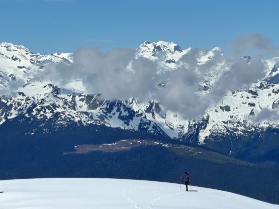
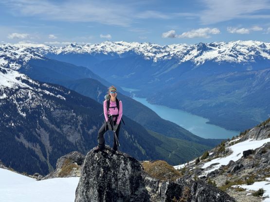
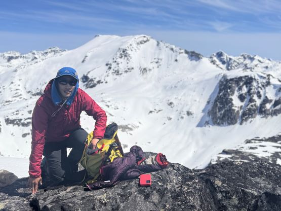
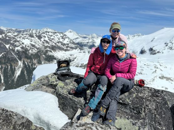
I had decided for us to carry 1.5 L of water each maximum because I brought a stove with fuel and planned to melt snow along the way. The 1.5 L water was enough to get us up Asherah Peak so while taking the needed break I melted another 3 L of water for us. We did a very long summit stay but eventually had to get going, and the decision was made to take the exact same route back even though I knew there were a few spots that we could have done better. The post-holing was already taken over and I wanted to stay with the knowns. I then led us down-climbing a steep chute which was essentially the short-cut to link the two peaks together. I knew Simon went further down and around but I wanted to minimize post-holing. Erica and I then took turn breaking trail (knee+ deep) to the south ridge of Twin Two East, and then we all scrambled the SE Face direct to the summit. There was one 4th class slab corner with lots of loose rocks but we preferred that over additional post-holing. The E. Peak is the higher of the two and I felt no need to traverse to the lower W. Peak, so we took another long break on the summit.
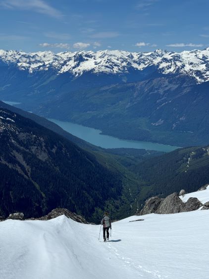
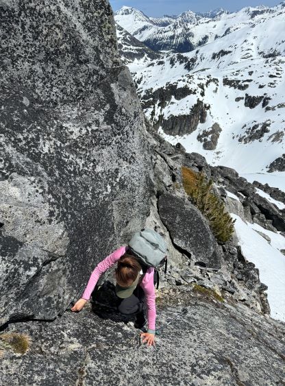
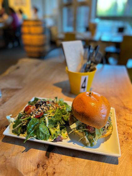
The down-climb of that slab corner with not easy and required a few lieback moves, and the snow condition was much worse. While plunging down we constantly sank ass-deep but honestly that was to be expected at this time of a year in the drier interior zone of the Coast Mountains. There was one melted pool and Miranda had actually brought a filter, so we did our second batch of water loading without turning on the stove. I then led us rejoining the west ridge of “Asherah Peak” by an exploratory traverse and was successful in minimizing elevation regain. The post-holing was horrible but at least we were descending, and the bushwhacking, though terrible, was tolerable as again, we were descending. The pick-up sticks were actually kind of fun on the way down because we just had to scramble from one log down to the next and then repeat. There were probably 500 dead falls and this route is definitely not for the averaged. Our round trip time was 12.5 hours but over 4 hours were “stopped time”. Erica drove us back to Pemberton after I got us down the FSR section, and that allowed me to take a short nap. We had dinner in my go-to place (Mile One burger) and then I did the rest of the driving, back home at midnight.