Pennask Mountain
January 28, 2024
1986m
Highway 97C / Okanagan Connector, BC
Pennask Mtn. is the highest peak in the vicinity of Highway 97C “Okanagan Connector” that connects Merritt to Kelowna. The entire area is a plateau of hills riddled with logging roads and clear-cuts. The peak does not “stand out” from the surroundings as even the highway traverses at around 1600 m elevation less than 400 m below the summit, but does boast over 600 m prominence. This suggests Pennask Mtn. is the highest peak of this entire plateau. Due to the close proximity to Highway 97C this is one of the easiest “P600m” objectives in the area from statistical perspectives. A few friends of mine had done it in the past in the absence of snow and reported some substantial amount of bushwhacking. My plan was to do it in winter but from my experience of snowshoeing in the interior zone I knew the snow likely wouldn’t be deep/consolidated enough to fully cover the dead-falls. Thankfully there’s a new-ish trip report popping up on peakbagger.com in 2022, in which Chris Jamieson had discovered what seemed like a snowmobile trail on the north slopes. The dead-falls on this path had been cleared. I inquired Chris about the GPX track and with this track I was hoping for no bushwhacking whatsoever. I was not sure if the Sunset Main (access road) would be plowed in winter but at the worst case scenario the extra road plodding should take no more than 1 hour each way.
Kate and I made the last minute decision to drive over 3 hours each way to escape the dreary weather. There had been an atmospheric river hitting the coast, and we wanted to drive as far away as possible into the rainshadow zone. The weather was even better in Cache Creek area but we had done quite a few trips out that way in this winter and I was keen on something different. The areas around Merritt would be “mostly cloudy” but without precipitation, so that’s it. Pennask Mtn. would be the no-brainer option, and we would do a secondary objective if this one was too short to fill in the day. Kate had recently purchased a brand new Subaru Forester with all terrain tires installed so it made perfect sense to test this new vehicle. I would still be the driver and I anticipated some better performances than the Toyotas, especially on snowy roads. The new vehicle surely did not let us down. After about 3 hours of driving we exited at Sunset Main near the highest point of Highway 97C, and luckily found out the plowed status of this road. The problem was that the road had then become an ice rink thank to the recent rain and warm temperatures and we were not equipped with tire chains. The grade of the 4 km drive to the start of Chris’ “snowmobile trail” was thankfully very mellow with only minor up-and-downs and the Subaru handled the job excellently. Kate was able to switch the driving mode to “snow” or “winter” or something like that. The “snowmobile trail” was clearly not used in the recent days and there’s no designated lot for parking, but thankfully we were able to find a spot to park not far from the start of the GPX track without blocking the traffic. It was still drizzling but we definitely observed a clearing trend throughout the drive.
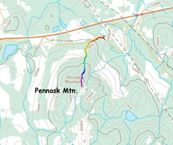
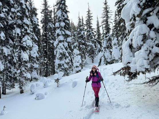
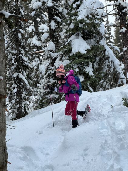
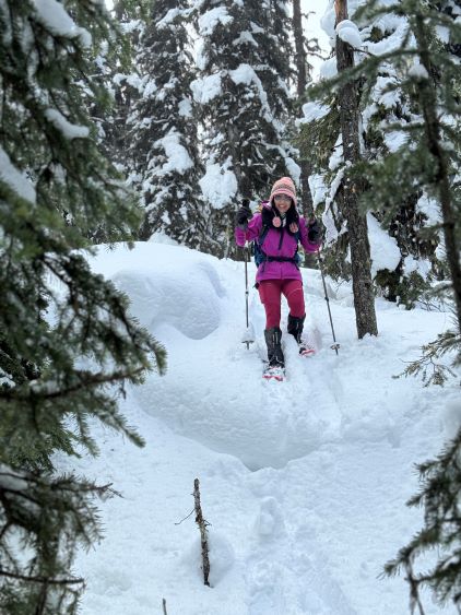
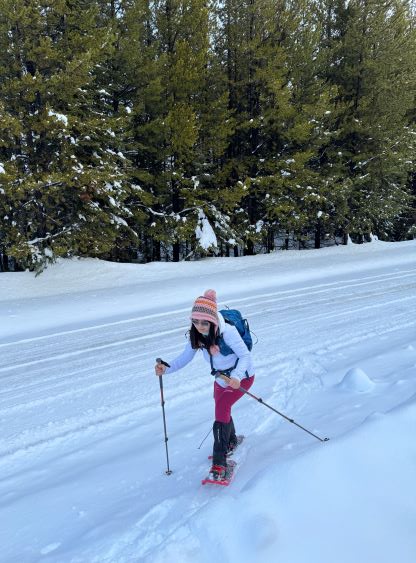
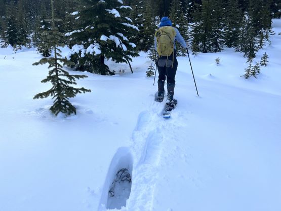
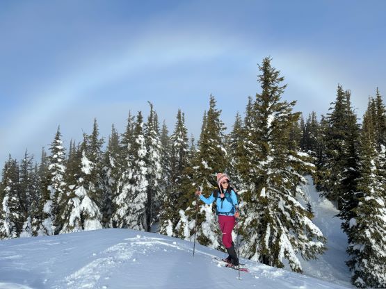
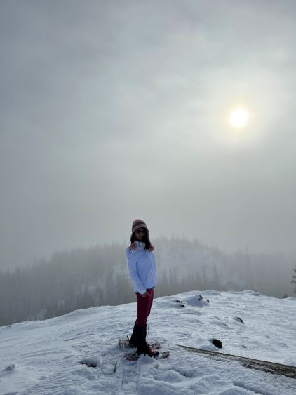
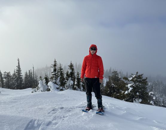
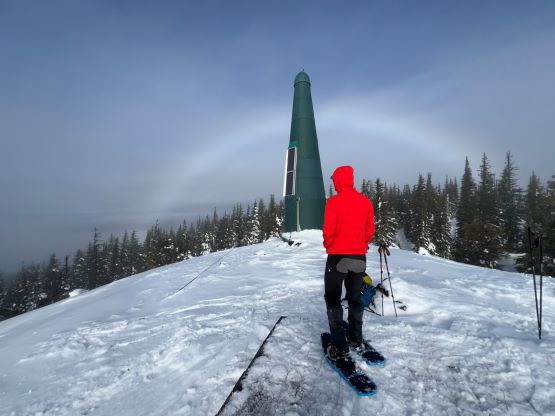
We almost needed microspikes to walk the slight uphill back to where that supposed snowmobile trail branches off from the Sunset Main, and this further proved the ability of the new vehicle. The first section of the trail was on a narrow and presumedly deactivated logging road. I donned the 30′ snowshoes right off the bat and I anticipated some heinous post-holing. The trail-breaking duty was indeed heavy throughout the day, but was not nearly as bad as I was mentally prepared. In less than a kilometer we came to an area of clear-cutting and left the road roughly following the GPX track. A few minutes later I found what seemed like a “snowmobile trail”. I could not confirm the purpose of this trail being for snowmobiling as I could not find any evidence to support that, but this was a damn good trail that should be shown on Gaia, AllTrails and other navigation apps. Even with a meter-deep snowpack the trail was easy to follow (as the pick-up sticks and small trees on the sides were rather thick). There was no bushwhacking. Upon reaching the summit ridge I led us bypassing the few bumps and went straight for the southern summit with a green dildo on top. Whether this was the highest or not this definitely offered the nicest views. The weather unfortunately did not cooperate.


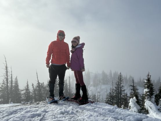
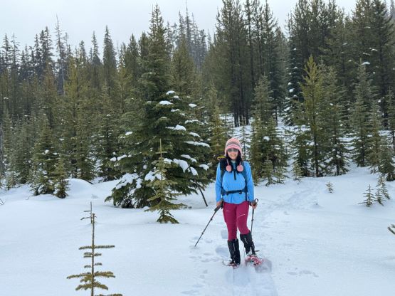
After about half an hour on the summit we decided to slowly head back. We tagged the forested northern top but I think the south summit was still the highest one. For the rest of the descent we simply followed our own steps. Our round trip time was 2 hours 16 minutes so there was definitely enough time for a secondary objective. My original plan was either Mt. Nicola or Fairweather Hills in the vicinity of Merritt, but given the plowed status of Sunset Main FSR we had to take advantage of that and do Culmination Point Mtn., which was about 10 km to the west.