Peak 1495 “Stinking Lake Ridge”
December 10, 2023
1495m
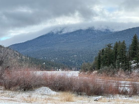
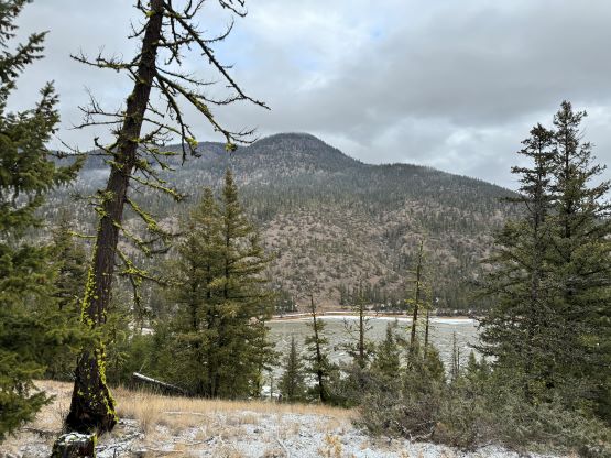
Cache Creek, BC
This unnamed summit is the highest point of the large piece of land between Highway 1 and Pass Valley to the east of Cache Creek and subsequently boasts over 600 m prominence. About 2 years ago Chris Hood noticed this undiscovered “P600m” objective and submitted it into the peakbagger.com database as “Stinking Lake Ridge”. I personally am not a fan of this name and I’d rather call it “Peak 1495” as there exists a spot height on the BC Basemap. One would believe the location of that spot height is the highest point but it’s not very obvious. The entire summit area is a large wooded plateau. There are only two reported ascents of this peak. Chris Hood did it from the W/NW by linking up some old logging roads, whereas Matt Juhasz went in from the S/SE by trespassing some private roads. Both reports made this sound like the worst possible “trash bagging” outing with substantial amount of bushwhacking in pick-up sticks, all for no view, but it’s statistically important so it’s not an option for me to bag it or not. Instead, I consider peak-bagging as my obligation. It’s just a matter of picking one poison or the other. As much as I like to trespass I do not on purposely seek that. In this particular case I do not think Matt’s route would give significant amount of advantage so I preferred the legal way, which is Chris’ way from the west end of Stinking Lake.
I made the spontaneous decision with Kate and we decided to take Kate’s Subaru to save some fuel. Taking the Tacoma would indeed grant 100% chance on the access but I was confident that there wouldn’t have much snow and we only needed to drive to ~800 m elevation on the backroads, such that the Subaru should be sufficient. I would still be the driver for most, if not the entire trip as I’m more experienced driving in crappy conditions. I had also driven this Pass Valley road on the Arrowstone Hills trip so I knew it’s suitable even for passenger cars. We left White Rock at around 9 pm on Saturday night and drove through some intermittent downpours and mists, which was to be expected in the Fraser Canyon. The weather was as shitty as forecasted and that’s the main reason why I picked such a shitty objective. It’d be shitty no matter what, so we might as well use a shitty peak to suffer and save the better peaks for some better days. In about 4 hours we made to Cache Creek after only doing one stop for gas. The Google Map directed us to Battle Creek FSR but I knew from first hand experience about the landslide on that road, so we ignored Google’s direction and took the longer but more certain “Back Valley Road”. The unpaved portion was about 20-30 km by estimation but the quality of this road was excellent, that it didn’t take us long to arrive at the start of Chris Hood’s route. There was only some light dustings of snow and only for a few kilometers. I had some other ideas and drove a few kilometers farther to explore an alternate starting point, but wasn’t satisfied. Instead, we drove back to the start of Chris’ route and car-camped. I decided to forgo the wake-up alarm, and we ended up sleeping in all the way to 9 am.


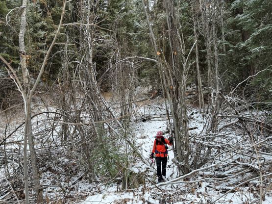
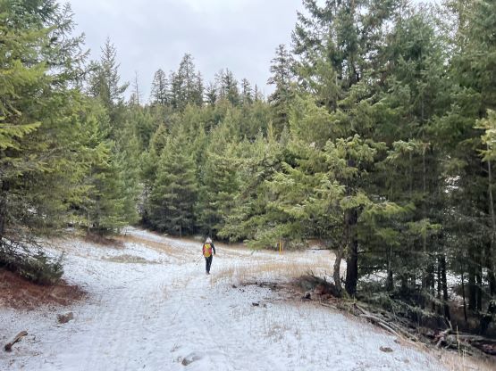
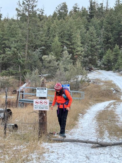
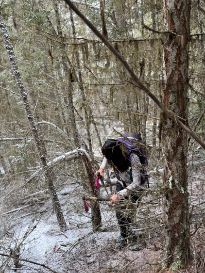
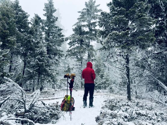
I had been debating about snowshoes but opted to carry them even for training weight. There’s no way would I drive this far without attaining the objective. Kate decided to take a gamble on the other hand, but then my new decision was to carry her 22′ snowshoes instead of my 25′, to save at least a little bit of weight. We noticed a gate with some warning signs and we anticipated having to trespass, after all. To our great surprise this was actually a government’s prohibition and only for motorized uses. In other words we were not on private land. The gate wasn’t locked and we observed multiple sets of tire tracks made by trucks and ATVs so I’m sure the locals give absolutely no fuck about the closure. We however, did not come here with my trusty Tacoma and we also preferred to have some exercise, so we would walk. I did regret for not bringing the bike as at least a few kilometers of this road could be ridden on the fatbike. I actually anticipated some thrashing on these roads as the satellite images made me believe they were seriously overgrown. I did consult with Chris about these roads but never would have expected them to be actually wide enough for biking. The road finally became narrower and overgrown as we approached the 1350-m “west side saddle”, and it was here that I made the spontaneous decision to ignore the final switchback and dive into the bushes.
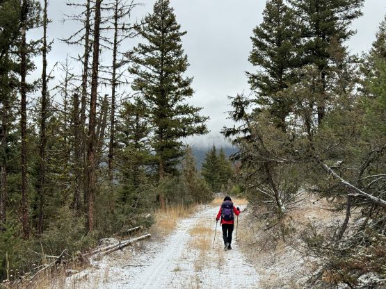

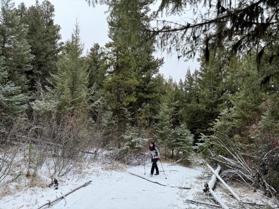
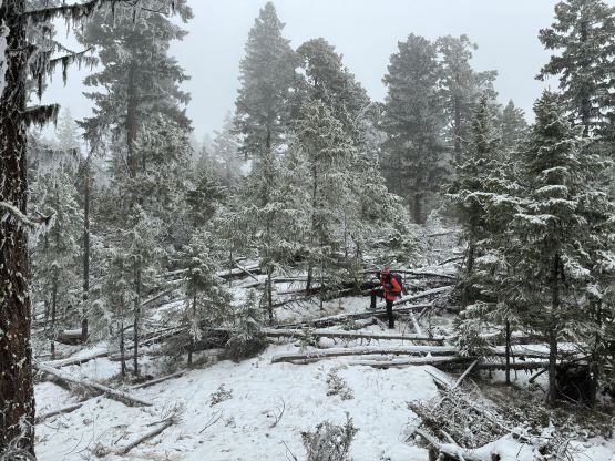
The forest was not nearly as open as I was hoping for, and we encountered bands of serious dead-falls and tight, secondary growth timbers. I considered turning around to follow the road to the end, but thought it wouldn’t save much time as that final switchback seemed rather unnecessary and long. The bushwhacking improved slightly so we kept going. After gaining 100 m elevation we had passed the elevation of the road’s absolute end and I still think we made the correct decision to ditch that uppermost road. The final kilometer of thrashing would be unavoidable no matter what, and it was as shitty of an experience as Chris described. Apparently he was not exaggerating. This final kilometer took us almost an hour and it wasn’t just about the bushwhacking. I also had to constantly consult with the GPS to make sure we wouldn’t be doing circles as there was hardly any reference on this wooded plateau. For a few times I thought it’s pointless to venture any further but I was determined to thrash to the location of that spot height. It turned out that my GPS reading from that spot height was 1492 m but I got a 1493 m from a much closer, western high point. It’s possible that the final 40-minute thrash was entirely pointless but without lengthy (hour-long) measurements using differential GPS units (not the iPhone’s app) it would be impossible to conclude. We even went further but did not get any higher readings, so I led us drawing a circle and settled on that 1492-m high point.


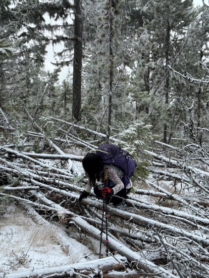


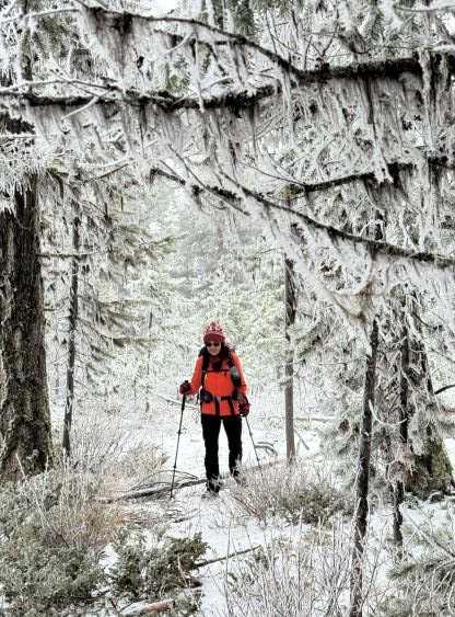

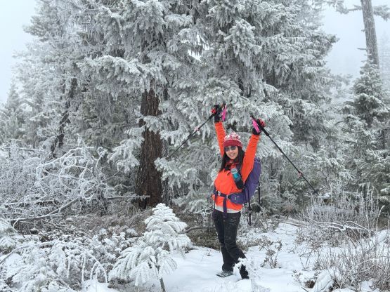
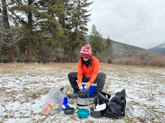
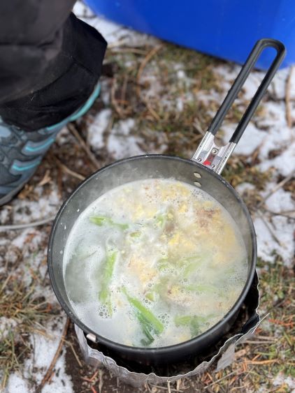
It was quite chilly as the weather was overcast with flurries, so we quickly grabbed a bite of eat and dashed down. The snow was as much as about ankle deep so the snowshoes turned out to be training weight again. The nicest thing about having at least some snow was the easiness in retracing our own steps. I did not need to consult with the GPS on the return as we only needed to follow our own footprints. Taking out the route-finding factor I actually thought the bushwhacking wasn’t that bad and the descent was actually quite efficient. I even spontaneously decided to take two more short-cuts lower down on the roads as I hated doing switchbacks. We finished the round trip in just over 4 hours. The original plan was to bag a secondary objective but the weather was still overcast, so we spent about an hour cooking and eating at the parking lot. Eventually it started to drizzle so it’s time to head homewards. I had to give the wheel to Kate for about an hour’s worth of driving between Ashcroft and Lytton. I took over once it’s getting dark, and drove us through some torrential rain back through the Fraser Valley.