Paul Peak, Peter Peak and “Peak 1159”
March 17, 2026
1159m
Kamloops, BC
Paul Peak and Peter Peak are two of the more recognizable objectives that overlook the city of Kamloops whereas “Peak 1159” is the unnamed high point of the ridge that contains these peaks. This unnamed peak is quite a ways farther back but ever since I entered it into the peakbagger.com database there’s at least one trip report that popped up. The unnamed peak is the main objective as it’s the one that boasts over 500 m prominence. I decided to simply download Jason Fill’s GPX track and used that as a reference. Jason picked a good loop route and my route turned out to be very much similar, but with the addition of Paul Peak at the very beginning.
One complication of these peaks is that they are completely within the boundary of the Indian Reserve and therefore technically off limit. From what I’ve heard from the locals that hiking was originally allowed on these hills but then an accident happened (with helicopter rescue) and that shut down future access. One used to be able to get permission upon request but not anymore. This is very unfortunate so I do want to point it out that doing these peaks are trespassing into the First Nation’s lands and should not be encouraged. A few locals had asked me to not post about this trip but there are plenty of existing trip reports and even trail GPX on the Gaia app as well as Open Street Map. Throwing my trip report in won’t change the bigger picture. Completionists will do it with or without the “beta” and with or without the “no trespassing” signs. For me this is not my first time trespassing and not even the 100th time (globally), and certainly wouldn’t be the last time neither. There were way more serious peaks that I had done as night-time ascent just to dodge the authorities. Oh by the way, there’s actually an article about “tresbagging”. It’s written by a well-known climber who I highly respect, so check your own ethical stand if you do use my trip as reference.
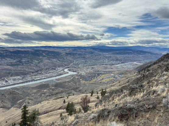
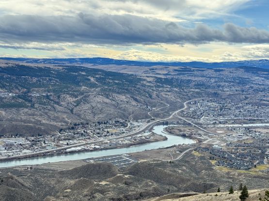
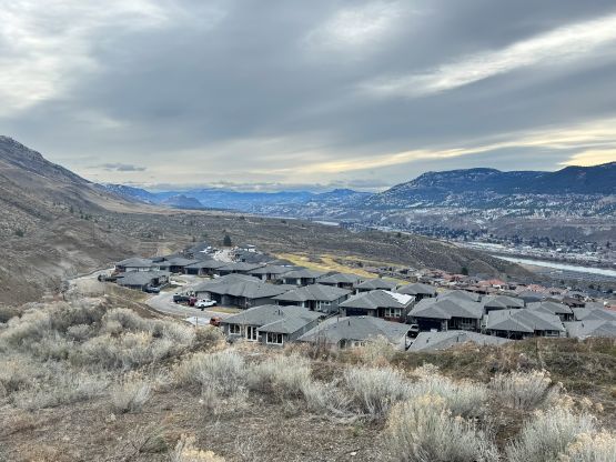
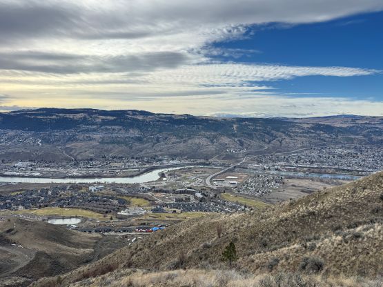
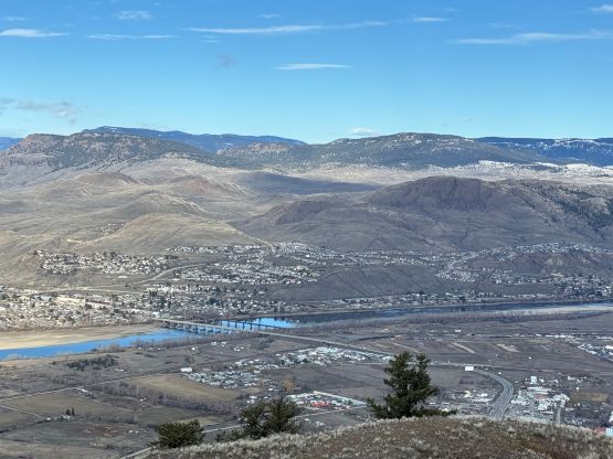
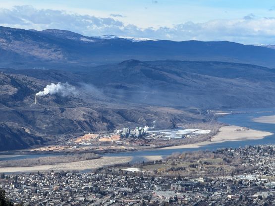
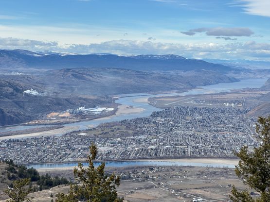
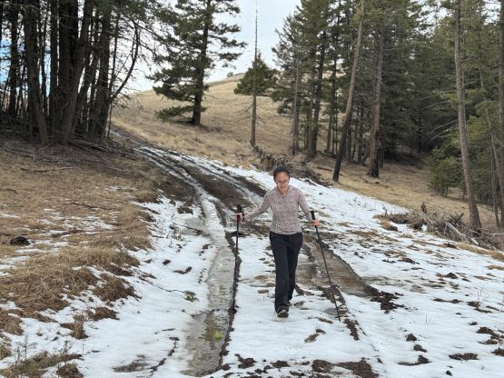
In any case Clair had a rare day available and I decided to take her out to Kamloops to escape the dreary atmospheric rivers in Vancouver. We left home at 10 pm the night before and car-camped in the vicinity of Merritt. I could have driven farther but I also knew the Comstock Road’s exit is a good place to spend the night. The next morning we resumed the drive into Kamloops and had a nice and leisure breakfast before driving up to the south side access point. I had little idea what exactly to expect, but we found several questionable spots to park the vehicle. There’s no clear solution as to where to leave the vehicle behind for a day and I eventually decided to park on the street which was technically “visitor parking area”. This was basically where Jason parked. A safer option would be to park in the town lower down and walk an extra kilometer or two, but this was already a long outing and Clair didn’t want to make it longer.
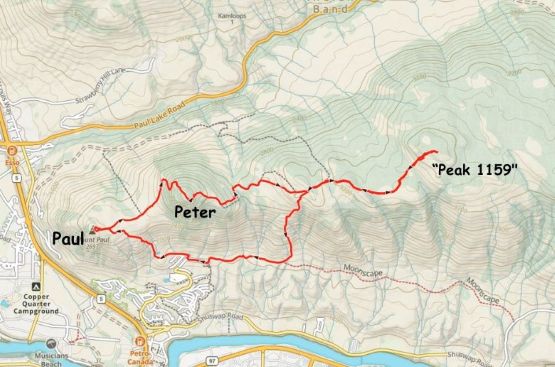
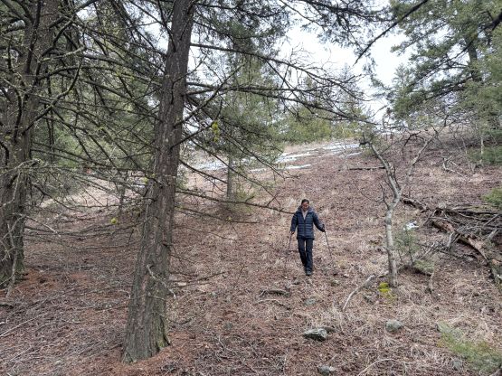
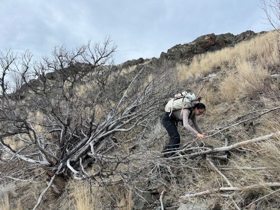
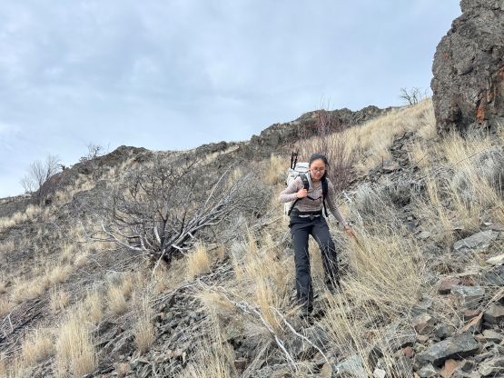
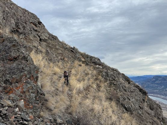
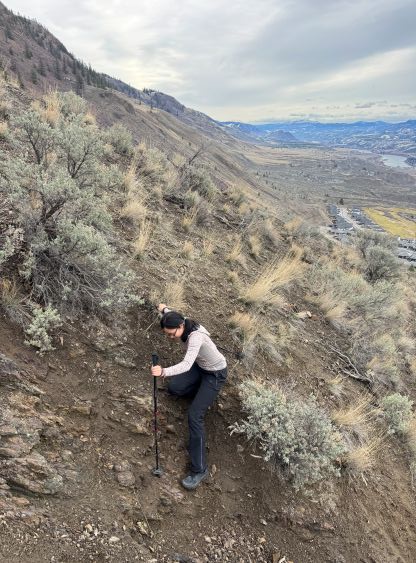
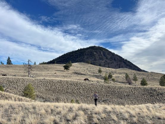
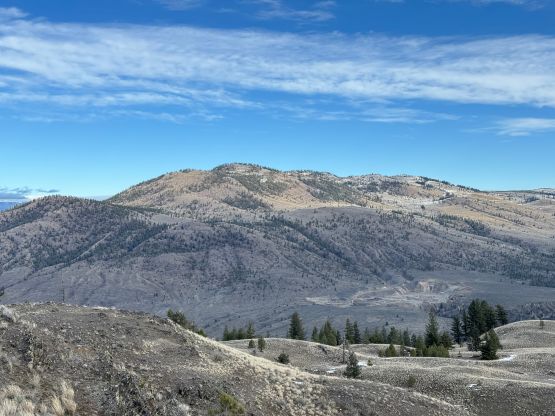
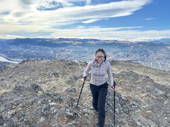
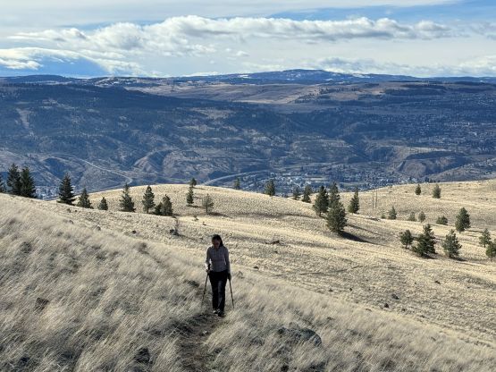
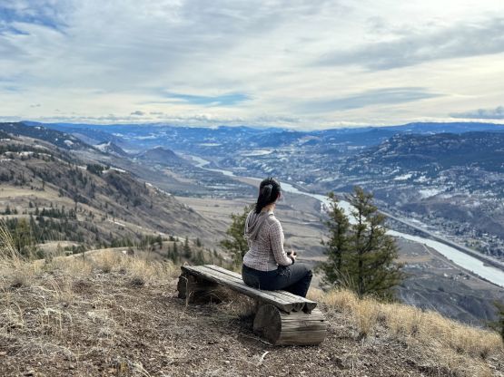
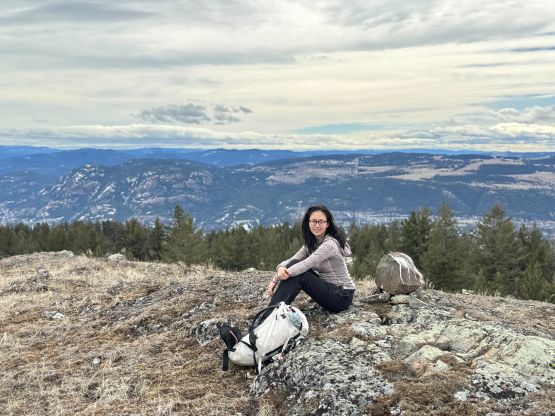
We went climber’s left past the end of the road and then went straight up the steep slopes underneath Paul/Peter saddle. The original plan was to ascend to the saddle but I decided to keep traversing left aiming for the shortest possible distance. Paul Peak would be the first objective anyway. The downside was having to cross several dry gullies with lots of loose rocks and Clair was certainly not very comfortable with that. Thankfully there weren’t that many gullies after all. After getting onto the plateau we noticed several horses near the saddle, but we turned left and were on the summit of Paul Peak in no time. The weather was as expected, mostly sunny with some high clouds.
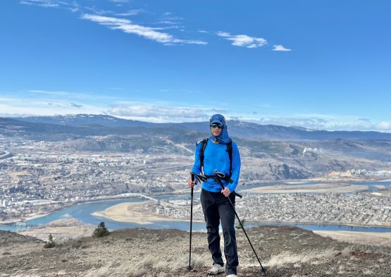
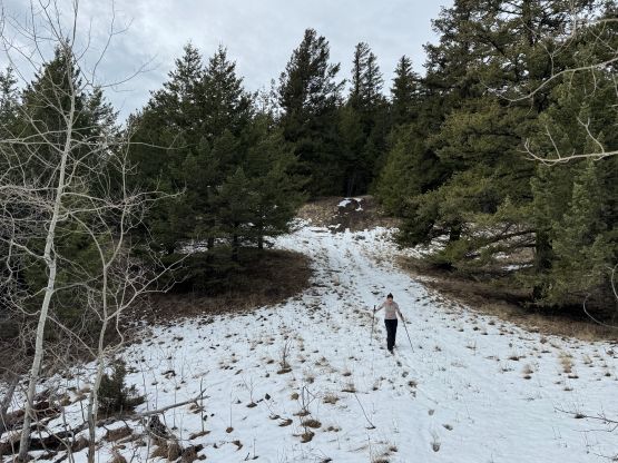
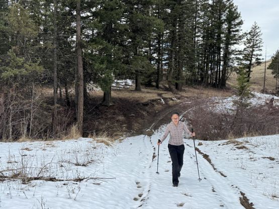
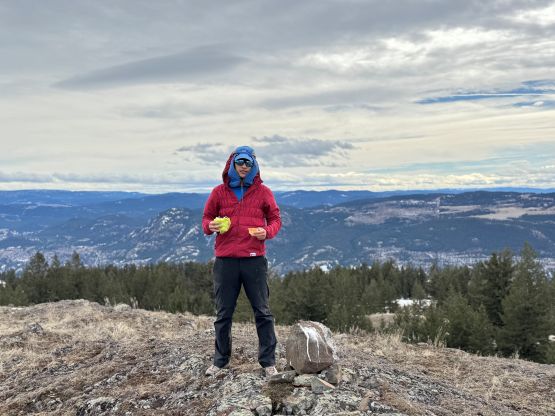
Not doing much lingering we quickly descended to Paul/Peter saddle following the unofficial trail, and then picked up the trail on the other side heading up the NW flanks of Peter Peak. It was apparent that Kamloops had seen some precipitation events a day or two prior, as the terrain was extremely muddy. There were also some fresh snow but not a lot at this elevation. The trail was quite steep and slippery, but it didn’t take us long to reach the summit of Peter Peak where we took the next break of the day.
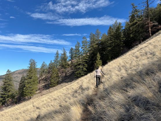

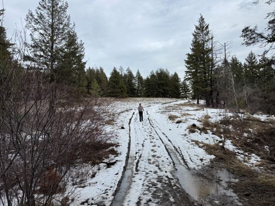
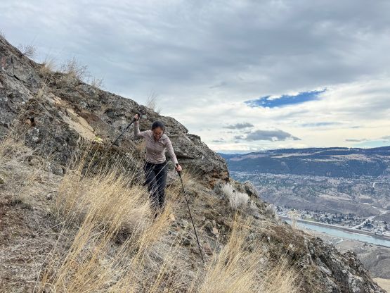
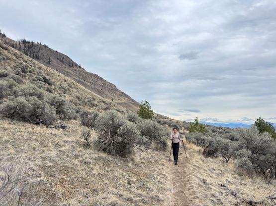
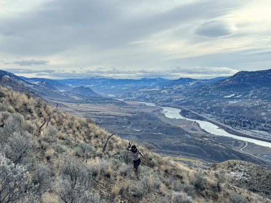
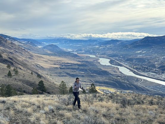
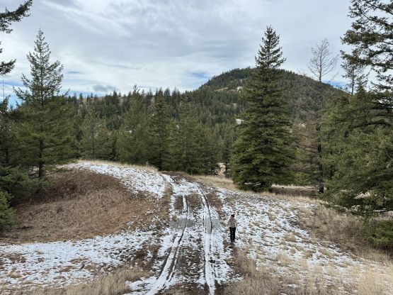
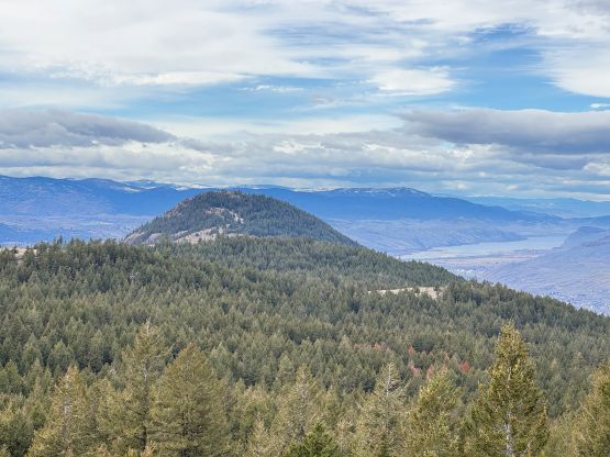
There’s a lookout slightly south of the summit of Peter Peak but we picked up the trail descending the eastern flanks, and quickly joined the ATV/Jeep roads heading down towards Peter/1159 saddle. We started to encounter more and more fresh snow and the going had started to become treacherous. Slipping started to become a real possibility so we both had to slow down and be more careful. Thankfully the grade of the terrain petered out and the rest of the (very long) plod towards “Peak 1159” was mostly on the aforementioned Jeep roads. We did make numerous short-cuts as the roads weren’t offering the most efficient pathway at times. I could tell that Jason utilized these roads for a lesser extent but I was too lazy to think, so followed the roads all the way to the base of the final objective. The last bits were cross-country travel with some steep slopes, but nothing overly worth noting. The bushwhacking was minimal.

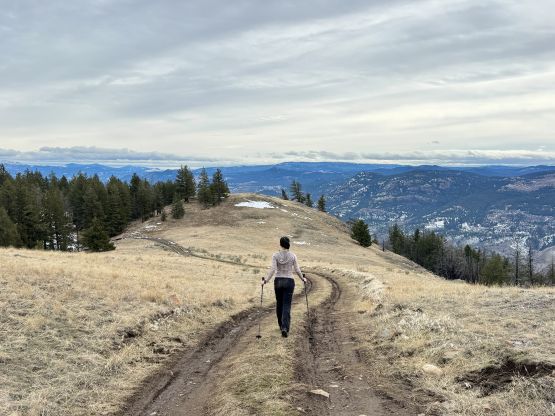
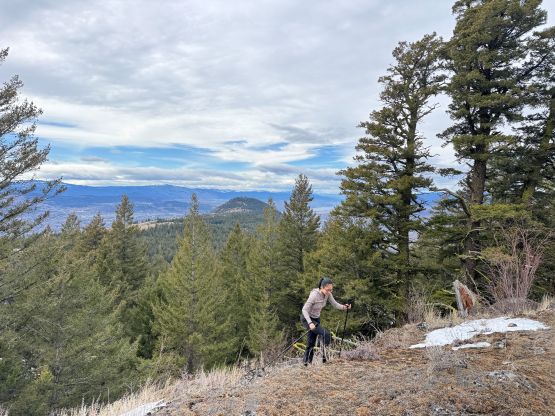
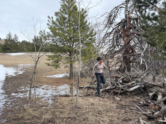
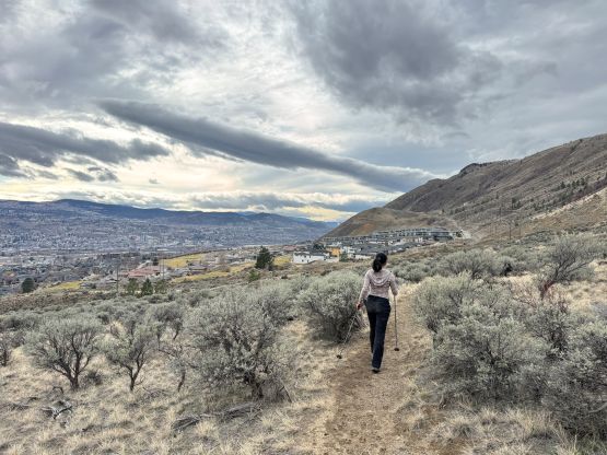
I had formulated a few ideas for the descent but eventually decided to take Jason’s route. We reversed our tracks back to the previous bump and then went down the steep south slopes. The terrain was harder than I thought that Clair was definitely not feeling comfortable, but we got ourselves down nevertheless after a long while of struggling. We eventually joined the Moonscape trail labelled on the Gaia GPS map, and came out of the closed area from behind that “no trespassing” sign. Clair was so tired that she decided to wait for me to retrieve the car after hitting the pavement, and I did come back to pick her up 5 minutes later. I got no parking ticket but I cannot guarantee this lot to be “legal” for future parties. Our round trip time was less than 6.5 hours which wasn’t too bad for a 15+ km loop with almost 1000 m elevation gain. There was still an hour of daylight after dinner so I decided spontaneously to add another objective into the day. Clair was done so waited for me in the vehicle.