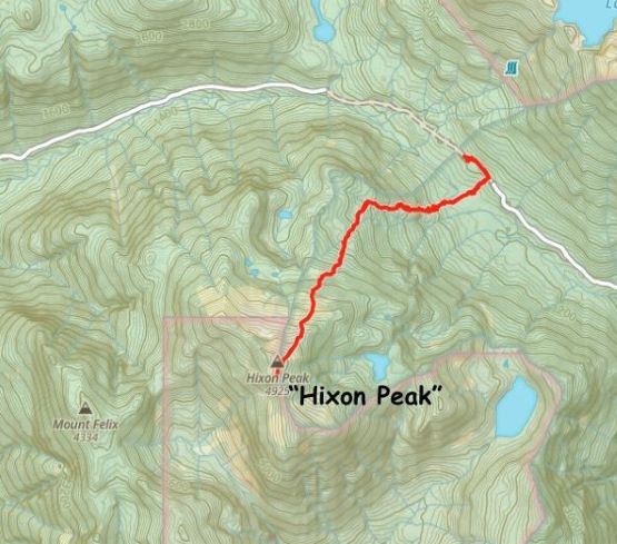
Hixon Peak
April 22, 2024
1501m
Indian Arm, BC
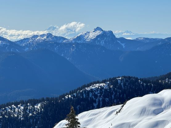
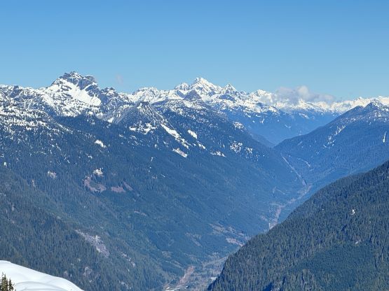
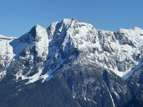
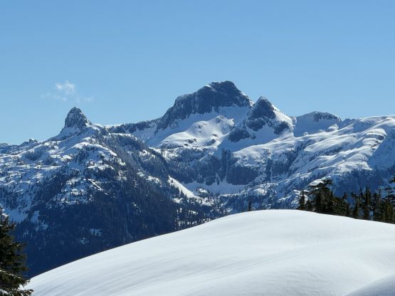
Mt. Felix that looms above the northern end of Indian Arm must seem more like a “peak” from the sea level but the official name is labelled nowhere close to the actual high point of the massif. There’s an 1500-m peak to the NE that boasts over 800 m prominence and this peak had been unofficially named “Hixon Peak” due to the proximity to Hixon Creek to the north. This peak is far more attractive than Mt. Felix because of the statistics but the ascent is apparently a representation of the notorious bushwhacking in the area. I believe Simon C. and Vlad M. was the first that went to embrace the unknowns in this modern era and since then, a few more prominence-chasing peak-baggers had followed the same route, and everybody had complained about the bushwhacking. I had already done Mt. Bonnycastle that shares the same starting point so I knew what’s entailed without consulting with these guys. I too had been contemplating about an ascent of “Hixon Peak” for many years but I have to admit that this is strictly a “peak-baggers’ summit”. The 80+ km of driving on logging roads and the intense bushwhacking would surely put most of the sane people at bay, and my trip report will not change that by much. The views were nevertheless good, but one has to work hard for them. The driving down Stawamus-Indian FSR requires one to climb up and over an 850-m pass, and that erases the idea of using a deep winter’s snowpack to make the bushwhacking easier. The start of the route is 200 m lower than the pass so once the road melts out one’s guaranteed to embrace the worst of the bushes, which were reportedly at the bottom.
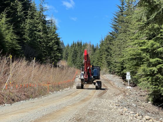
Then all of the sudden Sean C. published a story on Instagram. There was no location tagged but I knew where that video was taken from even though I hadn’t seen that view myself, so I went onto the Peakbagger app and sure enough, the trip report was already updated. I immediately made the plan to follow Sean’s footsteps two days later. The weather would be sunny and the 20 cm fresh snow on Sunday wouldn’t change the bigger picture by much as the route mostly avoids avalanche terrain. There’s some concerns of the access as they had been actively constructing a pipeline from Coquitlam to Squamish and the route follows the exact path along Hixon Creek FSR and Stawamus-Indian FSR. The status of the road was “subjected to closure” according to their websites and Sean basically stated that they could close it at anytime from now and the access could be significantly affected until they finish the project, which would be at least 3 years later. To make sure I could have enough time contingency to divert to a secondary objective the decision was then made to leave in the previous evening and sleep in the vehicles, and to further complicate things I absolutely needed to get back to White Rock by 3:30 pm for work. The nasty bushwhacking meant this is not an ideal objective to ascend in the dark and the hike would take at least 5-6 hours, and the drive would take at least 3 hours each way so everything had to go down rather smoothly. Kate decided to join and even offered to take her Subaru to unload some of my driving duties, but I still needed to drive the FSR portions and I had to consult with Sean to make sure the road’s currently suitable for a Subaru. The answer was basically a “yes and no” but Kate’s Forester has all-terrain tires and I’m decently experienced in off-roading, so the final decision was then made.
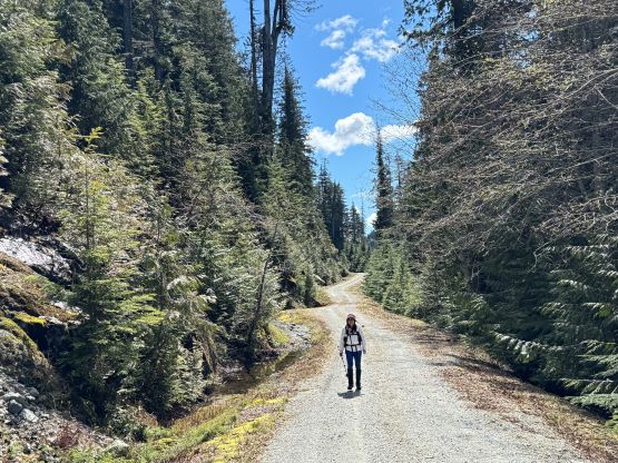
Kate and I left White Rock at 8 pm after work and got to Squamish about two hours later. I needed to make a stop in my parents’ house to grab a few pieces of gears including an InReach. I had no concern about the route itself, but there’s some major unknown about the access, that at least two people had popped the tires of their trucks getting to Mt. Bonnycastle and/or Hixon Peak. We did not even have the best vehicle for this kind of missions (my trusty Tacoma) and we were further subjected by the unpredictable working zones. I could not even rule out the possibility of being denied of exiting and having to wait several hours for them to clear the work zone. All of that made the InReach a crucial piece of item to carry, at least in the vehicle. The 3 km up Mamquam FSR was a cruise sail because they had filled in all of the pot-holes, but I had been seeing multiple warning signs discouraging people to drive the Stawamus-Indian FSR. One sign indicated the road being closed from 8 am to noon, and from 1 to 6 pm or something like that, so we would time ourselves to drive out in between the two closure periods and that should also give us plenty of time to get me back to White Rock for work. The new gate at 3.5 km was not locked at night, thankfully, and the Stawamus-Indian FSR was plowed and maintained at the pass. There were about 10 trivial creek crossings but that’s it. The only rough section was the last few kilometers up Hixon Creek FSR to the parking in front of the Coquitlam Watershed’s gate. There were enough loose rocks to make that stretch a slow crawling. The bottom of the Subaru got hit hard one time probably because I was more used to the clearance of a Tacoma, but we made it nevertheless. I had to inspect the bottom thoroughly afterwards to make sure nothing’s leaking, and we eventually settled for the night at 11:30 pm.
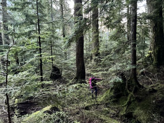
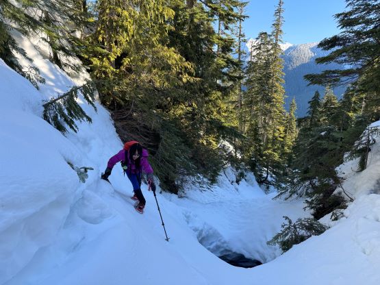
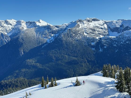
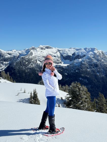
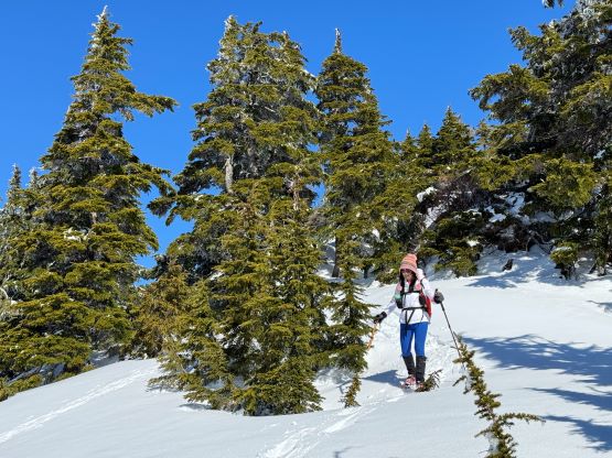
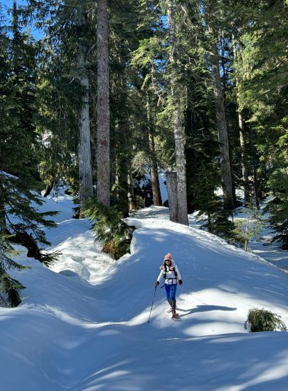
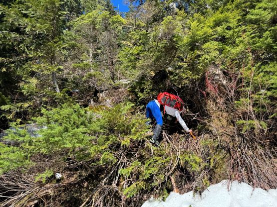
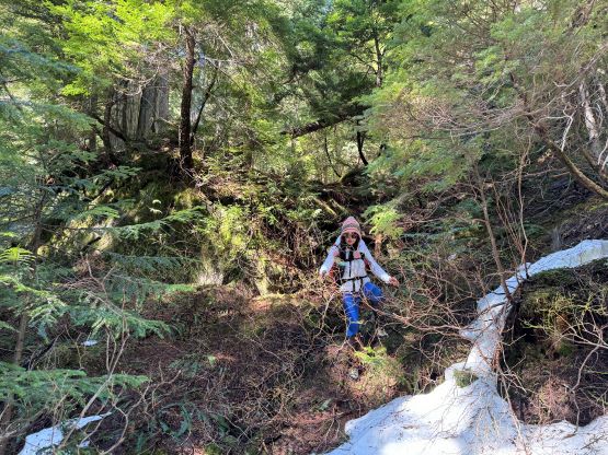
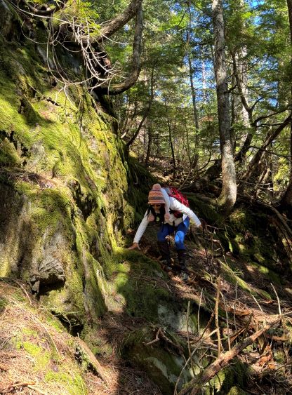
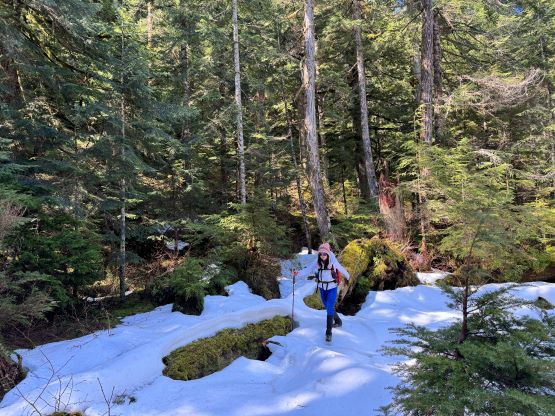
Kate and I woke up at 4:30 am and started hiking about an hour later with only half an hour’s head-lamp time. There’s no need to wake up too early because again, we were timing to get back and drive through the FSR in between their working periods. I had downloaded two sets of GPX tracks and they both entered the horrendous bushes right from the vehicle, but I made sure to have studied the maps and satellite images thoroughly. There’s a band of old growth a few hundred horizontal meters to the south and my plan was to use that band to (hopefully) reduce the pain. There’s one obstacle to bypass at the beginning that was not trivial, but I cannot elaborate too much here as you never know. I have to assume that the authorities do actually monitor these online articles and I don’t need unnecessary hassles. In any case the worst bushwhacking was on this bypass (level 4 for 10 minutes) but it was still worthwhile. The actual bushwhacking in that band of “old growth” was definitely annoying but nowhere as bad as what the others made it sound like on the “standard route”. After losing 50 m elevation we crossed a swampy area that still held patches of crusty snow, and the creek crossing was a simple step-across with no detouring required whatsoever. We encountered several bluffs at around 700 m elevation on the opposite side of the creek and those required some minor route-finding. At around 800 m elevation we picked up the gigantic post-hole steps left by Sean. There were still a few stretches of annoying bushwhacking but we eventually hit continuous snow strapped the snowshoes on at 900 m.


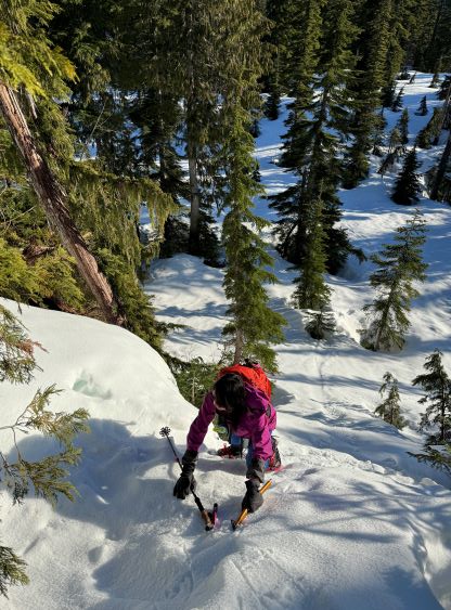
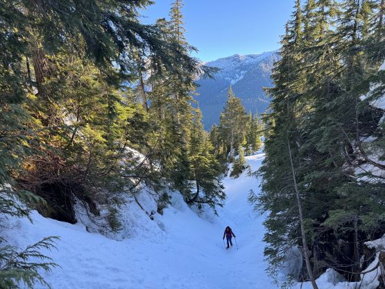
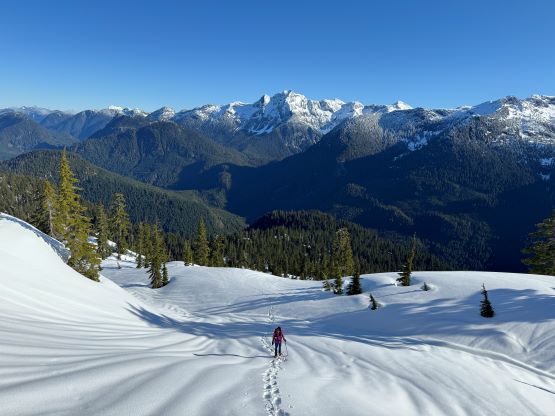
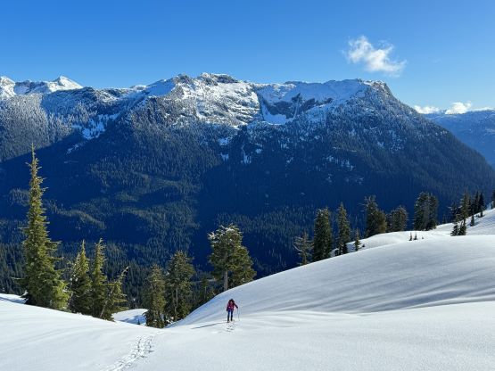
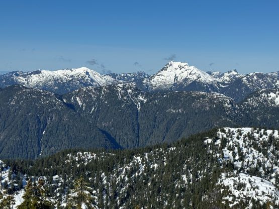
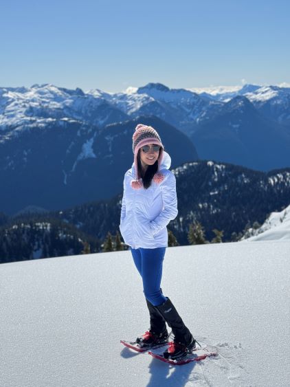
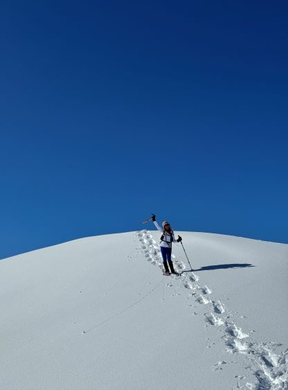
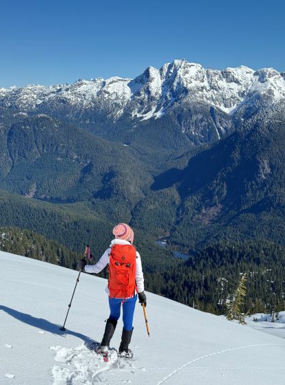
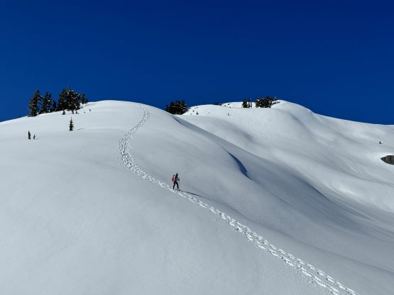
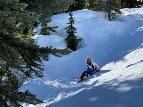
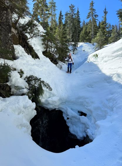
There’s one steep step immediately above the “snowshoe point” that forced Kate to take out an ice axe, but I was fine to do the whole climb with just the trekking poles. The terrain was quite variable as we entered a zone of “canyonlands” at around 1000 m. Sean’s tracks ascended the middle of the snow-covered creeks and there were a few cruxy spots. I’m sure those could easily be bypassed had we searched for an easier alternative, but I thought it’d be more fun to attack them head-on. Sean’s tracks were no longer visible from 1200 m elevation onward thank to the 20 cm of fresh snow, but the trail-breaking stayed reasonable for us throughout. The lack of visible tracks actually made the terrain more pristine and I certainly wouldn’t complain. The final 300 m ascent to the summit was actually quite nice but again, to get here one would have to push through the nasty below-treeline stuffs no matter what. We firstly went to check out the lower but more scenic south summit before settling on the higher, north summit.


The snow had already become mushy by the time we descended back to the treeline zone and that was at 10:30 am, but thankfully we didn’t have a lot of steep slopes to content with anymore. The canyonlands were still in the shade so the snow was still supportive. That was great because I would otherwise be concerning of falling through into the creeks. Kate was overall relatively new to the off-trail travel so our descent pace was nowhere as fast as I had hoped for, but we still got back in under 7 hours round trip. There wasn’t a lot worth noting in the bushes because all I did was to check the GPS screen every couple minutes to make sure we stayed on the exact same path. To bypass that final obstacle I decided to check out the uphill side, and found a much easier way that required very minimal detouring.


We were slightly behind the schedule in timing to drive back in between the working periods, but encountered no issue and eventually exited Stawamus-Indian FSR at 1:20 pm. There was a lot of working traffic but everyone was friendly including the one truck that blocked the road. I did have to stay 120% alert because on one hand I was trying to be quick but on the other hand we did not have a radio. There were at least 50 signs on various parts of this road saying something like “must call Hixon 0.5km up” or something like that, but in my entire peak-bagging career I had never owned a radio for the purpose of that. The original plan was for Kate to drive me back to White Rock from Squamish but I decided to drive us southwards for as far as I could, because we were slightly pressed in time and my driving was considerably faster. I do not normally speed but I could, if needed. I ended up passing almost everyone and even took the risks speeding through the Lions Bay corridor, and got us all the way past the Kingsway/Boundary Bay intersection in Burnaby. I did eventually make Kate to drive the final half an hour and I used that time to take a much needed nap, and did show up at work on time, though barely. I then worked straight through the afternoon and evening to 10 pm, concluding another exhausting but satisfying day. I basically squeezed two days worth of materials into one, but that’s just how I push myself. People liked to ask why I had so much time, well here’s the answer.
On a side note, since I did this trip I had put in some time to research that pipeline project, and apparently they were going to build that through the watershed, and yet the authorities were putting up “no trespassing” signs near the summit of Hixon Peak worrying about our contaminations? It was just like when I did the “forbidden” Cathedral Mountain a few years ago. Minutes after leaving the summit I saw a helicopter landing on the top dropping some heavy ass equipment. What a joke. Seriously are they worrying about us peeing but not the pollution from the gas pipelines? I hope the Coquitlam locals are not concerning about their water quality thank to this stupid fucking project.
