Forks Peak and “Goat Ridge Peak”
February 14, 2025
1172m
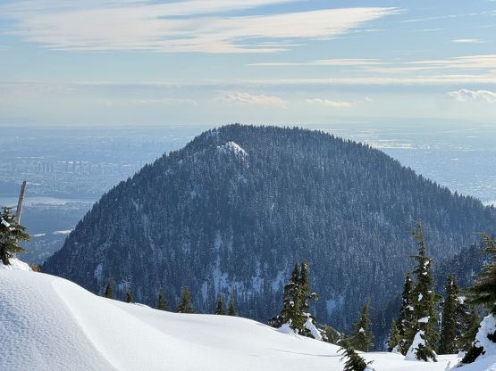
North Shore Mountains, BC
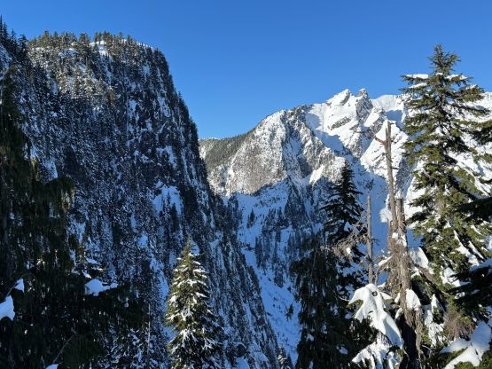
“Forks Peak” was once an extremely obscured objective buried in Hanes Valley hidden behind the rugged Goat Ridge. This peak does boast over 100 m prominence so it’s “legit”, and offers a nice couloir route on the north face according to one of the earlier trip reports on bivouac.com. That party however, spent 3 days to make the winter ascent even with taking the gondola up. I did not understand how it’s possible to climb with such a slow pace especially with a healthy snowpack to fully cover up the bushes. The earliest summer trip report was from Simon and the guidebook author David Crerar’s ascent and they reported some horrendous bushwhacking. In the past few years the status of “Forks Peak” had changed thank to the inclusion in the Bagger’s Challenge, that nowadays there’s a climber’s path along with more-than-needed amount of flagging on the standard route from Goat Ridge. This is still a serious undertake due to the shear amount of elevation gain, loss and regain. My plan was to do as many of these North Shore’s objectives in winter as possible as I believe most, if not 95% of the peaks in the Coast Range are better done with a snowpack. The main problem in winter is the access, but that’s never an issue for the North Shore Mountains. I had debated about taking the standard route versus Wickenden Creek from Lynn Headwaters, but I thought it’d be more fun to take the standard route and there’s a bonus of tagging “Goat Ridge Peak” on the return to fully clean up the area.
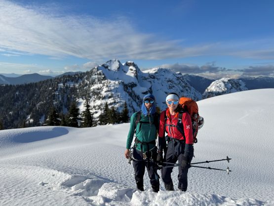
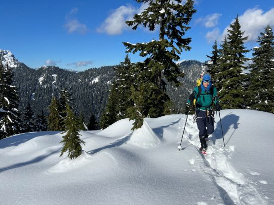
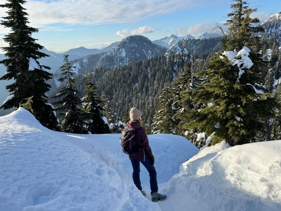
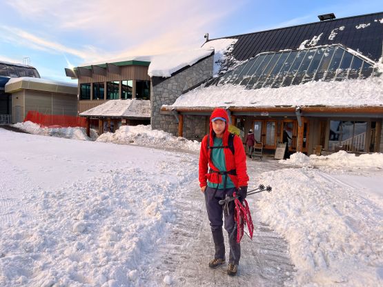
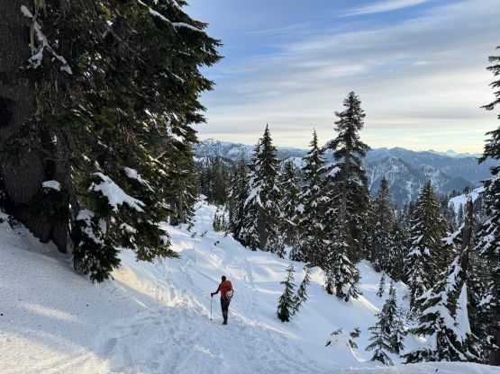
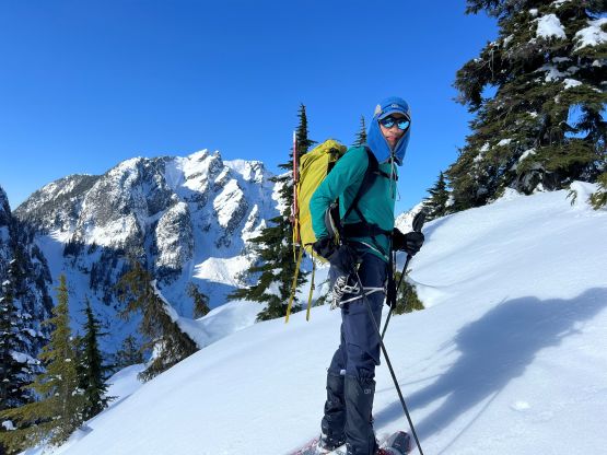
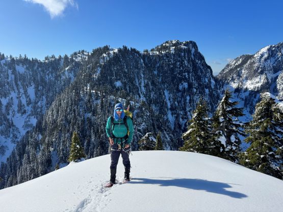
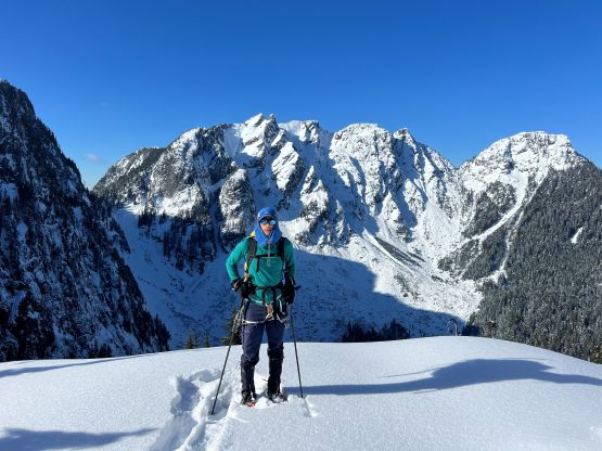
I of course, would not plan to spend 3 days for such a lowly objective and my idea was to simply day-hike it even by starting from the BCMC trail-head. Having a bullet proof snowpack would simplify things, but there are too many “bigger” objectives to consider when such a window happened. I eventually picked a day when the avalanche hazard was low but the snowpack was deep and unconsolidated, and still only needed 11 hours for the round trip. This trip also happened coincidently on the Valentine’s Day and thankfully Holly signed up for the challenge so I didn’t have to spend the Valentine’s Day alone in the cold. Another reason to finally go for “Forks Peak” was that I just did a trip to the nearby “Beauty Peak” two days prior, so I knew what exactly to expect at the moment. The weather also downgraded for Washington as otherwise my original plan was Jim Hill Mountain near Stevens Pass. Holly and I agreed to meet at Grouse Mountain’s parking lot D at 5:15 am to start hiking no later than 5:30 am. The plan was to take a break and load up our water bottles in the chalet and that wouldn’t open until around 7 am. For gears I decided to carry one 30 m rope, a bunch of cords, two ice axes/tools each, steel crampons and the smallest sized snowshoes. The trail-breaking wouldn’t be easy but there’s already a track all the way to the summit of Goat Mountain, and the majority of the terrain beyond that would be descending (400 m loss, and less than 200 m regain to the summit of Forks Peak).
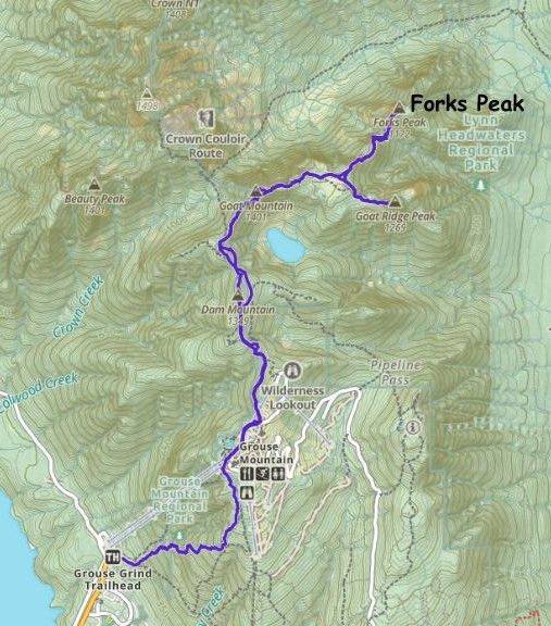
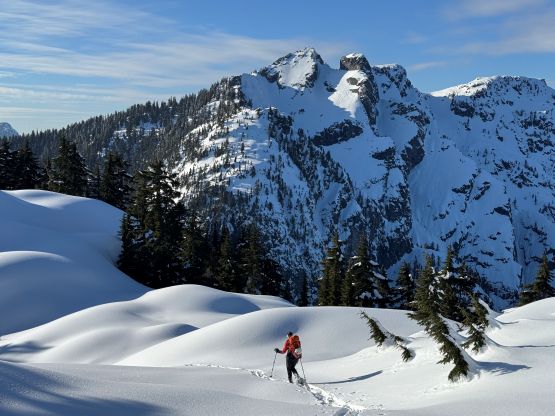
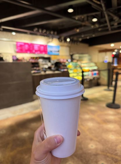
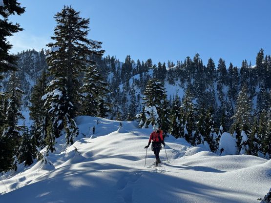
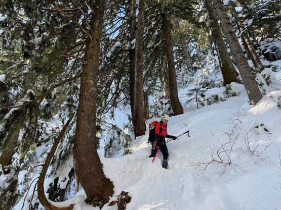
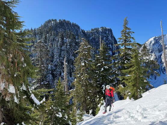
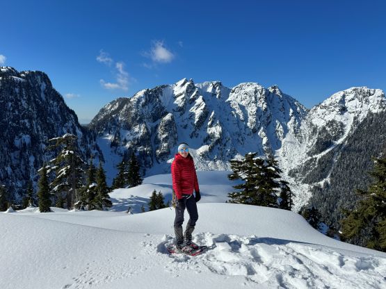
For the ascent of BCMC trail I made Holly to lead the pace as I’m never the greatest at setting a sustainable pace. This was just a repeat of what I did two days earlier but we got to the chalet 10 minutes faster, in 1 hour 25 minutes. We did start a little bit higher by parking at the lot D, and directly hopped over that closure sign instead of trying to find an alternative starting point. The chalet was open as expected, and we ended up spending more than half an hour chilling. They had even opened the cafe so I bought a cup of hot London Fog for 7 bucks, and loaded up the water bottles with hot water. I don’t think we should get too used to this kind of European style though. Holly is apparently the expert of Grouse Mountain as this entire idea was her suggestion. I had done almost every single peak in this range and this was the first time that I actually took advantage of the services. Holly also knew the right way to navigate the maze of trails and ski runs, that we managed to pick a line in between the two routes that I took two days ago, and did not need to don snowshoes. We opted to bypass both Dam and Little Goat Mountain as the objective was to get to “Forks Peak” as quickly as possible. We did not need to don snowshoes until after Dam/Little Goat saddle. The bypass of Little Goat was as bad as what I remembered from two days ago in the dark, but at least it’s no longer an unknown.
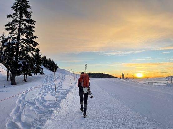
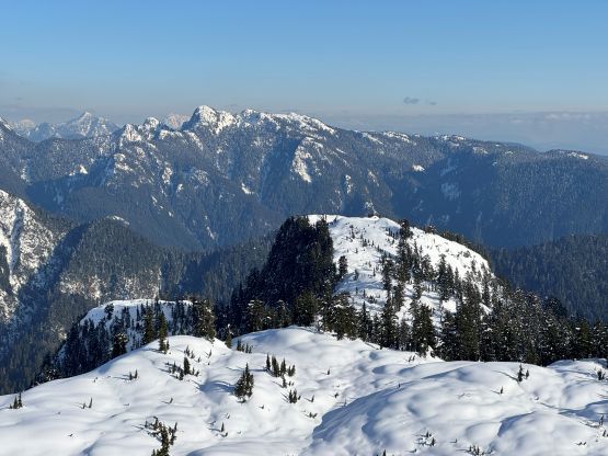
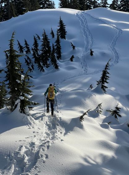
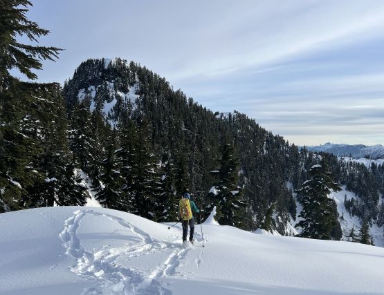
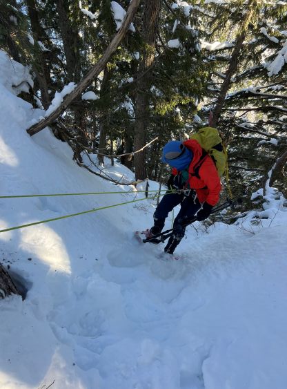
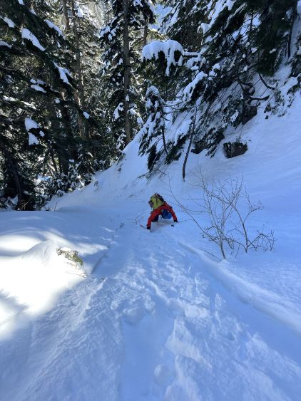
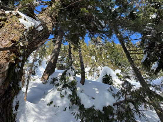
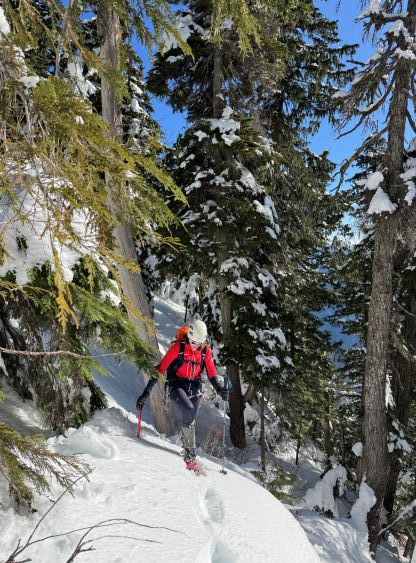
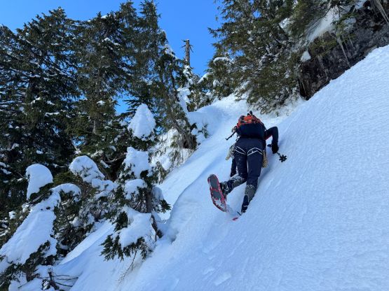
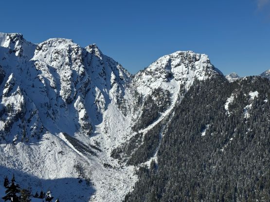
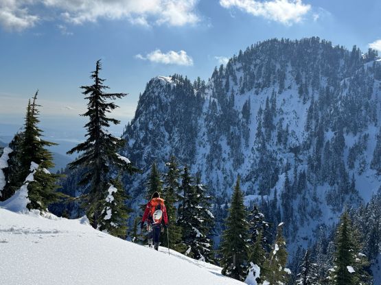
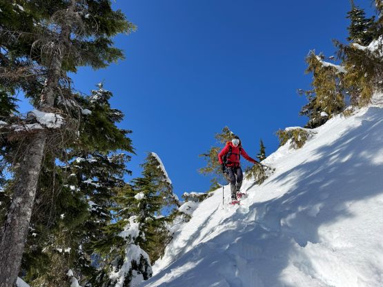
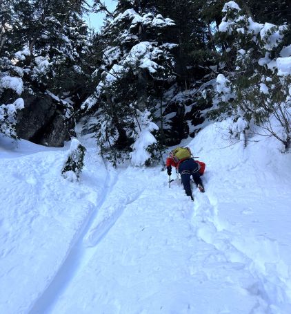
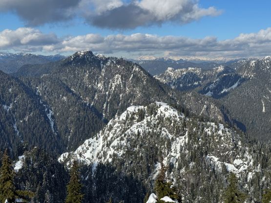
The tracks up towards Goat Mountain turned out to be terrible as whomever made that set of tracks had apparently opted to descend on foot, totally destroying the snowshoe tracks. I don’t know how is that possible for someone’s snowshoeing skills to be that horrible to opt for such deep post-holing. The snow condition was basically all time prime for snowshoeing as it’s not firm at all. To snowshoe on top of their post-holes was awkward but was still better than breaking our own trail. I led us bypassing the uppermost 50 m elevation gain to the very top of Goat Mountain by cutting across the steep south face. Holly was not very keen on that, but my route worked out well. And as expected we were on our own breaking trail afterwards. The amount of undulating terrain on Goat Ridge exceeded my expectation but the views were great and the trail-breaking wasn’t too bad. I tried hard to avoid plodding up and over those bumps so did a lot of side-hill cutting and I think I picked a good line to the junction between “Forks Peak” and “Goat Ridge Peak”. What laid ahead would be the 250 m adventurous descent into the deep Goat/Forks saddle but this was what we came here for. I was actually quite excited. The steep descent could be broken into two stages with one section of flat ridge in the middle. The crux was definitely the second stage but we ended up doing one rappel on each stage. The first rappel was mostly due to my impatience and could be totally avoided. I also kind of wanted to rappel as I sold this trip to Holly by promising that we would be making some rappels on snowshoes and this would be the first time for any of us doing that. Elsewise we were able to keep the snowshoes on, but the grade and condition was pretty much on the borderline of what could snowshoes handle. This really put my route-finding and snowshoe down-leading skills in test.
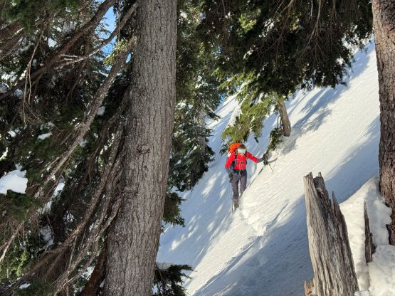
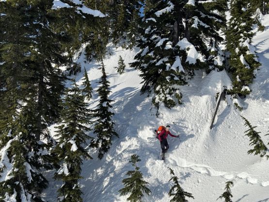

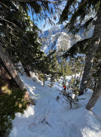
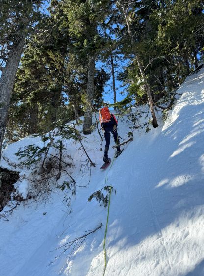
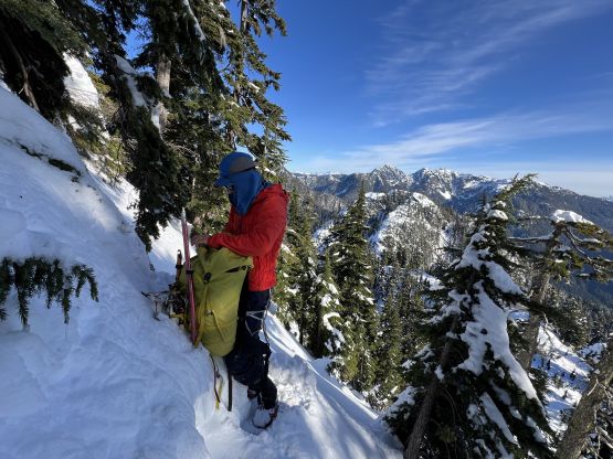

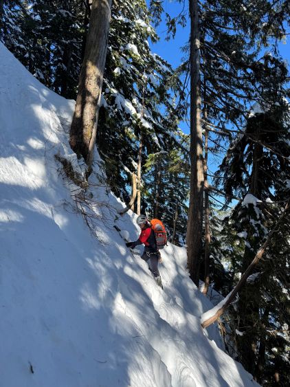
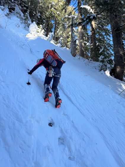
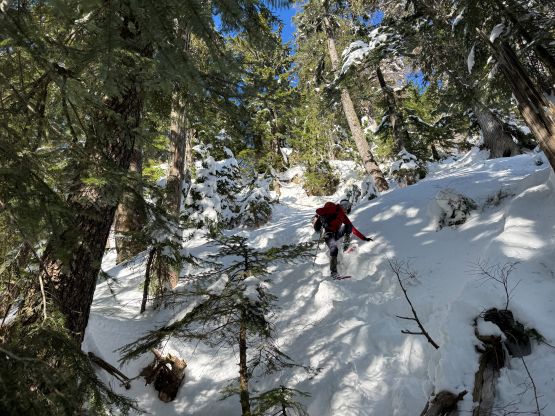
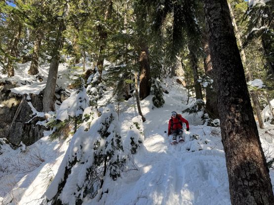
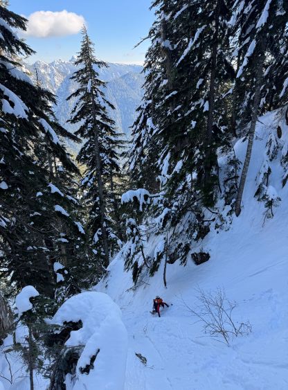
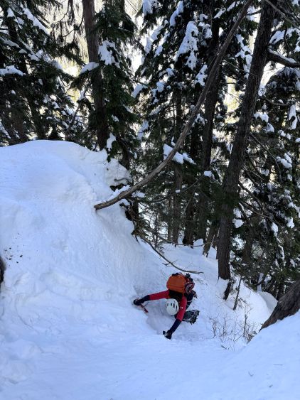
The second stage was considerably steeper than bluffier than the first and right off the bat I had to make several backtracks (which I rarely do) unless we wanted to make several unnecessary rappels. I knew we had to keep a skier’s right bearing but the correct route always existed on the left (cliff) side followed by taking a traverse on some ramps. This got me confused several times. The crux step was done by rappelling and I think we made a good choice, as otherwise we would have to switch gears to crampons and ice tools. We then encountered a long, steep and exposed traverse and about halfway across I made us don crampons. The consequence of slipping on snowshoes on this 45-degree terrain was disastrous and the down-leading on snowshoes was getting to my comfort limit. It was not any easier to lead across this traverse on foot due to the deep snow. For a few times I sank waist deep but that’s the only safe way to make this happen. This traverse brought us to a gully and it’s obvious that we had to downclimb this gully for a ways. This required facing into the slope and for a few steps I wished to have taken the second ice tool out. We picked a better line on the return, but the route I picked on the way down involved a few thin moves on ice and mixed terrain. I then led us traversing skier’s left back into the forest and made some deep post-holes down to Goat/Forks saddle.
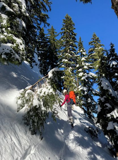
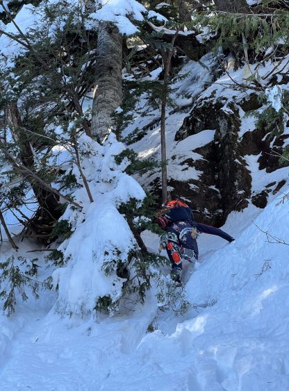
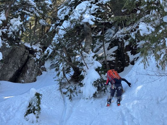
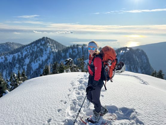
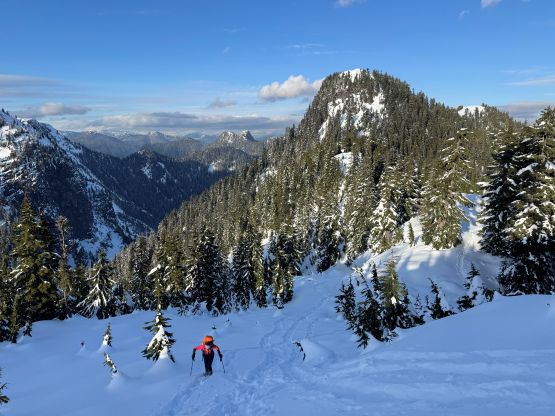
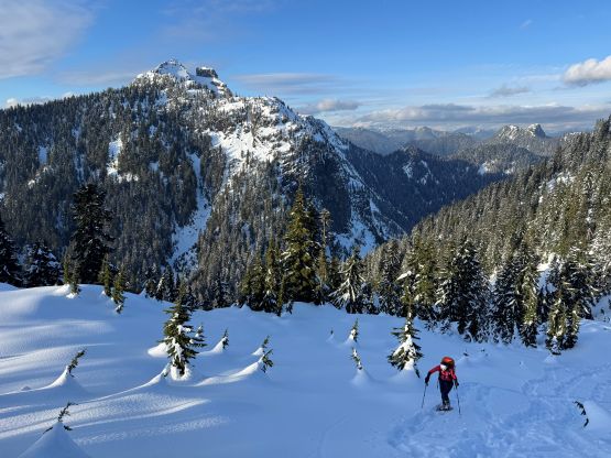
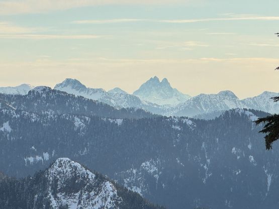
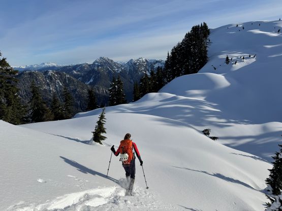
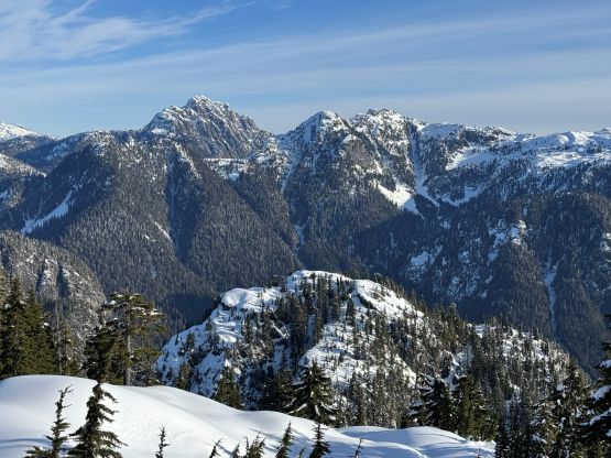
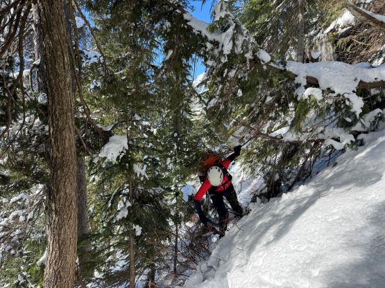
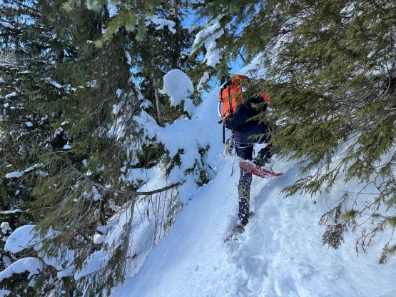
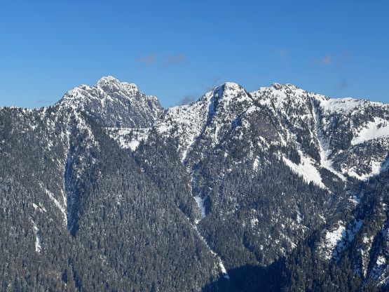
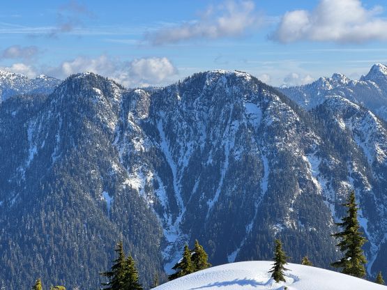
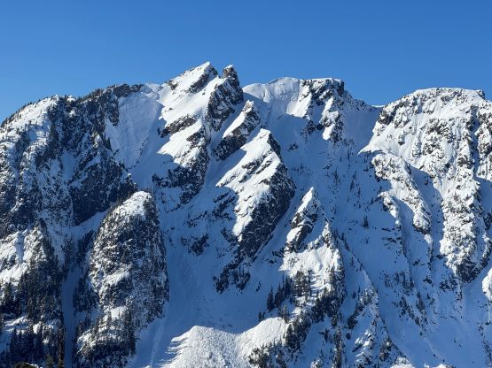
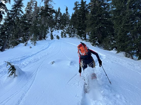
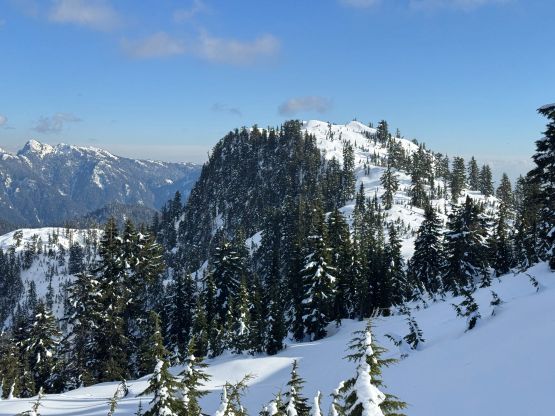
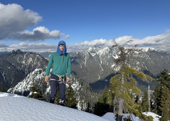
Due to laziness I opted to continue post-holing up towards the other side. It would make far more sense to switch to snowshoes but I remembered from that bivouac.com report that the terrain was “50 degrees”. We encountered perhaps 10 meters of a slope of that grade but that’s about it. We ended up descending this entire ridge on snowshoes an hour or two later and had no issue with that. About 100 m up I was constantly sinking waist deep and made the call to do another gear transition. Holly and I then took turn breaking trail on snowshoes. Holly actually volunteered to lead what appeared to be the crux of the SW Ridge of Forks Peak, and the wallowing on the 45-degrees unconsolidated snow took a long while. I eventually took over the lead and got us through that stretch by pulling on vege. The rest of the ascent was still tiring but not technical. This peaklet offered surprisingly good views especially towards the east faces of Crown Mountain and “Spindle Peak”, and therefore it’s not a dumpster objective by any measure.


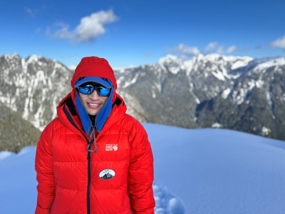
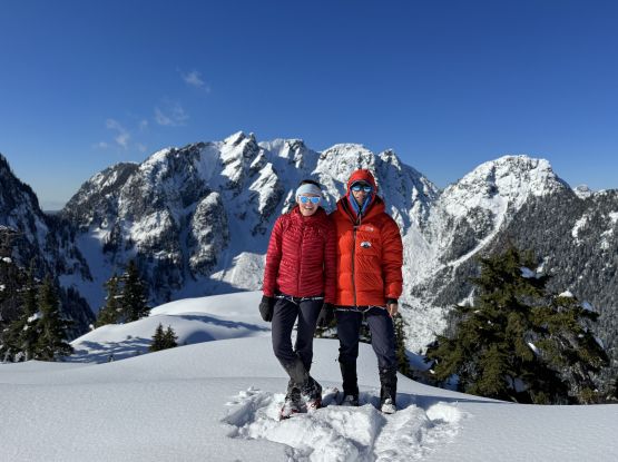
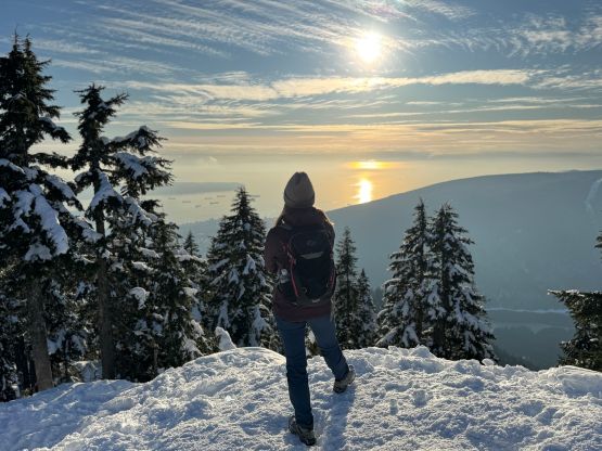
There’s good cell coverage on the summit so I made a few updates to inform various friends about our progress. Holly was still keen on her “mountain meditation” but I didn’t approve that. Instead I thought we had to hurry up especially that my phone’s battery had dropped to below 50%. I did not bring a battery pack and I had to count on the phone for a lot of things (well, almost everything). The descent to Forks/Goat saddle was quick and entirely done on snowshoes, and then I even managed to lead us halfway back up the lower crux zone on snowshoes before being forced to switch to crampons. There were at least two steps in addition to that traverse that required crampons, and with the existing tracks the post-holing was actually not that bad. To climb up the section that we had rappelled was harder than I thought. I was originally going with only crampons and trekking poles but halfway through that section I had to take both of my ice axes out. There were a few moves on thin snice and the grade was at least 55 degrees. Holly did fine without asking for a belay. As mentioned earlier we avoided the second transition by finding an easier alternative around that upper rappel, and grunted back up to Goat Ridge on snowshoes. Holly had done “Goat Ridge Peak” many years ago so she opted to take her “mountain meditation” while waiting for me snagging that meaningless summit. I had to manually set the filter of my peakbagger app back to “zero prominence” to even find this dot. The only reason that I bothered with it was the inclusion in the Baggers’ Challenge so it’s sort of getting popular these days. I do not consider this as a “peak” otherwise, and despite the inclusion in the list it does not go on my personal count.


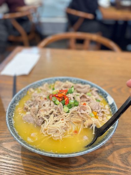
After the solo jaunt I rejoined Holly and resumed the upwards plodding across the undulating Goat Ridge. Holly had opted for a head start as soon as she saw me descending “Goat Ridge Peak” so it took me a while to catch up. Holly also suggested that we should make an up-and-over ascent of Goat Mountain which I was not keen. I eventually reluctantly agreed to make a repeat on that objective, but then I said we might as well tag all of the bumps from here onward, including Grouse Mountain at the very end. We ended up only tagging Little Goat and Dam Mountain as the weather was moving in and my motivation of making a sixsome day was getting low. We were also able to make an efficient dash back to the chalet and concluded the round trip in 11 hours. I stopped the tracking for the half-an-hour-plus resting inside the chalet in the morning as the GPS would otherwise jump around, so the time excludes that portion. Holly also knew the trick to save 5 dollars for the download ticket, that apparently it’s cheaper to book the ticket online. I did so but they had stopped selling the same-day ticket but that’s only due to some issues of the website. I showed the screen shot to the receptionist and he’s able to sell me the ticket at only 20 dollars (instead of 25$ that I paid two days ago). My phone’s battery had dropped to 5% by the time we got back to the parking lot, but the USB port had unfortunately gotten wet during the day. I seriously needed the phone for navigation so I turned on the AC and held the phone making sure the port was facing the fan, while driving. The water thankfully vaporized in about 10 minutes by the time the battery dropped to 3%. I also redirected the bearing to Richmond as I thought I deserved to have a good meal after a big day of hiking. The traffic was unfortunately not great and the restaurant was also busier than usual probably due to the Valentine’s Day. I nevertheless celebrated my Valentine’s by having a fancier-than-usual dinner alone.