“Peak 620”
February 24, 2026
620m
Hope, BC
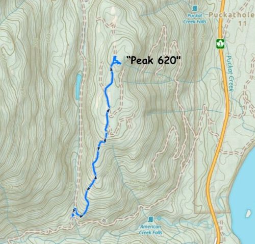
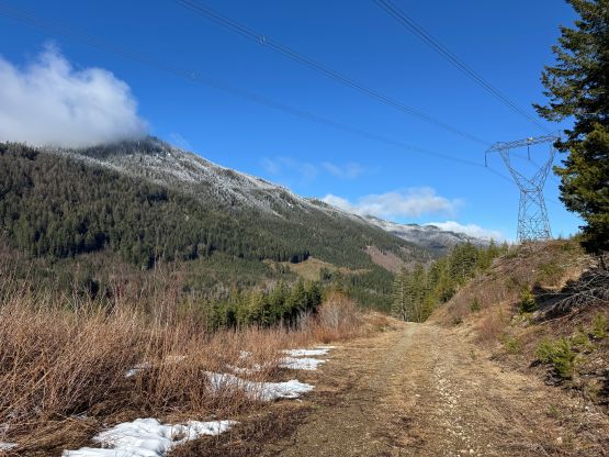
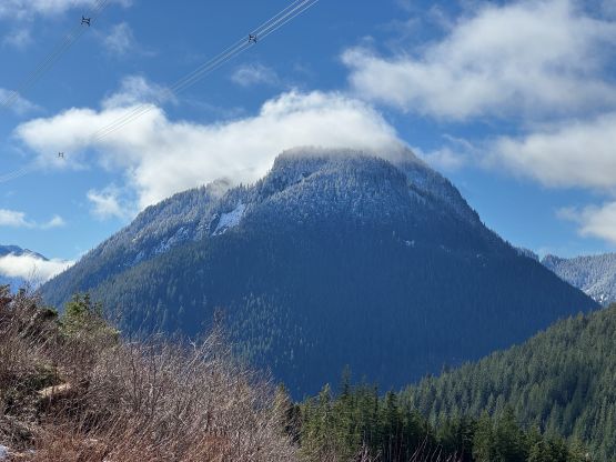
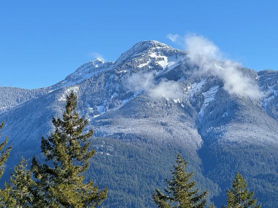
This is one of the unnamed pimples in the lower Fraser Canyon that boasts over 100 m prominence and hence qualifies as an independent peak despite the lowly nature of it. There’s no spot height marked on the maps meaning it hadn’t been surveyed, so the elevation could only be “estimated” to be between 620 and 640 m based on the contour lines of the government-issued BC Basemap. A more precise LiDAR conduction in the near future could upgrade its elevation status but for now, let’s call it “Peak 620” as 620 m is the lowest possible elevation of the summit. I had added several of these Fraser Canyon’s P100m bumps to the peakbagger.com database a few years ago but I missed a bunch of them. This is one of those that I missed, which might or might not be a bad thing because it then actually gave me the oppourtunity to explore it. The few other ones were already logged by at least half a dozen fellow baggers with several trip reports popped out over the past few years, but this one had no online “beta” whatsoever. It wasn’t difficult to draw a line out on the maps though, as a powerline road practically goes up the south ridge all the way to the forested summit.
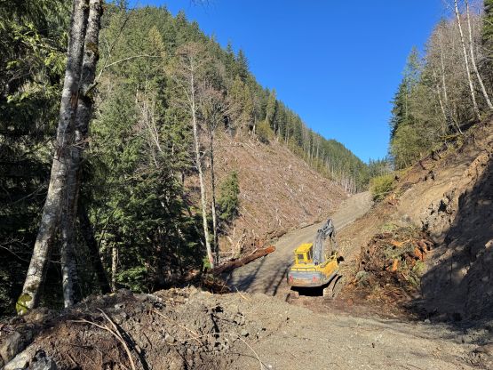
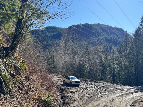
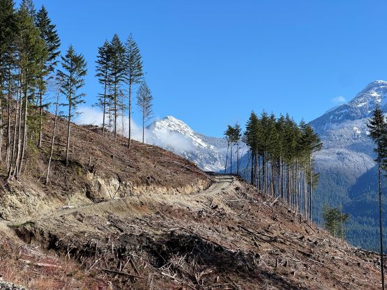
I made the spontaneous decision to tag it immediately after completing the nearby “Peak 703” as I still had a few hours to do something. I only needed to be back in White Rock by 2:30 pm for work and I didn’t want to sit in the office for several hours doing nothing. I debated about going for “Schkam Peak” which was formerly known as “Peak 580” but I couldn’t find enough motivation. Instead, I was more keen on venturing into the unknowns. The biggest uncertainty was the access as there are two roads to get to the start of that south ridge powerline road. The one that starts from Highway 1 has a gate visible on the satellite layers so I settled on the connecting road from American Creek FSR. The gate at the start of the connector happened to be open but this was apparently an active logging zone. There were lots of fresh tire tracks left by the massive ass logging trucks making the road extremely slippery and muddy. I nevertheless opted to trespass in, as those who know me know how much I’m NOT a law-abiding person. Of course I was fully aware of the chances of getting locked in upon returning, but I decided to take my chance as the worst case scenario was missing work and getting lectured by the authorities, which I was fine with. Driving to the start of the south ridge spur required at least AWD with medium amount of clearance. The recent downpours combined with the logging activities had made this a rather difficult drive. The start of the spur was already destroyed by one parked machine so I backed down and parked at the 3-way junction, making sure I gave enough room for the trucks to go by.
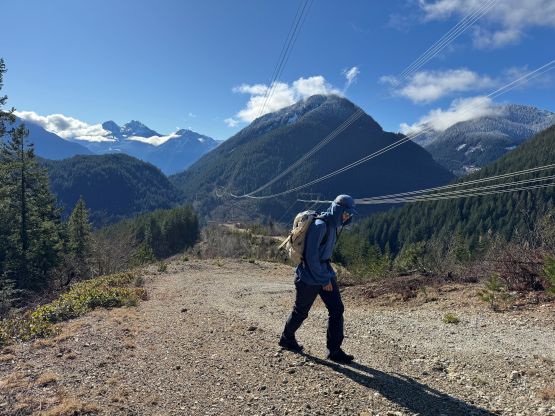
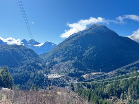
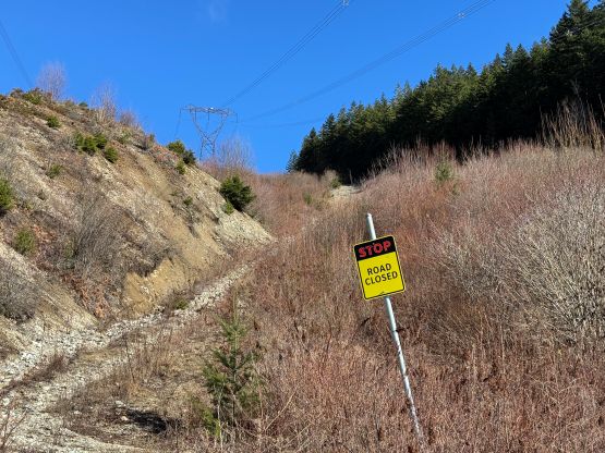
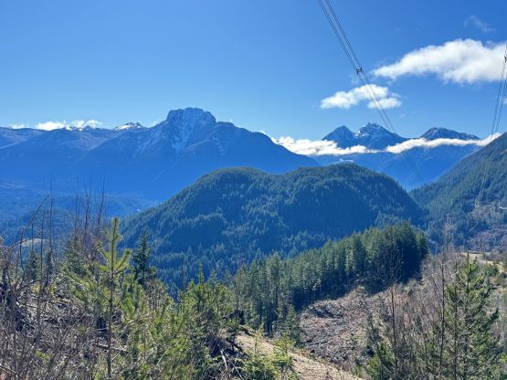
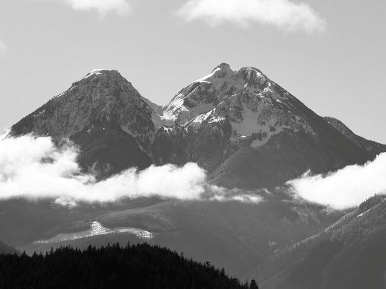
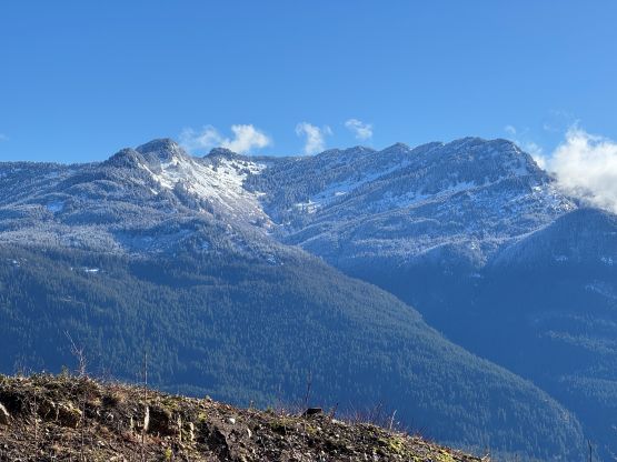
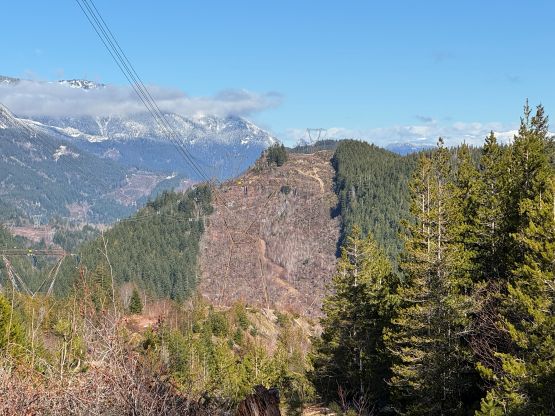
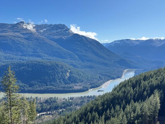
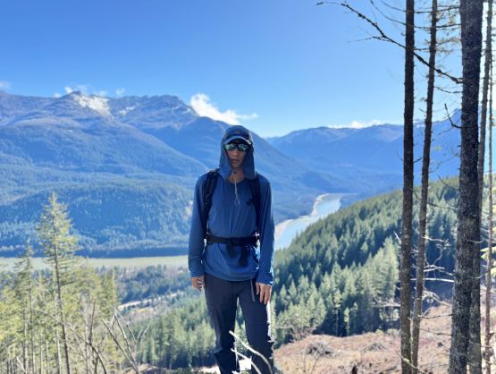
I spent no more than 2 minutes to gear up as I didn’t want to get caught by the workers in this stage (and hence having to turn around). Once I plodded past the destroyed part of the spur road I knew the summit would be in the bag, as no truck could go past that section. The powerline road was actually another spur road branching off as I quickly discovered. I almost went off route by taking a new logging spur traversing eastwards, but thankfully I doubted myself by checking the GPS bearings. The amount of logging activities on this hill was quite absurd. There’s a clear sign of “road closed” on this powerline road and sure enough, I encountered a stretch that could only possibly be negotiated by skilled ATV drivers. Higher up the terrain became flatter but the views accompanied me for 80% of the hike. The true summit was also not far from the road. The thrashing required to tag the highest point is less than half a minute each way, but just as I was searching for the “pole stand” take a selfie on the viewless true summit I noticed some openings much farther east, about 100 m of horizontal thrashing away. I decided to check that out, and that turned out to be an excellent viewpoint with views down to the canyon, so I took the selfie there instead.
There’s sporadic cell reception so I actually logged in the website page of peakbagger.com and did the peak addition on my phone, which was difficult to operate but then this was also not my first time doing that. I then logged my ascent on the Peakbagger app after refreshing it, and then thrashed back to the powerline road. I didn’t bother to update the socials this time for some reasons. The rest of the descent was uneventful. I could hear laud noises from logging farther up the valley but my parked-down-low vehicle was still intact upon returning. I quickly turned on the engine and drove away. To my relief the gate was still open and my next stop was the pho restaurant in Abbotsford. I eventually made back to White Rock by 2 pm, earning myself half an hour of break before showing up at work.