Mount Widdess
May 4, 2025
2250m
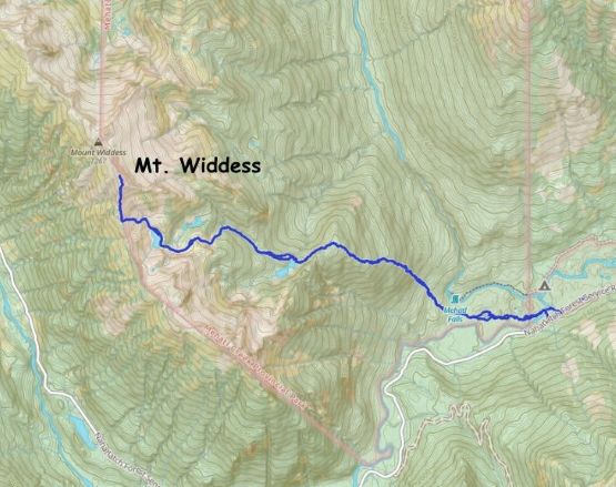
Nahatlatch River, BC
A few days prior to the ascent Francis Bailey messaged me if I’d be interested in a potential first ascent. Francis sounded quite sure about his plan except for an unknown river crossing, which he suggested to purchase an inflatable boat. I immediately suggested that I actually own a high end Alpacka packraft that had been used on an 160-km expedition in the Canadian Arctic and the boat was still in good conditions. The objective was Mt. Widdess. The name sounded familiar as I had spent thousands of hours on our local maps over the past decade, but I could not recall any recent memory of coming across this name. This peak locates on the southern end of Nahatlatch-Mehatl Divide and the only few records of previous visits in the area are much farther north along the divide – the traverses by John Clarke et al. in 1989 and Justin Brown et al. in 2010. I never bothered to make additional digging as I trusted Francis’ thoroughness when it comes down to the researching job, but whether this was indeed a first ascent or not I was keen on the mission.
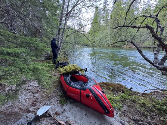
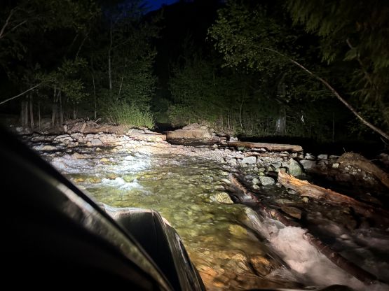
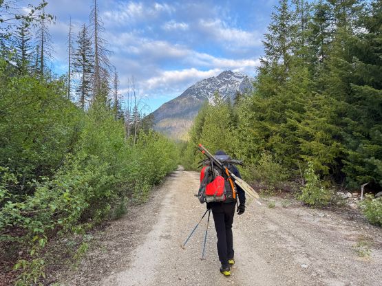
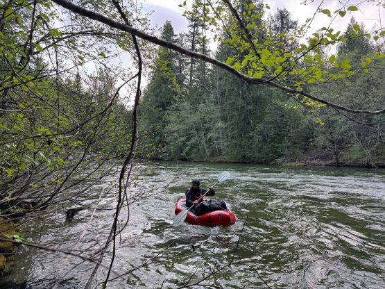
Francis had even made a scouting trip to get some pictures of the objective and to get familiar with the Nahatlatch FSR which was not to my surprise, in a very poor condition. In addition to the crossing of Nahatlatch River the route also involves 2000 m elevation gain with substantial amount of bushwhacking on completely unknown terrain so the plan was made to leave the city on the night before. Francis picked me up at 8:30 pm and the drive took 4 hours. There were more pot-holes than expected and the few washouts near Frances and Nahatlatch Lakes definitely required 4×4, high clearance vehicles. The 30+km of crawling from Kookipi FSR junction to the absolute drivable end took easily an hour and before reaching the end we got out of the vehicle to inspect the river. The decision to bring a packraft was definitely correct as this river was nowhere in the fordable state. The width exceeds 40 m, the current was fast and the depth could easily be several meters. We simply crashed on the truck bed and the alarms were set at 6 am in the morning.
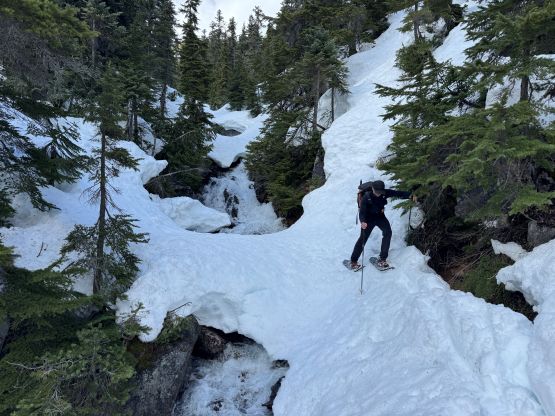
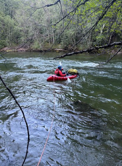
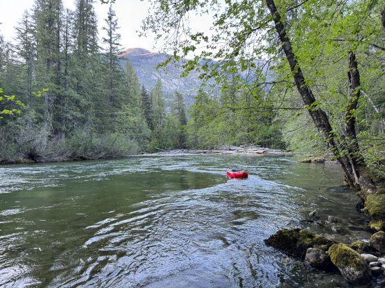
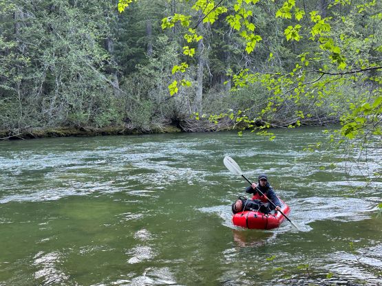
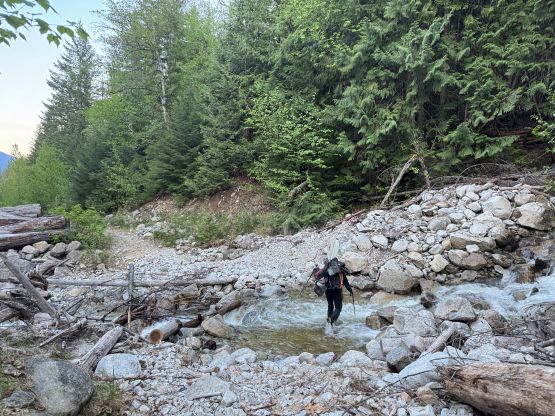
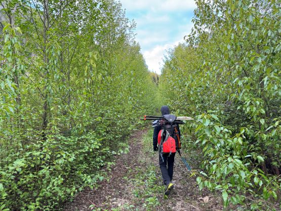
Theoretically we could have started at least an hour and half earlier but we were both exhausted from work and the long drive and desperately needed the extra hours of sleep. We had discussed the potential spots of crossing Nahatlatch River or Mehatl Creek over the past few days based on the satellite images. They were similar in width and definitely not fordable. There wasn’t a clear solution so we basically just picked a feasible spot (for boating) and went for it and that was on the Nahatlatch River close to the confluence. We had to carry the packraft and paddle etc. for about 2 km up the FSR and then bushwhack down to the river bank. There’s an additional creek crossing that forced us to take the shoes off, which was not a problem but annoying. The volume of the water still exceeded my expectation but on the bright side, the launching and landing spots weren’t difficult to find. It had been a few years since I mounted the packraft so the process took a while, but in the very end we sorted out the problems. I had also opted to put a bunch of gears inside the tubes to lower the center of gravity as my packraft has that “cargo fly”, but the downside was that we would have to inflate the packraft again on the return. The strategy now was for me to lead across while carrying all of the sharp equipment and towing the 60 m tagline and Francis would coil the rope and take the rear. The width of the river was about 40 m based on the satellite images but we used at least 50 m of the rope. I had underestimated the amount of dragging in this kind of situation so the final bits of upstream paddling were exhausting. I eventually grabbed some alder branches and hauled myself out of the water as otherwise I could not have parked the boat.
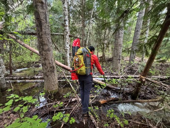

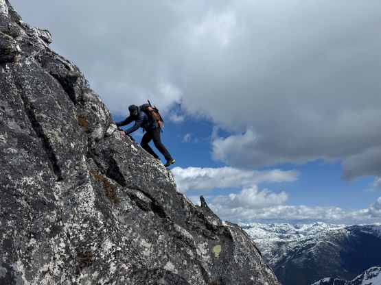
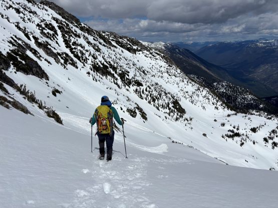
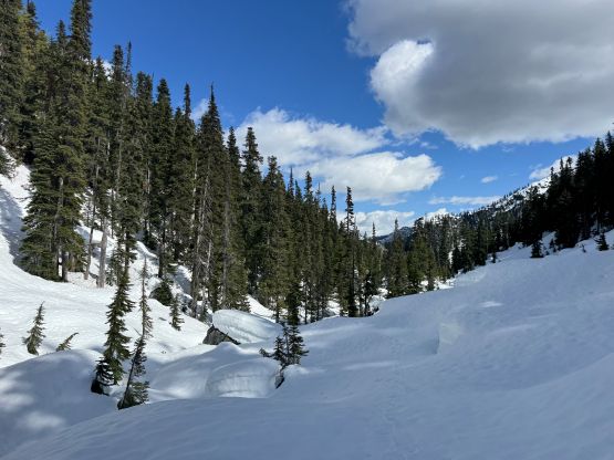
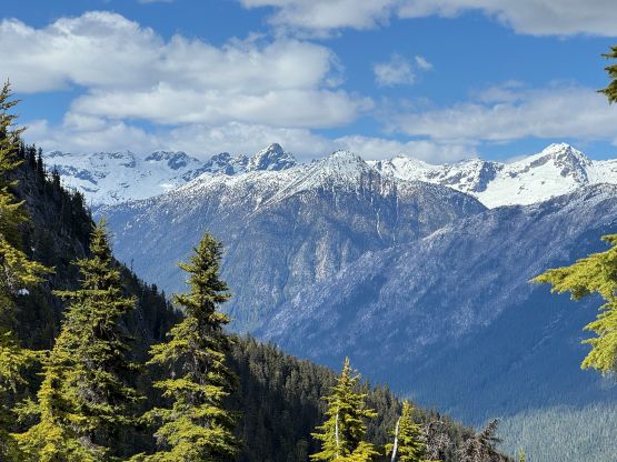
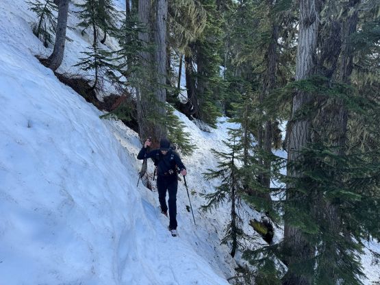
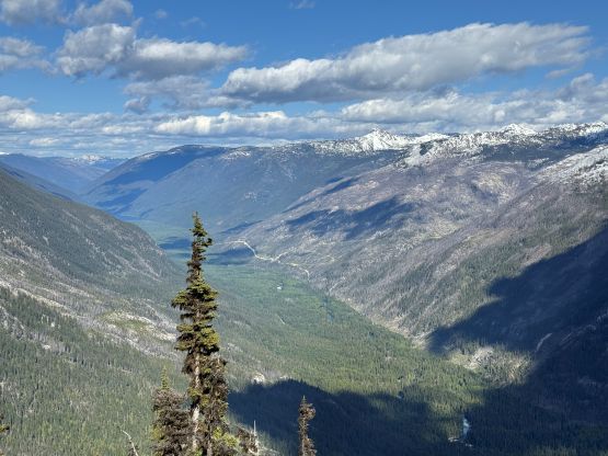
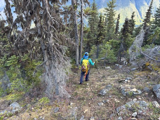
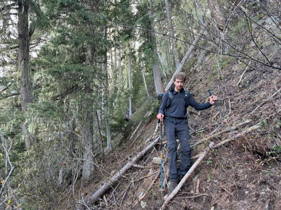
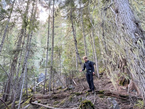
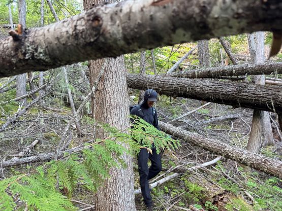
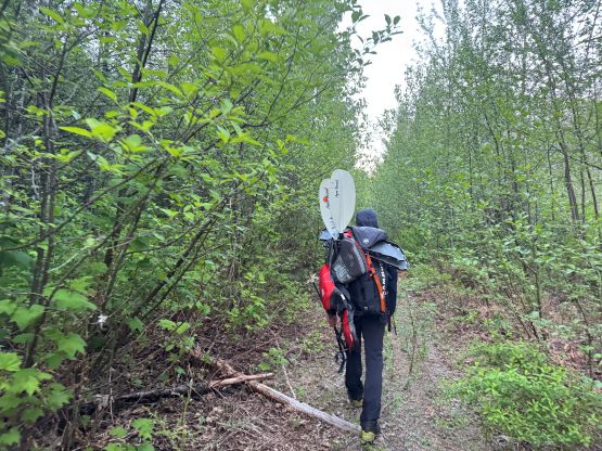
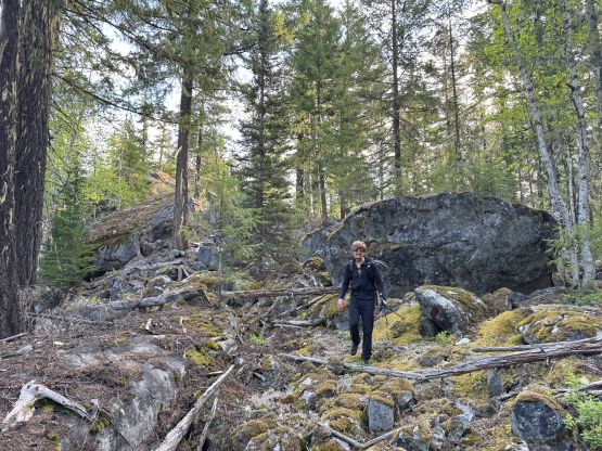
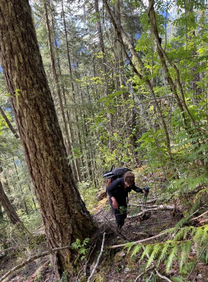
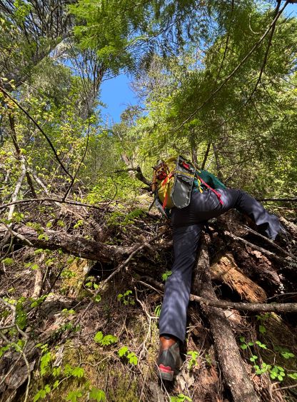
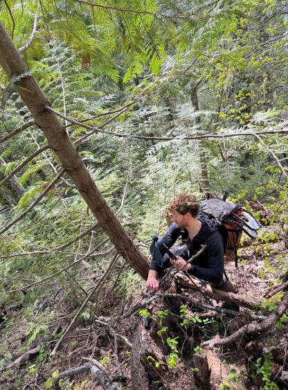
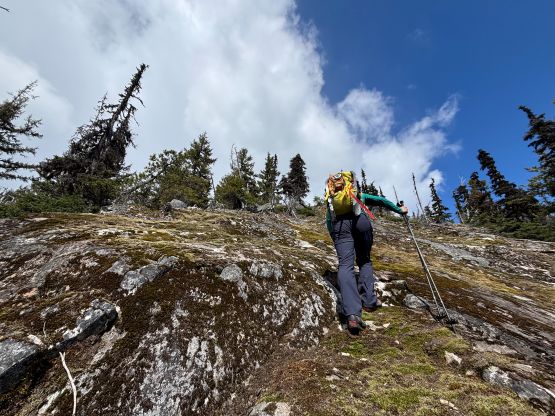
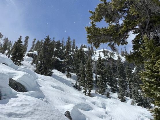
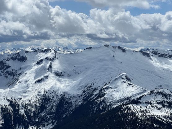
Once Francis came across we took our time recollecting ourselves and as mentioned earlier we would have to unzip the cargo fly to take the gears out of the tubes. The next stage was the mile-long bushwhacking over undulating terrain in between Mehatl Creek and Nahatlatch River and this stage was also more difficult than expected. The satellite images showed some large patches of boulder fields but there were a shit ton of disorienting micro-terrain, and the boulders were mostly car sized. The bushwhacking in the forest was actually not that terrible so we mostly stayed on the south side and more or less managed to take a direct and efficient bearing. At least an hour later we finally got to the start of the climb and our elevation here (right next to Mehatl Falls) was 370 m. This was shaping to become another exhausting day. The next stage was a grueling 1000-m grunt up to the 1350-m shoulder and we would have no snow to help with the bushwhacking. The contour lines were very scary around 800 m. I knew by traversing farther out to the climber’s right we could have encountered less steep terrain, but it was not that easy to maintain a constant traversing orientation given the amount of pick-up sticks and all kinds of annoying stuffs. In the end we got sucked into the bluff zones and were forced to do some exposed scrambling on loose dirt. The terrain was far from ideal but manageable such that we eventually decided to just “deal with the knowns” on the descent many hours later. Francis took over the lead from around 900 m elevation and the terrain tapered off slightly. We encountered another band of steep bluff near the top of this grueling stage but then we were finally greeted by some open terrain and finally, patches of snow. The snow quickly became continuous as we crested the 1350 m shoulder and we donned snowshoes from there.
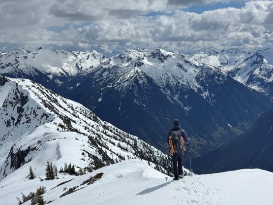
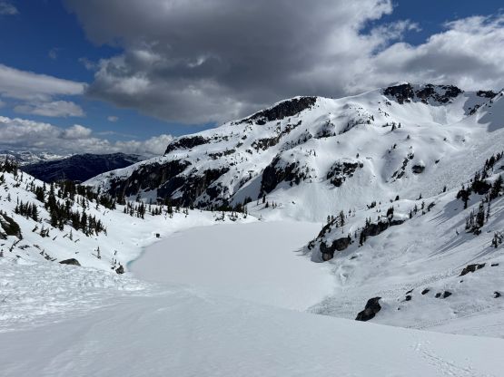
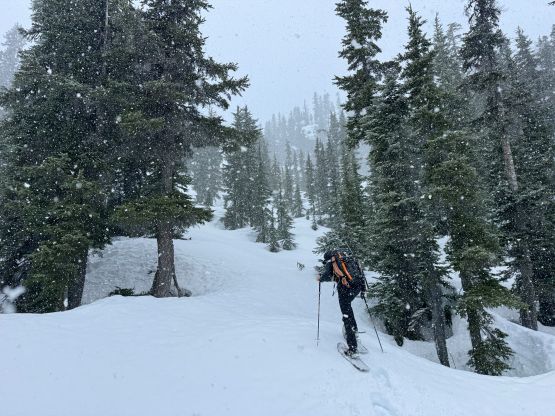
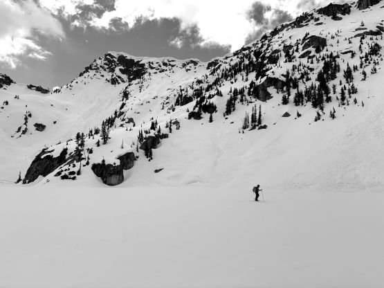
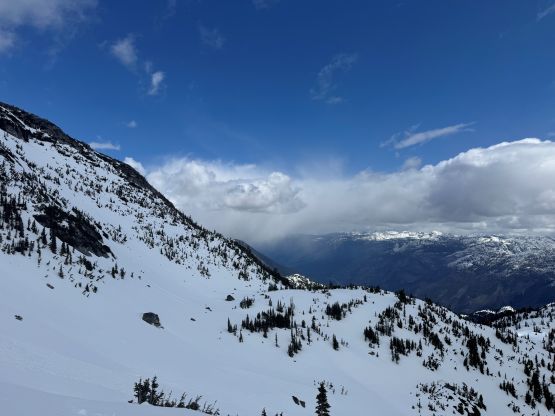
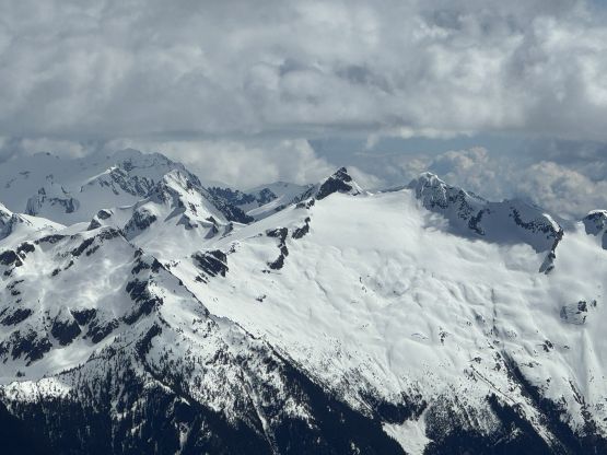
We would then traverse around the north side of this shoulder trying to maintain the elevation to the outflow of the 1350-m lake, and Francis had the most concerns about this section. The contour lines were again, very scary so we might have to lose some precious elevation. I volunteered to lead us across the unknowns as I was more confident on dealing with complicated terrain on snowshoes. The side-hilling turned out to be 45 degrees for a lot of the spots with some exposure, but we never ended up encountering any “show stopper”. We never ended up losing too much elevation but the stage still took a long while. The outflow of this lake was the perfect spot to take another lengthy break refilling the water bottles. I had opted to carry a stove with a fuel canister and those had become training weight. We had to deal with another stretch of side-hilling on confusing terrain on the north side of this lake but then eventually merged into a valley leading upwards towards the upper lakes. The weather momentarily closed in and we had about half an hour of fairly intense snowfall. This was in the forecast so we weren’t surprised. Francis had some different ideas than mine so we followed his lead bypassing that middle lake. This route worked out nicely as well and only involved about 20 m elevation loss. The upper lake didn’t appear fully frozen but the side-hilling around looked awfully painful. I ended up taking half of the route by contouring but then put my fate on the ice and went directly across.
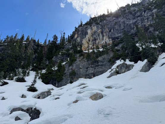
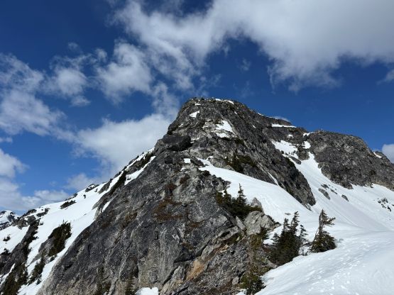
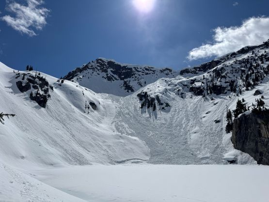
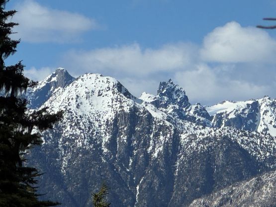
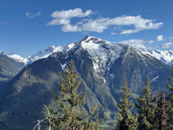
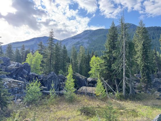
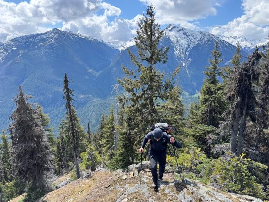
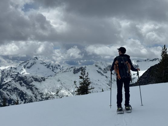
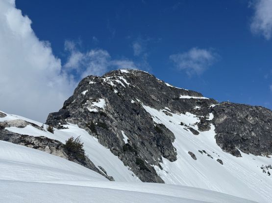
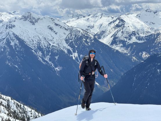
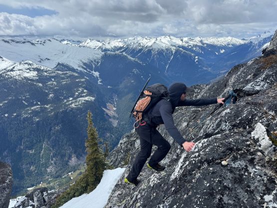
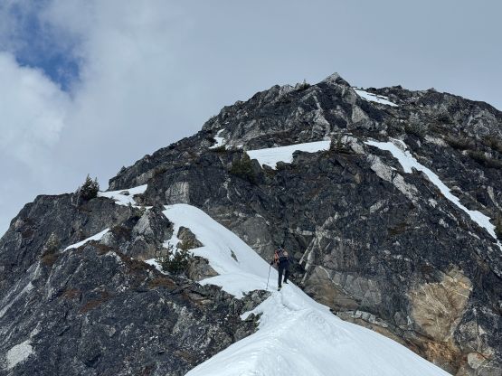
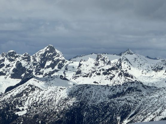
To gain the south ridge my original plan was to climb almost the entire course of the SE Face on steep snow before cutting onto the uppermost south ridge mostly to bypass a steep section with unknown difficulties. Upon examining the route in person we decided to join the ridge much lower down and deal with the scrambling, which appeared to be straightforward at least from our vantage point. This would limit our exposure to the south facing steep slopes. The snow condition was still firm thank to the deep overnight freeze that we got in the previous night. We were able to wear snowshoes all the way to the 2000-m ridge but we could have easily swapped the ‘shoes for crampons. The grunt took a long while and we were both exhausted by this point. The snowshoes were quickly ditched as the ridge appeared mostly dry, but the scrambling was slightly more involved than I thought, with the crux being a pitch of wet and exposed 3rd class on somewhat down-sloping terrain. We nevertheless overcame the problem and the final bits of scrambling did not exceed class 2. The true summit was about 200 m to the north and the highest point was on a rock boulder. Francis got to the summit first and did not discover any sign of previous human visit so this could be a first ascent, after all. We however, noticed a green communication tower a few kilometers to the south down the ridge. This area is not inside any provincial park nor protected area so landing a helicopter is permitted. We could not rule out the possibility that the workers in logging industry had been flown in and tagged the summit in the past.
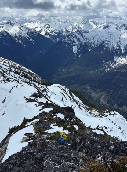

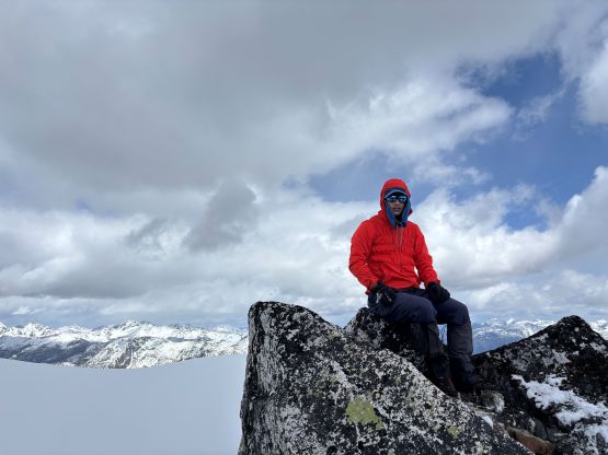
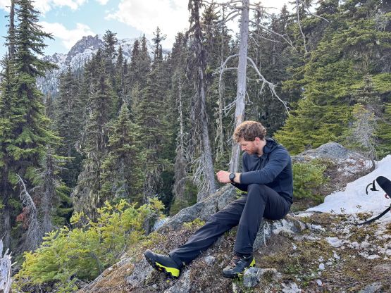
We took our time building our own cairn on the very tip top of the summit boulder and then began the lengthy and tiring descent. It had taken us 7 hours 40 minutes to make the ascent and the descent could not be too much faster. The descent did turn out to be easier than anticipated mostly because we timed ourselves perfectly for the “corn o’clock”. Even though we weren’t on skis the condition was perfect for boot skiing and glissading, that in no time we were down to the upper frozen lake. We both skirted around the lakeshore after donning snowshoes, and then gingerly followed our own snowshoe tracks back to the outflow of the lower lake where we took another long break refilling the water bottles. The snow was getting mushy but the snowshoeing was not too terrible. I then led us back across that steep side-hilling traverse back to the 1350-m shoulder where we took the last long break while taking the snowshoes off. The 1000 m grueling descent down the forest was demoralizing and so was the mile-long traverse back across the undulating terrain. There was a shit ton of GPS navigation involved and a lot of bushwhacking over dead-falls. At least we got ourselves back to the river crossing with daytime to spare as we were both concerning having to paddle across the water in the dark. We got the packraft inflated much faster this time, but I got myself thoroughly soaked by flipping the boat right at the beginning. Thankfully the water was not deep that I was able to recover quickly. We eventually finished the round trip in just under 14 hours, and eventually got back home at 1 am in the morning.