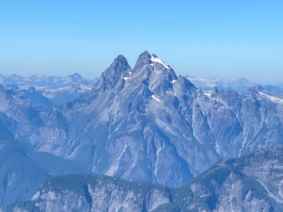
Mount Ratney and Mount Bardean
September 21, 2023
1967m
Chehalis Area / Harrison West, BC
Mt. Ratney and Mt. Bardean are two iconic summits in the southern Chehalis area. The is a remote area due to the lengthy access on backroads, and most of the peaks are difficult, but these two are relatively straightforward. With a reliable high clearance, 4×4 vehicle one can drive to within 1 km from the start of the scramble, and the upper mountain can be easily accessed by scrambling up the slabs in the SE Gully. I don’t know who discovered this route but Alan Blair had written a trip report a few years ago and Francis Bailey had published a GPX track using Alan’s “beta”. All I did was to download Francis’ GPX track and the rest would be decided in situ. The scramble involves fair amount of route-finding, but should not exceed “class 3” if one’s aiming to stay on the easiest possible way. It does not make any sense to do one of them and leave the other one behind, so I’m combing the two peaks in one report.
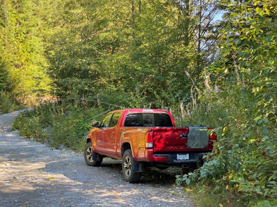
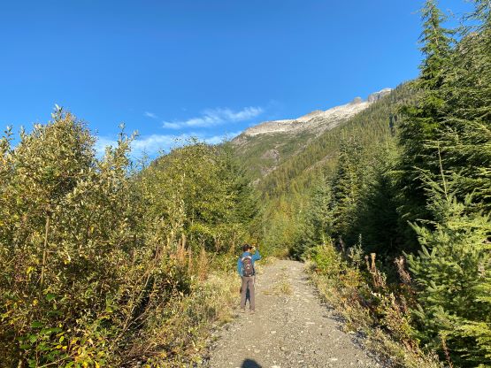
A few years ago I scrambled/climbed the nearby Stonerabbit Peak and I knew Ratney/Bardean would offer a similar, albeit easier experience. It took me 3 years to come back for them, and at the last minute I decided to invite Finn Nguyen to join. Finn and I connected through a “buy and sell” post in the SWBC Peakbagger’s discussion forum as I was willing to sell my Matt Gunn’s scrambles book. Finn does not live in White Rock so we might as well do a trip together so he could grab the book. The decision was a last-minute one to take advantage of Thursday’s incredible weather, and the decision was made to leave White Rock at 4:30 am. The drive was a little bit easier than anticipated as the logging company had recently graded the Chehalis mainline to around 15 km. The second half was unfortunately as bumpy as I remembered, and the final 4 km Skwellepil Creek FSR was probably rougher than a few years ago. I was crawling on rocks for a long stretch near the beginning of this spur road. Nonetheless the Tacoma did a great job and we had no problem making to the drivable end in front of a massive rock slide. To our surprise the off-roaders had made a way for ATVs to pass this slide, but the bypass was not designed for the full sized trucks.
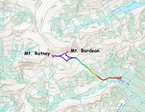
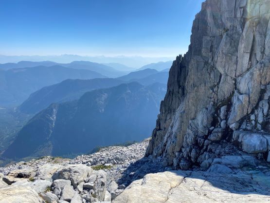
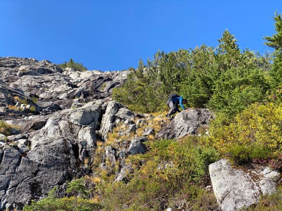
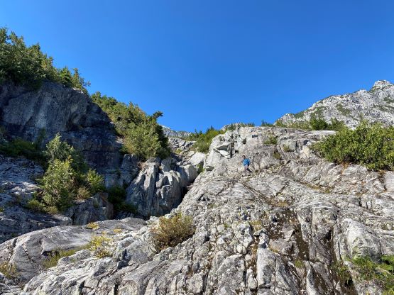
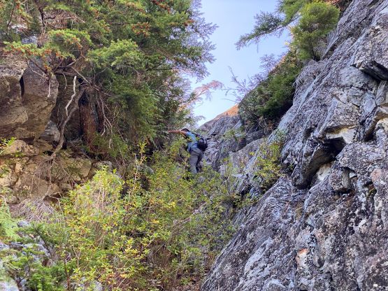
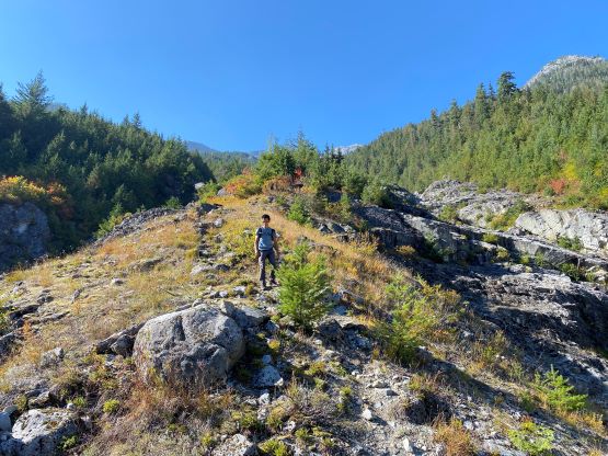
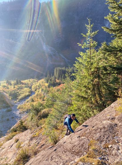
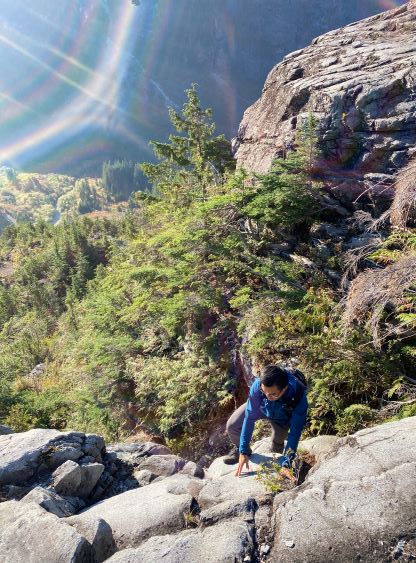
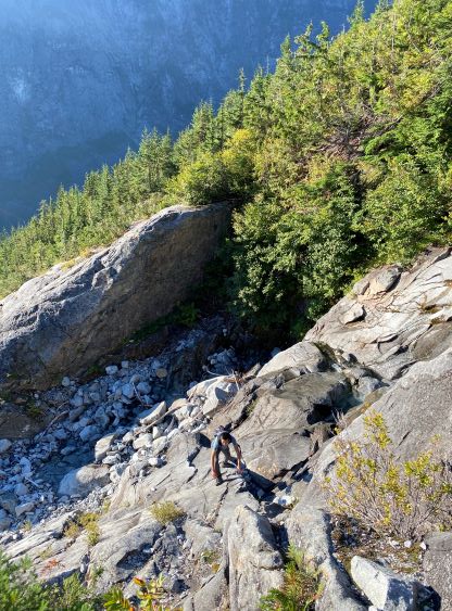
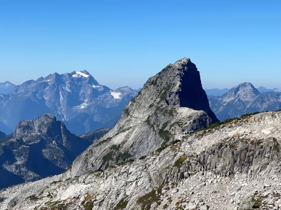
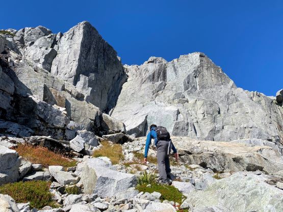
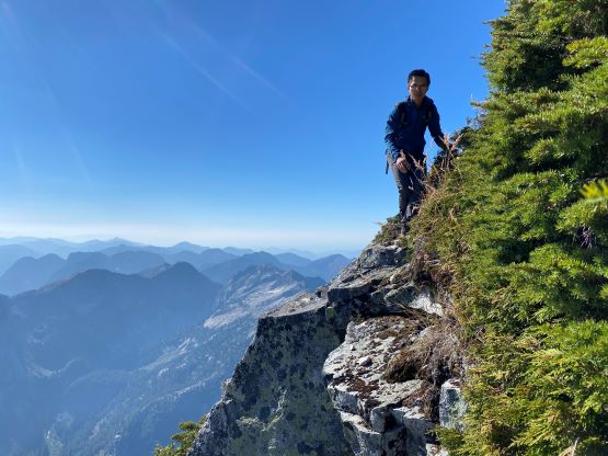
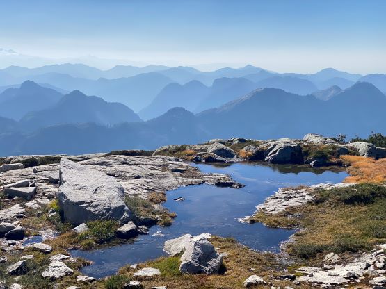
There was only 1 km of approach for this route so in no time we had started the scrambling. The bottom half of this SE Gully was more difficult than the upper half. We started by ascending a grassy rib between the two branches of the gullies but encountered some minor bushwhacking. I double-checked the reference track and it seemed like we were “on route”. At one point we traversed rightwards and ascended an extremely slick 3rd class gully, and I would consider this to be the “crux” of the whole route. I was fairly sure that the slick gully could be bypassed but we did not bother to look for. Above this gully we exited the “green” zones and it was a continuous fun scramble on granite slabs to the upper basin under the SE Face of Mt. Bardean. We had gained 1000 m elevation in this stage, and we encountered a few 4th class moves. Again, we could have bypassed them but did not bother.


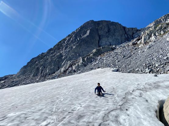
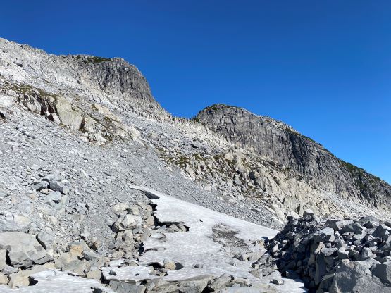
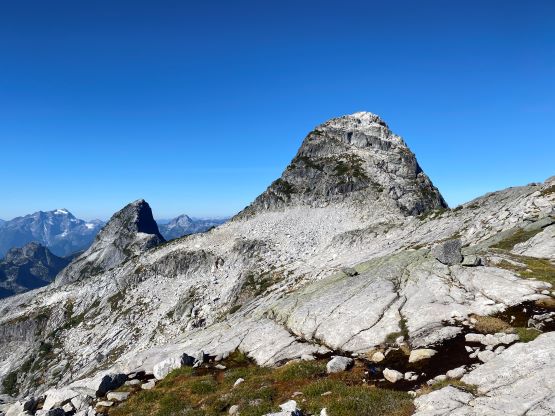
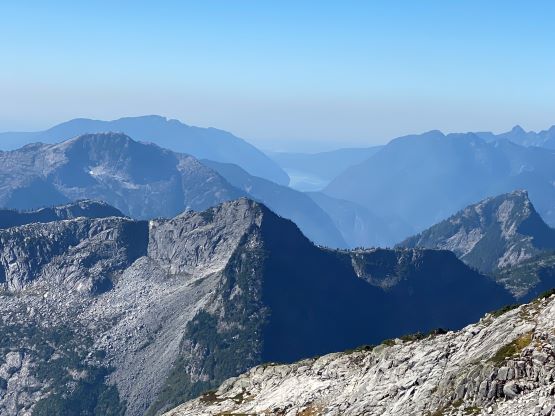
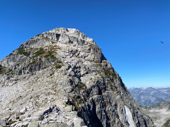
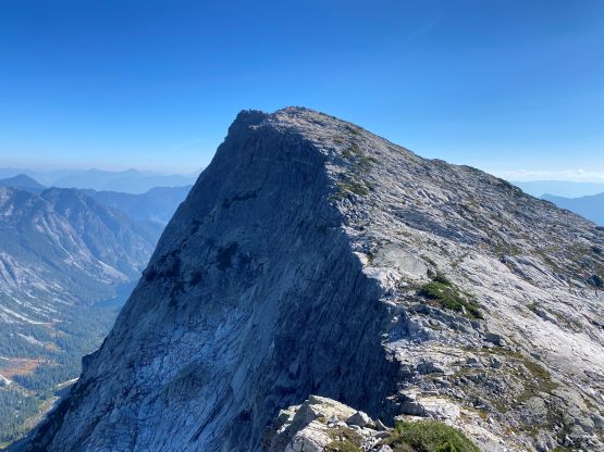
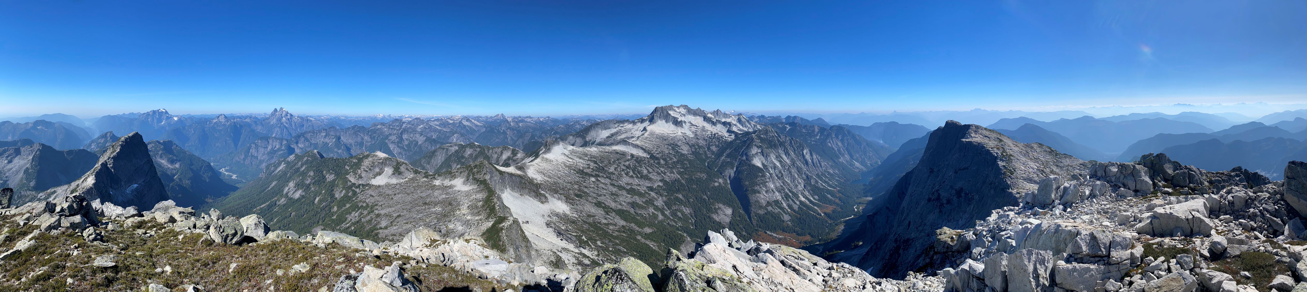
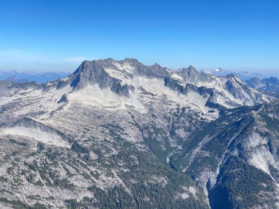
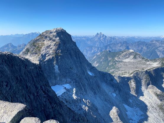
I decided to scramble Mt. Ratney first as it’s the taller of the two objective. We followed the GPX track turning climber’s left aiming for the shoulder on Mt. Bardean’s south ridge. This section was not as enjoyable as some of the boulders were loose. We also traversed underneath a patch of permanent snow and that explained the flowing water in that slabby gully. We then traversed across the SW Face of Mt. Bardean on mostly easy terrain to Ratney/Bardean col where we took another energy break. The weather was sunny as forecasted, but the wind was quite cold for a September day. I could see snow on the higher peaks to the east. The east ridge of Mt. Ratney was mostly a “plod” except for one short rock band. I could see two ways and we opted for the climber’s left variation. We had to do an airy step-across while traversing around a corner, but I think it could be bypassed as well. The summit was then gained from the south side and there’s a bit of micro-terrain to content with.


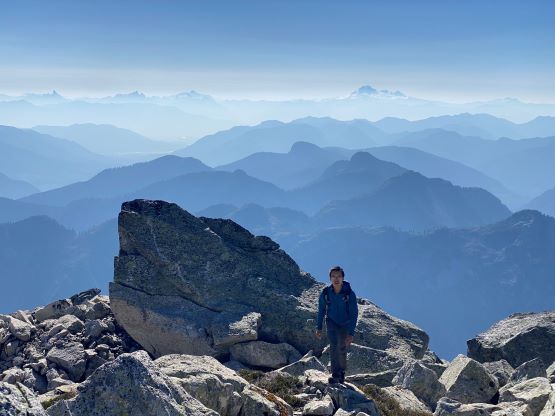


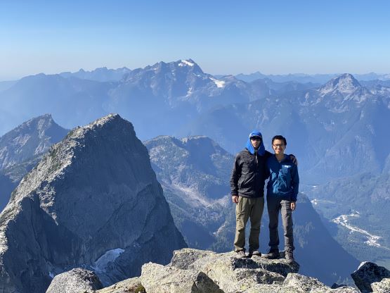
We stayed on the summit of Mt. Ratney for about half an hour before deciding to move towards our next objective. We opted to descend the exact same line that we took on the ascent, including that step-across move, that in no time we were back down to Ratney/Bardean col. The ascent of Mt. Bardean via the west ridge was very straightforward and in fact, I felt this one to be rather boring. Nonetheless we lingered on the summit for another half an hour. I caught some cell reception on the summit of Mt. Bardean so did some connections on the socials.


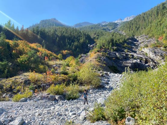
To descend I opted to not follow the GPX track as I spotted a short-cut down the SE slopes. There’s some route-finding involved, but it went mostly as expected with nothing exceeding “class 2”. I also utilized that patch of snow field to minimize hopping on those unstable boulders. We then stayed close to our ascending track most of the way down the slabby gully until the bottom 100 m, where we took a more direct but bushier variation. This resulted in about 5 minutes of bushwhacking for the whole trip. Our round trip time was 7.5 hours on a fairly leisure pace. I thought that I would need a nap break for sure, but I somehow managed to pull off the entire drive-home in one shot. We did do one stop in Mission for dinner and that’s it.