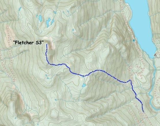
“Fletcher South”
March 14, 2026
1400m
Chehalis Area / Harrison West, BC
This is the unnamed peak that boasts more than 300 m prominence about 3 km to the south of Mt. Fletcher and it had been mostly referred as “Fletcher S3” according to bivouac.com. It seems like the shortest way to access is from the logging spurs in the Statlu Creek drainage but the roads on the west side of this peak have more unknowns. A few groups did it from the east last year by thrashing straight up from Chehalis FSR, and the going sounded reasonable. There’s even a flagged trail in the lower (steeper) part of the forest but the route is still best done with a healthy snowpack. The road access is much more certain from the east so my plan was to simply follow their GPX tracks.
I had made plans to tag this peak for at least 2 or 3 occasions in the past year but the plans all fell through for one reason or another. This peak is doable as a “before work exercise” but not without sacrificing the precious sleeping hours. In the end I spent a full day on this objective but that wasn’t the “Plan A” of the day. Miranda and I were originally going for Mt. Nutt in Golden Ears area but we came to a locked gate. The ranger stated that the park’s closed due to “snow”. I couldn’t buy it, but I also knew that any further arguing wouldn’t lead anywhere, so I turned around and instantly diverted us towards “Fletcher South”. This required more than 1.5 hours of driving detour but the ascent was supposed to be shorter than Mt. Nutt, so that’s okay.
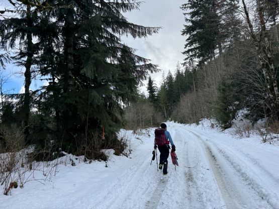
I guess the ranger was correct that there was indeed snow on the roads. About 15 km up the Chehalis FSR we started to encounter continuous snow even though the elevation was only 350 m. There were also way too many pot-holes. The only reason we could keep driving was the existing set of tire tracks as the snow was already deep enough to scratch the undercarriage of my Subaru. I worried about the turning around situation as the only way for me to not lose control was to stay exactly on the tire tracks. I was sure that the trucks ahead wouldn’t be doing this peak so there’s a decent chance I couldn’t turn around and park at the trail-head. About 1 km from the trail-head I spotted a tiny area with thicker canopy so the snow wasn’t as deep, and immediately made the decision to turn around and park. It’s much better to be safe than sorry. In retrospect I should have kept driving to the actual starting point as there’s another patch of shallower area to park the vehicle slightly beyond the trail-head.
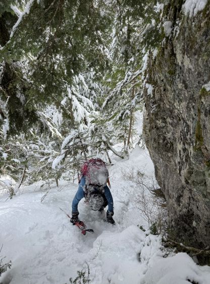
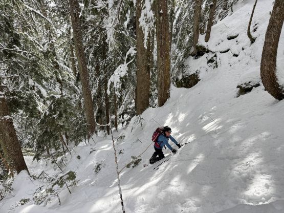
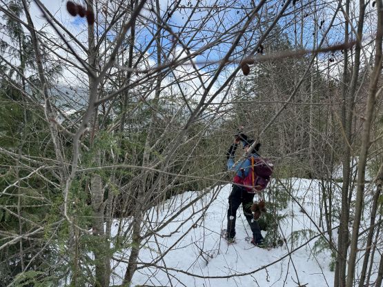
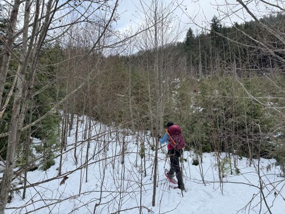
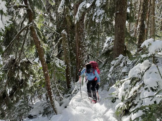
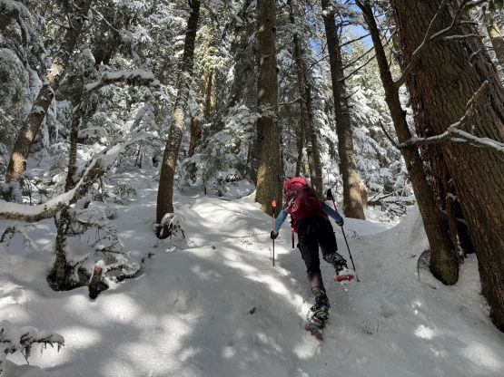
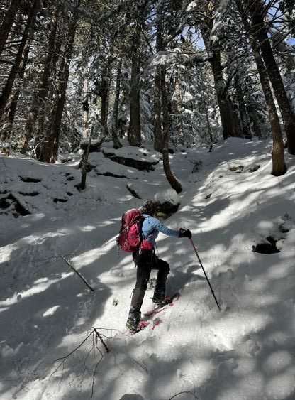
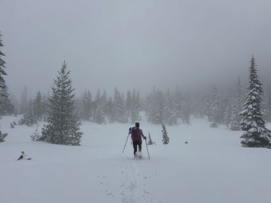
I had done zero research beside having armed with a GPX track but the condition would be very different anyway. The snowshoes were strapped on almost immediately after leaving the Chehalis FSR. We were following an overgrown spur road for a short distance and then bailed into the cut-block. I didn’t bother to follow the track as it’s much easier for us to snowshoe straight the hell up the slope. We did see some flagging here and there in the lower forest. I had brought the 30′ snowshoes and for now it was definitely the right decision. The post-holing was averagely knee deep in the cut-block but not that bad higher up in the forest. There’s actually a layer of crust that could more or less support our weight, and higher up this crust had become almost too icy in some places. Since we weren’t following the trail/track we had to do some bushwhacking, but nothing’s overly terrible. A long while later we encountered a few bluffs and went more or less straight up even though we could have found some gentler routes by going around.

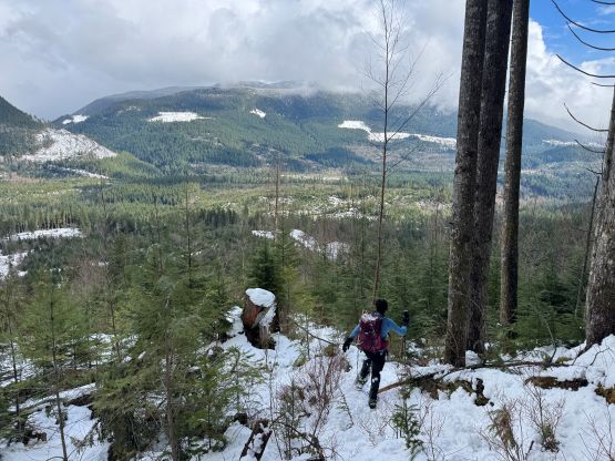
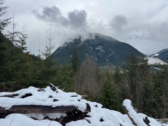
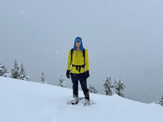
Above 1000 m after a short bit of elevation loss we came to the first plateau section of this route. By this point it was clear that the weather was not going to be “mostly sunny” as forecasted. Instead, we were mostly in the fog and even started to get periods of snow. The type of precipitation was convective and based on my experience in this kind of situation I knew the clouds most likely wouldn’t lift until at least early evening. The snowing got intensified as we worked our way up the next two steep rises towards the broad south ridge. I caught some cell reception not far below the summit, and sure enough the forecast had downgraded. I didn’t bother to check the last minute weather forecast this morning, but on the other hand I had to appreciate that ranger for closing the Golden Ears Park. I would not be very happy if we missed the views on Mt. Nutt.
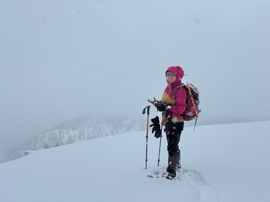
There’s no sign for the weather to improve so we quickly started descending. Miranda was very efficient in downhill snowshoeing so I let her leading the entire way down. Miranda was quite good at glissading in tight forest with snowshoes on (which I’m not very good at), so whenever she took a slide I would fall behind. I had to work quite hard to keep up with the overall pace, but that’s good as I didn’t want to miss the family dinner at 6 pm. The entire descent was unpleasant as the snow was heavy and wet. Wearing the cumbersome 30′ snowshoes didn’t help neither. We did see some patches of blue skies during the descent but the bigger peaks were engulfed in the clouds full day. Our round trip time was just over 5 hours which wasn’t bad given the extra distance we walked on the road and the heinous trail-breaking the entire way. The day’s still young and I thought about adding another peak namely “Green Mountain” but the sanity won this time. Instead of doing another terrible bushwhack in rain/snow I leisurely drove home for some much needed rest. I eventually dropped Miranda off in the Skytrain station and got home in time for the dinner.