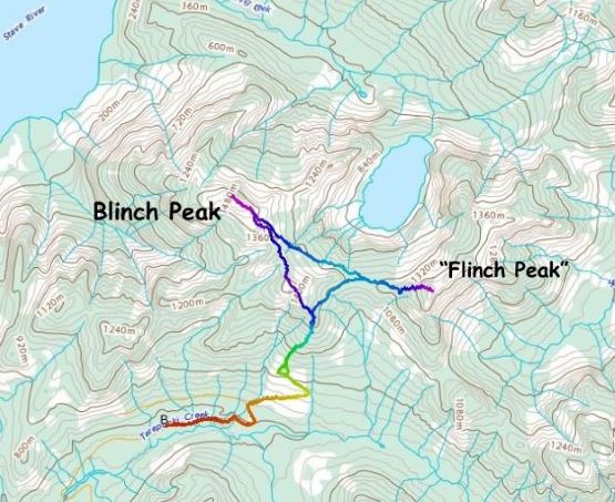
Blinch Peak and “Flinch Peak”
November 26, 2023
1511m
Mission, BC
“Blinch Peak” and “Flinch Peak” are two unofficially-named and obscured summits on the north end of Stave Lake with “Blinch Peak” being the taller of the two, boasting over 500 m prominence. “Flinch Peak” is only a few meters lower but still boasts over 300 m prominence. The name “Blinch Peak” must have been derived from Blinch Lake that is in close proximity, but I’m not quite sure about the origin of the name “Flinch Peak”. I assume it’s just another random name inserted into the peakbagger.com database by Grant Myers back in the days when he did those peaks. In any case these two peaks are accessed from near the end of Lost Creek FSR, about an hour of bumpy ride north of Mission on some rough roads. These roads had been significantly deactivated that even with a 4×4, high clearance vehicle I was still not 100% sure about the access. There was hardly any “beta” on the internet but the “Barkers” beat me to it in Jan. 2023, albeit taking a slightly different route than my thinking. For many years I was also hoping for a winter ascent to reduce the pain of bushwhacking, but the access would be even more of an unknown due to the lowered snowline. I eventually opted to pull the trigger in this so-called “shoulder season”, with some snow to smooth out the terrain above treeline, but not enough snow to cover the forest, which turned out to be a major pain.
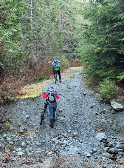
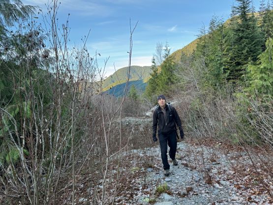
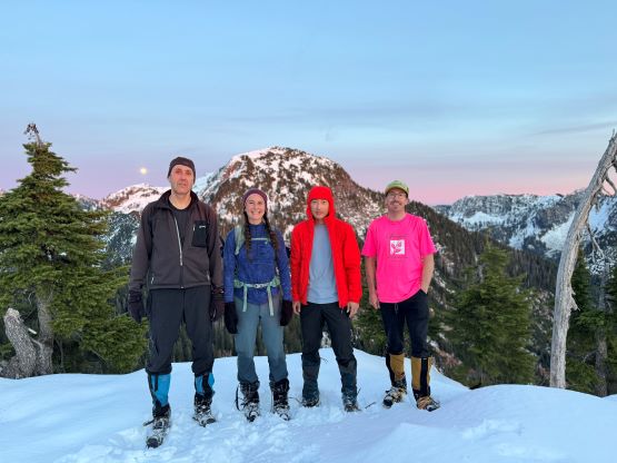
Upon seeing a bomber window on Sunday I managed to convince Vlad, Al and Katie to join as these guys are some of the most experienced bushwhackers out there in the Lower Mainland. I insisted for us to bring bikes because I couldn’t find the up-to-date updates about that road, and didn’t want to be pressurized about “driving as far as I could”. Vlad did not want to bike due to some wrist injuries but in the best case scenario the bike ride would be less than 2 km each way. Vlad wanted to count on the best case scenario so I turned out to be still pressurized to drive “as far as I could” after all. I also planned to include “Flinch Peak” as doing these two peaks together simply made the most sense. This turned out to be quite an ambitious decision as I significantly underestimated the difficulties, but with some positive mindsets we managed to solve all of the problems and got the job done. Vlad showed up at my home in White Rock at 5:30 am and we picked up Al and Katie from Mission an hour later. Another hour later we came to that deactivation ditch at Grotto Falls and that was the spot where the Barkers parked. It turned out that there’s an obvious bypass on the west (left) side. To drive around wasn’t an easy task in the long box Tacoma but it was doable. I also managed to drive under 2 km up the spur road in Terepocki Creek drainage before being stopped by an enormous ditch. In addition to the ditch at the beginning that scrapped the bottom of my truck both ways I also needed to crawl through a rough section that was more like a creek bed. The ditch that eventually stopped us could be driven across in a lifted vehicle or an ATV but this was already the “best case scenario” that Vlad was hoping for, so I turned around the parked.
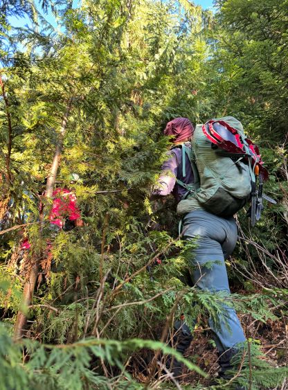
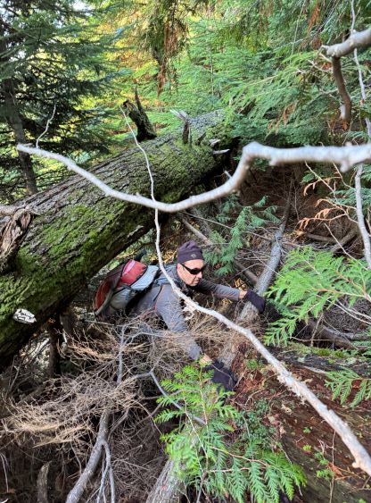
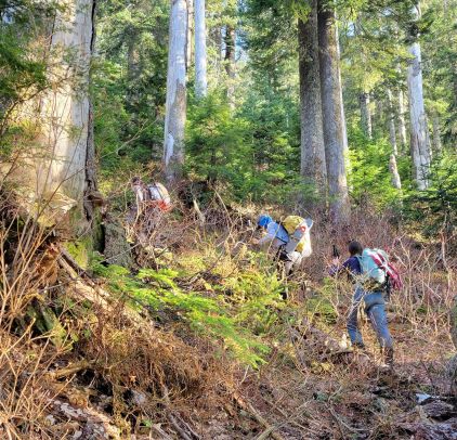
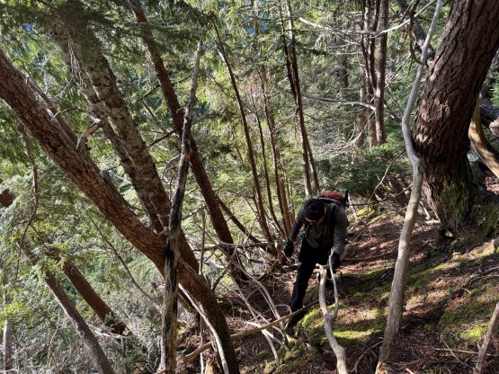
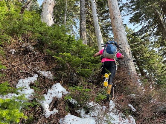
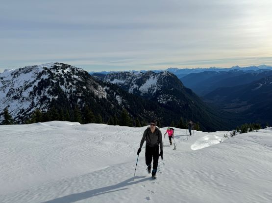
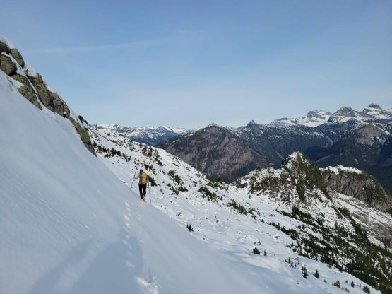
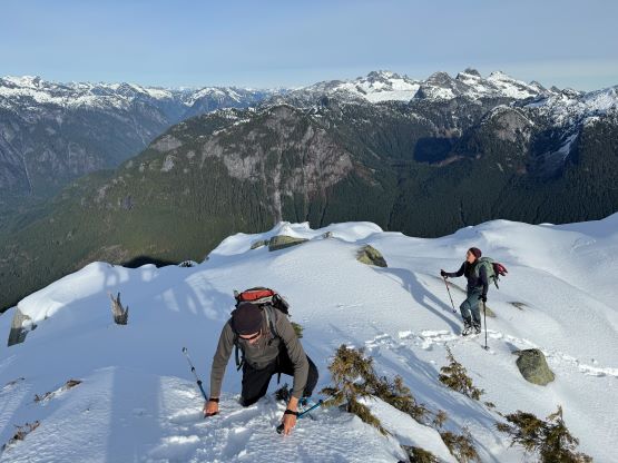
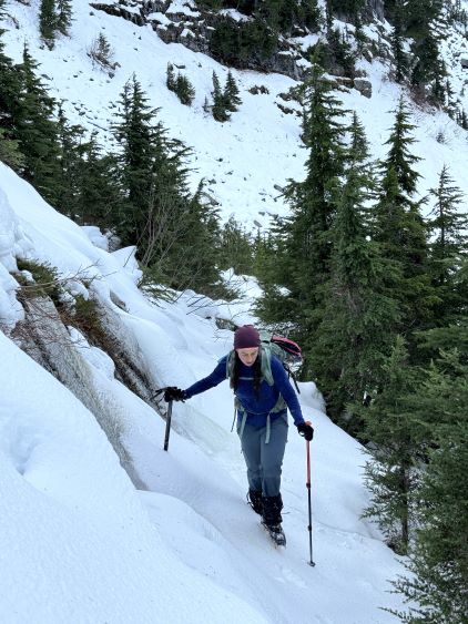
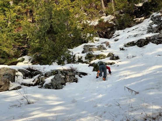
The rest of us still unloaded the bikes as we had brought them so we might as well put them in use. The ride was still worth bringing the bikes in my opinion. There were a few steep stretches that necessitated pushing, and a few gigantic ditches that required lifting our bikes across. Those lifting actions turned out to be quite some upper body workouts. We eventually ditched the bikes at around 700 m elevation as the final kilometer of the road was heavily overgrown. In fact, this final kilometer was already a “thrash” such that in another few years this spur road would become a nightmare of alders so it was good that we came now. Al led us thrashing to near the absolute end of the road. Al had done his homework and noticed a band of old growth that hadn’t been logged. I did not pay that much attention to details but I had downloaded the satellite layer in the Gaia app, so combing the two of us’ research and preparation we made the decision to enter the forest now, but keeping a traversing bear towards climber’s right. We had apparently thrashed too far up such that we had missed that band of old growth, but I figured we could just traverse into the band higher up. This short section of thrashing in the secondary growth turned out to be a horrible mess that necessitated full body wrestling. The old growth was not much better with the steep and slippery foot bed and consistent growth of prickly plants. There were also a few bluffs that required 3rd class scrambling on vege-belay, and some inconsistent snow patches that only made things worse. We eventually decided to don crampons at 1100 m elevation even though we hadn’t even the zone of consistent snow coverage. Al and I took turn leading and after a couple hours of thrashing in some of the worst bushes that I had encountered we exited the green zone at 1300 m elevation. The snow had also become continuous but then the post-holing took over. Vlad had decided to take a gamble for not bringing snowshoes. I approved his decision as I thought the chance of using snowshoes would be less than 5% based on the various recent trip reports, but I was slightly being too optimistic. This gamble turned out to be successful but not with a lot of margin.


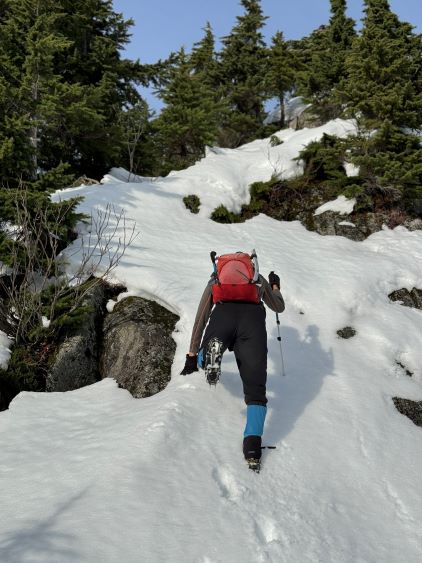
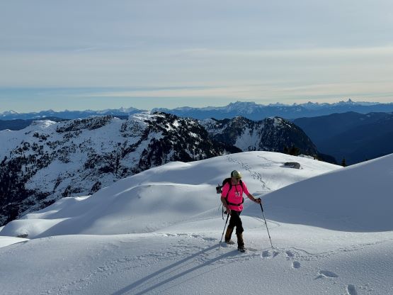
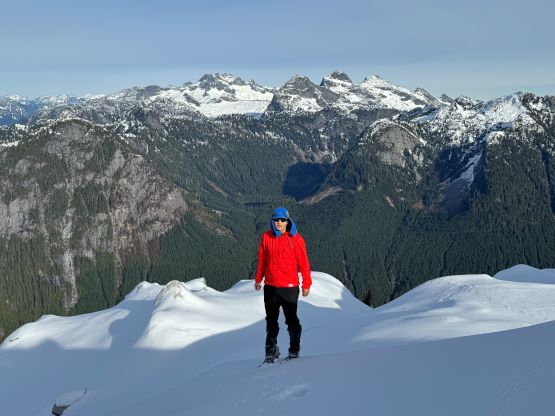
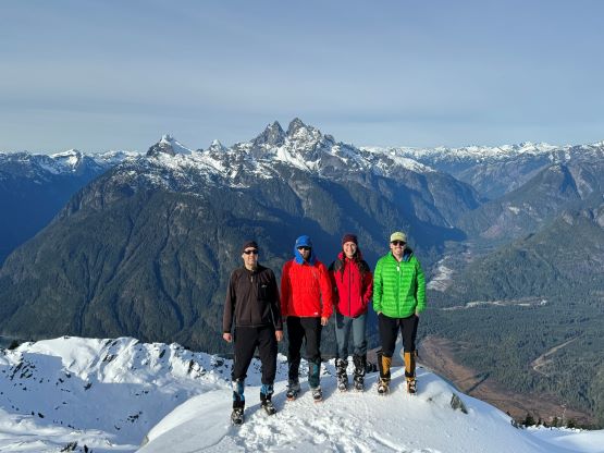
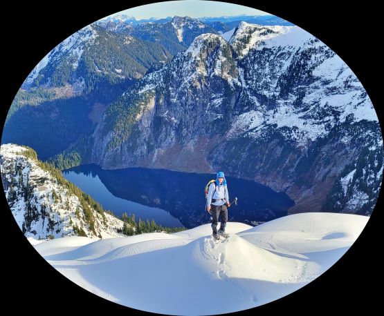
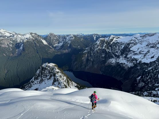
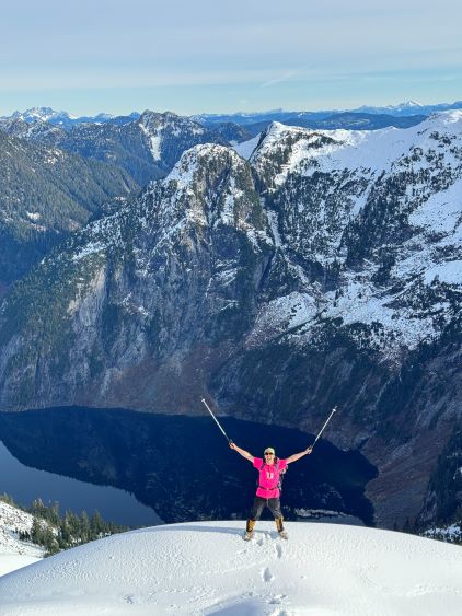
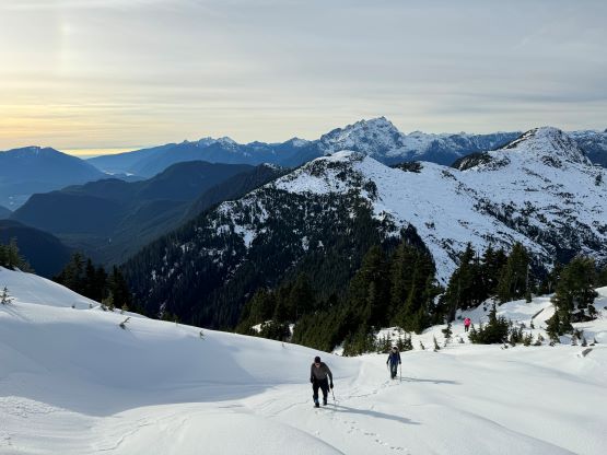
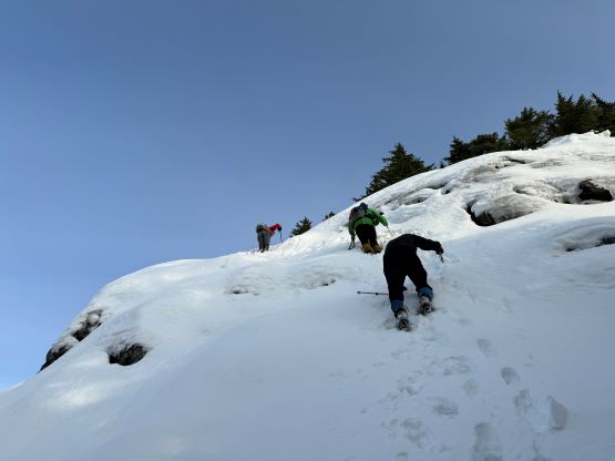
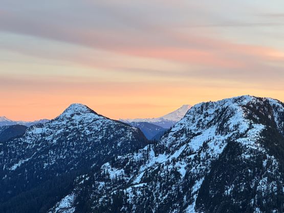
The plan was to plod up and over the very top of the subsidiary “south summit” of Blinch Peak. This unnamed sub-peak does not boast over 100 m prominence so does not count as a peak in my book, but I still made the very summit for completion purposes. The going was mostly straightforward but the descent off the north side was slightly complicated with a few steep rolls and icier conditions. There was also a secondary sub-summit that we managed to bypass on the east (right) side. The ascent of the true summit was also longer than expected with numerous false summits and undulating terrain, but the views kept improving. I led us mostly staying on the climber’s right side of the ridge as the right side was more open with better views. We eventually made to the summit of “Blinch Peak” in 3 hours 50 minutes from the truck, which was not bad at all.


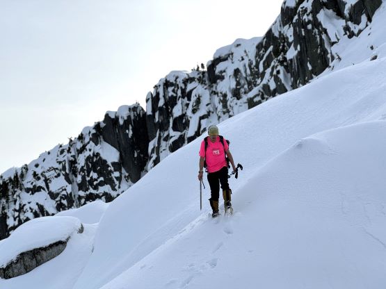


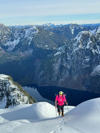


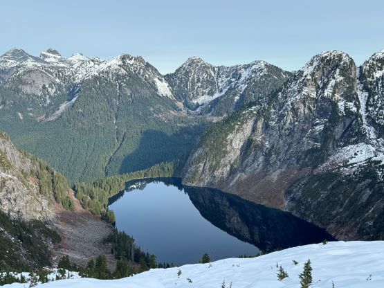
I had a plan to traverse to “Flinch Peak” by staying entirely on the north side of that subsidiary south-east summit of Blinch Peak. There was no “beta” whatsoever from this point onward and I anticipated some micro-terrain. The going was indeed not entirely smooth as the snow coverage wasn’t deep enough to completely smooth out the various obstacles, but the snow condition was firm on the north slopes such that with crampons we were able to make efficient work. I ended up only needing to backtrack once, and on-sighted the rest of the navigation without any mistake. A few boulder fields were annoying and so were some deep gullies, but those were to be expected. There was about 50 m of regain to dash back up to Flinch/Blinch SE col. The col was not an aesthetic place with lots of Christmas trees and post-holing, so we kept plodding for another 5 minutes to an opening. We made the decision to ditch some gears including Vlad’s entire backpack, and carry onward in the “light and fast” style. We weren’t doing particularly good on time so we must hurry up somehow. My BD Speed was capable of carrying two axes so I carried all of Vlad’s essentials.
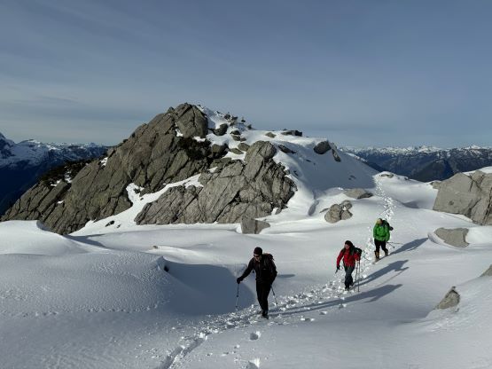


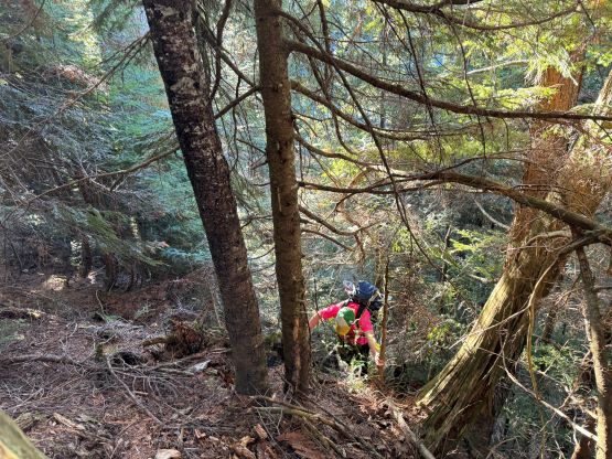
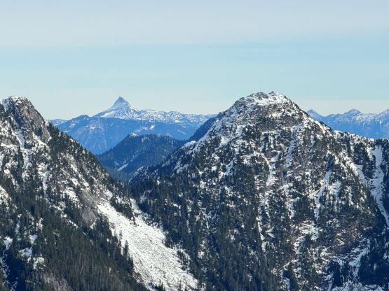
Al and Katie decided to ditch their snowshoes but I thought the post-holing was about to become annoying. I initially ditched the ‘shoes with them, but then made the spontaneous decision to swap crampons for snowshoes, mostly to justify bringing them. The snowshoes turned out to make my struggling easier for the next 500 horizontal meters to the base of the steep climbing, that I subsequently caught up to, and passed Katie, Vlad and finally Al. I did not know what exactly to expect from this west aspect of “Flinch Peak” and the bluff ahead appeared dauntingly difficult. I traversed climber’s right but could not see an obvious solution, so I swapped the snowshoes back to crampons. Meanwhile Vlad had already started climbing but I caught up and passed him in the first bushy section. The terrain was at least 45-50 degrees but with a shit ton of vege-belay for added security. I mostly used my ice tool to hook on tree branches. In short time the difficulty eased but we still encountered two more steep bluffs higher up. For those two bluffs I opted to attack on some 45+ degrees snow. The snow condition was good so the climbing was rather fun. There’s still substantial amount of dragging and post-holing to reach the summit of this peak and the time was definitely getting on, but at this point we must suck it up and get the job done. The views made the suffering worthwhile.


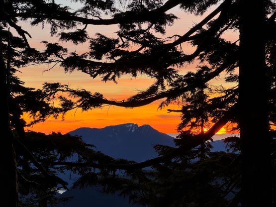
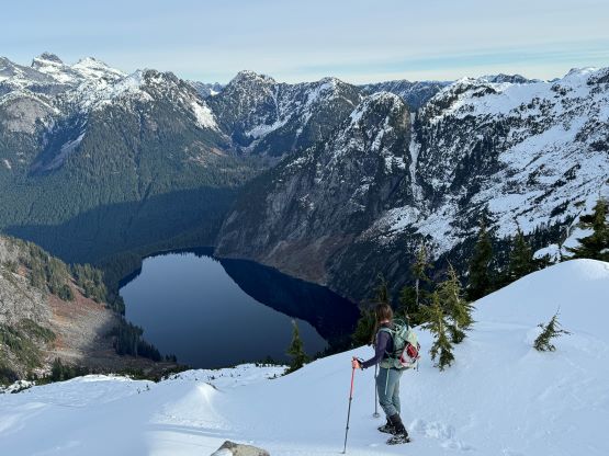
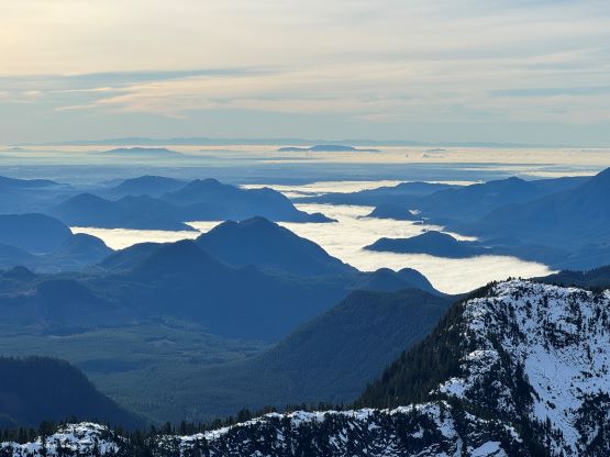
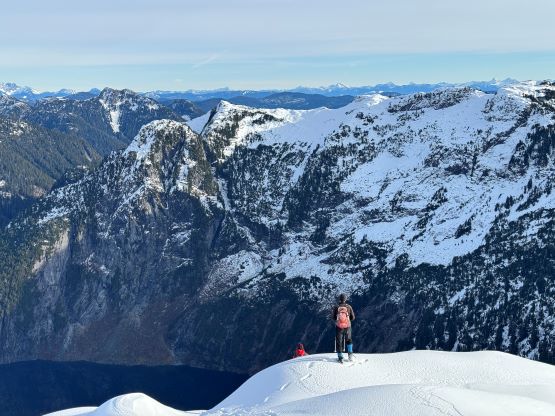
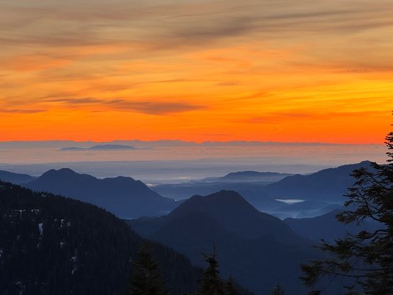
Not doing a ton of lingering we quickly made our way down, following the exact tracks that we had just made. The few down-climbing sections were actually quite fun. Throughout the trip we had been discussing the options to bypass that Blinch’s SE summit by taking a rising traversing line on the south-east side, but we doubted the feasibility as we could see several deep drainages that needed to be crossed. The back-up option would be to regain an additional 100 m elevation and use an obvious bench, also on the south-east side of that sub-peak. I was being optimistic and wanted to at least give that low line a try, and it turned out to be not as bad as we thought. In fact I was already convinced that we had to gain that extra 100 m elevation, but the initial section was so steep that the only logical way was to traverse sideways. This subsequently brought us to the first of the two gullies and the crossing looked to be rather trivial. We also got our much-needed water refill in the middle of this gully. After this crossing we still needed to gain ~80 m elevation and still encountered some steep and difficult terrain, but this was definitely more efficient than gaining all the way to that higher bench. We rejoined our tracks at around 1250 m elevation right around sunset time. The views were awesome, but then we had to thrash our way down in the dark.


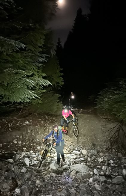
At least we no longer needed to deal with the unknowns so I wasn’t too concerned about bushwhacking down in the dark. The in situ decision was made to keep the crampons on for as long as we could to minimize slipping, but the crampons kept getting caught on the vegetation. It was a trade off between two kinds of hazards, but I still preferred the crampons-on option. None of us here is Matt Juhasz who could literally run on this kind of terrain and we all preferred things to be “static” instead of “dynamic”. About half an hour later it had become too dark to see, so I made the call to swap crampons for head-lamps. The rest of the bushwhacking was entirely done by GPS navigation and I made sure we stayed exactly on our own track except for that final 50 m. Upon reaching the boundary of that nasty secondary growth I bailed off the existing track and went straight down the forest. The bushes were still thick enough that we could not see our feet at times, but it was never that terrible on the downhills. After what seemed like eternity we found the (overgrown) road. There was still some thrashing left on the road, and then the exhilarating bike ride in the dark. I thankfully had the fatbike and the tires were designed for riding on rough surfaces. Al and Katie unfortunately had to be on some survival modes. Vlad was able to keep up with us by walking, but still finished the last. It was then the hour-long drive out of the Lost Creek FSR system. I eventually got home at around 10:30 pm, and went straight for work. I had promised to work for an hour no matter how late the return would be, and I did the exact, to midnight.