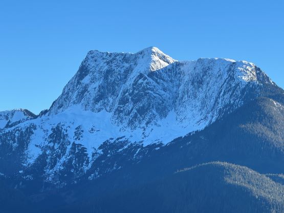
Mount Van der Est
January 19, 2025
1801m
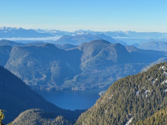
Bute Inlet, BC
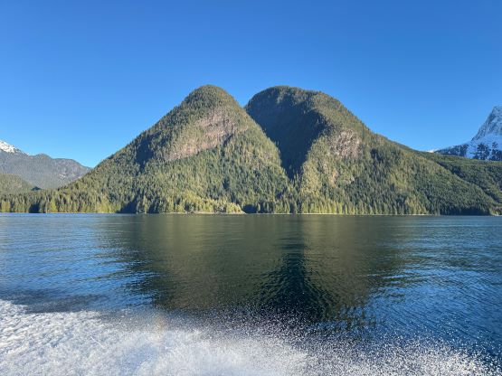
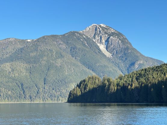
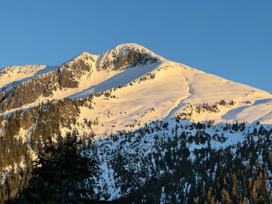
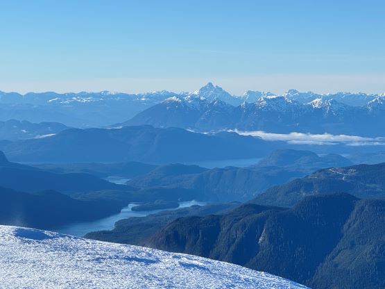
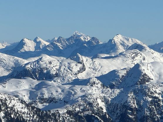
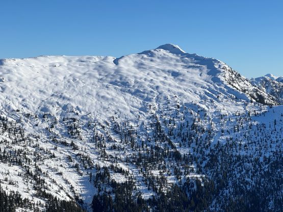
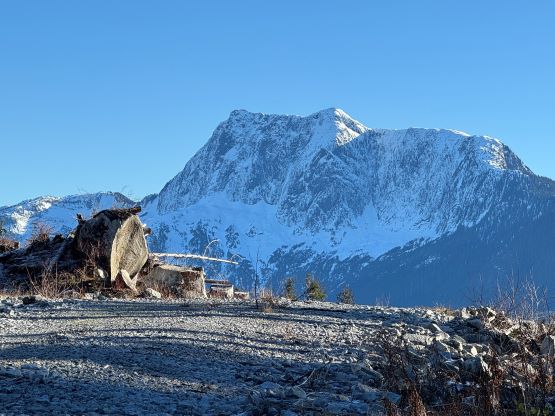
Mt. Van der Est dominates the skyline between Bute and Knight Inlets in the South/Central Coast Range of British Columbia when viewing from Campbell River area of Vancouver Island. This was not how I noticed Mt. Van der Est however, as in the international peakbagging circle it is more known as one of the 1500+ “ultra prominent peaks” in the world. Future detailed surveying of the exact elevation Phillips-Moh Pass “the key col” could possibly downgrade the “Ultra” status but regardless the prominence, this peak is an attractive objective for exploring and mountaineering purposes. There are two other “Ultras” in the vicinity of the surrounding islands and sounds – Estero Peak and Mt. Addenbroke. None of them is difficult from technical perspective but the accesses require either multi-day sea kayaking or chartering a boat, and the “beta” is scarce or non-existing on the internet. I had engaged in quite a few discussions of these three peaks with separate groups of people over the past 10 years but I’m not into water sport and I had never owned a motor boat so the “plan” stayed merely on paper. I had never actually thought about an attempt until Matt Juhasz suddenly logged it on Peakbagger.com with a reasonably detailed trip report. Apparently Matt was able to charter a boat out of Vancouver Island and even pasted the contact information in his trip report so I immediately sent a message to Peter Dick who owned a cabin and several boats on Sonora Island off the coast from Campbell River. With Matt’s route beta and Peter’s company the trip then started from here.
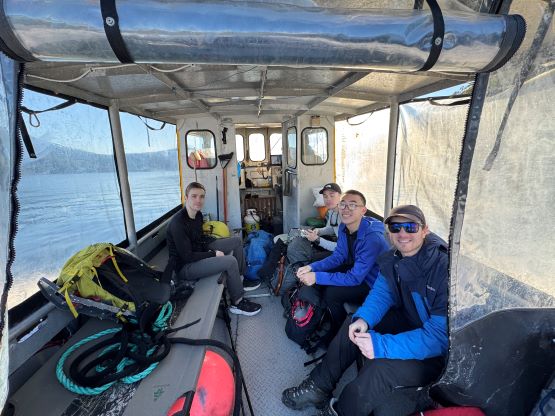
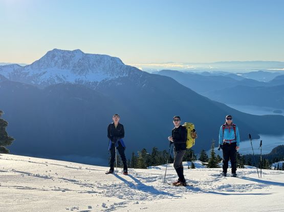
The easiest plan for me was to follow the exact route and itinerary that Matt had laid out but instead of doing two objectives over two days I would aim solely on Mt. Van der Est and spend only 1.5 days away from home. The reason was simple, as I had to work on Saturday. Even by taking the 6:35 pm ferry from Horseshoe Bay to Nanaimo required me skipping some working hours but I would not hesitate doing that for an important objective like this. The weather window on Sunday looked as good as it could ever get for January in the Coast Range, and the avalanche forecasts had dropped to L/L/L across all zones for multiple days in a roll. Meanwhile Peter replied me that it was possible to “copy Matt’s itinerary” on Sunday and the boat could fit up to 8 people. Peter’s rate was not cheap but instead of bargaining I would bring the price down by filling in this boat for as much as possible. Matt had paid both ways of gasoline, the Nanaimo ferries as well as this private boat transfer all by himself and that costed over 1000 dollars. I sure could do better than that. After getting sure words from Peter I sent a whole bunch of messages to at least 10 partners but eventually only Alex, Trevor, Kostya and Harry made the commitment. A few candidates were set on another objective and Erica unfortunately had some city commitments on Saturday night, as otherwise I could have easily filled in all of the 8 seats. We did have a time constraint to catch the 8:15 pm ferry back to Tsawwassen or the 8:45 pm ferry back to Horseshoe Bay so the participants had to be fit enough to pull 28 km and 2000 m gain of snowshoeing in about 10 hours of time. Matt’s round trip was 9 hours and I used that as a reference, so even though a few more could be interested in I could not send the invites out. The pick-up time was set at 4 am, half an hour earlier than Matt’s.

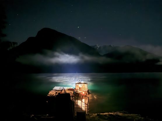
The next thing on the itinerary was to figure out the vehicular transportation. The exact location of the boat’s pick-up would be Elk Bay which was about 40 minutes north of Campbell River but the final 13 km was unpaved. I consulted with Matt about the feasibility of taking a city 2WD and the result was 50/50. Though doable Matt advised “driving slow” and based on how I knew Matt, this meant the road would not be a “no brainer”. I had recently traded the Tacoma in for a stock Forester and thankfully I was able to get the Subaru on Friday in time for the trip, as otherwise we would have to pick between my parents’ Corolla and Kostya’s Tesla. It was also not possible to fit all 5 of us with overnight luggage in one vehicle so Alex and Trevor volunteered to drive out separately while taking one of the earlier ferries on Saturday. They would be driving in Trevor’s 2WD Toyota so there were still some uncertainties. When Kostya, Harry and I were driving north near Comox I finally received a text from Alex’s inReach that they were able to make the Rec site. The gravel road turned out to have lots of pot-holes and several steep stretches but with care and driving experience any vehicle should be able to make it. We however, struggled to find the boat ramp. It turned out to be a gravel ramp and the tide was quite low making the landing not so obvious in the dark. We ended up wondering around for at least 20 minutes with our head-lamps on before finding the spot which is one turn before the Rec site. I was then able to send a confirmation text to Peter using the iOS 18’s satellite texting and pulled in next to Trevor’s vehicle. I simply slept in the back of the Subaru while Kostya and Harry had each brought their own tent. It was possible to cramp two people inside the Subaru but it’s better for them to camp out separately for maximum comfort. By the time we finally finished settling for the night it was already past midnight, and the alarms were set at 3:30 am.
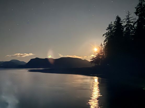

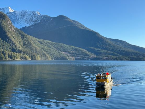
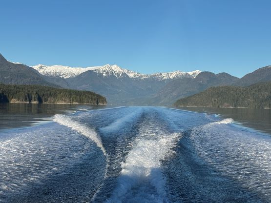
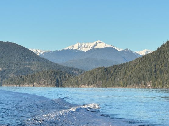
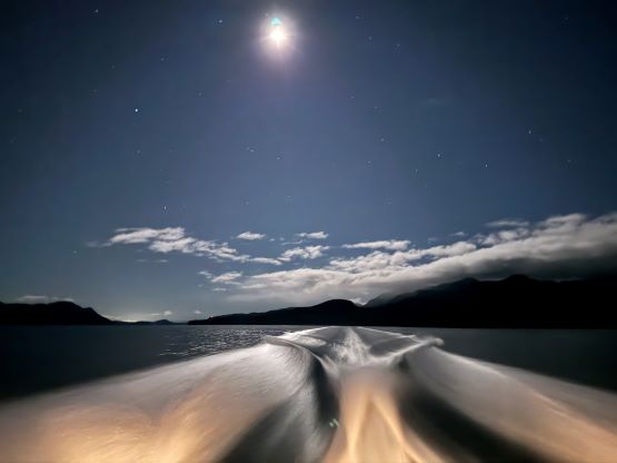
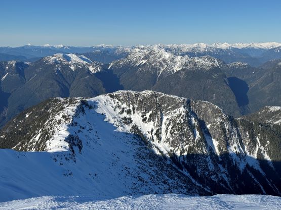
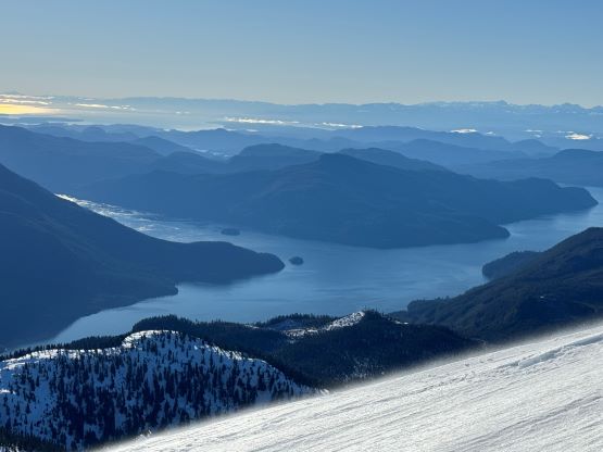
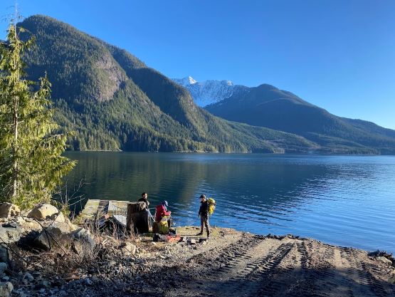
The ride would be around 45 minutes and I anticipated it being quite cold, so I carried one duffle bag with some extra layers and that of course would be left in the boat for the return. The walk from the Rec site (parking) to the boat launch was short but felt awkward with the extra luggage, and then we waited there for 20 minutes for Peter to arrive. For some reasons I failed to receive the satellite texts that Peter sent to me but in any case, we boarded the boat at 4:20 am. The ride in the dark was smooth and fast so apparently Peter knows the area really well, and by 5 am we had landed next to Mt. Van der Est. There’s even a designated dock at the landing so the locals do come here regularly. Apparently Alex R. had chartered a different boat and done this hike back in Sept. 2024 but did not make a post anywhere, and Alex told me there’s a gigantic cairn on the summit. This peak gets ascents much more often than we thought and we were nowhere close to making a second or third ascent.
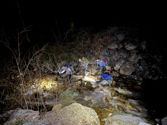
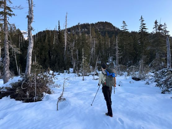
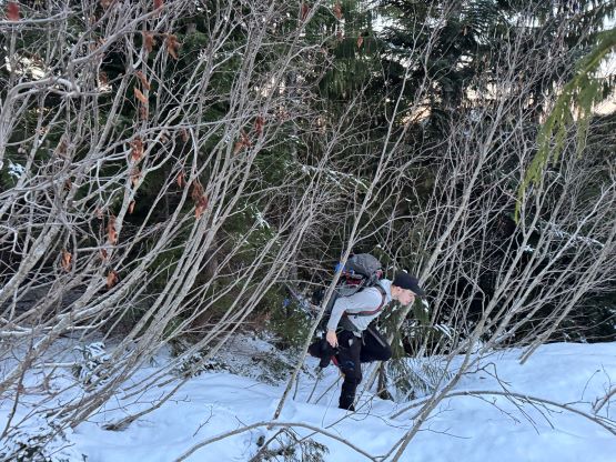
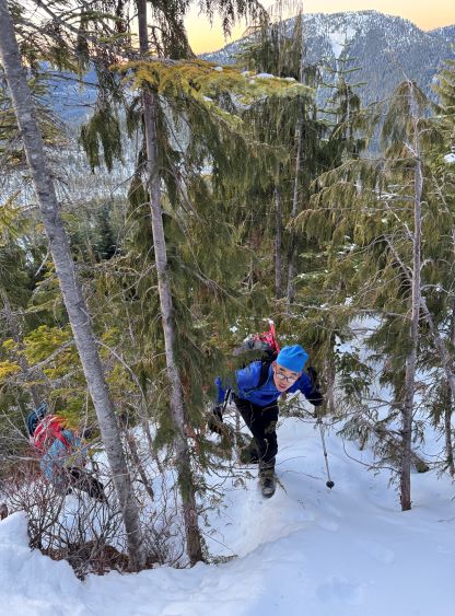
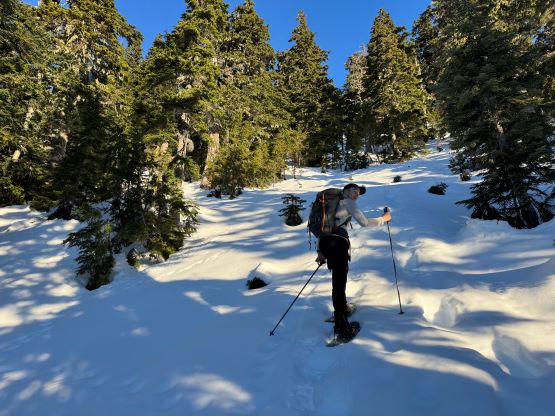
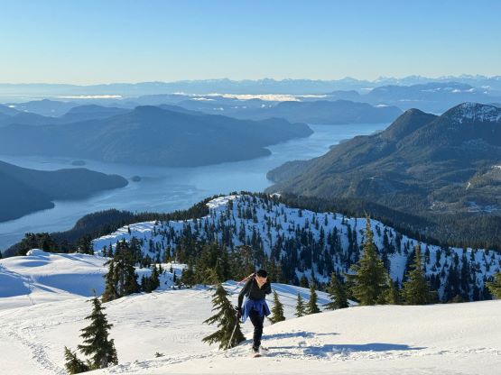
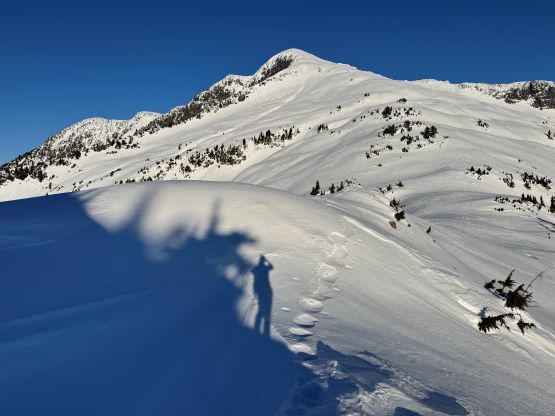
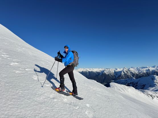
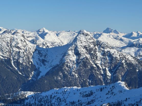
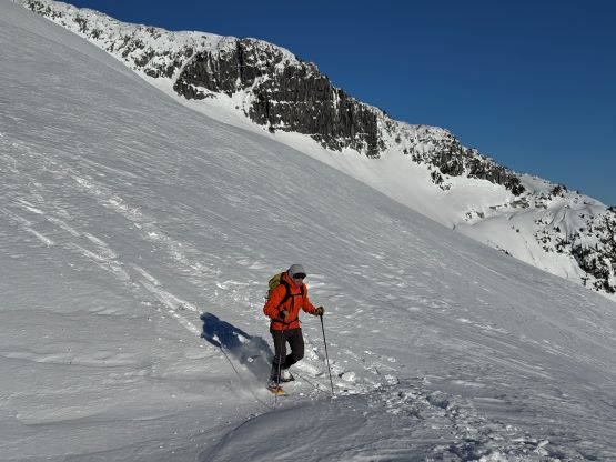
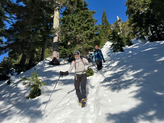
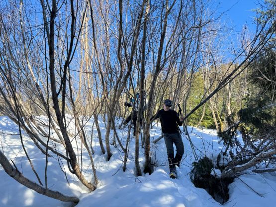
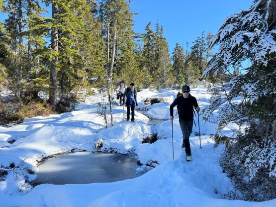
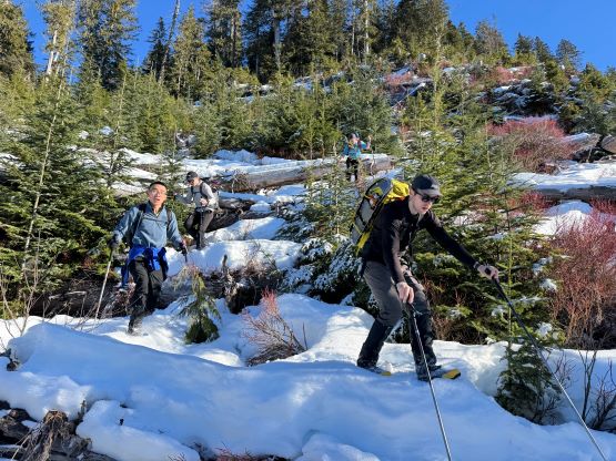
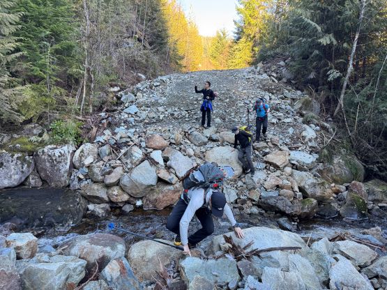
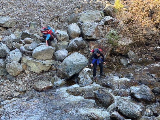
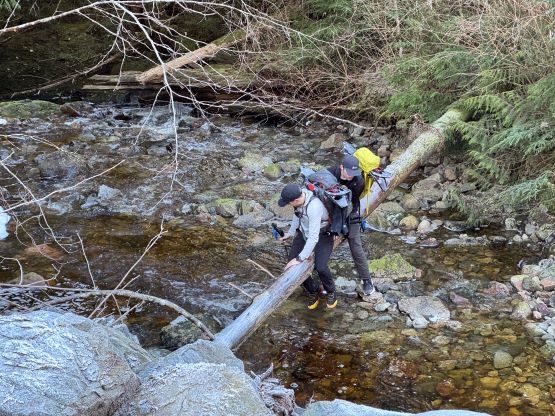
For the footwear I opted to wear trail-runners for the logging road plodding while carrying the mountaineering boots. I also thought this would be the perfect oppourtunity to test out the brand new La Sportiva G5 that I bought back in June last year. The firm conditions could necessitate the use of proper mountaineering boots and/or crampons but we would see. The snowshoes, on hindsight could possibly be left behind but that stayed on hindsight only. One should never leave the snowshoes behind unless 150% sure. While analyzing Matt’s GPX track I noticed a short-cut potential right at the start so we dived right into the bushes from the dock. The bluffs punished us and the thrashing was much worse than I thought so the plan was to take the roads on the return, but the bushwhacking did warm ourselves up. We also made a navigation error by taking a wrong turn not far from the start but I noticed that mistake fairly quickly. The roads were generally wide and open without any notable alder thrashing, but there were at least 50 massive deactivation ditches and at least 3 pulled bridges that resulted in some challenging hopping on verglass covered rocks. We all managed to cross those creeks without fording but a few of us did fall into the water. The first one was the worst and the verglass was still there upon returning. The other ditches were otherwise easy to negotiate, but annoying. At 650 m elevation, about 1.5 hours into the plodding and still in pitch dark we came to a critical junction. I had decided for us to abandon Matt’s route and take my climber’s left variation. Two things that caught my attention in Matt’s report – swamps and bluffs. My route would avoid that major swampy area at least according to the satellite images and the contour lines also appeared more friendly there than around Matt’s crux bluffs. From the road’s end we did have to ascend a tedious cut-block and that 50 m elevation loss was still unavoidable. We did as well encounter some (frozen) swamps covered mostly in firm snow, as well as bushwhacking in 35-40 degrees terrain, but nothing overly worth noting by SW BC’s standard. We also managed to kick-step all the way onto the ridge at 1100 m elevation without the need to don snowshoes.
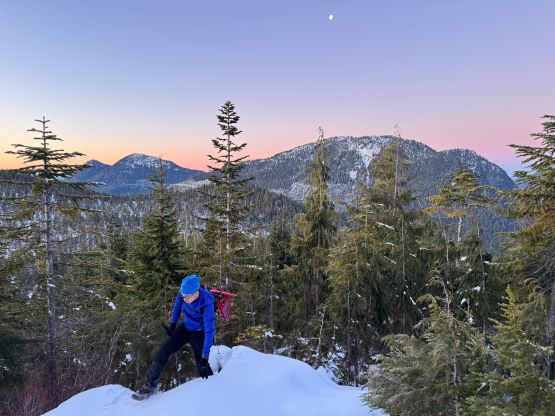
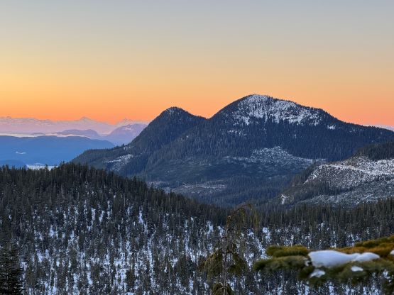
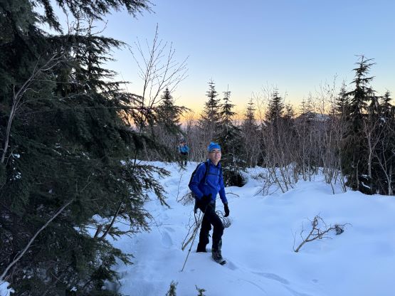
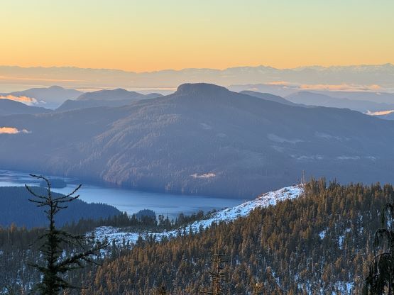
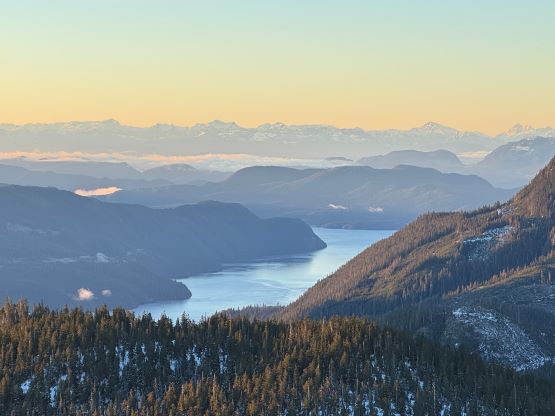
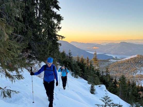
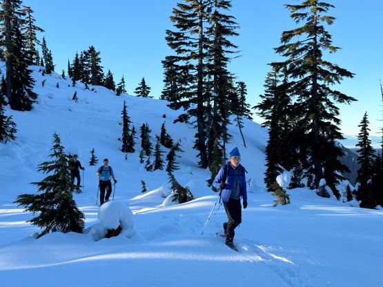
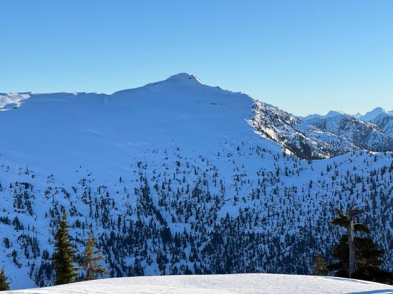
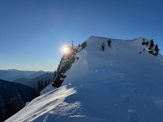
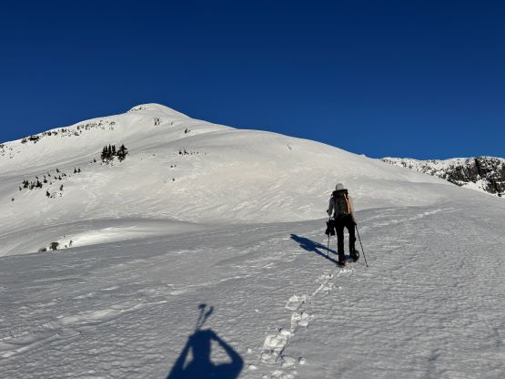
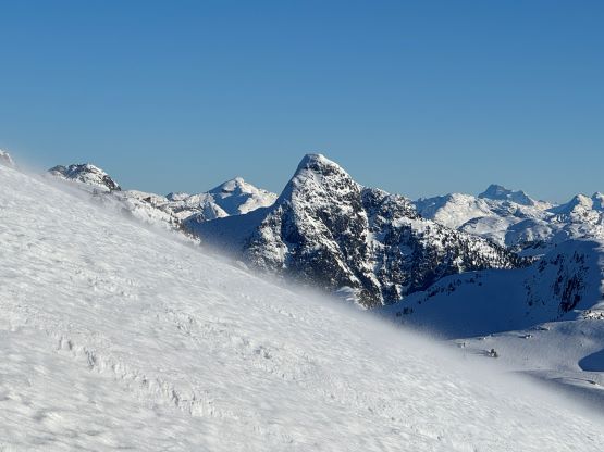
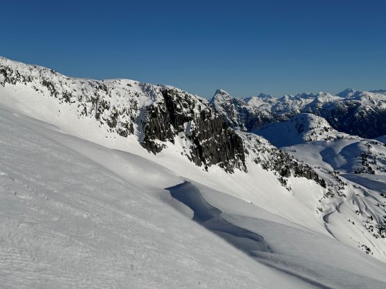
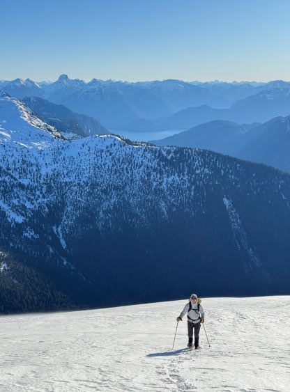
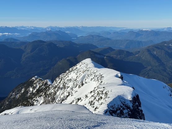
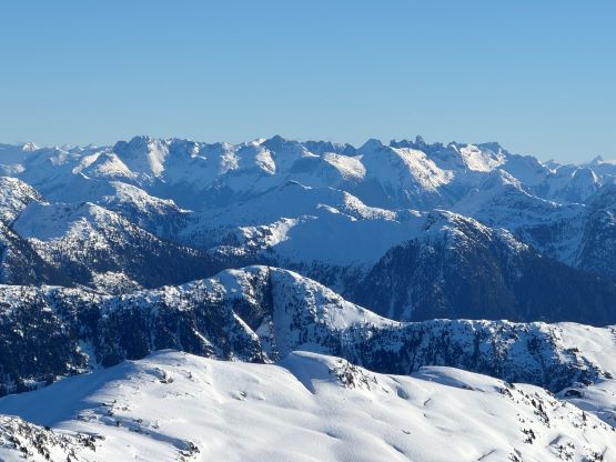
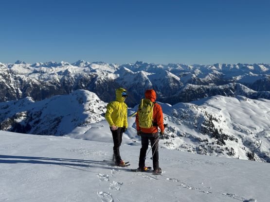
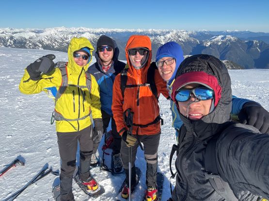
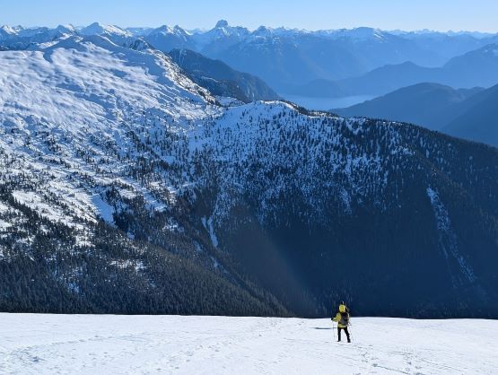
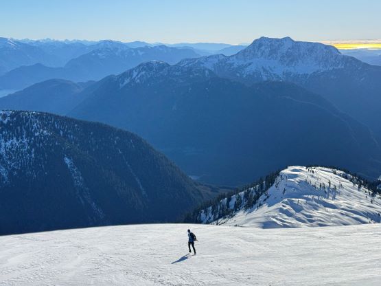
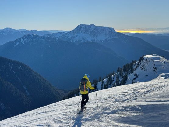
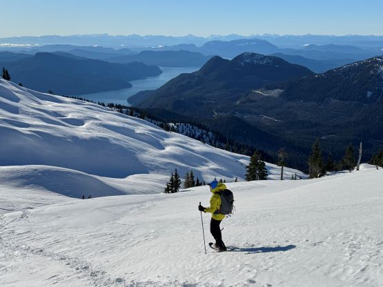
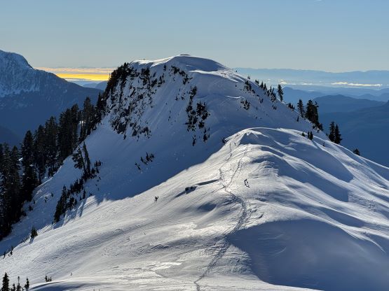
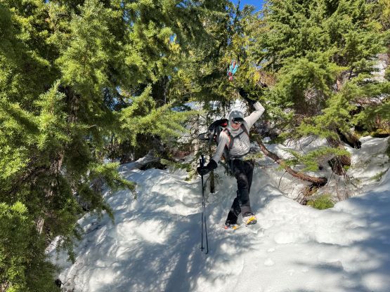
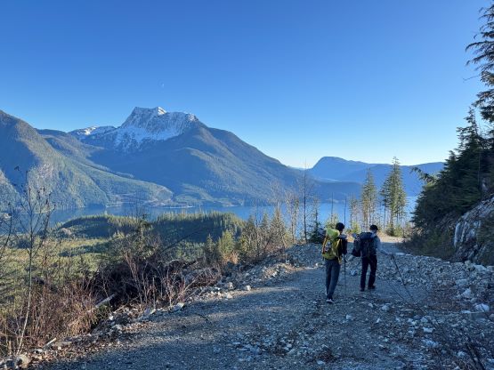
Despite still being in the shade we took the first lengthy break of the day here, donning snowshoes while ditching the ice axes and crampons. We brought the mountaineering gears mostly for Matt’s crux bluffs so they were no longer needed anymore. Though firm, the snow condition was also not as icy as I thought so the built-in crampons on the snowshoes were already “good enough”. There were a few bumps to traverse over along the connecting ridge, and I led us bypassing the first set of bumps all together by making a kilometer-long snowshoeing traverse on climber’s left side of the ridge. We then joined Matt’s route and his tracks were still visible despite the perpetual outflow winds we had been experiencing in the past week. There’s another steep section in the trees and we mostly just followed Matt’s tracks up. Matt bypassed the next bump (with at least 30 m prominence) but Alex led us traversing up and over this bump. We didn’t mind the extra bits of elevation gain because the route was already quite scenic by this point. The rest of the ascent was a mind numbing plod up the SE Ridge/slopes for 400 m elevation gain. The route involved a few steeper, 35+ degrees rolls but as mentioned earlier the built-in snowshoe crampons were sufficient enough. What made the day tough was the cold northerly winds, as we must battle the sustained head winds for the rest of the ascent. Most of us did not bring enough layers for the weather so we all suffered to some extent, so after everyone arrived on the summit we had to immediately start the descent. My ascent time was just under 5.5 hours which as on par with Matt’s.
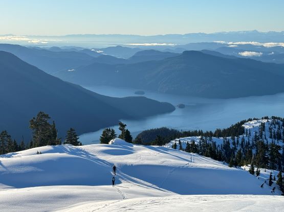
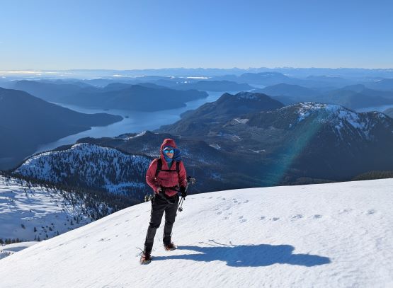
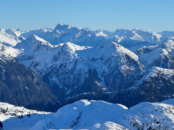

Despite the cold winds I was able to send out a few texts mostly to Peter to inform our progress, as the cell reception was fairly strong on the summit. I could not log the peak on Peakbagger app unfortunately and at the time I thought it was the internet problem. Later on I realized the app was not functioning properly for at least a few hours during the day, and it wasn’t just me having issues. For the descent Kostya expectedly had become the fastest and in no time he led us running down the entire 400 m upper slopes. The rest of us opted to keep the snowshoes on for the added traction and we all took a much-needed (late) lunch break at the saddle. We then followed Matt’s track bypassing the P30m bump and then took the snowshoes off starting from the first steep forested section. The snowshoes were never used afterwards so we could have done the entire trip without them, but it was nice to have them for the treeline zone at least on the way up. There weren’t a ton of worth noting events for the rest of the descent as we simply just followed our own tracks back to the logging roads, and then jogged back to the dock. Kostya led the final few kilometers of running and my GPS recorded the maximum pace of 15 km/h, but we still finished 20 minutes slower than Matt’s round trip time.
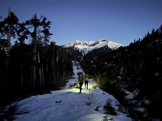
I sent Peter a text message when we swapped footwear from boots back to the trail runners and sent him another text when we all got down to the dock, and Peter replied that he was fishing in the vicinity and would come to pick us up in 5-10 minutes. This was very efficient and that earned him the 5-star review. I had some rough experience with boat and helicopter pick-ups in the past time but with the improved technology these days the pick-ups are definitely becoming easier. Another hour later we were back to Elk Bay on Vancouver Island after a scenic ride, and now in daytime we were able to actually see the surroundings. I had brought a stove with fuel canisters so spent about half an hour cooking a ramen meal for myself before starting the 2.5-hour drive down south to Nanaimo. We weren’t going to make the 5 pm ferry so we could take our time for the 8:15 pm ride to Tsawwassen, and I got home before midnight.