Zum Peak
September 13, 2024
1886m
Coquihalla Pass, BC
Zum Peak is straightly a peak-bagger’s summit as it requires substantial amount of bushwhacking on steep terrain, and the peak itself is forested to the top. The access requires about 7 km of driving up the Coldwater FSR which is not plowed in winter, so the idea of using a winter’s snowpack to eliminate bushwhacking isn’t very practical. On the other hand, there are classic scrambles in the immediate vicinity such as Yak, Needle and Guanaco so there’s no wonder why Zum Peak is the least sought after objective in Coquihalla Pass area. It is officially named however, so I nevertheless must tag it at some point. About 9 years ago Simon carpooled out with Vlad and myself and soloed Zum Peak whereas the rest of us tagged Vicuna and Guanaco Peaks nearby. I had been thinking about this peak ever since that trip but for obvious reasons I was never too keen. Finally I made the spontaneous trigger on this Friday as I happened to have a bit more than half a day available. The weather made the decision for me as the highest chance of seeing sunshine was towards the Coquihalla area and this was basically my only unfinished business. It was too late to make any practical plan with others but that’s a good thing, as I doubt anyone would be keen to join anyway.
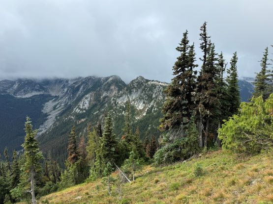
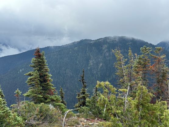
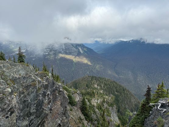
I woke up at 4:50 am and was quickly on the road. The Tacoma had been parked in the garage for over 2 months so I was sure that it wanted to breathe in some fresh air. The weather was unfortunately not as promising as I was hoping for. There was some continuous drizzling between Hope and Coquihalla Pass but the precipitation stopped minutes before I exited the highway onto Coldwater FSR. I could finally see some patches of blue skies further up the corridor towards Merritt but that’s not where I was going. It was not sunny at Zum Peak but at least the summit wasn’t engulfed in the clouds. The 7 km driving up Coldwater FSR was much rougher than I thought. I had been up this way 9 years ago and it was basically cruise sailing to the recreation site at the base of the peak, but it was no longer the case anymore. A wash-out not far in required high clearance to negotiate, and the second half of this access road had become overgrown. There was evidence of recent cutting of alders but continuous pin-stripping was unavoidable. It took me a while to drive these few kilometers but eventually I turned the truck around and parked at the site.
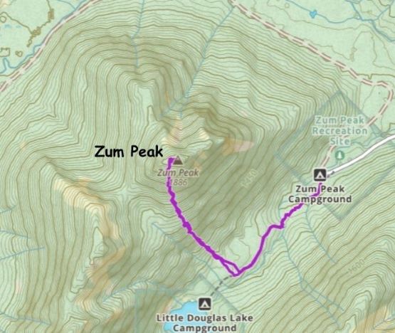
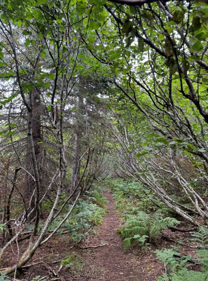
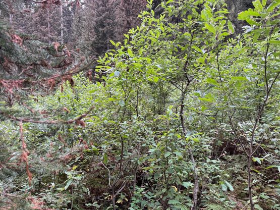
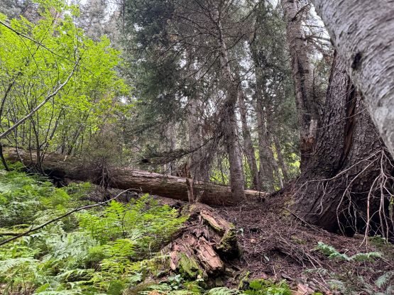
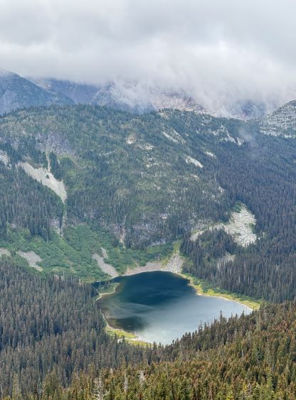
I did not bother to read Simon’s trip report as the route is obvious. I picked up the slightly overgrown but well-defined trail heading towards Little Douglas Lake but I would leave the trail before reaching the lake. It wouldn’t matter where exactly to start bushwhacking as there’s no clear “better solution”. The bushwhacking was actually better than I thought. It was never nasty, but rather unrelenting for 500 vertical meters. Another thing worth nothing is that I had opted to wear the Arc’teryx trail shoes instead of my go-to mountaineering boots. The trail shoes had proven themselves on all terrain except for the steep bushes so I wanted to test them out. I generally prefer boots when it comes to bushwhacking as the boots give much better edging but now with shoes I had to rely more on smearing. For a while I was going much slower than anticipated and I felt like I was re-learning how to bushwhack, but I got the rhythm going fairly quickly. The worst was a band of steep forest with needles making the ground extremely slippery but as long as I could reach out to some vege belay I felt fine. Higher up the undergrowth in the forest gave way to some talus fields which eventually turned into class-2 scrambling. I took a more direct line up the south slopes and encountered no further difficulty except for a few bands of thick brushes. The summit was reached in 1.5 hours from the truck and I lingered up there for quite a while hoping the clouds would lift. It never did and the weather would only become worse later.


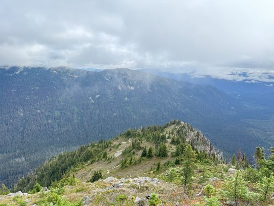

After sending out a few text messages I quickly started the descent. I briefly contemplated about descending the north couloir or the NE Ridge but I wasn’t super motivated to fuss things around. Instead, I decided to follow the GPS track closely to descend the exact same way that I had come up from, so there wasn’t much worth nothing. The descent felt much easier than the ascent as there’s less smearing needed while going down. I slipped and fell a few times but that had to be expected while wearing trail runners on this type of terrain. I got back down to the trail quicker than I thought, and then finished the round trip in less than 3 hours. Not doing much lingering I quickly drove out and got back home for a late lunch. I earned myself several hours of napping time before showing up at work.