Mount Payne and “Sumallo Peak”, via Zero Gully
May 31, 2024
2468m
Hope / Sunshine Valley, BC
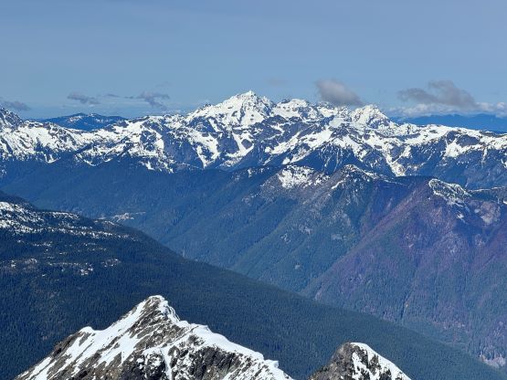
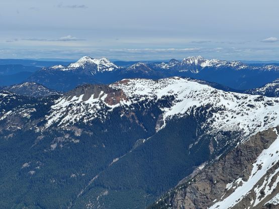
Mt. Payne and “Sumallo Peak” are two of the taller objectives in the Silvertip Group but are much more obscured. The normal south side approach is supposed to be difficult and unpleasant, that only a few parties had dared to make an attempt. I was only aware of two in the past decade and both made it sound like an absolute nightmare. Then I started to wonder about the other ways to get into the zone, and apparently climbers had done that via the “Zero Gully” in the Sumallo Cirque in the fall/winter seasons. The logging roads access was also questionable and the climb sounded fairly technical (mixed climbing), and the limited “beta” were old and sketchy so combining all of those factors I was not going to climb these two peaks anytime soon. Then all of the sudden Chris Gulka made a successful ascent in the spring season. I always thought the exit could be blocked by cornices in spring due to the orientation and aspect of that gully, but apparently that’s not the case. Chris only did “Sumallo Peak” due to the weather but I was confident to do both peaks and I just needed to pick a better day, and that happened to be a mere few days later.
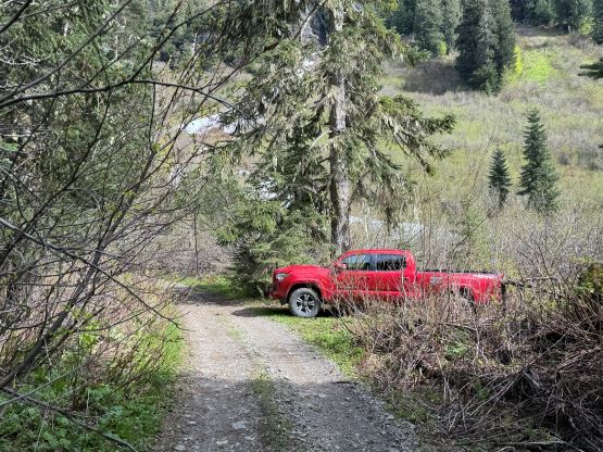
The Friday of this past week saw a narrow window with clear weather and reasonable freezing level, but this was the only window as there were at least 4 days of precipitation leading to the day, and the days afterwards were supposed to be miserable as well. Chris and I exchanged some last-minute beta for our respective climbs. I headed out at 8 pm on Thursday with Elise to get rid of the driving uncertainties in the evening, whereas Chris went for Atwell Peak together with Jacob and Jon. The three of them climbed the peak but died on the descent in an avalanche. Elise and I made to the Sumallo River FSR and the first 4 km to the Brown Mountain turn-off was very smooth going. I even noticed a new bridge that could potentially make Mt. Forddred, Mt. Green and Mt. Potter easier than before. From around 8 km mark we started to encounter rougher sections with some severe pin-stripping, but nothing was overly problematic for the Tacoma. I ended up pushing the truck more than 2 km beyond Chris’ starting point, made an extremely difficult and sketchy turning around and settled for the night just before the final crossing of Sumallo Creek. The road had seen some recent ATV maintenance and it was a wise decision to stop pushing any further.

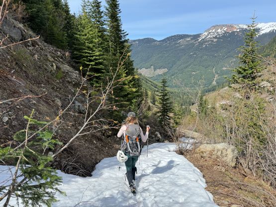
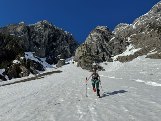
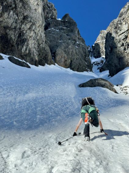
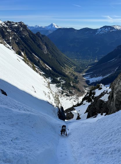
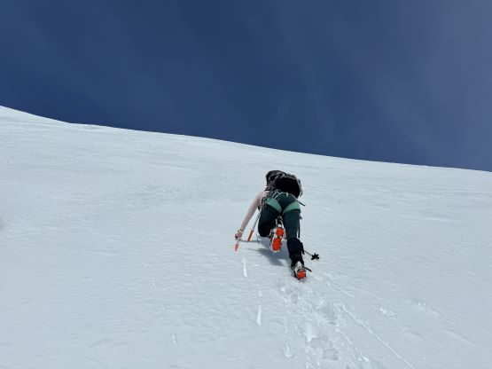
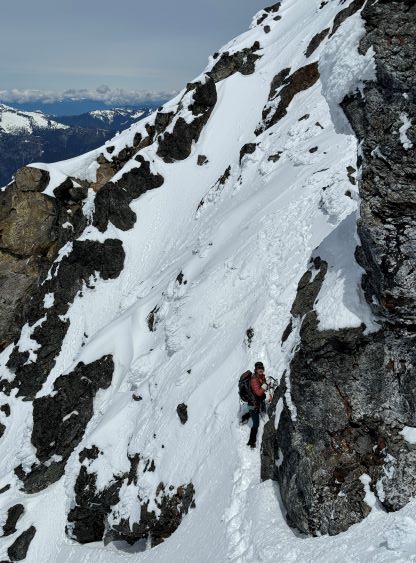
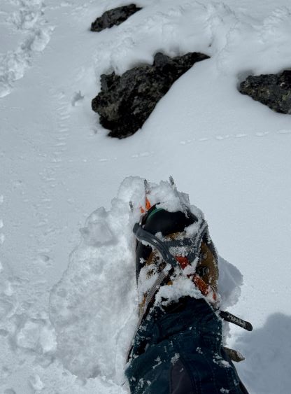
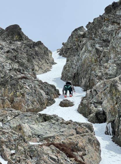
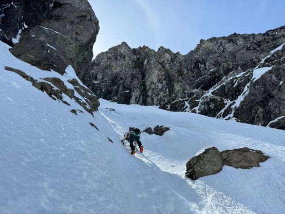
Elise opted for the in-truck spot and I slept open on the truck bed. By 5 am, our supposed starting time I noticed some frost on the sleeping bag and I instantly decided to sleep in for another hour. If the overnight freeze was that good then it made no sense to front-point our whole way up the gully (400 m vertical). We eventually started our day at around 7 am and in about 40 minutes we made into the Sumallo Cirque. We were following the tracks made by the previous party and there was some post-holing involved. We had decided to not carry the snowshoes based on the in-situ observations. That was a good judgement as the snowshoes could have come handy, but only for about 500 m horizontal distance. In any case we post-holed our way to the bottom of the “fan”, then step-kicked our way up. This section was longer than I thought and felt like a drag, and the ice tools were not taken out until the actual entrance of the gully. The condition was “okay” at this point, but I thought this was going to be a harder climb than a few days earlier. There were some massive runnels in the middle of the gully and the gully itself hadn’t seen any sun rays and we all knew how icy these runnels would be. I forgot to don harness at the bottom of the gully but thankfully I did not regret about that later.


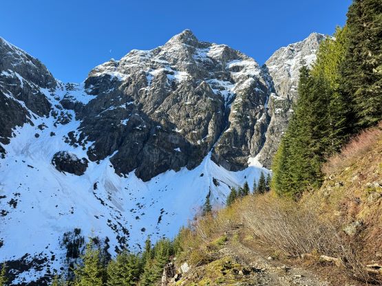


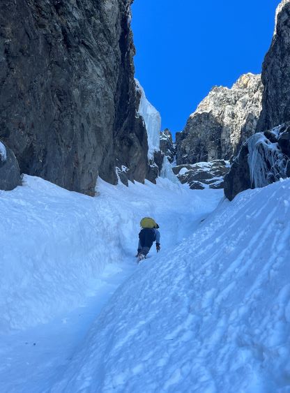
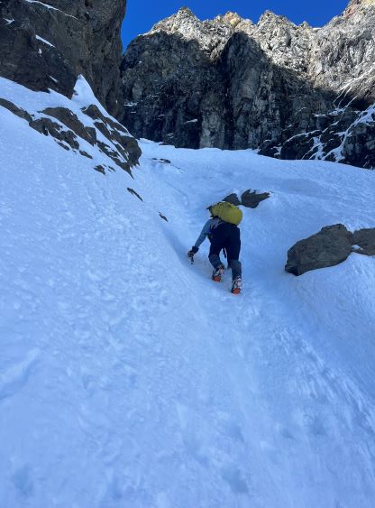
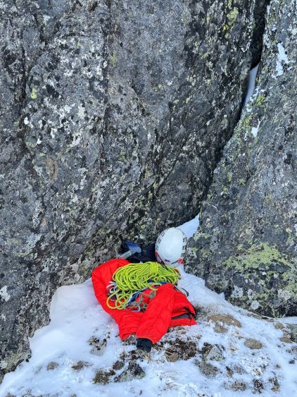
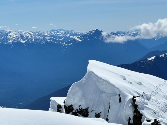
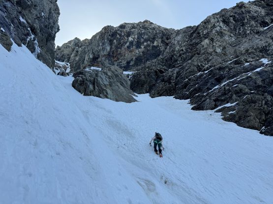
Elise and I swapped leads in the lower gully and stayed mostly on the climber’s left side of the runnel until the terrain forced us to merge into the runnel. It was here that the grade had steepened to 45-50 degrees and it would stay like that for the rest of the climb. The runnel was as icy as expected, and I led the rest of the way up from here. It was not possible to stay entirely on one side of the runnel so we had to make at least 3 or 4 crossings, and some of those crossings involved climbing a few meters of 60-degree snice in the middle of it. Two proper ice tools, aggressive crampons, full shank mountaineering boots and some extreme comfort on steep snow were the must to handle these conditions without donning any protection. It actually reminded me Lincoln Peak, though not nearly as steep nor exposed. We had only brought one 30-m rope and one fluke and I had some concerns of the descent. I probably could have down-climbed those snice steps if there’s no other choice, but we would have to try hard to find some other ways around. Other than some fallen ice from the sun hitting the walls high above us we encountered no further difficulty in the upper gully, and eventually topped out after 2 hours of intense climbing. The exit of the gully provided an excellent platform to ditch some gears, but it was cold and windy up there so we only had a short break.
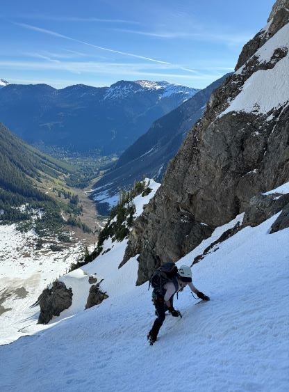


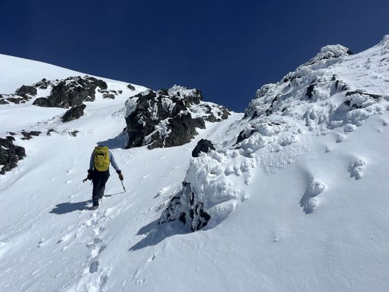
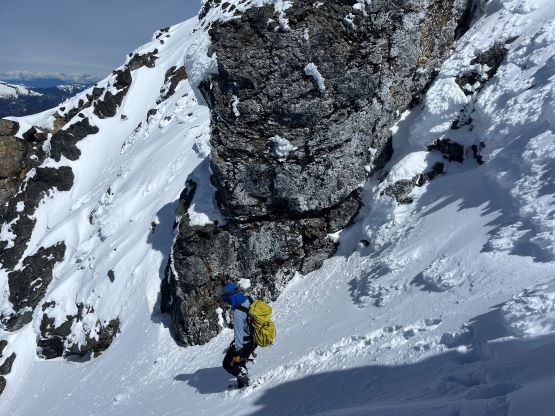
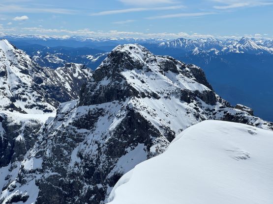
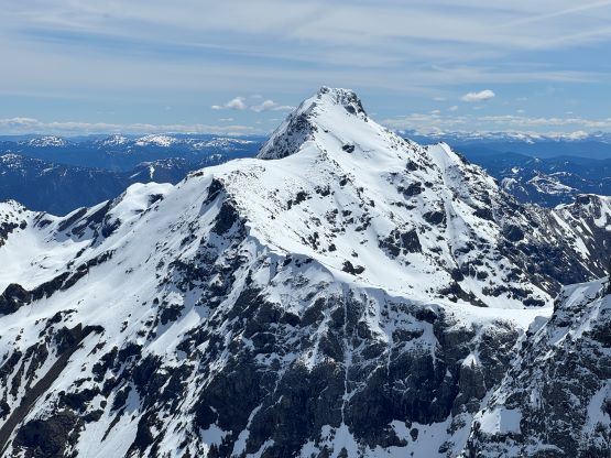
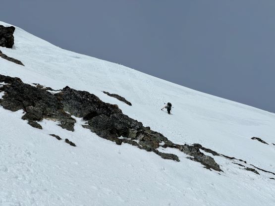
We quickly made a side-hill traverse on some thin snow and choss to bypass that intermediate bump and then we were at the base of Mt. Payne’s SE Face. I was not expecting much from the actual ascent of Mt. Payne but it was both longer than more difficult than I thought. To intersect the upper south ridge it seemed like we would have to climb at least one section of steep snow and it was definitely over 50 degrees at one particular bulge. I was not being very patient to “pick the easiest route” as I was having both of the ice tools so we might as well climb something fun. The snow condition was not very fan though, as the 15 cm of recent snow was severely balling underneath our crampons. The ascent was not a big problem, but the descent would be extremely tedious. The south ridge itself was also not a walk in the park, as we had to either do some scrambling or use more steep snow slopes to bypass the rocky sections, and there’s a sting in the tail at the end. The true summit was on the far side of the ridge and we must negotiate a bunch of gargoyles and cornices to get there, and that required more route-finding, steep and exposed snow traverses and one 3rd class mixed step. We nevertheless made it and in a timely manner.


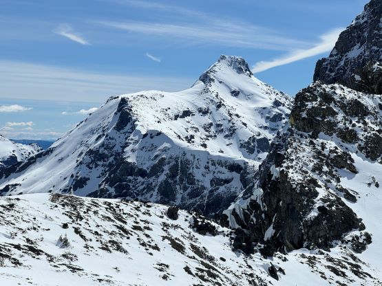

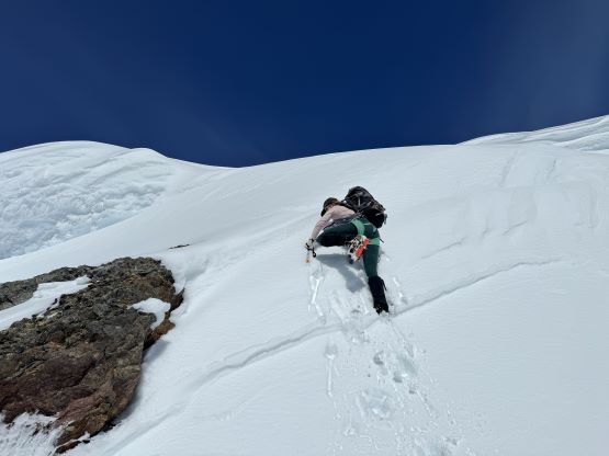


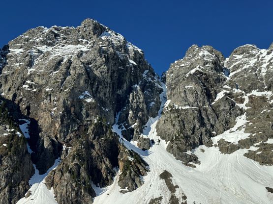
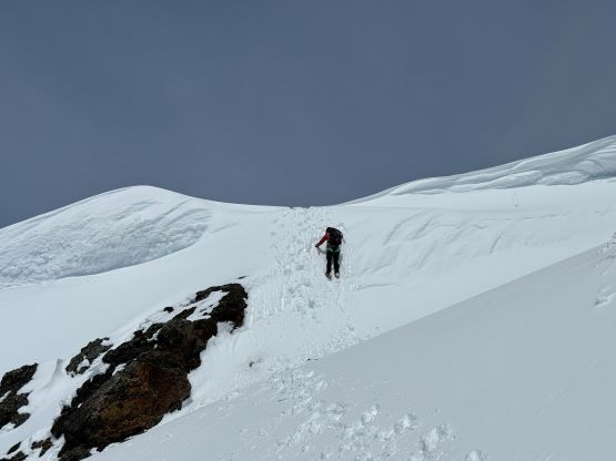
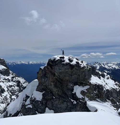
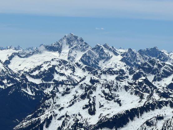
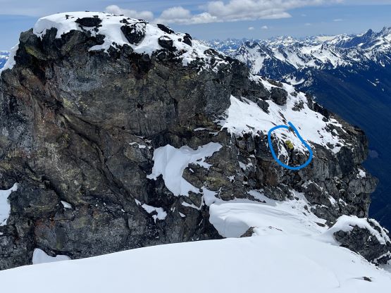
I tried to catch some cell reception but that was none, so we quickly descended following the exact same route that we had just made. The warm sunrays and the balling problem made the descent a very mentally taxing game. It would be too slow (and not steep enough) to face into the slope but plunging while facing outwards required some 120% concentrations. I did manage to descend most of it without having to properly “down-climb”, but I also had to clean the snow off the crampons for at least 100 times. I had been thinking about “Sumallo Peak” for a while as it was not looking to be straightforward. I did not bother to get additional beta from Chris about his climb, so we would have to figure things out by ourselves. I consulted with the satellite images and noticed one thin snow couloir on the SW Face that could potentially help us bypassing most, if not all of the rock steps on the lower flanks, so I led us there by traversing a lower route across that intermediate bump than the one we took towards Mt. Payne. The SW Couloir appeared even thinner than on the satellite images, but it would be a continuous snow climb so we went for it. The climbing turned out to be rather straightforward. There was again a sting in the tail as the true summit apparently required one strenuous 4th class vertical step, which I was not aware of. It took me two tries to figure out a solution but the down-climb felt very committed in the current mixed climbing conditions. It would still be 4th class in summer, I thought. We had decided to leave the rope behind so Elise stayed on the east summit while nervously watching me down-climbing.


Descending the SW Face/couloir went without event and then there came the tiring re-ascent back to the top of the Zero Gully. By now the sun had been out in full force and there was a shit ton of sluffing in the gully. Waiting until the sundown would definitely grant less objective hazards, but we also didn’t have the gears to comfortably down-climb or rappel the entire gully if it was going to be front-pointing the whole way, so we opted for the elevated objective hazards in order to have some easier climbing conditions. I led the entire way down and was able to find bypasses of those icy sections by staying on either side of the runnel. There were still some front-pointing and strenuous moves, but nothing was pushing beyond my experience scope. I did get hit a few times by fallen ice, but compared to the south couloir of Mt. Bryce this was nothing. I never pulled away from Elise and we stayed together until the terrain eased off. I then sped up to collect my ditched poles, took the crampons off and got the hell out of there. Elise showed up about 5 minutes later at the bottom of the Sumallo Cirque and another few minutes later a gigantic cornice-induced avalanche came down the entire NE Face of Mt. Payne. It did not make a sweep of our exit route but it was very close. It took us a while to absorb what had just happened and the amount of risks we had been taking recently.


There were some significant post-holing to get out of the cirque but the previous party’s track made it not that strenuous for us. We then power-walked the final few kilometers back to the truck. The drive-out was not as bad as I thought, as the truck handled the few gnarly sections and the flooded stretches well. The truck did get severely beaten by the pin-stripping but that was just something to be expected adventuring in BC. Elise and I got back to Hope at around 6 pm and another hour later we were having dinner together with Francois in Langley. We also made a stop in MEC and eventually got back home at a reasonable time. The plan was made to hike Mt. Lytton on Sunday so there wasn’t much time to rest between the two trips. Meanwhile our friends that went for Atwell Peak were gone missing.