Cima Dódici
September 1, 2025
2337m
Trentino-Alto Adige Region, Italy
Cima Dódici is the highest peak in the plateau to the immediate south of Borgo Valsugana in northern Italy, not too far from the city of Trento. The northern wall rises almost 2000 vertical meters above Brenta River whereas the plateau to the south provides easy access for farming as well as hiking. The normal route that comes up from the south is nothing fancier than a “walk-up” via the trails and dirt roads system and the distance one needs to walk on foot depends solely on the capability of the vehicle as well as the willingness and daringness to trespass. With the assumption that one dares to trespass by driving to the absolute road’s end I would consider Cima Dódici as one of the easiest “ultra-prominent peaks” in the Alps, if not the entire Europe. Adam and I had been peak-bagging in the eastern Alps for over a month but we had somehow orphaned Cima Dódici even though we had bagged pretty much every single “Ultra” in the vicinity. This was actually a “planned” event because towards the end of this trip I decided to challenge myself by tagging 12 “Ultras” in the last 12 days. The weather in the Alps is fickle enough that I needed to plan strategically. When the weather was good I absolutely had to aim at the taller and harder objectives, and Cima Dódici was on purposely left behind as a “rain day objective” if/when there’s a day with absolutely crappy weather.
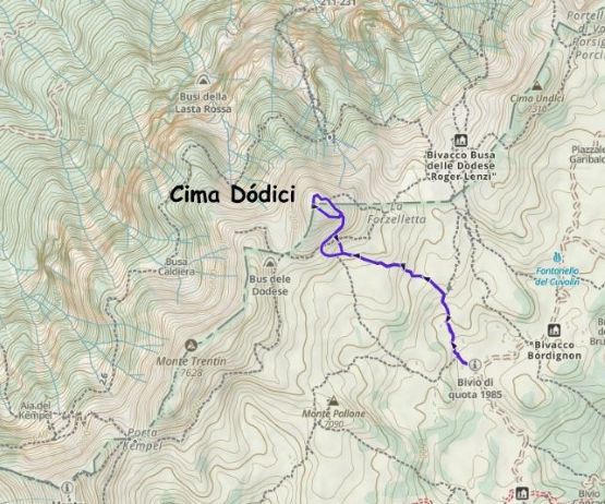
The 2nd last day of this trip turned out to have absolutely no workable weather as all models agreed with 100% thunderstorms with possibility of localized flooding everywhere in the Alps. I could see that happening from a few days back so I carefully laid out an itinerary to take in consideration of that. The success of this project eventually came down to tagging both Ellmauer Halt and Cima Dódici on the same day with more than 4 hours of driving in between. The ascent of Ellmauer Halt was uneventful as the weather was still stellar in the morning of the 3rd last day, but the system was moving in rapidly. The traffic situation was also terrible that we ended up wasting more than an hour on the road. With enough power drinks I managed to do the entire drive single-handedly and then there came the final 10-ish kilometer up the dirt road. The road was quite steep and loose but imposed no problem to the rental 2WD. The start of Deividas’ GPX track is the highest legal parking area but there was no gate and the road conditions appeared rather reasonable beyond. I made the spontaneous decision to ignore the “no driving” sign and eventually pushed the vehicle to within 100 m from the absolute road’s end. This shaved off at least 5 km of walking each way. Adam and Erica were originally considering to sit this one out but with the (much) higher starting point they agreed to come along.
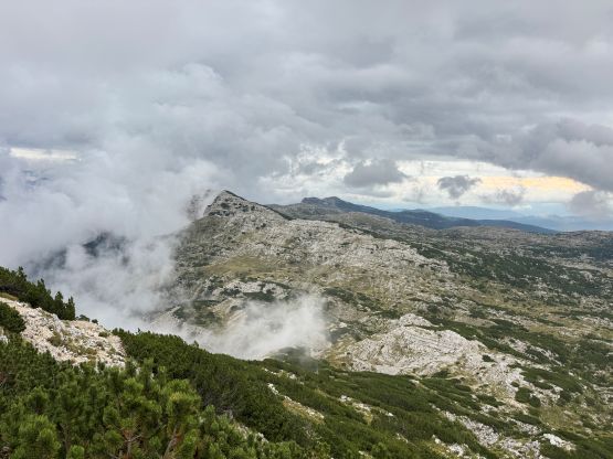
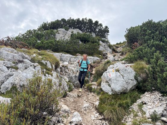
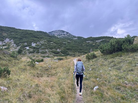
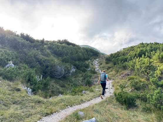
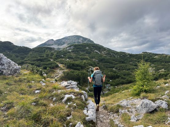
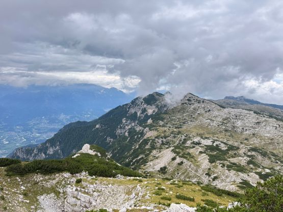
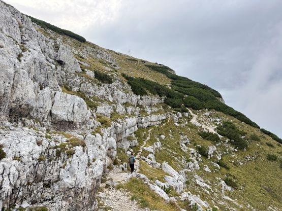
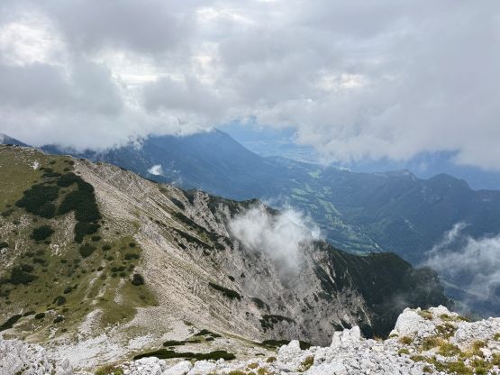
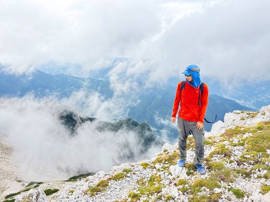
Adam’s app showed some heavy rain coming in about 2 hours and we also had about 2 hours of daylight left. I thought we would definitely finish the trip in less than 2 hours but given the illegal parking situation I also agreed to rush by hiking as fast as we humanly possible. Adam opted to start when I was still having dinner (I couldn’t eat while driving), and this gave him about 5 minutes of advantage. Adam was powering up at his fastest possible pace so Erica and I didn’t catch up to him until almost back at the vehicle an hour later. There’s not much worth noting about the ascent itself as the route was well marked. The view was foreshortened though, and it definitely took us longer than I thought. Fortunately the rain had been holding off nicely for us, and we even got some views from the summit.
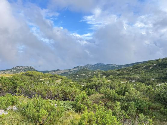
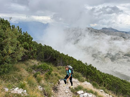
Erica and I didn’t see Adam so he must have taken a different way down. I checked the map and noticed a shorter trail heading directly south from the summit, so we took that on the descent. This trail was shorter but looser. Lower down we spotted Adam taking another short-cut so opted to follow, but this short-cut turned out to be thrashing in bushes. We then power-walked the entire way back and caught up to Adam within a minute from the trail-head. Not wasting any time I turned on the engine and drove us out of there. We did not get a parking ticket nor punch a tire. I was originally considering to camp in the vicinity but with the copious amount of precipitation coming we made the last minute decision to find a hotel. With three people sharing the cost this wouldn’t be too ridiculous. Eventually Adam found the only hotel in the range of 100 USD per night and that turned out to be only an hour north of Venice.