Cerro Pircas
January 8, 2025
4380m
Barreal, Argentina
Cerro Pircas is the highest point of the front ranges of the high Andes west of San Juan and east of Barreal and the access, though difficult, can be made from either side. About 5 years ago when Connor, Dave and I went to Barreal for Cerro Mercedario we briefly considered tagging Cerro Pircas as well, but Grajales, our logistics company could not manage to arrange the needed 4×4 transportation. Our pick-up driver, Nuria from Barreal assured us that Cerro Pircas indeed could be done, but such would have to wait for another trip. Fast forward to 5 years later when Erica and I came back to Argentina to climb Aconcagua, we ended up finishing the main objective too soon so had about 4 days to spare before flying home. Erica would likely prefer to do some cultural things but such would not happen in my trips. For me it’s either peak-bagging or going home for work, and I preferred the former. While resting in Aconcagua’s basecamp I spent most of a day researching the potential bonus objectives and eventually I narrowed that down to two – Cerro Pircas in San Juan province and Cerro Champaquí in Córdoba. I briefly considered joining Rob, Deividas and Alastair who happened to be doing the same peaks at the same time by coincidence, but decided against that as their third objective, namely Mogote Corralitos would likely not going to work and their 4×4 transportation was way too expensive.
I contacted at least 4 or 5 local drivers but only two responded. One of them happened to be Rob’s contact from the east side in San Juan, and the other one was through Nuria, from the west side in Barreal. I managed to bargain the west side price down to 200 USD which was less than 1/3 of the other so that made the decision for us. Luis Gonzales would be the organizer (middle man) and he told me that there’s one catastrophic flooding event about a week or two ago, that had destroyed some of these roads but he assured that it was still possible to go to Cerro Pircas. The flooding applied to both sides of the mountain so it’s never a clear solution as to which side would be more assured, but again by pure coincidence the two groups happened to attempt this mountain on the exact same day but from the opposite side. I still thought our side would make more sense even just by zooming in on the maps. Our first challenge was to obtain efectivo (cash) in the city of Mendoza as there’s basically no ATM that currently worked. Erica eventually managed to get about 100 dollars worth of pesos but the charging rate was almost 30%. We eventually put the bid on our new friends made on Aconcagua and got some much needed cash as otherwise, these bonus peaks might not happen.
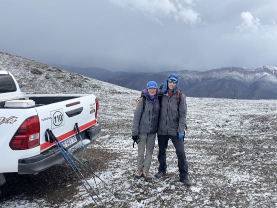
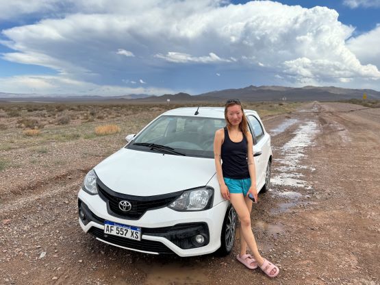
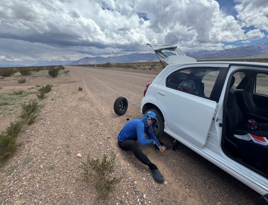
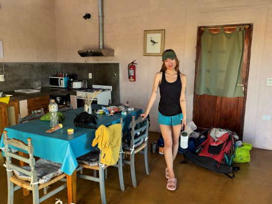
There’s also no public transportation from Mendoza to Barreal so we would have to rent a car, which would be needed for the long drive afterwards to Córdoba province for Cerro Champaquí anyway. The cost for renting a car in Argentina was not cheap unfortunately, but also not outrageously expensive. For 4 days the cost was slightly above 300 USD and I considered that as “acceptable”. On Jan. 7th we took a Uber to Mendoza airport and got our rental car sorted out, and subsequently drove 3 hours to Barreal. I remembered a long stretch of unpaved roads on the Mendoza side of the province border from 5 years ago and apparently the province still haven’t managed to pave that part. Our rental car took a beat and showed us a flat tire right off the bat. I had thankfully done some tire rotations back in the university days when I was very cheap so I was able to put on the spare tire for us. I then had to drive extremely carefully for about an hour and thankfully the tire fixation in Barreal wasn’t too complicated and only costed about 6 dollars worth of pesos. The payment to our hotel (Casiopea) had to be done in cash unfortunately, but we simply didn’t have that much cash available. We eventually managed to give enough pressure that the manager permitted us to do a bank transfer (in USD) to her sister. We could have directly made the transfer to herself but Wise app was having trouble sending money to Argentina at the moment, so the options were definitely very limited. The hotel was a very nice one (basically a private house) and it’s a bit unfortunate that we had to move on after spending only one night here. Luis came to visit us that same evening and then we spent some time walking in the town. I also contacted Nuria and we promised to definitely see each other the next day after doing the peak.


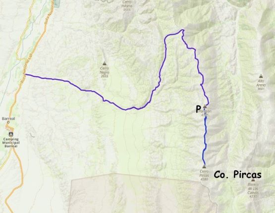
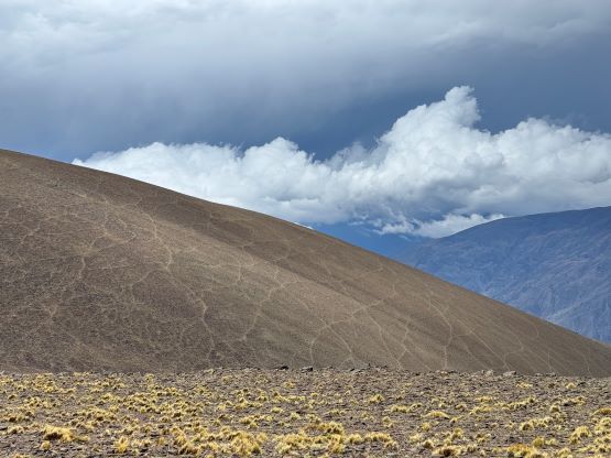
Luis’ driver, who spoke no English came to pick us up at 5 AM and for once, the Argentinian was not late. I think Luis had worked with enough westerners that he had realized that the time commitment mattered a lot more for us than in his culture. This driver seemed to know what he was doing, but I quickly realized that he was not taking us the same way as Petter, Adam and Rockinstraw did in the past few years with their driver/guide Franco. I thought maybe the roads connected higher up or there’s some local knowledge that I was missing, so I wasn’t putting in too much thoughts. There’s a gate that he opened with a key, so the route we took would not work for private trips, and minutes afterwards we entered a dry river bed and started crawling. Indeed, the flooding just before the New Year had destroyed the roads but with the Toyota Hilux and the driver’s experience this was still possible. At one point we had to get out to shovel a path so obviously this route hadn’t been used much since the event. Higher up we passed some cable lines and houses and it was now apparent that he was veering north (as per the way shown on the Gaia map) away from Petter’s route. This would not position us anywhere close to the main summit so I made some questions and complaints in my broken Spanish. This driver eventually got what I meant by “there’s another road from Barreal that actually goes to the peak” but the response was that we needed a permit as that road’s privately owned. We actually managed to catch some sporadic cell reception and made a call to Luis, and the response was the same so this was our only shot. The driver promised to drive us southwards along the undulating ridge for as far as possible so let’s see how far we could go.

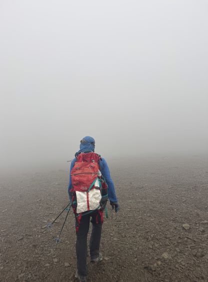
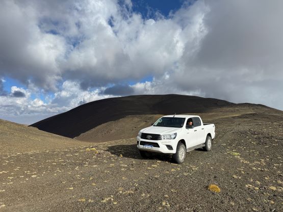
First of all there’s a short-cut shown on the Gaia map and that road surely existed, but the driver refused to take that road as he thought it’s long gone (I think he’s correct, to be honest). We then continued the northwards detouring and eventually got onto the ridge system. The roads never became any worse in this stretch but we were now 25 km away from the peak in a crow’s fly. This was obviously not possible to walk in a day, so up the ridge we went in the Hilux. For most parts along the ridge all the way to the very summit there existed a road somewhere, but the road was not continuous and had numerous crux sections. For many times we had to make guesswork as to where to drive towards but we were always able to spot the next stretch of roads across on the next hill (or dip). This lasted all the way past the “road’s end” as per the Gaia map and we eventually pushed all the way to near the summit of Cerro del A. Panteón at 4100 m elevation. This was over halfway done but we still had 10 km to walk with considerable amount of up-and-downs, but the driver didn’t want to go any further. In retrospect he was correct as the descent from Panteón towards the next saddle would most likely only work in a motorcycle or a quad. Luis had said that this driver knew the range better than anyone else and he surely wasn’t exaggerating. The weather had now turned overcast and we were in some intermittent fog. There was thunderstorms forecasted throughout the day (or the week for that matter) so it was still not guaranteed at this point. In my broken Spanish I told the driver to not move and wait 6 hours for our return.
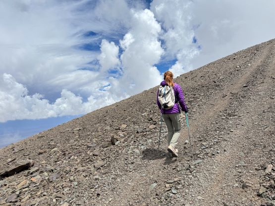
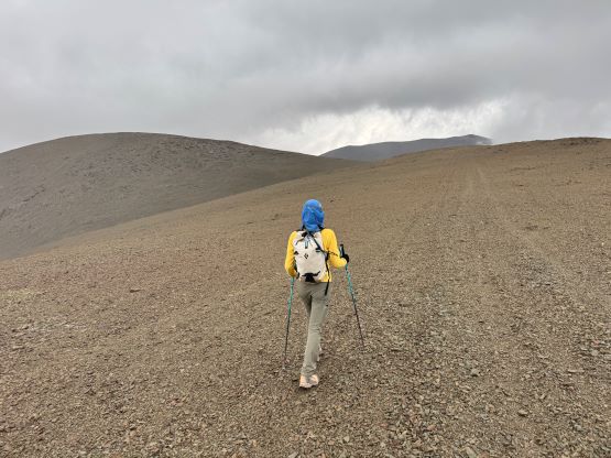
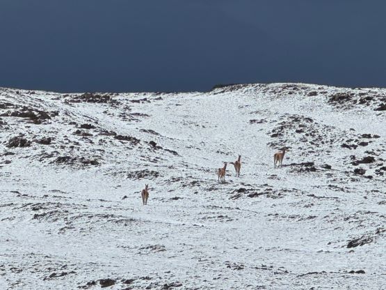
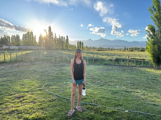
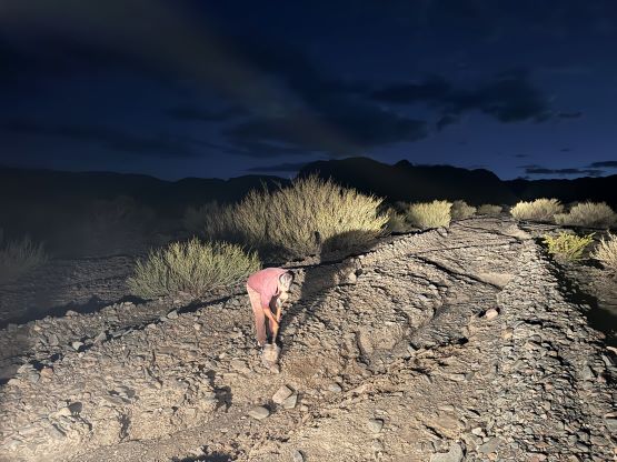
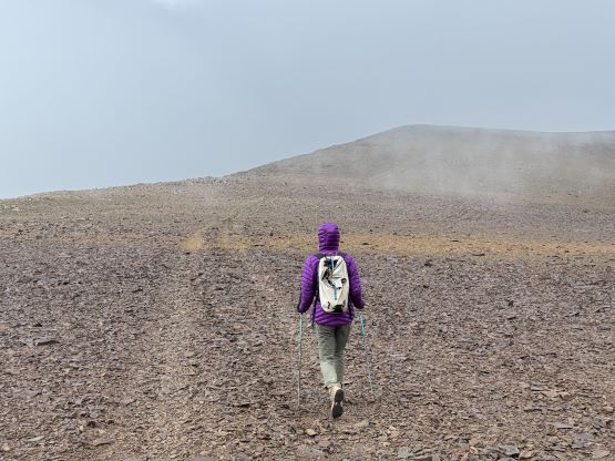
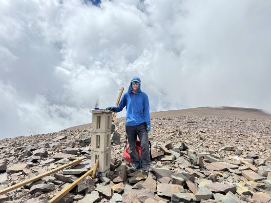
In fire drill mode Erica and I got out and got ourselves ready for the plod in a mere few minutes. It was windy and cold so I put on my warmer layers and instead of carrying only one pack we had to carry two, one being my bulky AMG 105L which was significantly overkill for the job. There’s actually not much worth documenting about the hike itself even though it’s not that short, as all we needed was to put one foot in front of another. I was struggling with the altitude for some reasons so I was dragging on all uphills, but we were able to jog most of the downhills. There were at least 3 or 4 major bumps to plod over and each had over 50 m prominence so the total elevation gain of the day was still more than 500 m. There’s also remanent of a “road” throughout the plodding but as mentioned earlier the road was not continuous that we were doing guesswork from time to time. Eventually we joined Franco/Rockinstraw’s GPX track and plodded to the false (north) summit, which was followed by another frustrating 50+ m elevation loss. Thankfully the true summit was not far away at the moment. We waited on the summit for about half an hour but Rob’s group was nowhere to be seen. It was unclear whether they had summitted or not and we later learnt that they summitted about an hour later. It would be very cool to meet up on the summit, but unfortunately the weather was not trustful on this day and we had another 10 km to hike back across the ridge so we must move on.


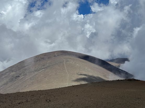

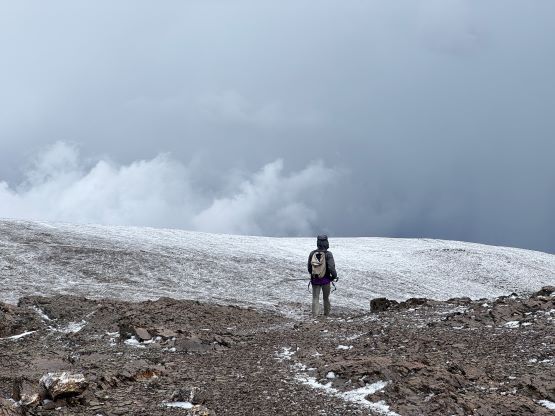
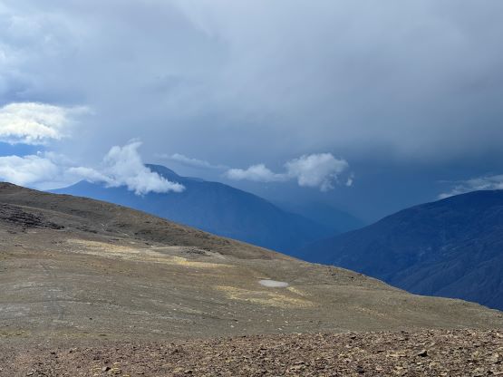
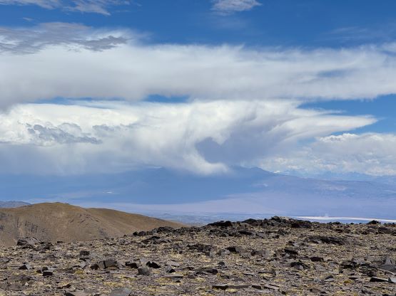
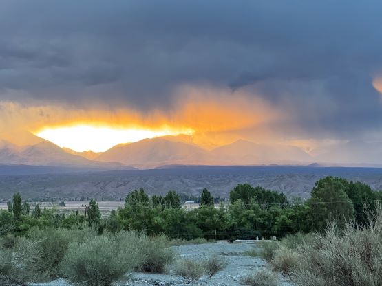
There were actually patches of blue skies but we could see some threatening clouds moving in from the west. We sped things up and got up and over the second-to-last major bump in worsening weather, but moments after starting the descent towards the saddle south of Panteón the thunderstorm hit. There were loud thunders and lightnings all around us and one strike was fairly close, so we quickly bailed the ridge for about 50 m and hunkered down. The hailing was rather intense but the storm passed quickly. As soon as we could see the west side again we made the final traverse up and over Panteón. The driver had been patiently waiting for us and the ridge north of us was now covered in a layer of snow. This would not impose any additional problem to the Hilux, thankfully. Our round trip time was over 5 hours and we did no lingering but immediately started driving down. With the storm now passing the drive was very scenic that we stopped frequently for photos. We also got off the truck and tagged an unnamed P100m bump along the ridge, for the simple reason of why-not. I eventually fell asleep for about an hour but the drive took almost 4 hours so we did not get back to Barreal until after 5 pm. Luis came about half an hour later to collect our cash, which was unfortunately mostly in the 1000 pesos (less than a dollar) bills. The currency and inflation situation in Argentina is apparently still quite bad at the moment. We then checked out with the hotel’s owner, paid a visit to Nuria’s vinery and then drove 3 hours to the city of San Juan. I finally received a text from Rob that they had also summitted and the plan was meet up in the hotel in San Juan. We did not get there until 11:30 pm but they also failed their next objective (expectedly). They were back to the hotel by 8:30 am which was the time I just got up and went down for the breakfast.