Cerro de los Cuervos and La Torre
March 13, 2024
3854m
Huehuetenango, Guatemala
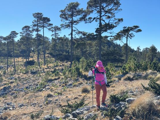
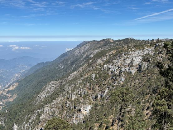
Cerro de los Cuervos and La Torre are the two highest summits in Sierre de los Cuchumatanes and subsequently the highest peaks in Central America that are not from volcanic origin. The two peaks are about the same in elevation but previous measurements (mostly by handheld GPS units) suggested Los Cuervos to be a few meters higher. After doing both I’m not fully convinced if one is definitely higher than the other, without a professional measurement device like the ones Eric Gilbertson’s been using. I managed to stay for roughly 10 minutes on each summit and the Gaia GPS did suggest Los Cuervos to be roughly 2 to 3 meters higher, but I think this is well within the error range of the device. Both summits are covered in trees and that could affect the GPS readings. In any case the higher of the two holds more than 1800 m prominence so to safely claim the “Ultra” one has to do both, and to further complicate things both Los Cuervos and La Torre have two high point contenders so I would like to do all 4 “summits” to be 100% sure. The two peaks are more than 5 km away from each other so I could totally see why at least half of the previous parties opted for only one of them. Without local knowledge and a trusty 4×4 vehicle one would have to walk the distance between the two peaks both ways, turning a short stroll to a fully day outing, all at above 3700 m elevation. One could consult with Rob Woodall and/or Greg Slayden for their detailed accounts of the long slog.
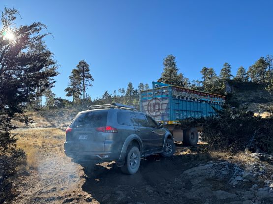
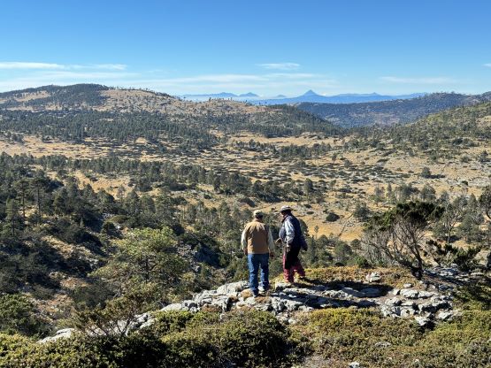
The lengthy walk could be significantly reduced, if not entirely eliminated and in fact, I only ended up having to walk no more than 3 km distance and gaining perhaps 100 m elevation for the two peaks combined. Kate and I hired Oswaldo as the driver (with a 4×4 vehicle) for this entire trip. Through Oswaldo we hired Firmin, and through Firmin we hired Victor, a local Mayan guide living literally on the north slopes of Cerro de los Cuervos at 3600 m elevation. Victor knows everything about this range including all of the rough roads that were not even shown on the Gaia map. I did find a bunch of dirt roads by zooming-in on the satellite images but the system was very confusing. Furthermore, Oswaldo had already successfully driven Deividas up to the saddle between the two summits of Cerro de los Cuervos at 3800 m elevation in Nov. 2023 so he knew how to get us up to at least that spot. March is the dry season in Guatemala and we did not observe any sign of precipitation in the first two days of visit, so the roads wouldn’t be muddy and I was confident that we could turn this “Ultra” into a rest-day objective. Indeed, we managed to drive up from the north side to 3800 m on Cerro de los Cuervos, within a stone’s throw from the summit.


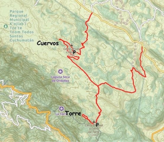
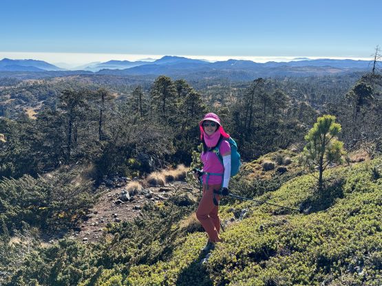
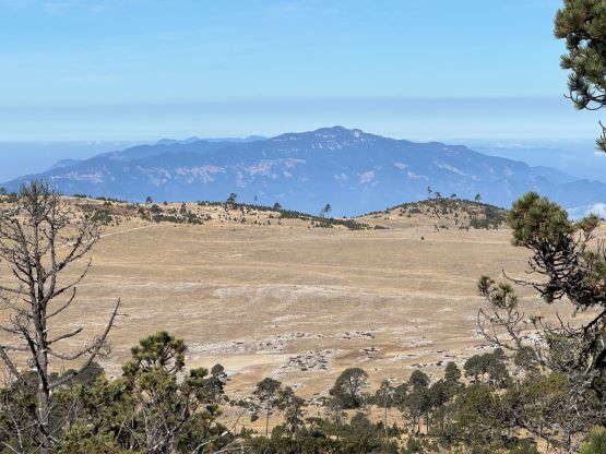
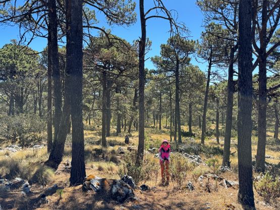
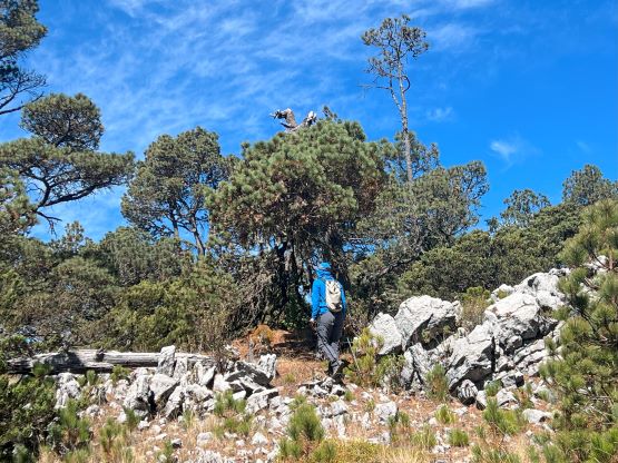
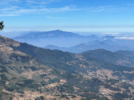
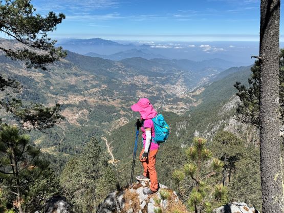
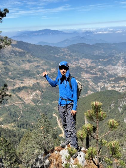
I informed the guides in Spanish that we had to do both the NW and SE (supposed true) summits of Cerro de los Cuervos so we still needed to walk at least 1 km after all. Victor then yelled at Oswaldo to drive to the saddle between the two summits and wait for us from there. There’s no trail to speak of, and the ascent of the true summit required a little bit of bushwhacking, but took no more than 5 minutes. The summit itself was partially forested with limited views. By the time we descended to the saddle Oswaldo had already showed up with his vehicle. We then made a quick dash up the NW summit and back. My GPS showed the NW summit to be about 10 m lower, and that should be enough to conclude the SE (first) summit to be the true one for Cerro de los Cuervos. Fortunately the NW summit offered better view towards north and west, so it wasn’t pointless to make this detour.


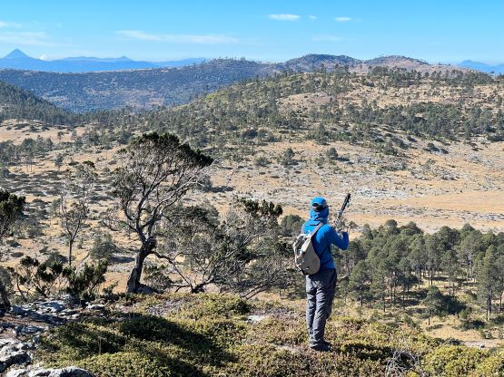


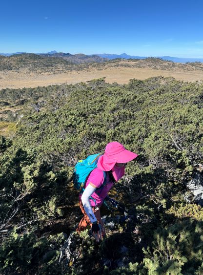

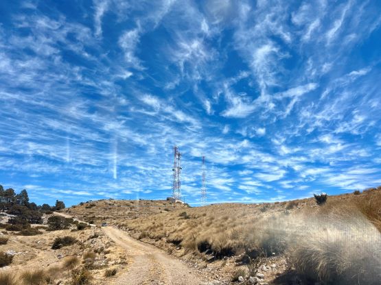
We then had a bit of adventure to drive down towards the plateau between Los Cuervos and La Torre. Victor knew the general direction, but made a couple mistakes and directed us onto some hardly-ever-travelled “roads”. The road wasn’t actually that bad but Oswaldo’s vehicle wasn’t equipped with the trusty all terrain tires, so we must drive very carefully. We eventually had to do a bit of re-ascending to connect to the correct road system, and then had no further issue driving to La Torre. I fell asleep during this stage and by the time I woke up we were already parked at the communication towers on La Torre. The round trip ascent of La Torre from there was at most 1.5 km with 50 m cumulative elevation gain. We traversed over the first contender to the second contender, and determined the second contender to be the actual summit of La Torre.


We drove out a different road and exited to the NE, and my GPS recorded the total distance from the main road back to the main road to be almost 22 km (20 km or which was driving). Had we used a different guiding company (such as the one that Craig Barlow’s group used) we would have to walk the entire way as that company refused to arrange 4×4 vehicles for this objective. After dropping Victor and then Firmin off the three of us spent the rest of the day driving a long ways to the SW to the small village of Sibinal near the Mexican border. All in all I would highly recommend Oswaldo’s services for this particular objective if your purpose is to quickly tick it off the list and to conserve energy while still bagging both Cerro de los Cuervos and La Torre.