Cashmere Mountain
September 15, 2024
2595m
Leavenworth, WA
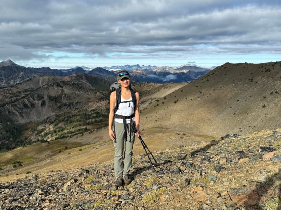
Cashmere Mtn. is one of the taller peaks lining the Icicle Creek drainage west of Leavenworth but is not in the core Enchantment area. This is a standalone “Bulger” that boasts over 500 m prominence. The standard route is straightforward but the somewhat exposed 3rd class scrambling near the summit isn’t a “walk in the park” neither. A few friends of mine had climbed it in the winter conditions and their ascent was a more serious mountaineering outing. I had thought about doing the same, but I especially disliked the 4 extra miles of road walking in the “off season”, so in the end I opted for the standard solution. A lot of folks prefer to spend a night at Lake Caroline due to the near-30 km round trip distance but this outing wouldn’t be long enough for me to consider an overnighter. This past Sunday was my first coming-back trip after spending over 2 months in the Eurasian continent. I reached out to Erica long ago and she agreed to come along, and I would simply let the weather to make a decision for us. Erica and I had climbed Dragontail Peak and Colchuck Peak earlier in the year so it would be fun to come back to Leavenworth for another trip. The weather was not the greatest anywhere but at least the chance of precipitation was minimal towards the far south-east. I only had three Bulgers left in the area – Cashmere, Cannon and McLellan and opted for the simplest in the end.
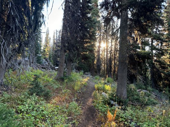
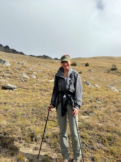
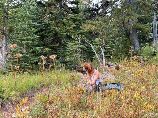
I finished the long work day on Saturday at around 6:30 pm, came back home for dinner and then picked up Erica from the Scott Road Skytrain station at around 8:20 pm. We made a quick stop in a nearby Subway and then drove south across the border. The 10-hour time difference between Mongolia and the Pacific NW was finally doing me a favour as I was exceptionally awake even at midnight. The trail-head turned out to be very packed but we did manage to find a suitable parking space with enough room to also pitch out my tent. That final 4 miles to the trail-head was the worst I’d seen with washboards and deep pot holes so I was glad to have brought the Tacoma all the way down there. I had thought about to take the Corolla to the Enchantment every time as it would usually make do, but this trip proved once again that it’s always a good idea to have enough contingency so that the end result could be achieved even in the worst case scenario. We went to bed at around 1:30 am and the alarm was set at 5 am. I woke up at around 4 am (again due to jet lagging) and couldn’t fall back asleep. About half an hour later I decided that I might as well get things going. I prepared our ramen breakfast from inside my sleeping bag and properly woke up Erica once the food’s ready. The morning routine took a while but we still managed to start way before daybreak.
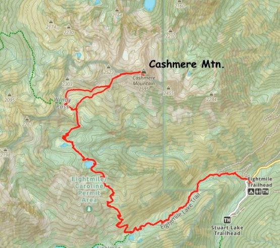
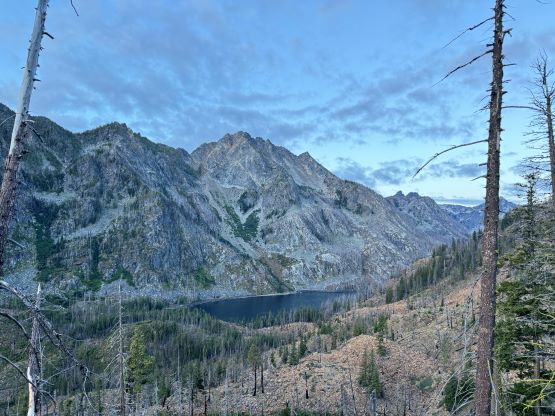
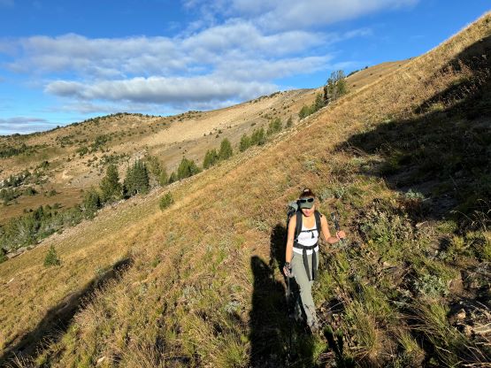
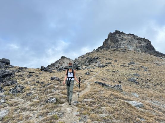
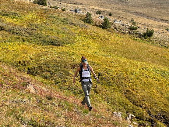
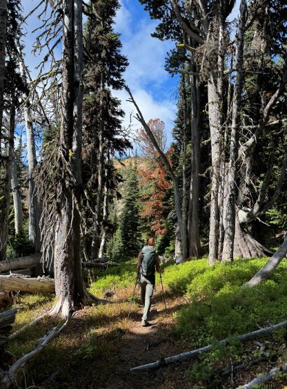
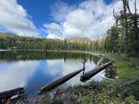
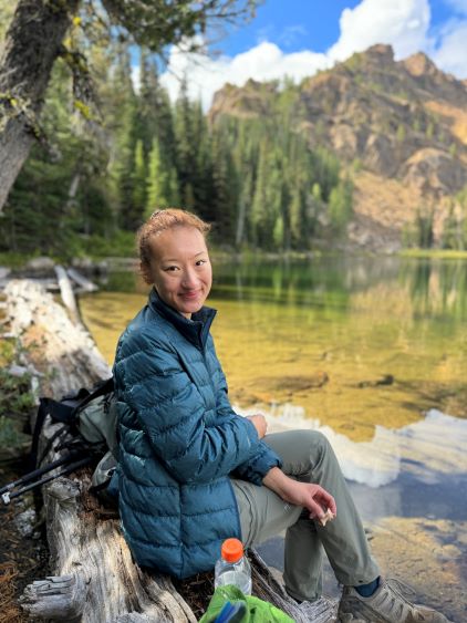
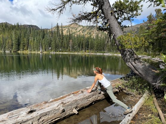
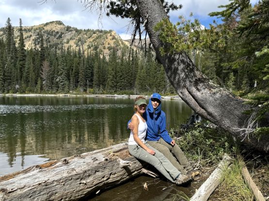
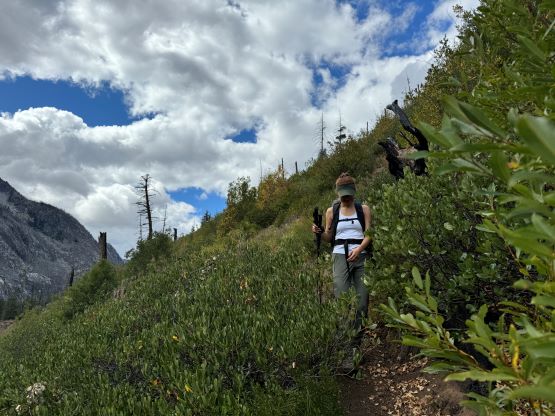
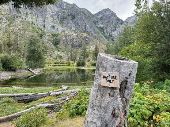
The initial 4.5 km was plodding along the Eightmile Lake Trail and we passed a group-of-five not far from the Lake Caroline/Windy Pass turn-off. I thought these people were also going for Cashmere Mtn. based on their packs and I was correct. This was also when we were able to turn off the head-lamps. There were many more people coming in and gearing up at the trail-head while I was preparing for our breakfast, and we wondered what they were doing. We did not encounter anyone else higher up on the route and we eventually became the first to summit on this day. In any case we correctly located the turn-off and the trail instantly became narrow and overgrown. Thankfully the thrashing did not last long as the path had become much clearer higher up in the open areas. We made quick work up towards the pass and then descended a short ways to the outflow of Lake Caroline. I was more concerning about the water sources as I didn’t bring enough water to last the entire day, and the outflow was looking very gross. For that reason we didn’t bother to check out the lake views until on the way back. There’s another outflow (of the upper lake), still not ideal but would make do. I loaded up two 500ml bottles for emergency use as I still had about 500ml of Gatorade. I did end up having to drink 500ml of the unfiltered creek water but I haven’t got sick yet, now a day later.
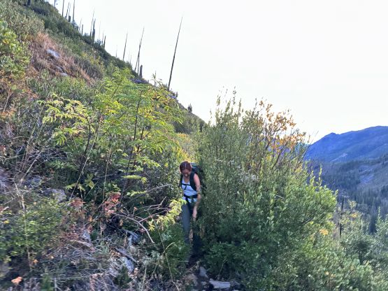
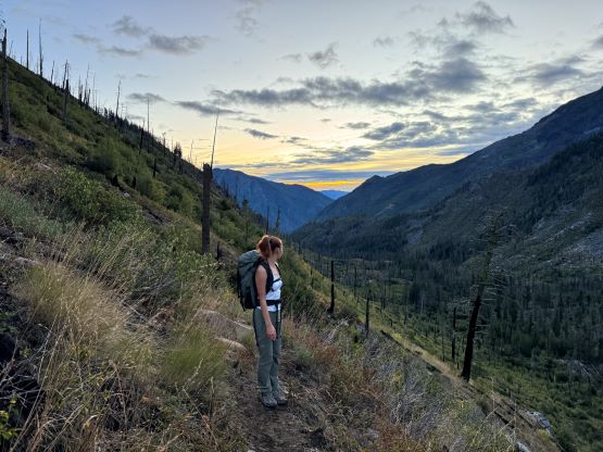
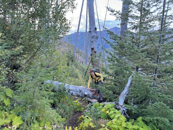
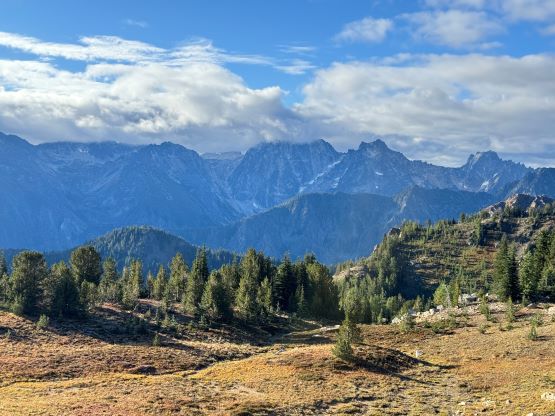
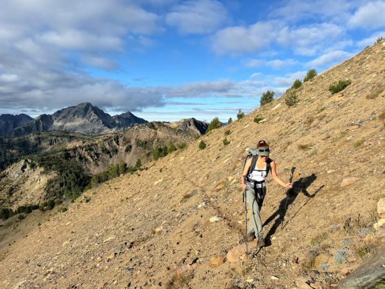
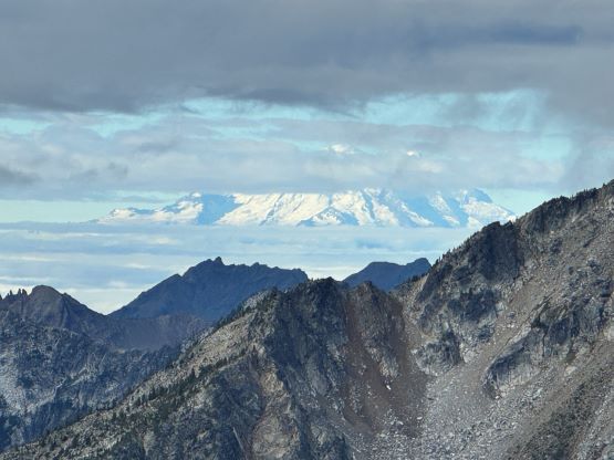
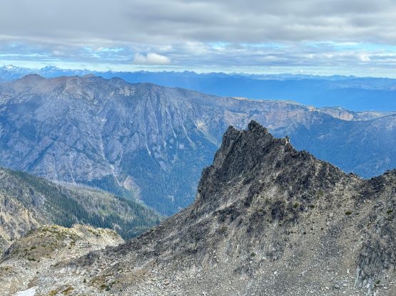
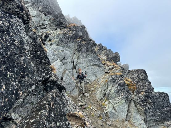
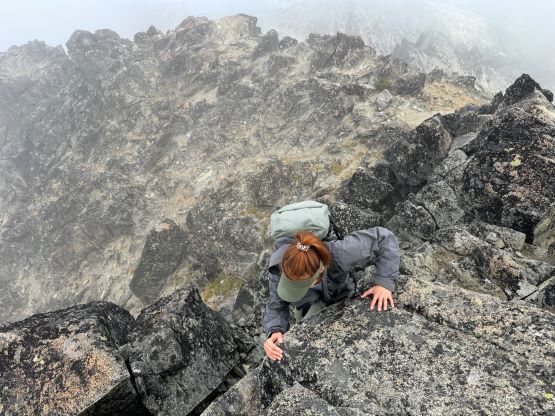
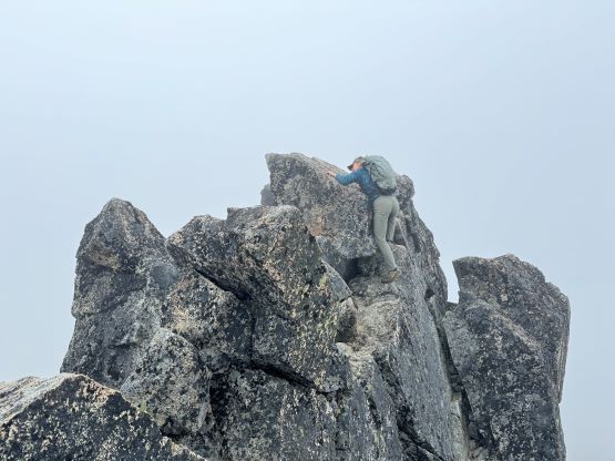
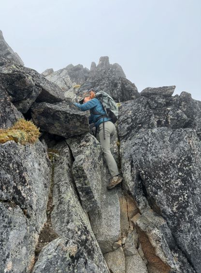
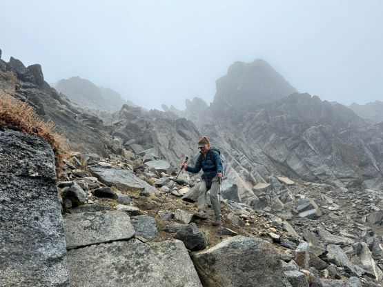
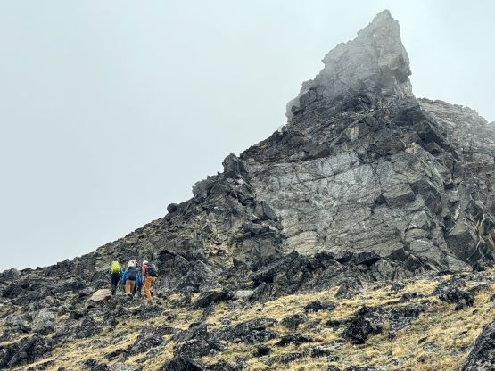
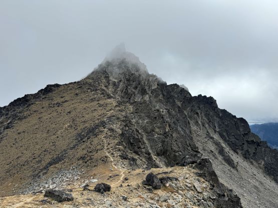
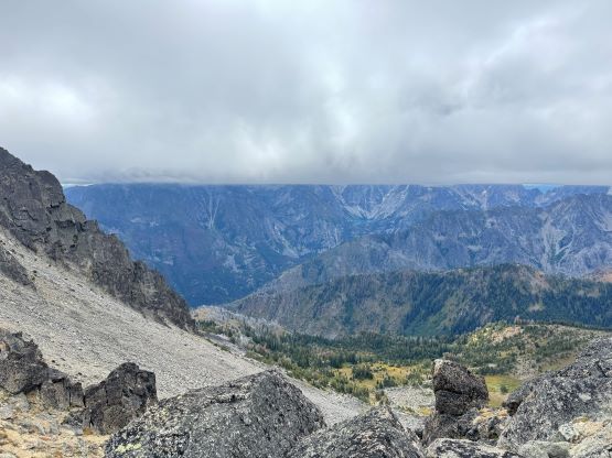
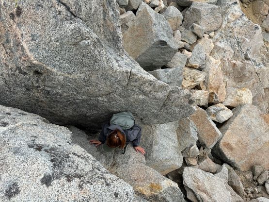
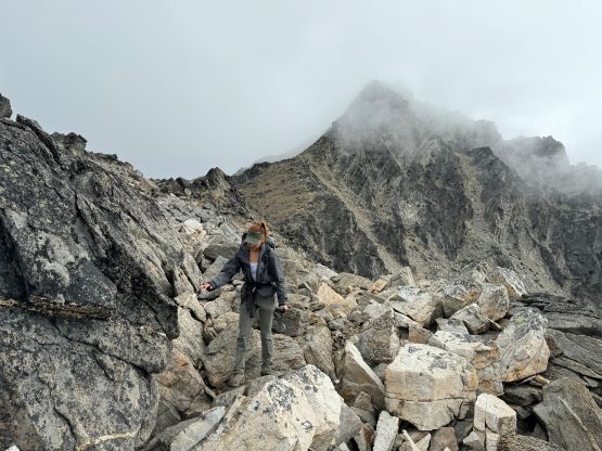
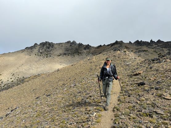
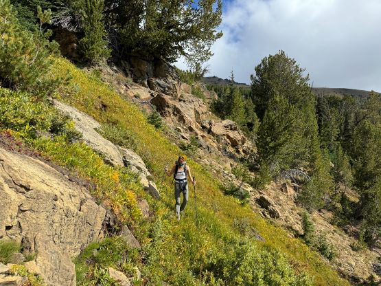
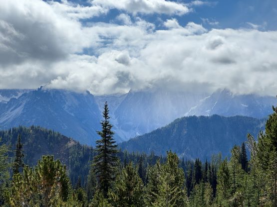
It was unclear whether we should plod all the way to Windy Pass and follow the undulating ridge, or to make a short-cut earlier. I had downloaded two sets of GPX tracks and they did not quite agree with each other. We didn’t bother to do more digging and would simply decide in situ. In this particular morning the grass was damp from the previous day’s precipitation so thrashing through the bushes wouldn’t be very smart, so we followed the trail towards Windy Pass. I made the spontaneous decision to short-cut about 50 vertical meters under the pass as we were now mostly above the vegetation zone. I led us making a mile-long side-hilling traverse due east to avoid the unnecessary elevation gain and loss on the ridge crest, and this eventually brought us to a SW trending ridge under the west peak of Cashmere Mtn. We encountered some steep side-hilling as well as some areas with damp grass but none really bothered us. The views had been exceptionally good up until this point, but the summit itself was unfortunately soaked in clouds just when we were about to start scrambling. To descend into the saddle between the west and the true summits we had to do some easy boulder-hopping with some route-finding, and then we picked up the climber’s path traversing across the north side of the west ridge. The scramble route up through a broad chute/fan to the summit was quite obvious as there were paths, cairns and even some footprints over the entire course. We eventually did one 4th class chimney but that was not entirely needed. The on-route crux should be the final airy traverse to the summit and I could see why parties had to turn around in snowy conditions. Even for us the rocks were damp and slippery.
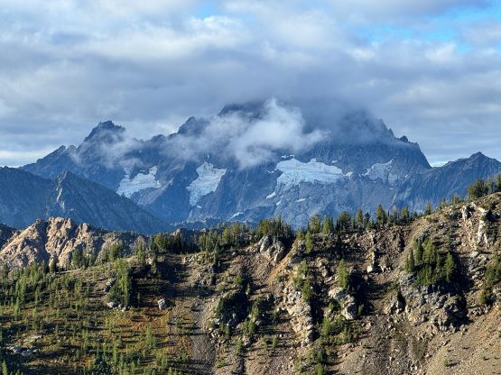


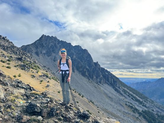


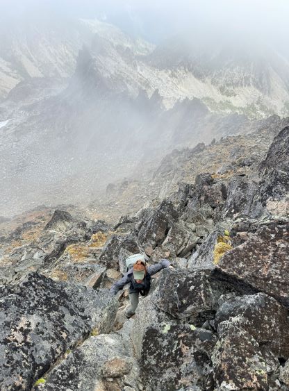

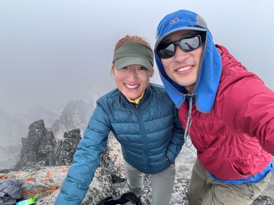
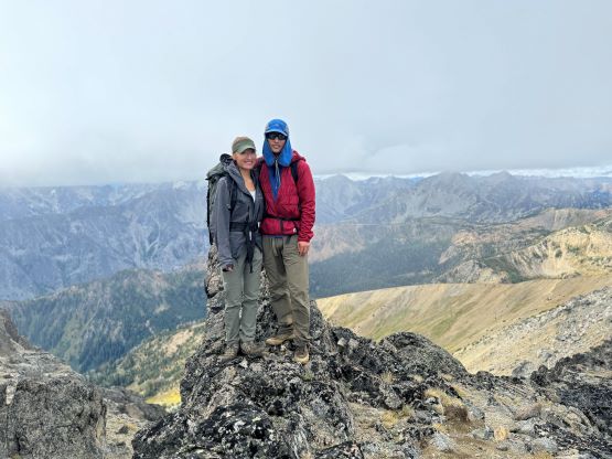
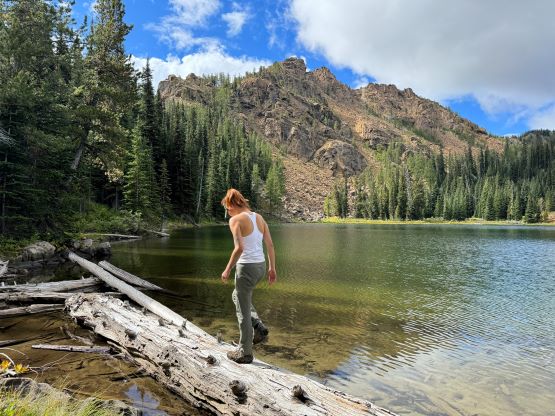
The summit had at most enough room for 2 people and we sat there for almost half an hour but the weather showed no sign of improvement. Some of the forecasts were calling for “possible snow showers” after 11 am and it was about 10:30 am now, so we decided to descend. I led us retracing the exact route we had taken including that optional 4th class crux for fun. We then came across that group-of-five near the true/west summits saddle. These people were properly geared up with boots, big packs and helmets whereas we had opted to be light-and-fast. I wore the Arc’teryx trail-runners for the whole day but Erica had developed some blisters on her heels. We picked a much better way short-cutting through that bowl on the descent. I thought we would have to bushwhack just like some of the others did, but we were able to avoid any form of bushwhacking by sticking close to a rocky ridge. I think following the GPX from my descent both ways would be the most optimal solution. We also made a spontaneous decision to check out Lake Caroline as the sun came out again and I was getting tired from the monotonous plodding. This eventually turned out to be an hour-long stop as the lake was quite beautiful in the afternoon sun. We made another stop lower down to do some stretching but then jogged the way back. Our round trip time was 8 hours 45 minutes including 2 hours of stopping time here and there. I had no idea why some parties took 9 hours just for the ascent.


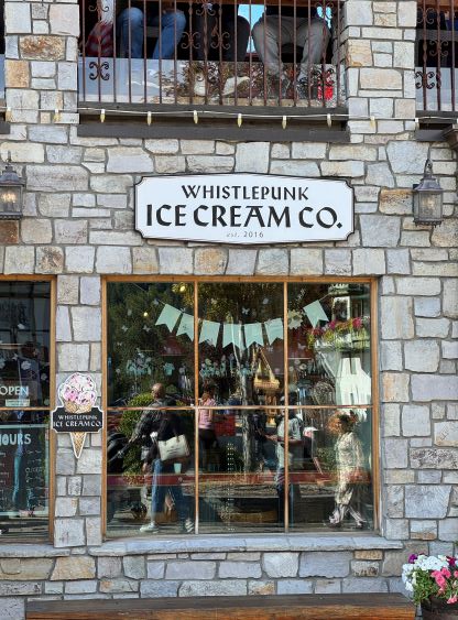
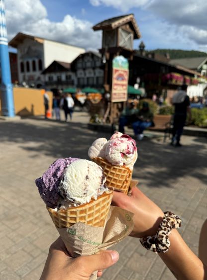
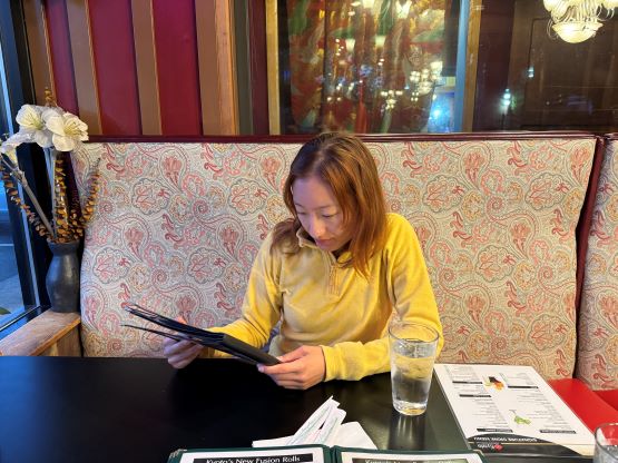
It was only 2:30 pm when we drove down that rough access road towards Leavenworth so we might as well pay another visit to the town. It was much busier than last time and we had to pay 3 dollars for an hour of parking. Even so finding a spot to park wasn’t trivial. But then the ice cream was excellent and so was the European-like experience. I think we came back to the parking lot after the 1-hour time limit but whatever. Erica and I took turn driving back to Bellingham where we stopped for dinner, and I eventually got back home at around 10 pm, completely exhausted. This was still a big day in the end but much more civilized then my previous visits to the Enchantment area.