“Cardinalis Peak”
December 6, 2023
607m
Mission, BC
The area north of Mission in Fraser Valley is the central of SW BC’s “trash bagging”. Most, if not all of the bumps in the area are forested that offer absolutely no mountaineering interest, and yet boast over 100 m prominence. Only a few of these had earned their respective official names but most of the bumps remain unnamed or unofficially-named. “Cardinalis Peak” isn’t an exception. This is one of the higher and more prominent objectives in the piece of woods sandwiched between Hatzic Prairie and the lower Stave Lake, and the access is by logging roads near the village of Steelhead. Over the past few years this peak had been explored by quite a few parties and there are two routes to consider. For those without bikes the shorter but more thrashy west slopes make more sense, but I preferred the longer and more roundabout south side route as I’d be approaching on bike.
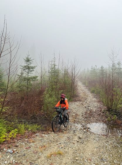
I would not waste a full day for objectives like this and in fact, I wouldn’t even bother to use a sunny morning as the summit is completely forested with no view whatsoever. The week has been quite active with a series of storms but Wednesday morning seemed to have a brief break. The forecast was calling for a tapering trend so I made the last-minute decision with Kate. We would leave White Rock at 8 am in order to start biking no later than 9:30 am. I had to be back home no later than 3:30 pm for work and I estimated the round trip to be not much more than 3 hours. It was raining when we parked in front of the gate at the start of the logging roads but I hoped it would stop soon.

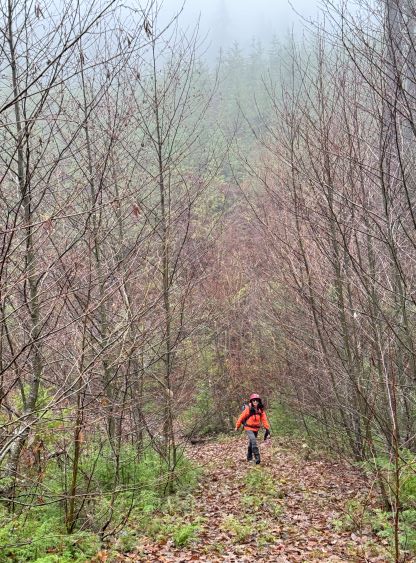
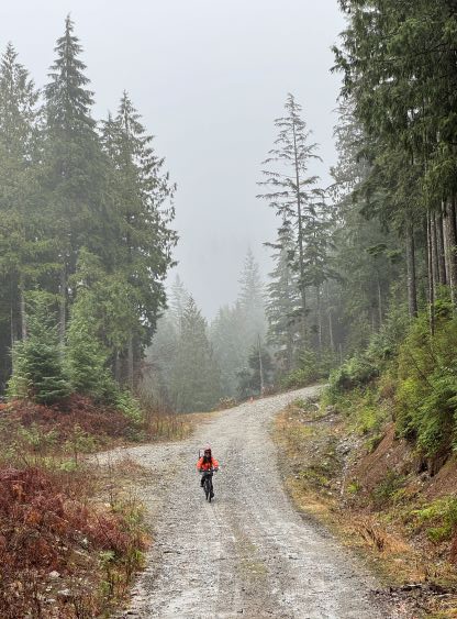
The biking portion was more difficult than I thought with numerous up-and-downs (that would be tiring on the return), and a few extremely steep sections that necessitated pushing even for me. Kate’s bike still costs over a thousand dollars so it’s not the usual cheap shit that I observed from most of my other friends, but Kate’s bike isn’t built for riding on rough terrain. As a result she was still suffering a lot trying to keep up with me, which was not to my surprise. There’s at least 50 m elevation loss from the point where the two routes diverge to wrap around the south side of the peak, and the FSRs were becoming increasingly rough and overgrown. The final kilometer was so rough that I called Kate to ditch her bike, whereas I stubbornly pushed my bike further, on mostly rocks while dodging the alder branches. I knew I could ride down this kind of stuffs (slowly with care) so I might as well make the most use of the fatbike. There’s no point in following the road to the very end as the south-east side of the summit offers the more direct attack, so I ditched the bike about 200 m from the road’s end, and then we dived into the forest.


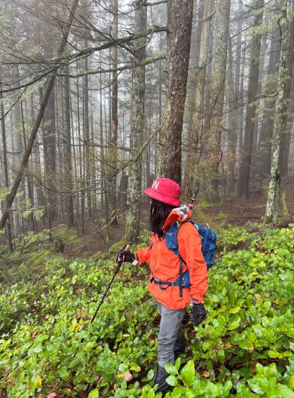
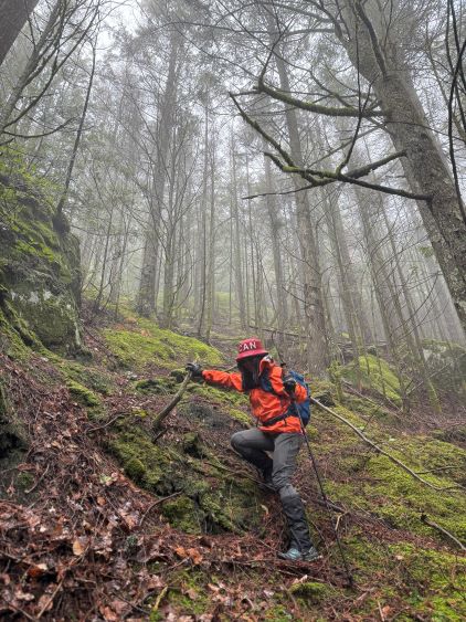
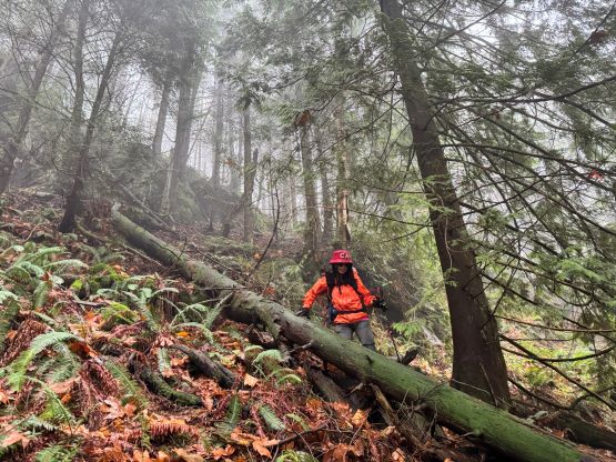
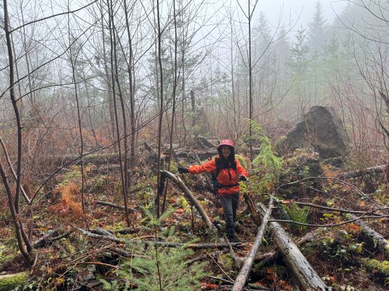
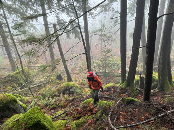
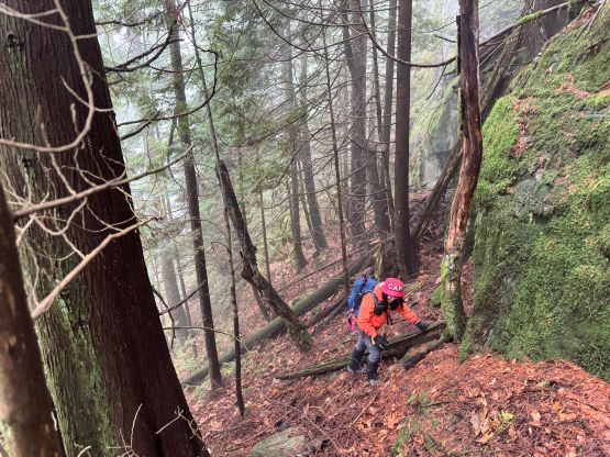
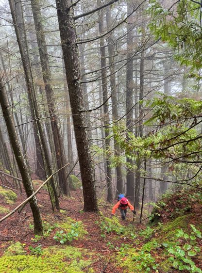
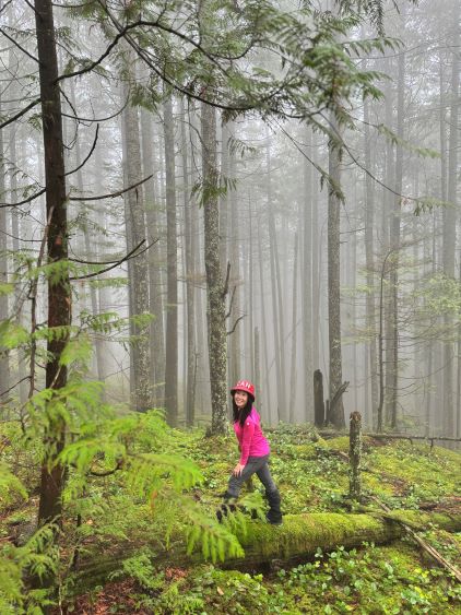
I anticipated some bad bushwhacking by reading some of the other reports but at least a few reports mentioned “not as bad as they thought”. I would tend to agree with the latter. The worst thrashing was a 10-meter band of brambles and dead-falls right at the start as the roadside is exposed to sunlight. As soon as we entered the forest the bushwhacking had become almost non-existing. There were occasional dead-falls in addition to one or two bluffs but that’s it. The slope was indeed as steep as most people made it sound like, but that’s to be expected on trips like this. We are thrashing in BC’s coast, after all. Nearing the summit we started to encounter salal and that added a little bit to the overall resistance, but the thrashing in salal wasn’t continuous. We could always link up patches of open forest. There’s no confusion about the exact location of the true summit as it’s rather obvious, but as expected, there’s no view.


On the descent I led us retracing the exact route that we took on the way up, that in short time we had exited the forest. I carefully rode my bike down to Kate’s ditched bike. As expected Kate’s bike wasn’t very suitable on trips like this, that she ended up taking a few crashes in addition to having to walk the bike down that couple steep rolls. With a better bike we could have ridden the entire way out in a single shot, but we nevertheless finished the round trip in just over 3 hours. Without wasting time I immediately drove us back to White Rock. Kate offered lunch in her house, and I did end up being on time for work, but not with a lot of margin.