Cadwallader Peak and Sunshine Mountain
July 12, 2023
2608m
Bralorne / Hurley FSR, BC
The original name of the highest peak in Cadwallader Range is “Crazy Mountain” but bivouac.com somehow decided to switch it to “Cadwallader Peak” probably because of simplicity. Either way it’s an unofficial name but the peak boasts over 700 m prominence and an impressive profile. The ascent is a straightforward scramble by plodding up and over Sunshine Mountain and the trail-head is easily accessible from Bralorne and is even facilitated with a cabin. Apparently the locals frequent the zone in both summer (on dirt bikes) and winter (on snowmobiles) but this area isn’t often heard on the internet. A few years ago a group of prolific peak-baggers in the SW BC community scrambled “Cadwallader Peak” and that’s it. This year Matt J. made an ascent. I wanted to use Matt’s recent beta and convinced Chris Gulka to join. Chris had never even visited the Hurley area and was keen to explore. Asides downloading Matt’s GPX track we did no research as the peak’s already snow free and the scrambling would not exceed 3rd class and only for a brief section.
I offered to drive us there but I said we should sleep in the truck at the trail-head. The weather forecast was calling for thunderstorms in the afternoon and we wanted to be off the mountain as early as possible. Chris and I then left Vancouver at around 8:30 pm and drove up and over the Hurley at midnight. The road was in an “averaged” shape. I was never stoked about driving this road but we made it through nonetheless. Using the GPS maps we correctly located the spur road heading to the cabin. There were numerous cross ditches and to drive to the cabin one needs a 4×4, high clearance vehicle. Those ditches imposed no problem to the Tacoma. Instead of sleeping in the truck we discovered several couches inside the cabin and opted to sleep there. That was a good call as the sleep was awesome. One random person on the internet then educated me it’s “not permitted” to camp in this cabin. My suggestion is to tell the owner to lock it or put a big and obvious sign saying “no overnight stay” or something like that.
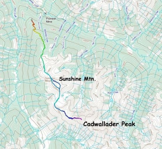
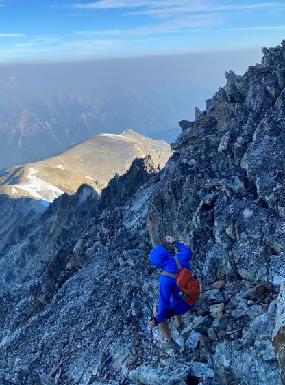
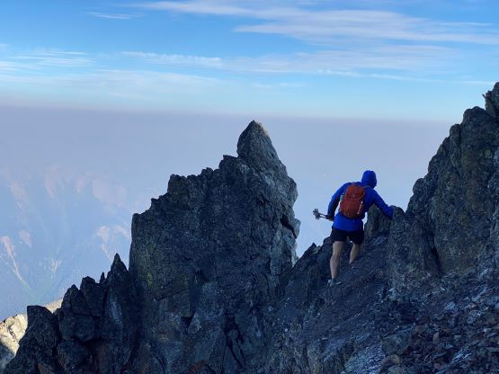
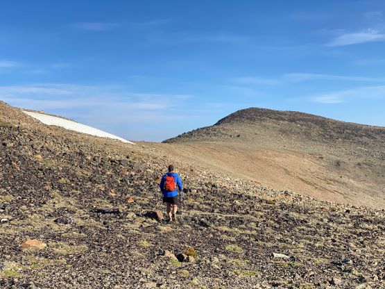
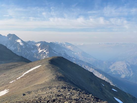
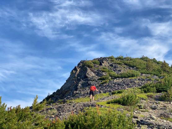
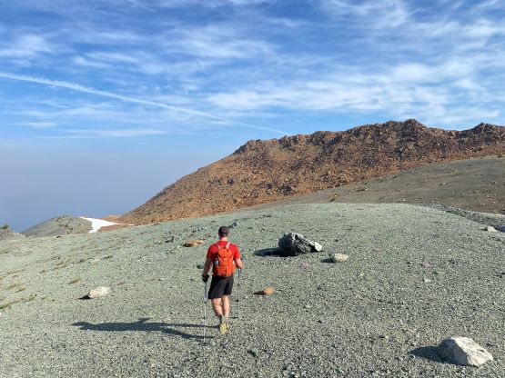
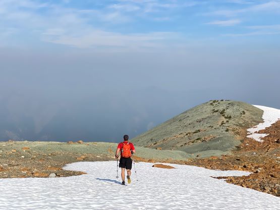
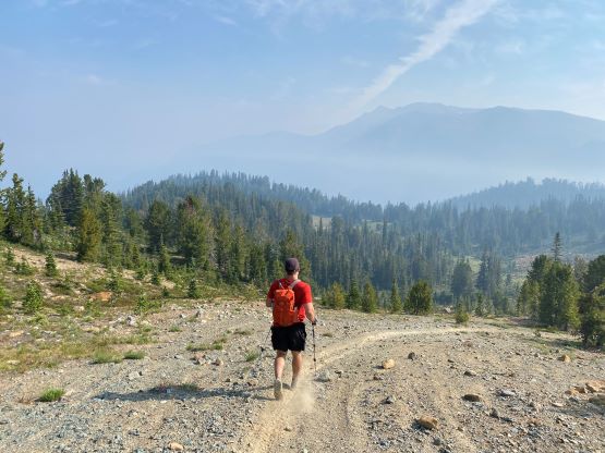
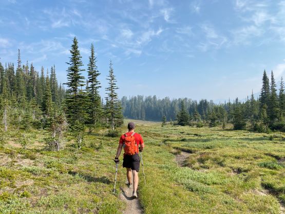
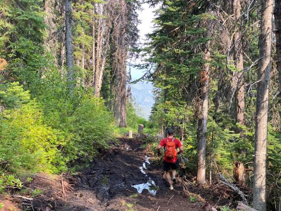
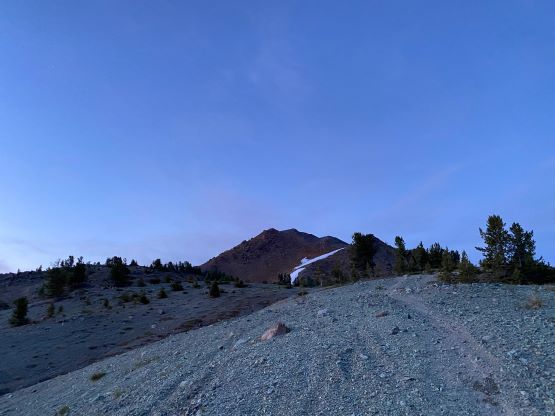
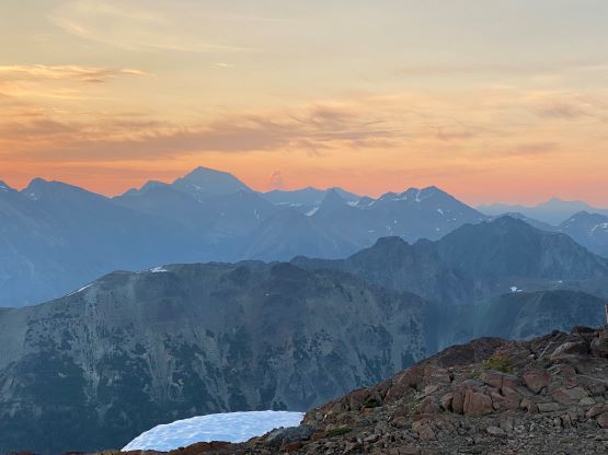
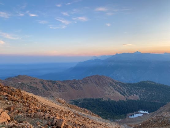
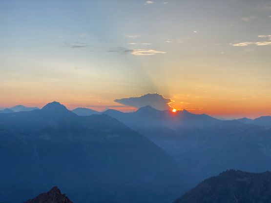
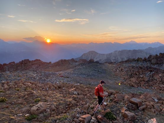
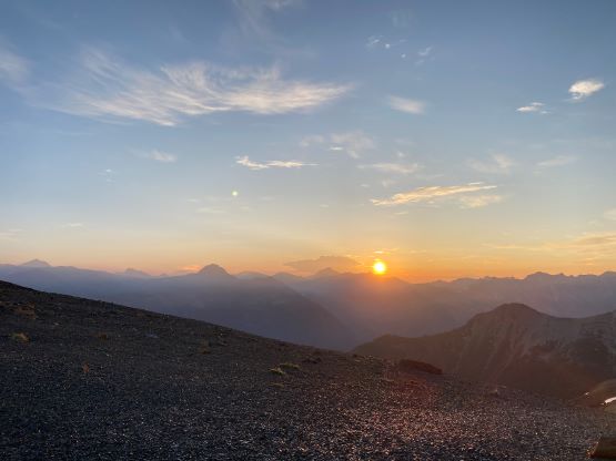
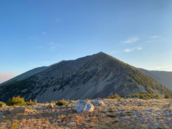
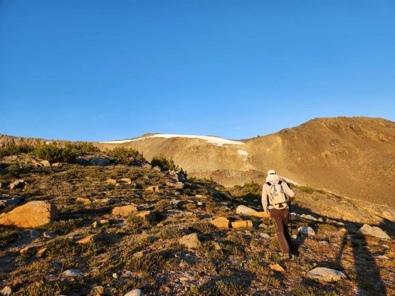
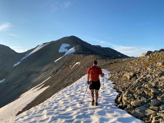
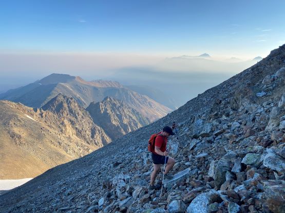
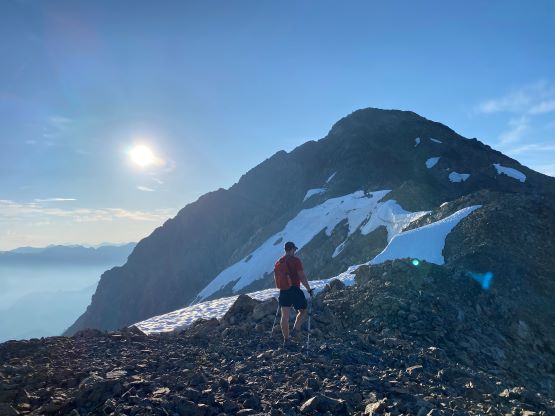
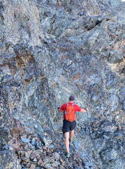
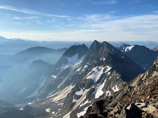
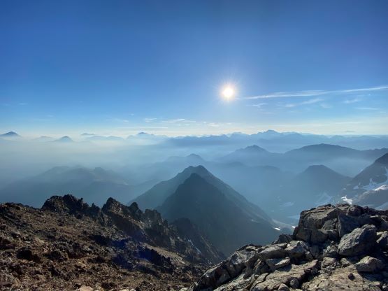
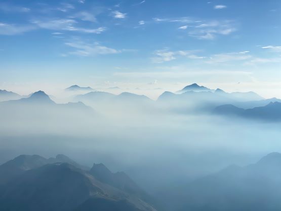
The alarms were set at 3:30 am and we managed to get going in just over half an hour. Chris couldn’t find his head-lamp but I had a spare one in the duffle bag that I always bring in these kind of trips. Without the spare head-lamp we probably would have to start at least an hour later, ruining the plan to watch sunrise from up high. The trail is essentially an ATV/dirt-bike road and I agreed with Matt J. that it’s mostly for dirt bikes as some parts of the road/trail are rather narrow. We bolted up at a fast pace and in no time we had gained 500 m elevation into the sub-alpine meadows. We finally no longer needed the head-lamps and followed Matt’s track traversing around the northern sub-summit of Sunshine Mtn. This stretch had one bad section with moraine type of choss, but otherwise was straightforward and efficient. Instead of taking the full “Sunshine bypass ledge” we scrambled onto the NW Ridge of Sunshine Mtn. and followed the ridge all the way to the summit. We arrived at the summit minutes before the sunrise.
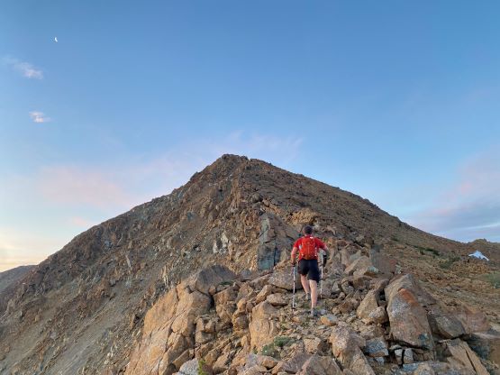
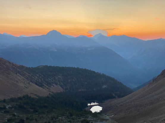
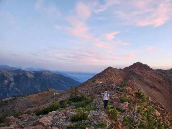
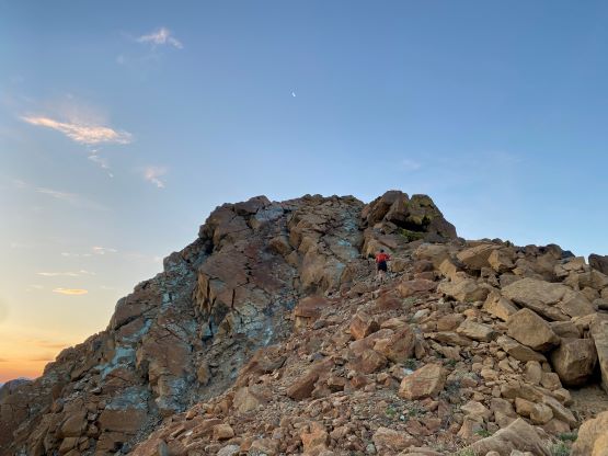
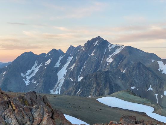
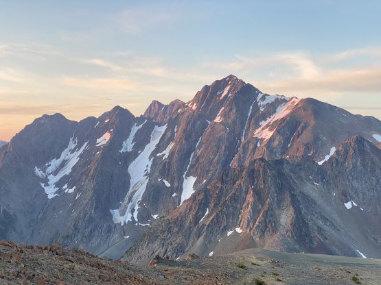
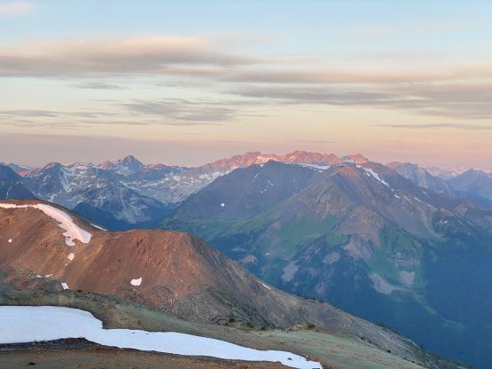
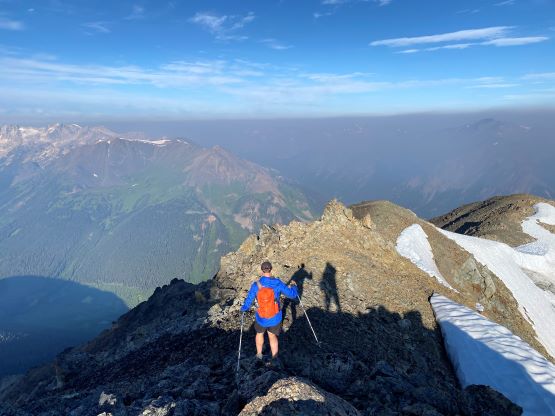
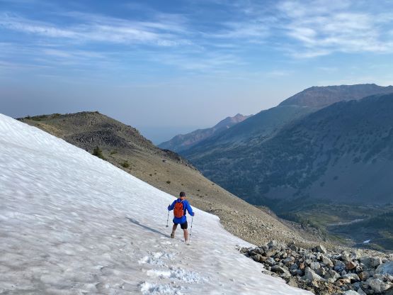
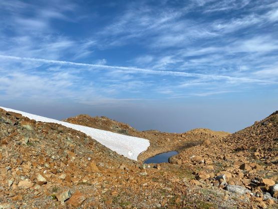
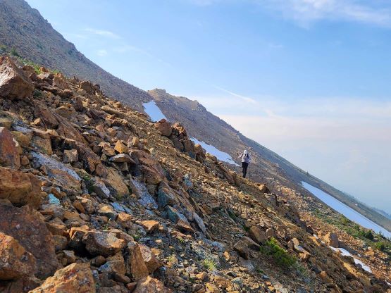
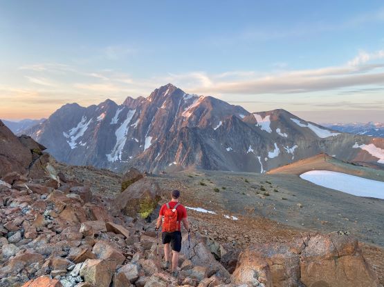
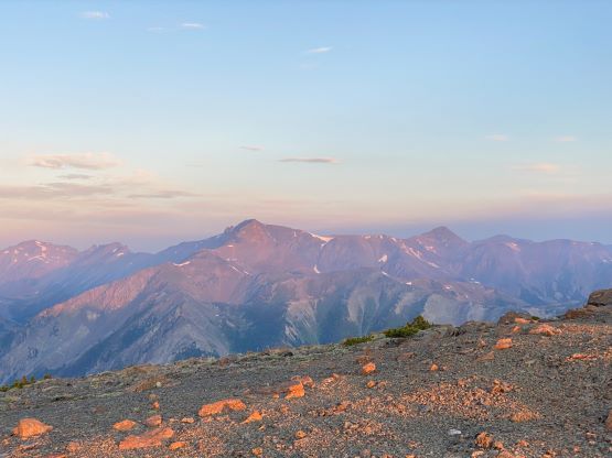
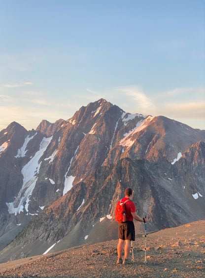
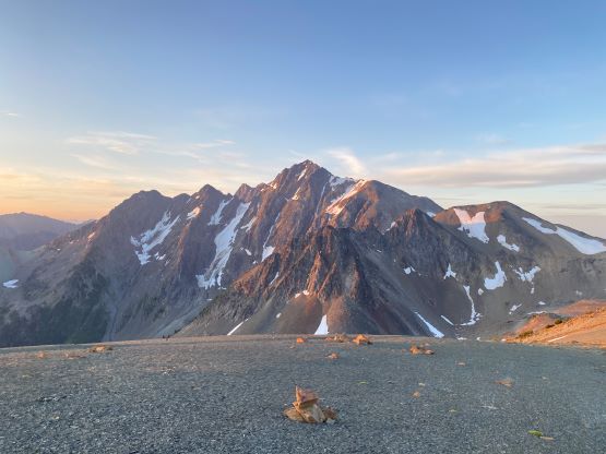
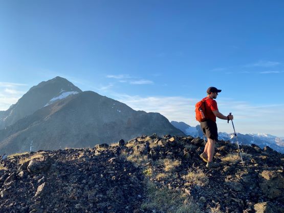
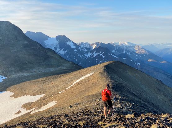
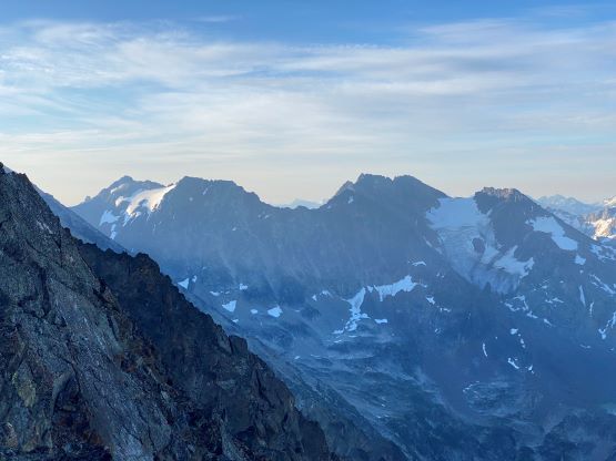
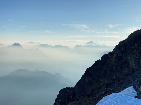
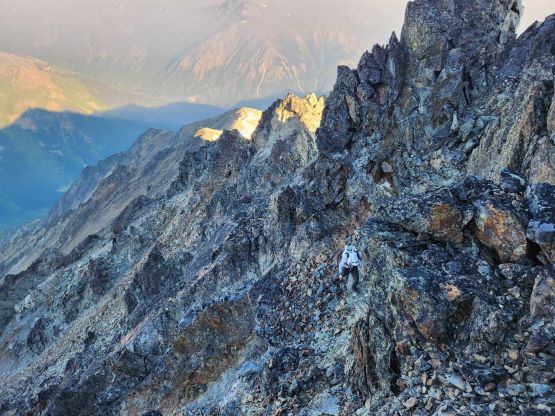
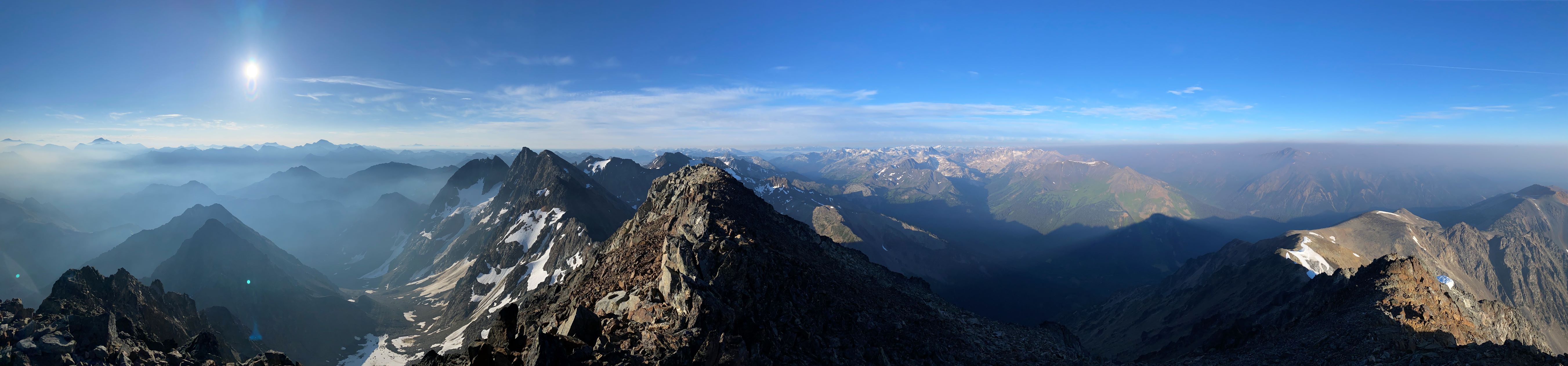
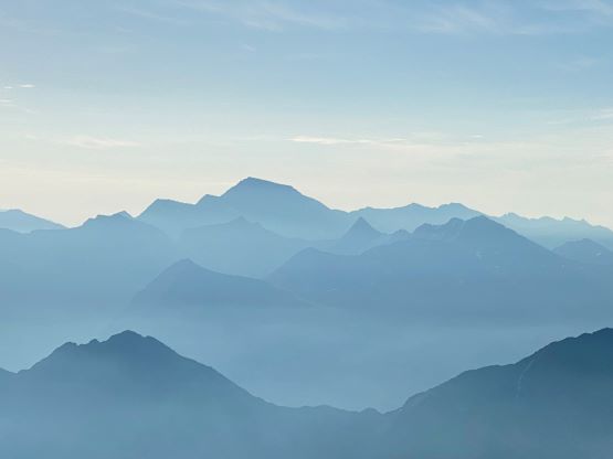
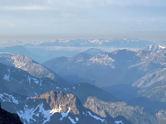
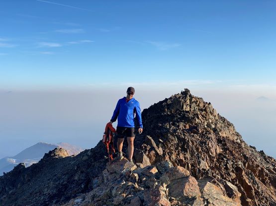
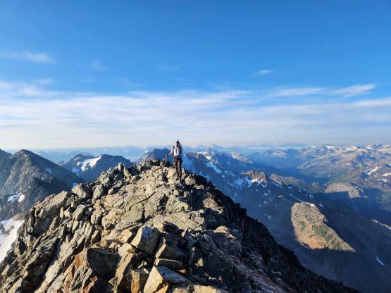
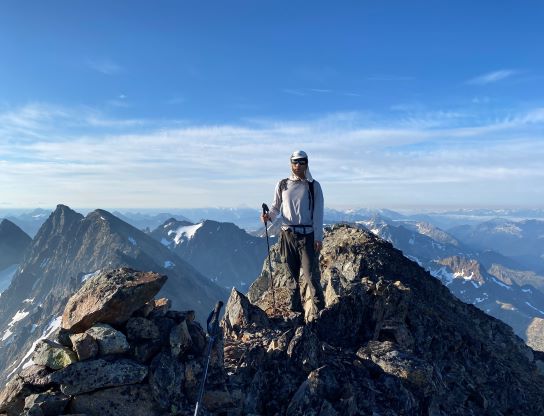
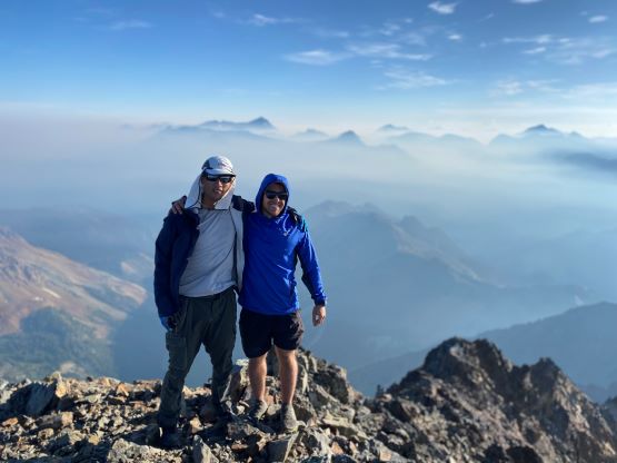
Not doing any lingering we resumed the traverse over the summit, descending the exact opposite ridge which merged down onto the south ridge. We had to descend over 200 m down to Sunshine/Cadwallader saddle and this section could not be avoided, meaning we must regain most of the elevation back a few hours later. We finally decided to take the first break in this day, at the low saddle, donning sun protection and drinking some water. To gain the NW Ridge of Cadwallader Peak was easier than appeared with only some choss and a brief snow slope crossing. The plod across the entire NW/W Ridge system was simple except for the final bits where we had to traverse into and across several gullies on climber’s right side. The scrambling was class 3 but very brief, with only some exposure. Nearing the summit I sped up because I knew our time would come close to Matt’s 2 hours 55 minutes. We ended up making the summit from the truck in 2 hours 59 minutes including the additional peak. We also went further along the ridge to check out some additional views before settling for a short break.
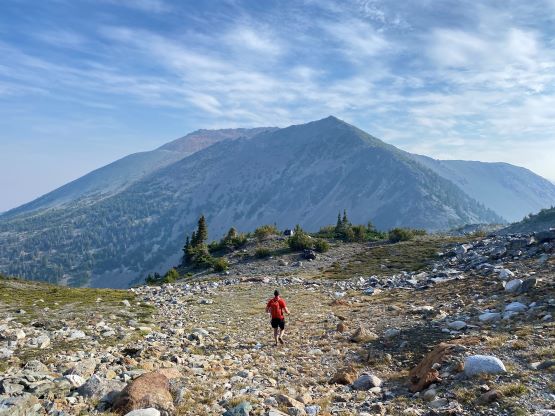
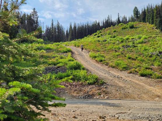
Chris led most of the way down, jogging as much as possible and I generally had to try hard to keep up the pace. I was able to jog down some parts but not all of the downhills. In no time we were back to Sunshine/Cadwallader saddle and faced that annoying 200-m elevation regain. I could finally no longer keep up the pace, so went at my own pace here. Chris had been a beast on this day because not many people could outrun me on the uphill sections. We then took Matt’s “sunshine bypass” ledge to avoid retagging the summit of that bump. The bypass ledge traversed around the mountain awesomely but we still had to cross that chossy gully, which was bad, but not too bad. The rest of the descent involved mostly trail-running and our round trip time was under 6 hours. We were back to the truck at 9:45 am and the weather was still completely sunny. It turned out that the car-camping, the early start and the fast pace was totally unnecessary for the purpose of dodging thunderstorms, but it was good to watch sunrise from up high on Sunshine Mountain. The drive was long and exhausting and the traffic was horrendous after entering the city. It took me over 2 hours to drive from North Vancouver to White Rock and this was as slow as I could remember in recent history.