Borah Peak and Sacajawea Peak
July 19, 2025
3861m
Lost River Range, ID
Over the past decade I had done several major road-trips down I-84 corridor towards Idaho, Utah and Nevada but none was in summer. Borah Peak is the highest in Idaho and is not suitable as a winter ascent due to the 3rd class scrambling sections on the “Chicken Out Ridge” which is the standard route. I’ve been contemplating making a summer road trip down that way, using Borah Peak as an acclimatization objective for taller peaks in Wyoming, Montana and/or Colorado and the trigger was finally pulled in July 2025 with Erica. We together had about a week and the weather suggested us to drive farther away from home. The first objective would be Borah Peak but upon further research I noticed an interesting looking secondary objective named Sacajawea Peak that could be combined with Borah Peak’s ascent. This is not to be confused with the P1500m Sacajawea Peak in Oregon which Erica and I bagged a few weeks ago, by pure coincidence. This one is the 13th highest peak in Idaho. It doesn’t catch that much attention from the community as it’s not an ID-12er and the logistically-easier NW Ridge is way above the paygrade for most of the Borah Peak’s summitters.
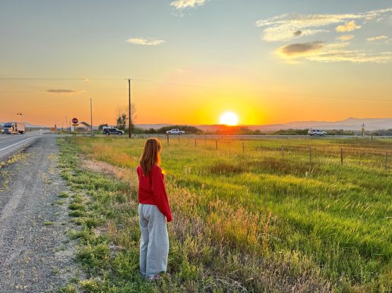
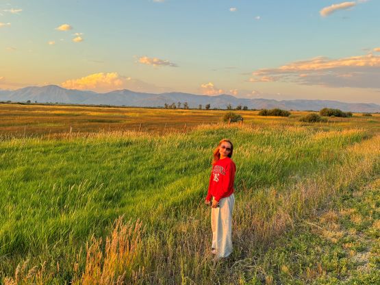
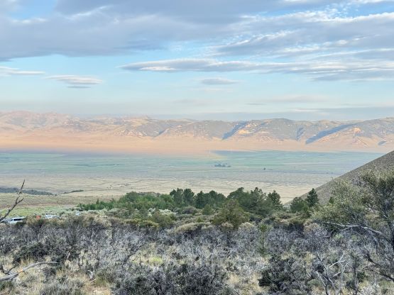
I was originally thinking to tag a bonus peak or two on the driving day but apparently I underestimated the driving distance. Without taking in account the traffics, border delays and gas/food stops the drive would take 13.5 hours so we had to budget at least 15 hours for the day. The bonus peaks would have to wait, but that’s alright. There’s actually not that much worth documenting about this driving day as it’s rather uneventful. Erica and I left home at 7 am and the traffics through Seattle was not too terrible. I eventually got too tired to drive and Erica took over for the portion between Pendleton and Baker City. The scenery improved after we left I-84 at Mountain Home in Idaho and we stopped a few times for the views. We eventually pulled into the trail-head at 11:30 pm and an asshole came out of his van to welcome us with a loads of 4-letter words and his flashlight pointing straight on my face. I assumed that the Americans had their guns so didn’t want to make any arguments. I did make sure to check his license plate and not to our surprise, he’s from Idaho. Thankfully we met a bunch of friendly hikers from the local areas during the day so hopefully this shitty guy was just an exception. This trail-head was busy as hell as at least 50 people were there sleeping in the vehicles.
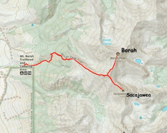
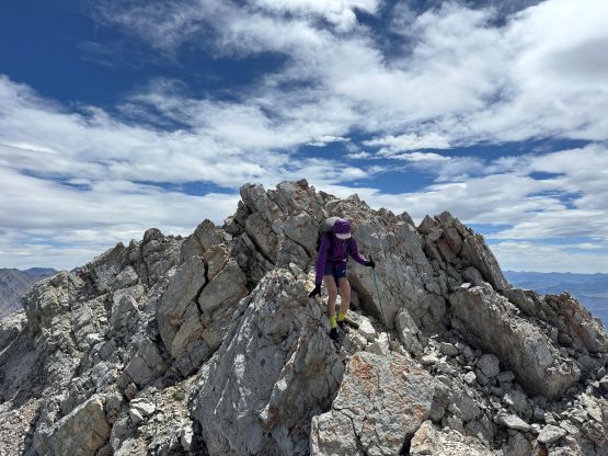
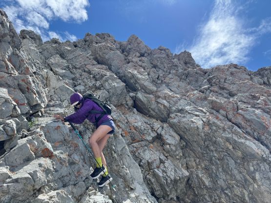
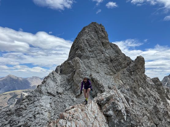
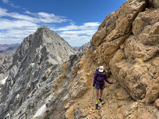
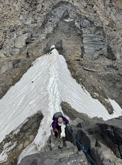
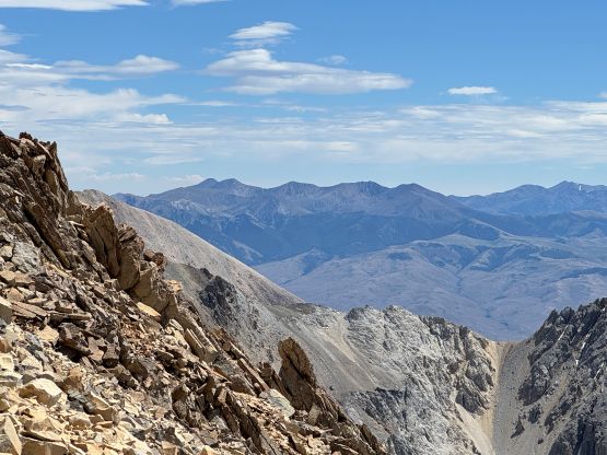
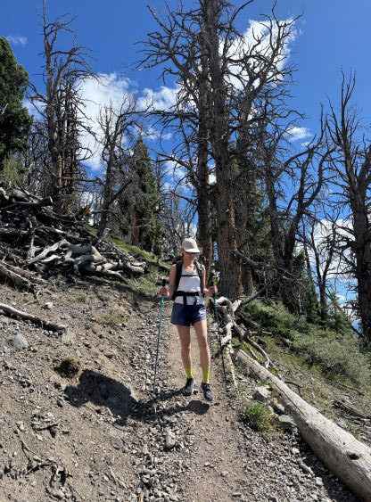
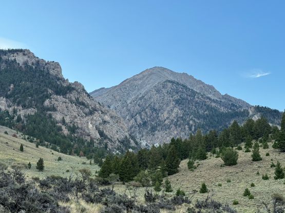
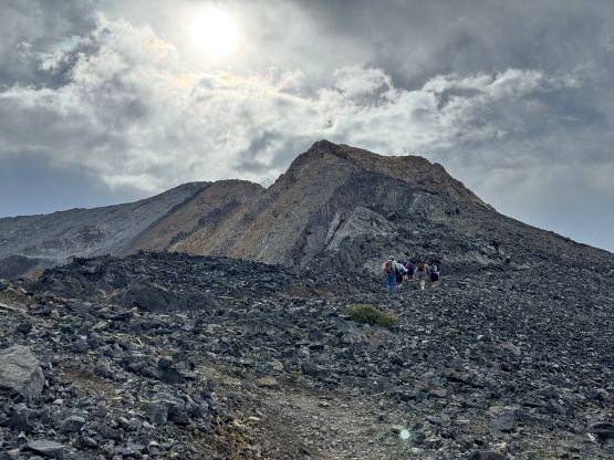
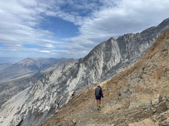
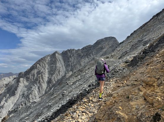
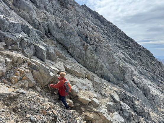
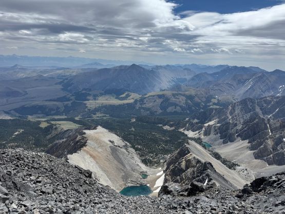
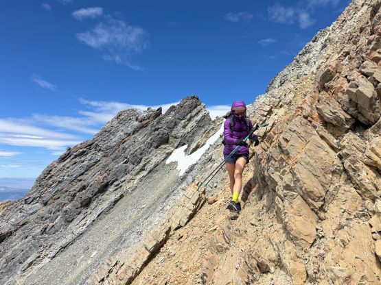
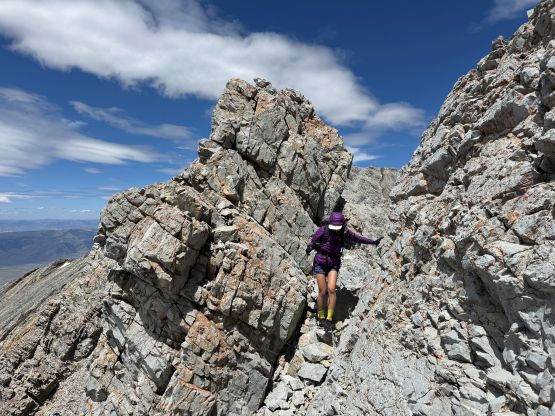
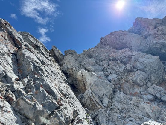
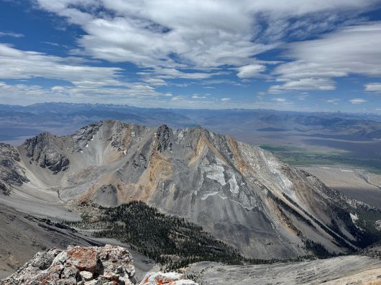
The weather forecast was not calling for the afternoon thunderstorms on this particular day so we didn’t feel the need to do an “alpine start”. Almost everyone else started somewhere between 4 and 6 am but we opted to wake up at 6 am in order to start hiking by 7 am. We were basically the last group leaving the trail-head but don’t worry, we would catch up and pass a bunch of them even though we were technically in the “acclimatization” phase. The weather was overcast and windy so I threw a pair of gloves into the pack at the very last minute, which turned out to be critical. We were both feeling the altitude so as planned, we plodded at a slow pace and made sure to stop for a break for ever 300 m elevation gain. By the time we reached the treeline at 3000 m elevation we had already passed a few groups. The next stage had some steady elevation gain and the terrain was generally “easy” with no scrambling whatsoever. Looking ahead we could see the high clouds finally dissipating but the winds were not dying down. The “Chicken Out Ridge” was more or less a joke, as we only found a few spots of hands-on scrambling near the top of the section and those could hardly be classified as “class 3”. At one point we followed some paths traversing climber’s left and ascended on the left (north) side of the ridge for a long while. This terminated at the crux down-climb with a fixed batman rope. Looking ahead we could see a steep snow gully extending all the way to the notch at that fixed rope. Someone had dropped his/her trekking pole into the snow gully and we wanted to check if it’s possible to retrieve, by traversing a few meters underneath the down-climb. This actually got us bypassed it. The snow was soft so we simply kicked steps across.
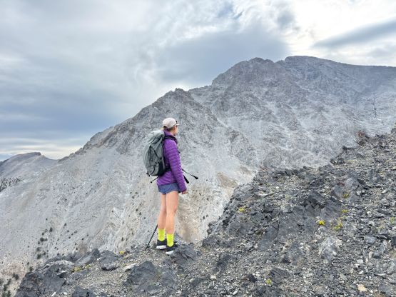
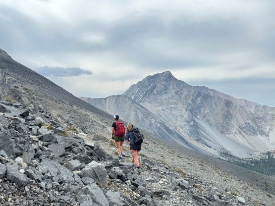
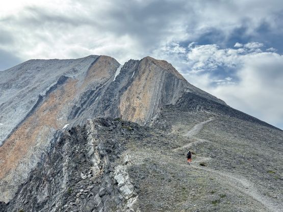
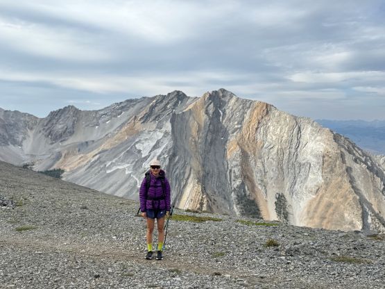
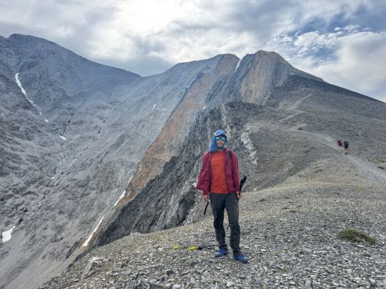
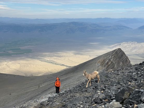
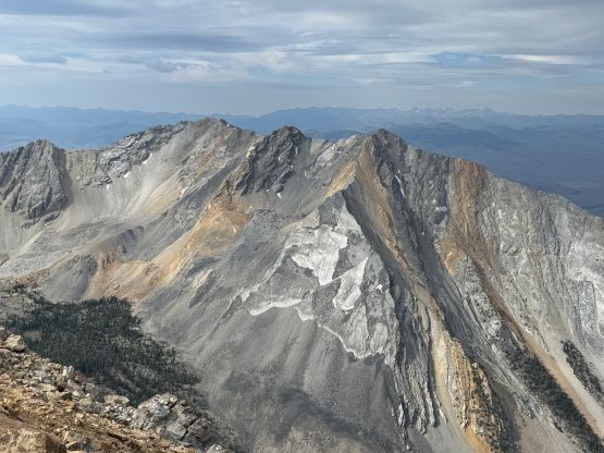
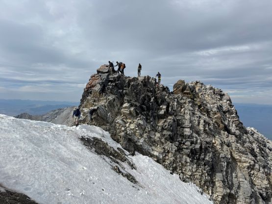
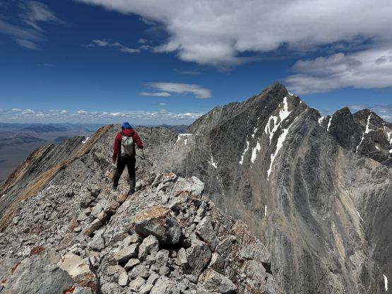
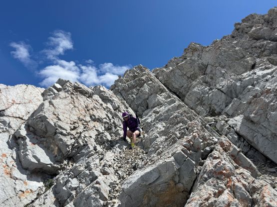
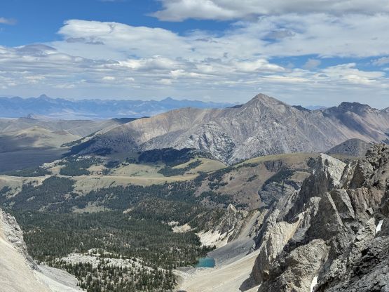
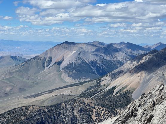
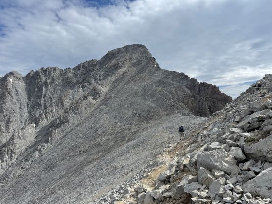
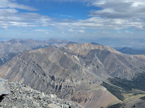
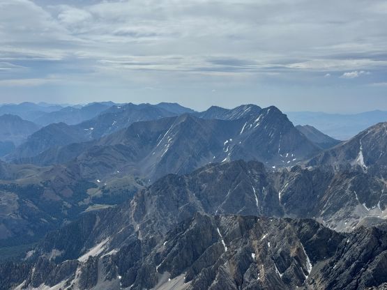
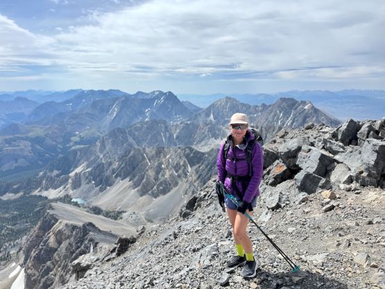
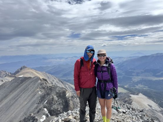
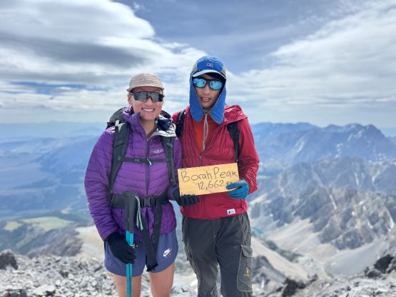
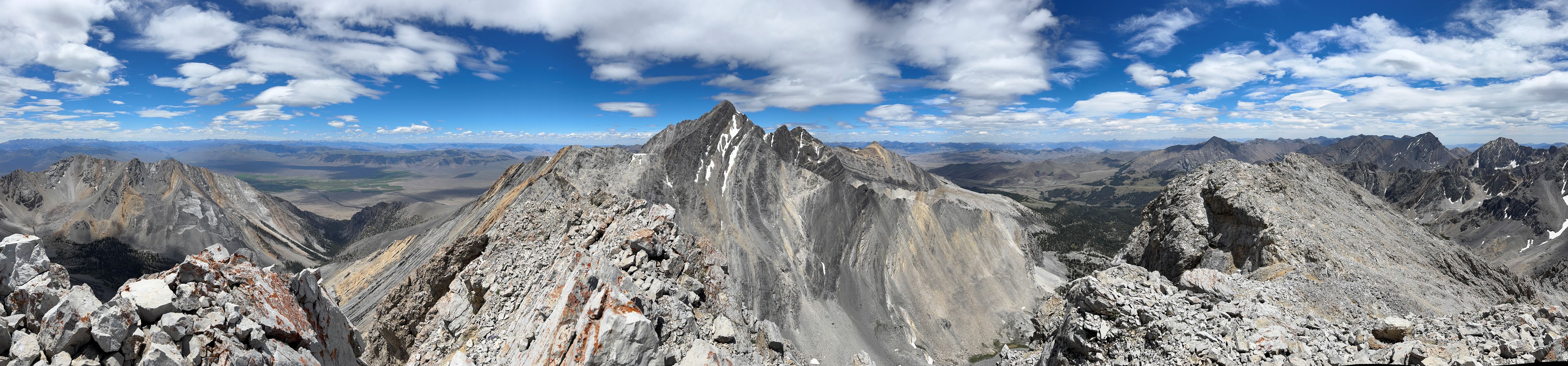
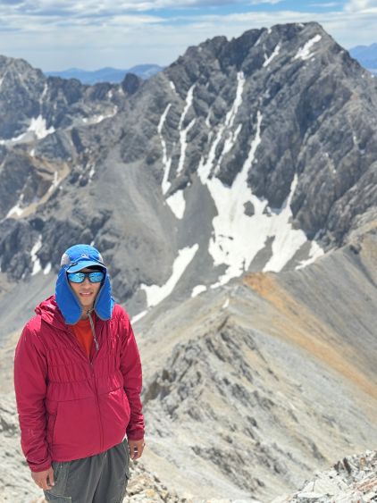
We then followed the obvious trail traversing the west (climber’s left) side of the ridge heading towards the final saddle on Borah Peak’s south ridge. This section was easy but very scenic, but the winds were still not dying down. The strongest gusts were around the south ridge saddle and I was forced to take my gloves out long before that. The south ridge of Borah Peak was rather trivial with only a few sections of hands-on (class 2) scrambling with some loose rocks. Managing rockfall with a gang of people might be the hardest aspect. The view was quite foreshortened though, so it took us a long while to reach the summit. We even took a break about 100 m underneath the summit, mostly for acclimatization purposes. Thankfully we were able to find some sheltered spots east of the highest point on the summit “area” so stayed there for at least 40 minutes soaking in the views.
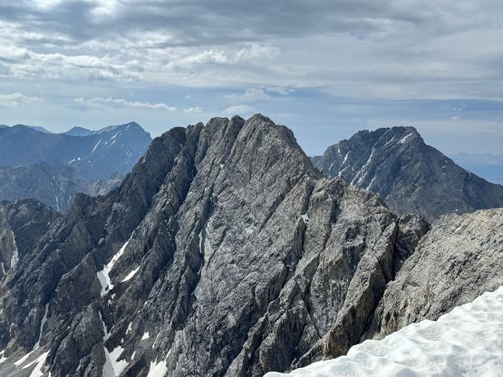
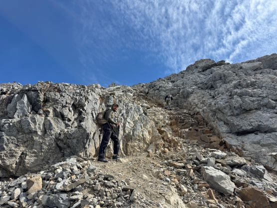

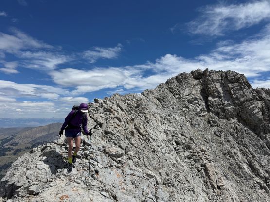
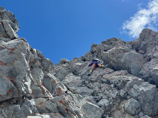
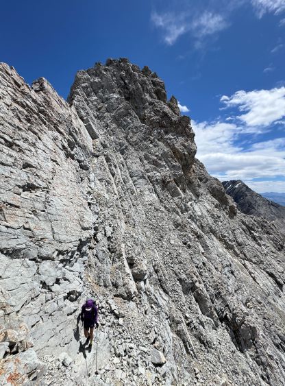
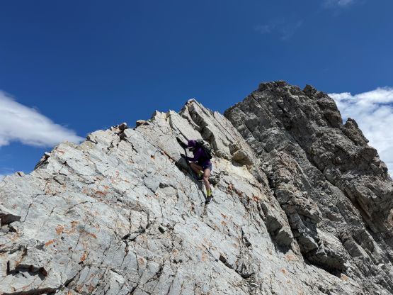
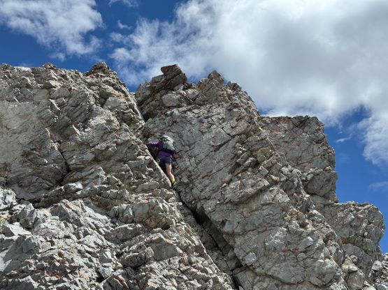
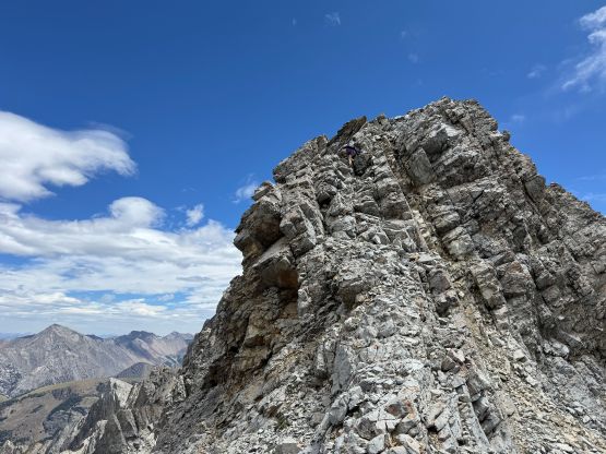
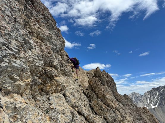
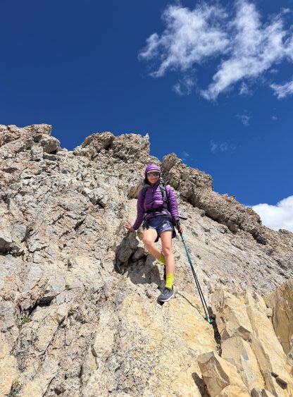
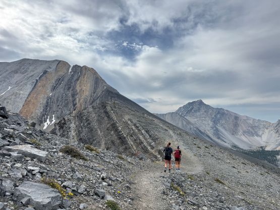
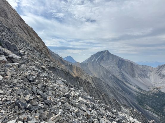
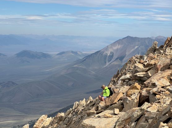
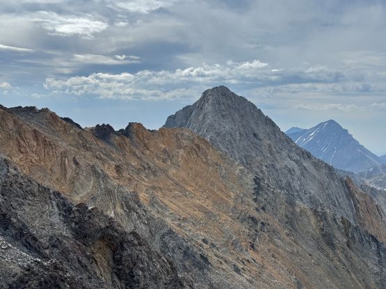
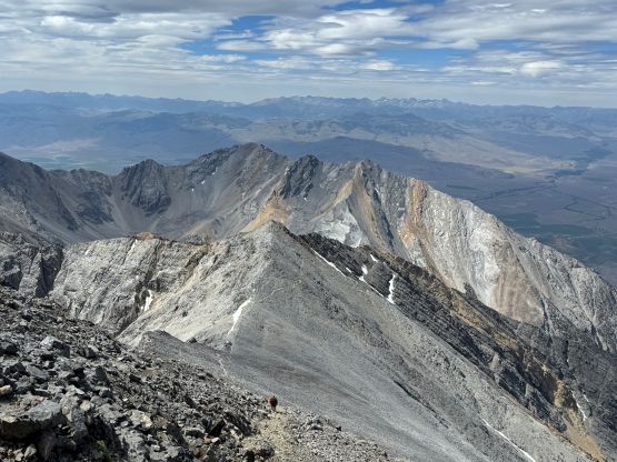
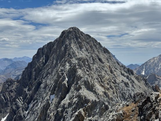
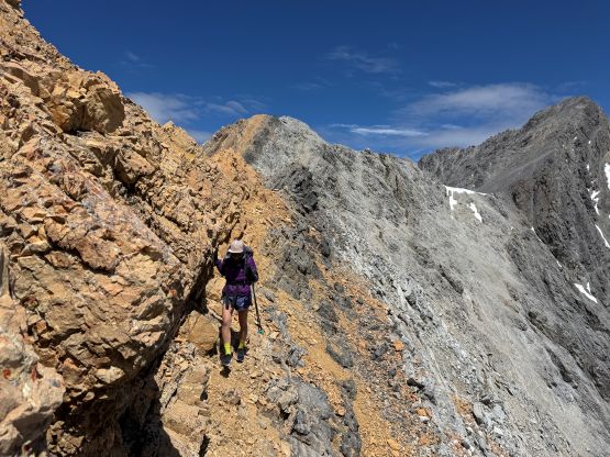
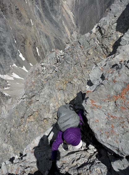
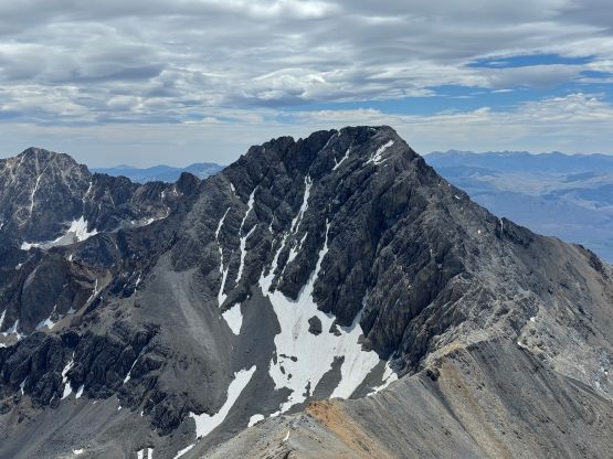
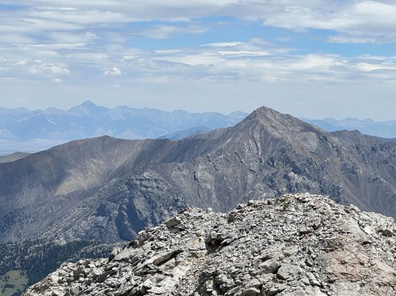
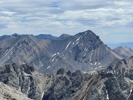
I still wanted to climb Sacajawea Peak so after taking in enough of the views we started the descent. In short time we were back to the top of the “Chicken Out Ridge”. To get to the traverse towards Sacajawea Peak we had to touch the snow briefly but as mentioned earlier, the snow was soft and imposed no problem. This initial traverse across several loose gullies was not as straightforward as I thought, mostly due to route-finding. It’s almost impossible to figure out the “best way” on sight, even with a GPX track in hand. After gaining the ridge the scrambling difficulty eased briefly but picked up again near the lowest point in Borah/Sacajawea saddle, where we must do some serious route-finding around some jagged sections. The ridge had turned into some knife edges that we couldn’t stay entirely on top. Upwards onto the NW Ridge of Sacajawea Peak the scrambling was again, mostly 3rd class with some exposure but we encountered several steep steps and the route-finding was not obvious. I agreed with the others that the crux was the final headwall near the summit where several 4th class moves were unavoidable. The rock quality felt like what one would typically expect from a chossy peak in Kananaskis of the Alberta Rockies. The final bits to the true summit was also longer than I thought with one more notch to traverse across, so this scramble was quite involved. This explained why we were the first party to sign Sacajawea Peak’s register in 2025 but I’m sure others had been up here in recent months.

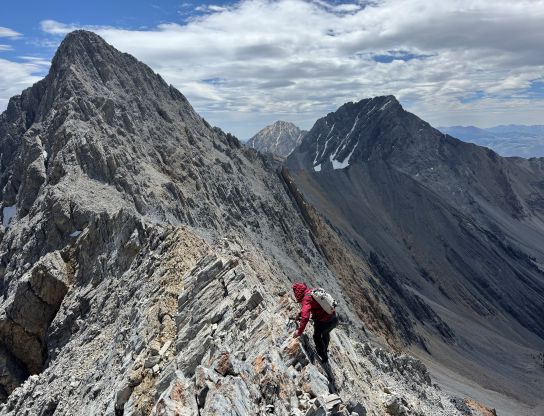
We were both getting tired at this point but the descent of Sacajawea Peak required lots of caution. We took our time and after what seemed like eternity we were back on Borah Peak’s “chicken out ridge”. By this point we had gained almost 1800 m elevation and this was supposed to be just an “acclimatization day”. We jugged up the fixed rope on the return and quickly realized that we were already the last group descending Borah Peak, but don’t worry as we would catch up and pass a bunch of them (again). Minutes after finishing the scrambling section we took the last break of the day consuming the last few droplets of the water that we had brought. We each brought 3 L but that was not enough for a 10-hour day at this altitude. After lightening the packs we practiced some trail running in the heat and the purpose was to get back to the vehicle as quickly as possible to rehydrate. We then drove down to the town of Arco to refill, and then drove a long ways NE towards Diamond Peak’s trail-head.