Akbaba Tepesi
July 18, 2024
3457m
Erzincan, Turkey
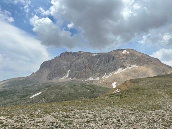
Akbaba Tepesi is one of the two “ultra prominent peaks” in the vicinity of Erzincan in eastern Turkey and this one is more mysterious than the other. Rob W. and team had made an attempt over a decade ago but failed due to terrorism activities in the region. Petter B. made a successful ascent a few years ago through the local mountaineering club and Petter’s route is considerably shorter than the “standard” east side route with half of the elevation shaved off by driving. The access was still very much of an unknown because the roads were not labelled on the various maps and in fact, the upper parts of this road was not even shown on any of the satellite images. It had been a few years since Petter’s trip and who knows if the roads were still existing. In any case Rob came back to make another attempt and this time Deividas, Dave, Adam and I would join, and we used the company “Ararat Climb” to help arranging the logistics. Through this company we were directed to the local guide, Yildirim and this guy helped to find two drivers with two (sort of) capable vehicles to transport the five of us together. Yildirim had no clue about Petter’s route but Deividas was successful in convincing him to at least give it a try. The communication was difficult, but at least we were able to make a rough plan. The price was ridiculous as we each paid ~330 USD and that did not include the hotel stays. This was nowhere the most expensive trip I’ve done but for the amount of money we paid all together we would expect the quality of the services to be better, but it is what it is. We needed this peak and we had very little “beta”, so they could charge us whatever they wanted.
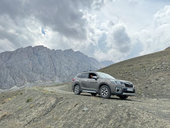
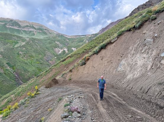
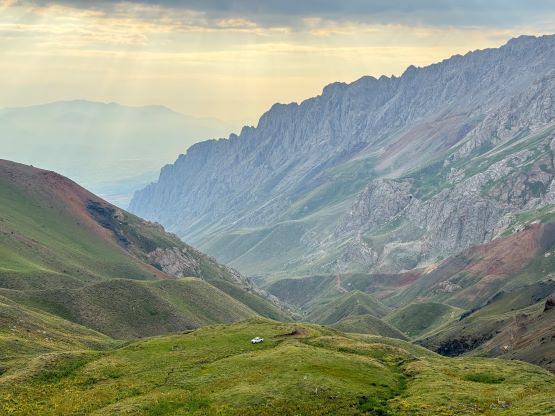
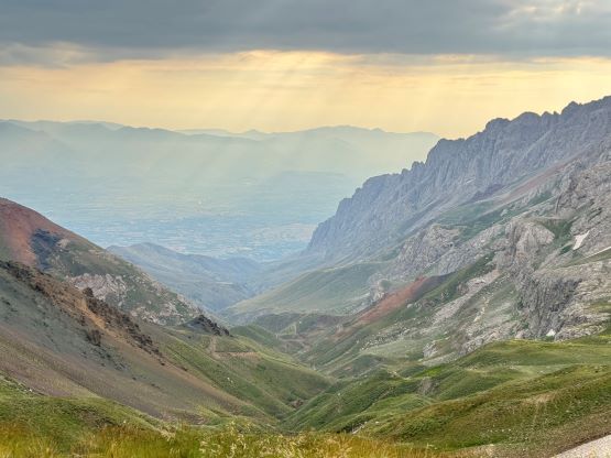
The plan was made to meet up in front of the hotel at 4:30 am and the guide and the drivers did show up in time. Adam was unfortunately still sick and decided to stay in the hotel. The guiding company refused to give him any refund which I thought was not very nice. Deividas, Rob and I got into the Mitsubishi pick-up truck whereas Dave opted to ride in the Subaru Forester and follow behind. The driver in our vehicle had little clue of where we were going, so essentially it was us who did all of the navigation. The first half was navigated by Deividas but his route deviated from Petter’s way and thankfully Rob and I noticed the mistake almost immediately. Rob and I then did the rest of the navigation. The driving was very intense as the road was extremely narrow and rough with at least one creek crossing that bottomed out the Subaru. The road did see some recent grading and we also came to a farmer’s camp with another truck parked. The Subaru unfortunately had to be parked so we were now down to one vehicle for the 7 of us. That was not a problem because the three of us who were originally in the Subaru could sit on the truck bed and our truck did seem to have sufficient power. We encountered some muddy sections and some extremely tight corners but the driver did an amazing job pushing all the way to Petter’s trail-head. At one point this driver asked us who’s that Petter guy because we together had mentioned Petter’s name at least 100 times by this point. None of these locals knew anything about this road and it’s not shown on any of the satellite images, so the only reason we drove there was because of Petter’s trip back in 2021. It was pointless to describe the drive in details because my GPX track includes the driving portion.


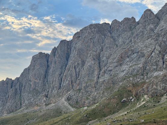


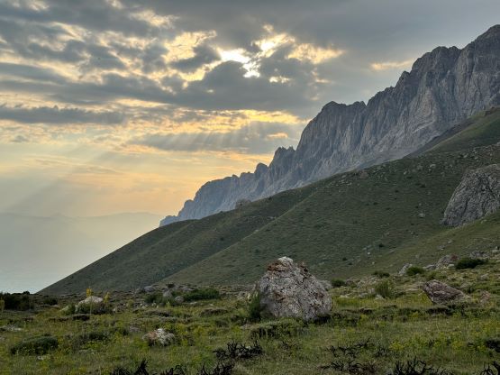


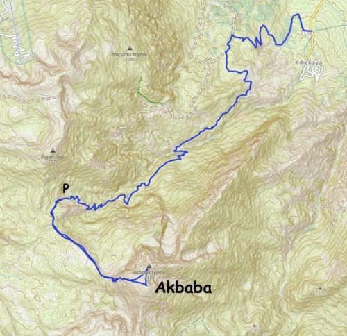
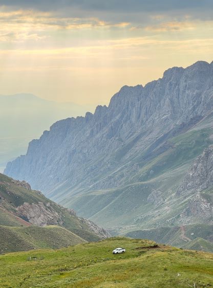
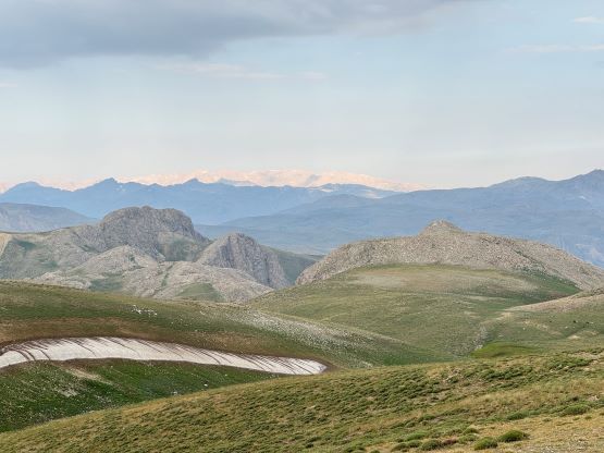
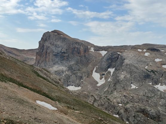
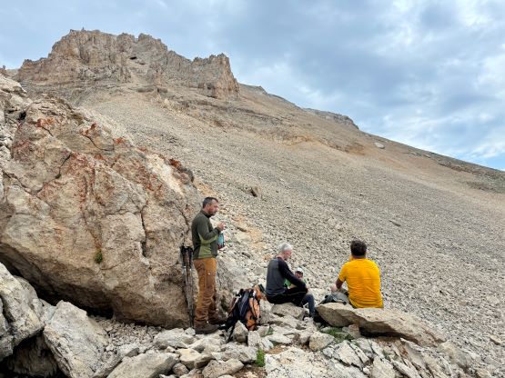
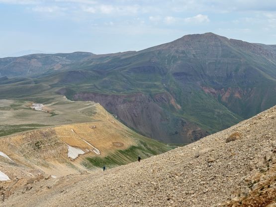
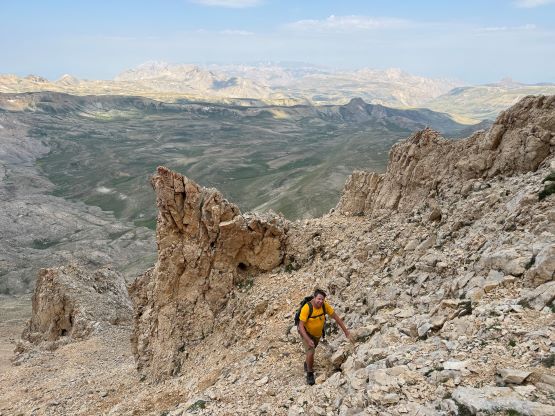
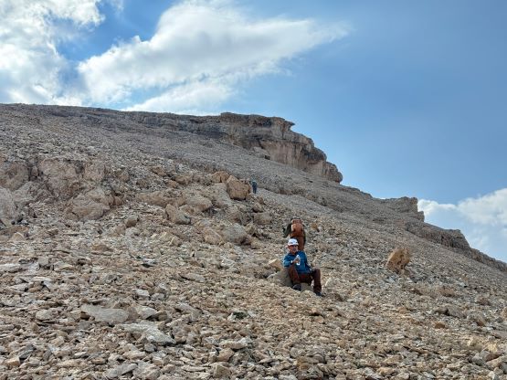
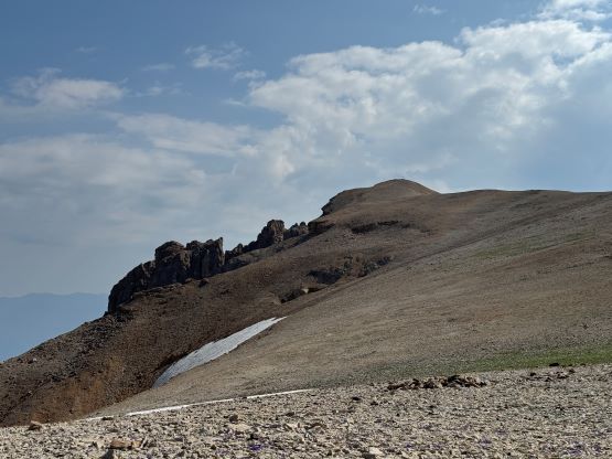
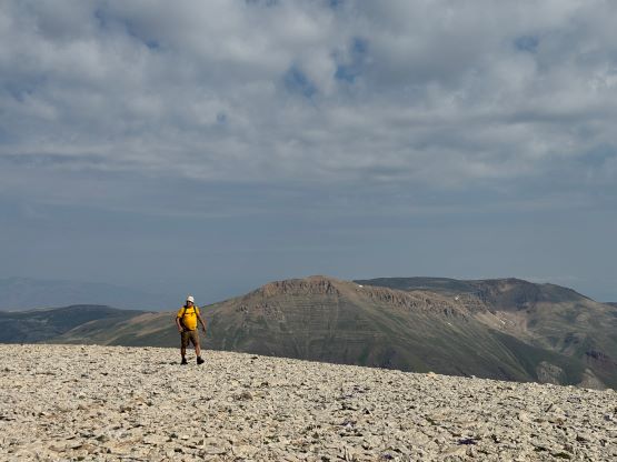
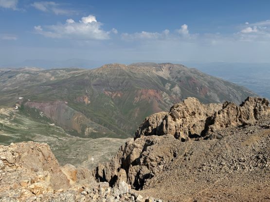
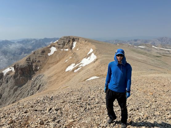
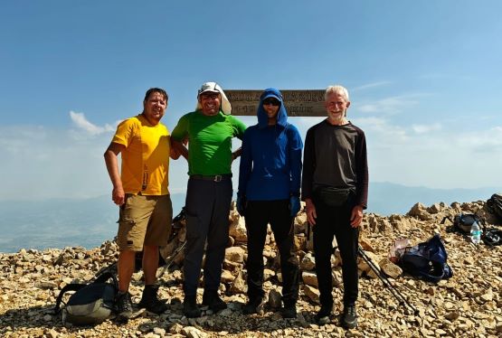
Because it was now the “best case scenario” we could ditch some unnecessary weight including the extra food and water. We had under 700 m elevation gain left and most of the travel would be on open terrain. The four of us started a few minutes ahead of the guide, but the drivers eventually decided to follow us up as well. One of them was quite slow and we ended up waiting for him for at least half an hour each way, but the hike was not long so we didn’t mind. Deividas picked up a faint trail that led us to the broad pass between Akbaba and Ergan. The trail disappeared but the travel between the two peaks was very straightforward with absolutely no bushwhacking nor anything worth noting. Eventually the terrain steepened and we ascended the scree cone to the base of some cliff bands. The correct route was to ascend and traverse the upper bench but we started traversing too early. The price we paid was some horrendous scree bashing but I’m from the Canadian Rockies so it wasn’t a big deal for me. The guide led the drivers sticking to the better path and we more or less joined forces to ascend through this tedious and loose section. Dave, Rob and I opted to check out the south summit first which turned out to be 7-8 m lower based on our hand level measurements. We then all joined together at the higher north summit, which is less rounded and offered better views.


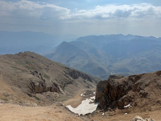


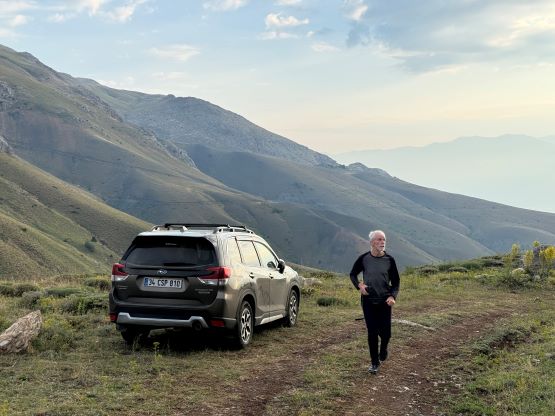
After what seemed like a long break we leisurely started the descent. Deividas also opted to check out the other summit for completion purposes. The descent back through that steep and loose section was nowhere as tedious because I was able to scree-ski most of it, even though I was only wearing the soft trail-runners. I thought about to tag Ergan Dağı but that would require almost 500 m extra elevation gain and I was definitely not 100% in my elements due to some mild food poisoning. I eventually decided against that so leisurely returned with the rest of the crew. The weather was not very stable neither with consistent afternoon thunder showers so it’s wiser to drive the hell out of here before that came. Some parts of this road would be very dangerous if not impossible in wet conditions. The guide and the Subaru’s driver descended faster and opted to walk down towards their vehicle. We caught up to them at the bottom of the steep, uppermost switchback section and offered them a lift. The drive-out was not as sketchy as I thought it’d be, and we even took a short-cut near the end directly towards Kılıçkaya. I was initially against taking an unknown road out but this spur showed signs of recent grading and it must be going somewhere. The condition of this road turned out to be similarly rough, but it was definitely shorter. I had stopped tracking by this point but I think Rob’s GPX includes this short-cut variation. We eventually got back to hotel at around 1:30 pm and the rest of the day was spent chilling and relaxing in Erzincan.