Mount Astley (SW)
June 7, 2015
2869m
Banff – Lake Minnewanka, AB
The weather was superb in this past weekend (a high pressure system building over central BC and Alberta), but temperature was too hot for alpine ascents. On top of that my feet really needed a break after the “Death March” on the Mons/Forbes expedition. The decision was made to attempt a short, but technical climb near Canmore, but also got changed at the last minute. Eventually I decided to join Raff, Eric and Vern for a scramble ascent of Mt. Astley – an unofficial, but less-known and rarely ascended peak near Lake Minnewanka.
There’s some confusion as which of the two summits (SW and NE) is the “real” Mt. Astley. The summit coordinates given by PeakFinder.com indicate the SW peak being the real one, so does Google Earth, but there’s also evidence indicating the NE peak could be the intended one when naming. To make things more blurry, the information on PeakFinder.com even contradicts itself as the peak “3 km SW of Mt. Aylmer and southwest buttress of Aylmer Pass” actually corresponds to the NE peak, but the coordinates and the pictures on the same site indicate the SW peak being the real one. In the peak-bagging perspective, the confusion can be easily solved by ascending both summits “just to be sure”, but in this case it’s not easy as the two cannot by traversed from the connecting col (so they’re two separate ascents). The SW peak is the eye-catching one looking from Banff well-guarded by impressive cliffs, but the NE peak is about 50 m higher in elevation according to our GPS readings. In the end, my conclusion is that either of the two can be “Mt. Astley”. I ended up ascending the SW peak while Eric, Raff and Vern opted for the NE.

Mount Astley scramble route. GPX DL
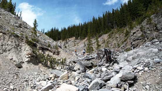
No matter which one you choose to be “Mt. Astley”, the approach is via Stewart Canyon Trail and then a long drainage south of the mountain. Eric had attempted this objective 3 weeks ago but turned around due to waist-deep saturated snow and poor weather. Following his fresh memories we managed to stay on the most efficient path. There’s a narrow but very deep canyon we went through and apparently it’s a secret sport-climbing area evident by the bolts and even two dangling ropes. After passing this interesting section the terrain started to get tedious. After another hour or so we came to an obvious fork and took the left one. Here’s also where we found the first running water source (what a relief as I only brought 1 L up expecting the drainage to be flowing, but apparently not).

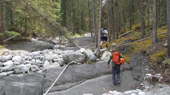
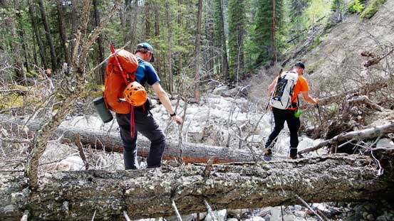
Raff, Eric and Vern hiking on Stewart Canyon trail
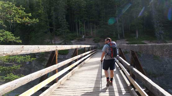
Eric crossing the critical bridge across Cascade River
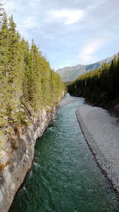
Cascade River
Hiking up the dry creek bed
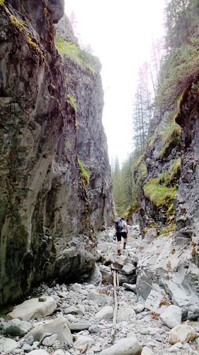
And, through the deep canyon
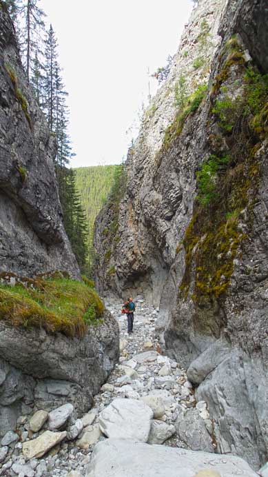
Quite an impressive sight here.
The left fork of the upper drainage was also very foreshortening but eventually yielded to a beautiful alpine basin with 3 summits looming above. The SW peak of Astley lies on climber’s left and appeared to be well-guarded by a series of cliff bands; the NE peak is straight ahead and looks quite impressive; and a 3rd summit (lower than both) lies on climber’s right and also looks fairly impressive. Here we had to make a decision. Vern, Raff and Eric thought the SW peak didn’t look very scrambler friendly but the other one appeared to be an “easy scree ascent”. I, on the other hand, was pretty keen on the SW peak. The terrain did not look exceedingly difficult to me and for the most important, this one had turned around so many parties and did not have a trip report published online yet. So I volunteered to try it out while the other three continued on for the NE peak.

Vern ascending the left fork of the upper drainage

Eric and Raff following up
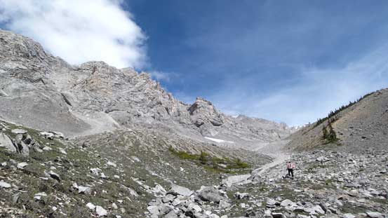
Into the alpine basin

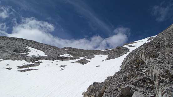
Here’s the SW Peak… Quite some route-finding here.
Right above me I had to find a way through a maze of rock bands. These bands looked down-sloping and slabby so I had to be careful picking the right lines. I ended up breaking the first band somewhere by a snowpatch, and then traversed climber’s right to break the second band. Looking upwards I could no longer see a feasible route through the next (the biggest) rock band so did a long traverse back climber’s left along a grassy ledge. After a while I found a reasonable break (class 3 with some exposure) to ascend through. I built a cairn to mark the exit and continued on. The rest of the ascent was straightforward, but did require some route-finding particularly I had to traverse climber’s left around two ribs in order to top out directly on the summit.

Traversing on some narrow ledges

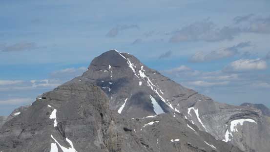
Looking towards the NE Peak. It looks quite like a peak from here!
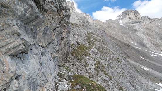
Another picture showing the ledge I traversed

And, I managed to find a Class 3 scramble break through the crux band
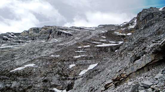
And, here’s the view of upper mountain. Still some route-finding but nothing tricky
I also had to cross this snow gully. Needless to say it’s isothermal top to bottom…

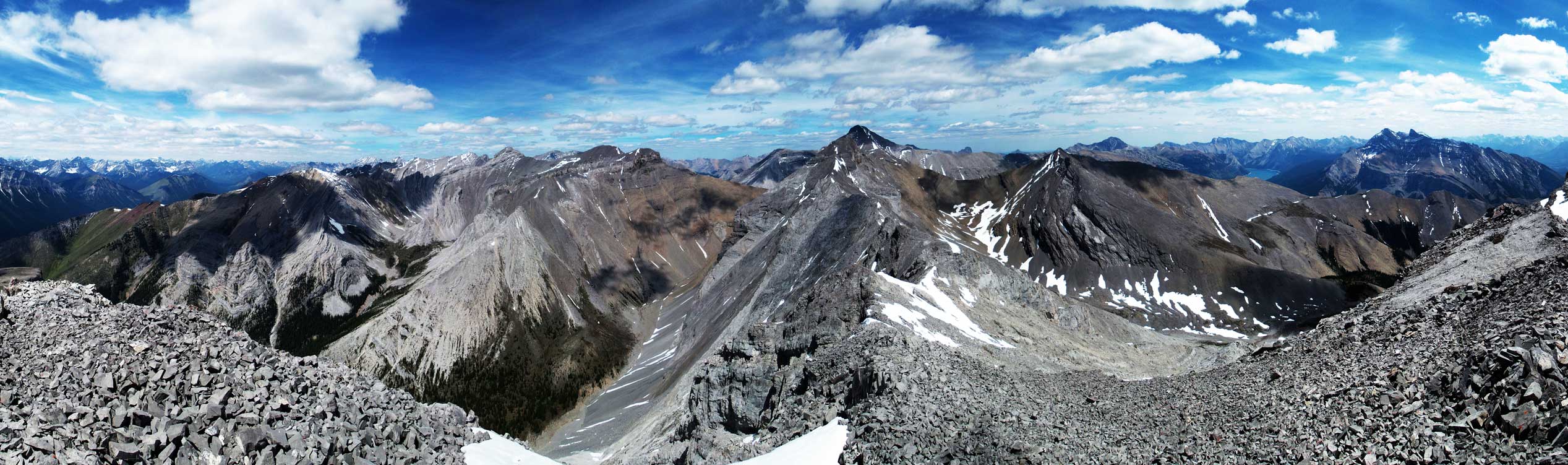
Summit Panorama. Click to view large size.
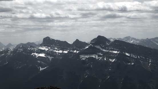
Bonnet Peak in the distance
Puma Peak is a big mountain in the front ranges

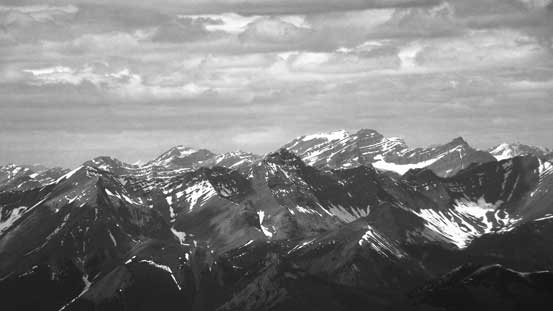
Typical front-range scenery
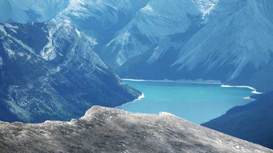
Lake Minnewanka
I really think Rundle should have more than just 1 name…

Bow Valley and Banff townsite is visible

Mt. Assiniboine is huge

Devil’s Head in the Ghost

Just like the nearby Rundle, Cascade Mountain is also a long one
Mt. Aylmer is a huge bulk
Mt. Costigan

Mt. Girouard and Mt. Inglismaldie
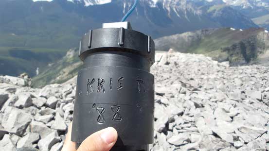
The register was placed by Kris T in 1988… Too bad the booklet was soaked and destroyed
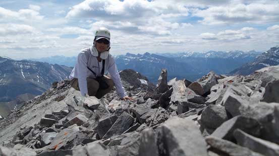
Me on the summit of Mt. Astley

Another picture of me on the summit
Another panorama from the summit. Click to view large size.
It’s also apparent that I made progress much faster than the other three, so while watching them making the summit I decided to take a short nap. The wind was calm and temperature was mild and for the most important, there’s no bug… Half an hour later I started the descent. I basically retraced my steps using fresh memories and the GPS tracks, and shortly after the other three joined me at the alpine bowl and we resumed the rest of the descent.

On the descent, looking towards the NE peak and Aylmer
Scree descent for a while

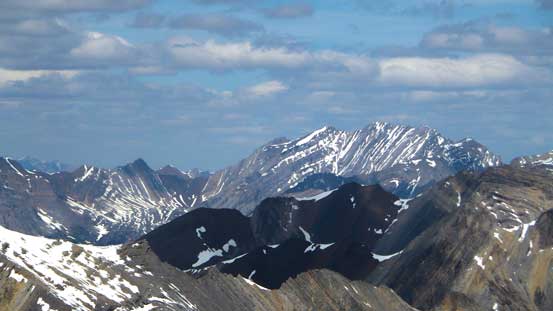
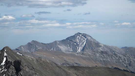
This is the 3rd peak of Astley area… It looks also interesting
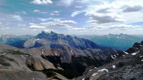
Gorgeous view towards Girouard and Inglismaldie

Looking back at the Class 3 scramble break that I used
It was just as expected, hot and tedious in this afternoon. The return would never fail to impressive me as it always seemed to be much longer than in the morning. The terrain also reminded us greatly the nearby Mt. Girouard (another long slog)… We re-filled our water bottles at the stream lower down, and the rest of the return was uneventful.

Vern descending the upper drainage
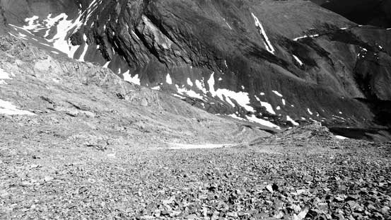
The upper drainage

Filling our water bottles at the fork. It’s a hot afternoon…
Descending the lower drainage
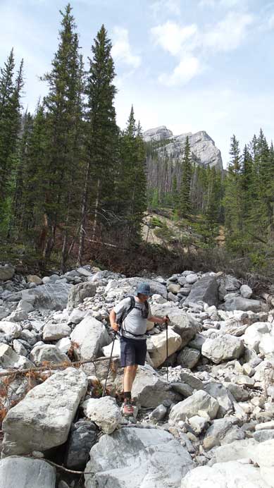
Eric and the typical boulder hopping

Back through the deep and narrow canyon

The tourist’s view of Lake Minnewanka
Our round trip time was 9.5 hours on a relatively leisure pace. It’s certainly not as a short trip as advertised by Raff, but not a terribly long one neither. I’d recommend either the SW or the NE summits to scramblers looking for some variation. The SW peak has some route-finding but if you find the easiest line it should not exceed class 3, while the NE peak is “easy scrambling” all the way up to the false summit followed by a sting in the tail (a loose and very exposed traverse to the true summit). The NE peak is also reported to be higher in elevation with better views towards Aylmer, while the SW summit offers an unobstructed view of Cascade Mountain and Cascade River Valley.
(For the ascent of NE peak make sure to check out Vern’s trip report).

[…] right which would have great views. (So Nakagawa has done this one.) We split up at this point – Steven really wanted to check out the "likely" formerly named summit to the west because there's no published reports on this route. The rest of us wanted the better […]
Too bad the register book Alan Kane and I left May 28, 1988 wasn’t intact. We went up the south ridge. We went over to the other peak, by losing much elevation to SE and put a film container there. Built cairns on both as there was no trace of anyone being on either peak before. Just learned today that they are now named Astley and have been climbed again.